

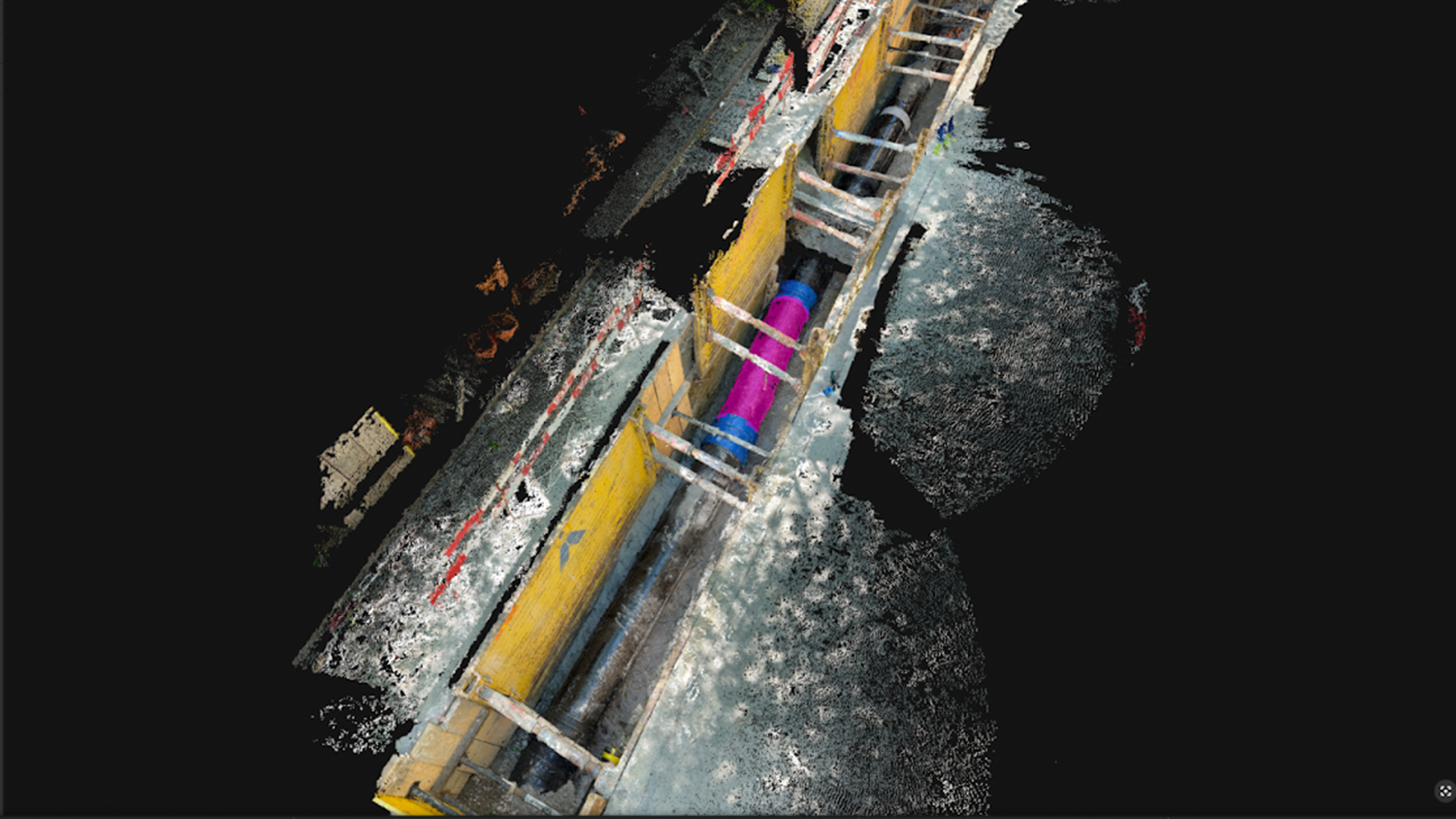
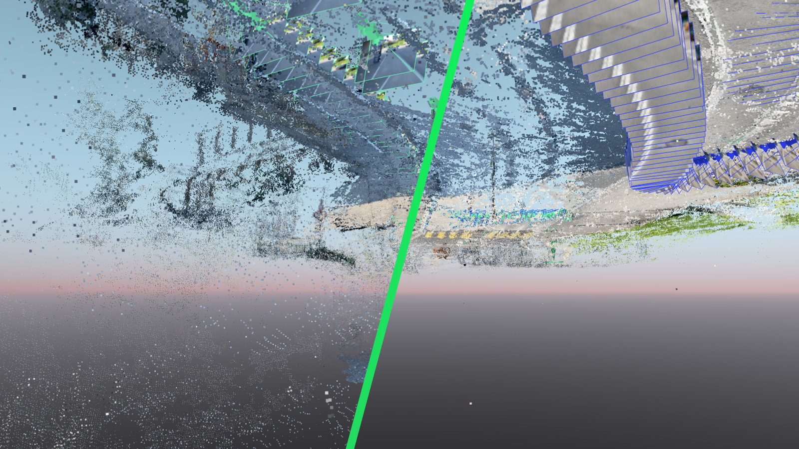
Semantic intelligence meets photogrammetry in PIX4Dmatic
Semantic photogrammetry and the role of scene segmentation with the Segment Anything Model (SAM).
Read more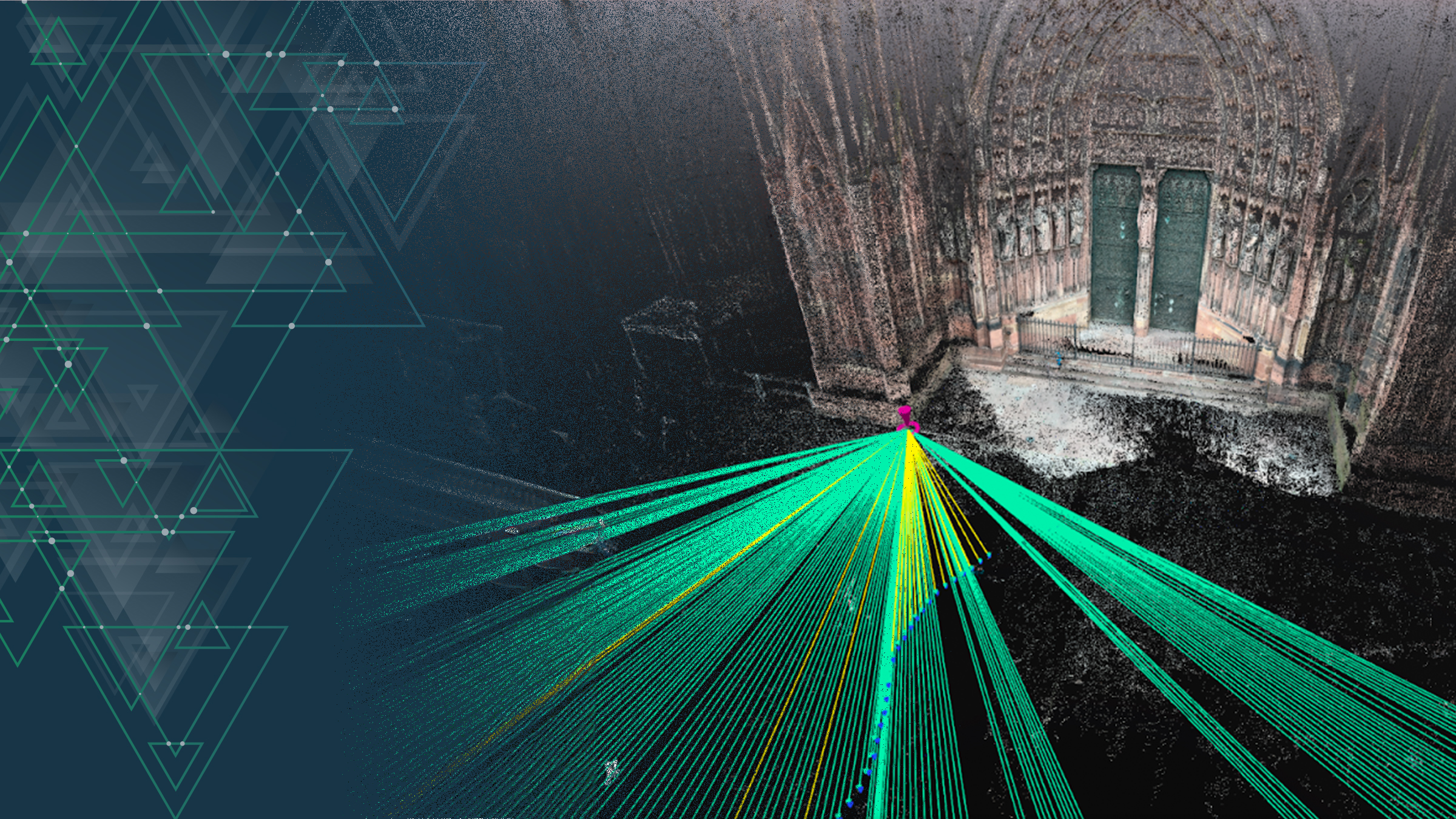
RTK, LiDAR, & photogrammetry for smartphone triangulation
With modern photogrammetry and an RTK equipped phone, we measured Strasbourg Cathedral’s height using triangulation.
Read more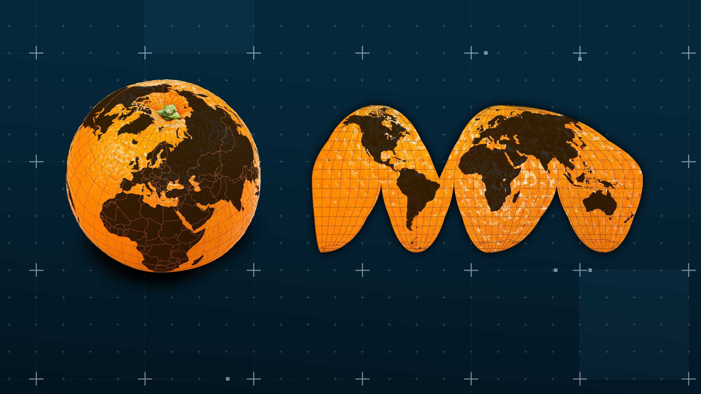
Precision mapping: Pix4D and coordinate reference systems
Coordinate reference systems are crucial for accurate, geo-referenced data. Find out Pix4D's approach to managing these intricate systems!
Read moreSemantic intelligence meets photogrammetry in PIX4Dmatic
Semantic photogrammetry and the role of scene segmentation with the Segment Anything Model (SAM).
RTK, LiDAR, & photogrammetry for smartphone triangulation
With modern photogrammetry and an RTK equipped phone, we measured Strasbourg Cathedral’s height using triangulation.
Precision mapping: Pix4D and coordinate reference systems
Coordinate reference systems are crucial for accurate, geo-referenced data. Find out Pix4D's approach to managing these intricate systems!
The new version of PIX4Dcatch, with improved GeoFusion
Testing the accuracy of PIX4Dcatch’s new GeoFusion algorithm in areas with weak GNSS signal.
Automation at scale: AI and machine learning at Pix4D
Discover the impact machine learning can have on photogrammetry workflows. A look at how Pix4D's algorithms boost productivity.
Exploring photogrammetry and NeRFs with OPF
Explore OPF's power and seamless integration into photogrammetry workflows, such as utilizing NeRF when rendering 3D scenes.
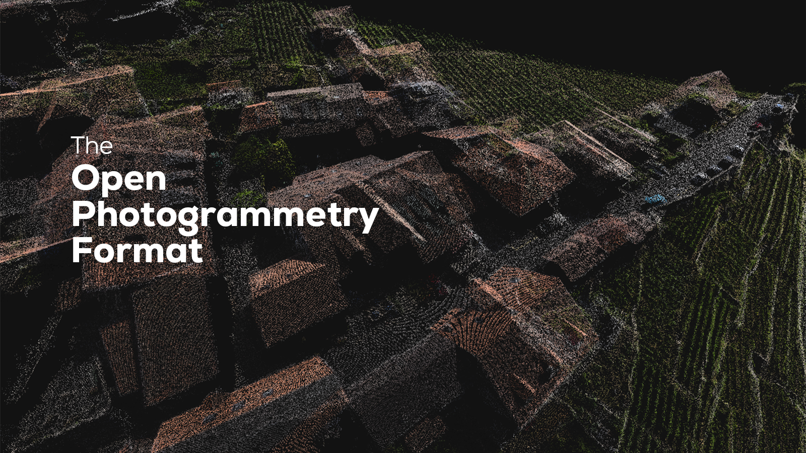
Pix4D Labs: Meet OPF - the PDF of photogrammetry
Pix4D is launching a brand new standard for the exchange of photogrammetry projects called OPF. Discover what it is and how it works!
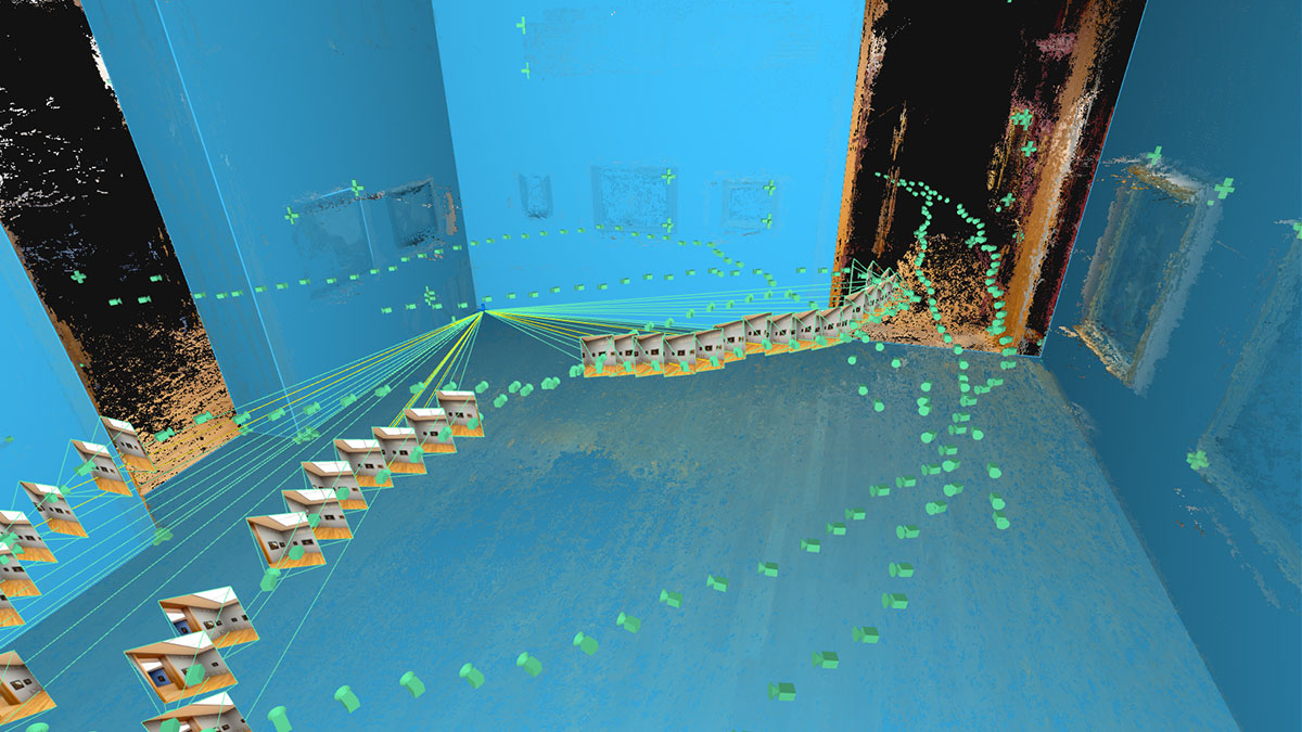
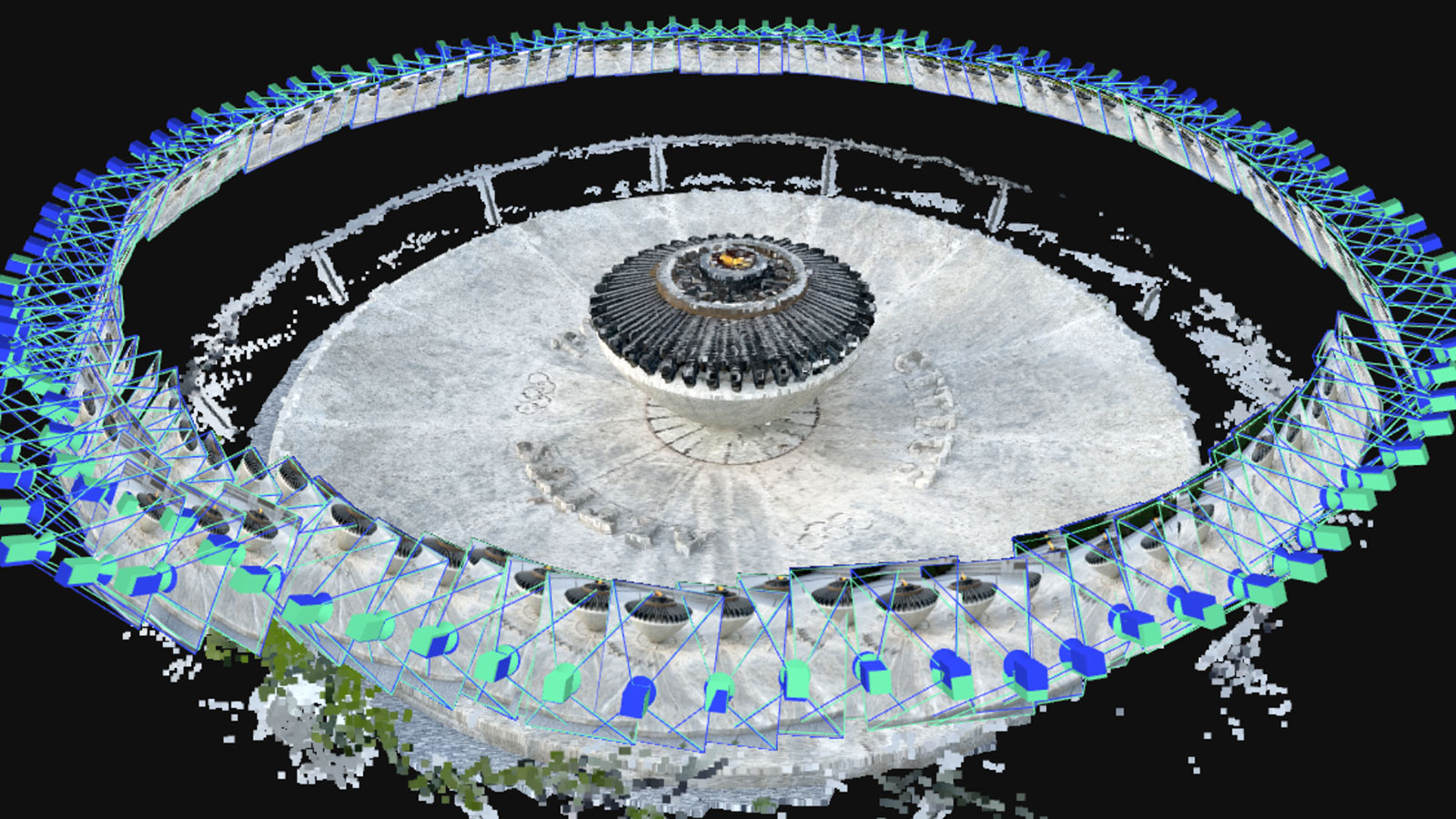
An introduction to PIX4Dmatic’s Intersection Tie Points
A new type of tie point in PIX4Dmatic is being used to improve calibration for indoor and outdoor scene reconstructions. Find out how!
Can semantic keypoints help us improve calibration results?
Recreating reality in 3D means digitizing everything, including objects like pavements. Could automatic detection help us improve results?
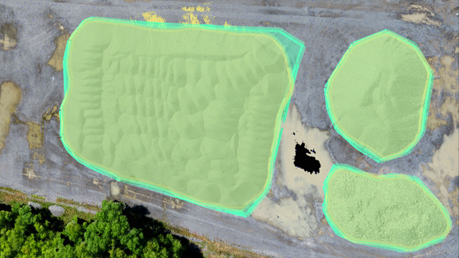
Measuring stockpiles on the point cloud: can it be faster?
We measure stockpiles for construction, earthworks, and many more industries. Can we improve how we measure them with photogrammetry?

How we can accelerate orthomosaic generation with GPUs
An orthomosaic is a powerful tool in photogrammetry. How can we optimize the generation process on hardware around the world?
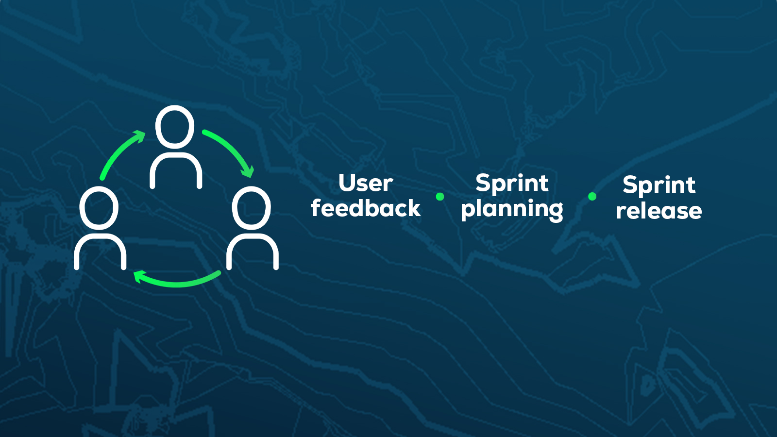
Updating software: why do we release every three weeks?
PIX4Dmatic and PIX4Dsurvey are two of our geospatial desktop software products. They have new releases every 3 weeks - we explain why.