
PIX4Dfields
Hybrid drone and satellite mapping software for aerial crop analysis and precision agriculture
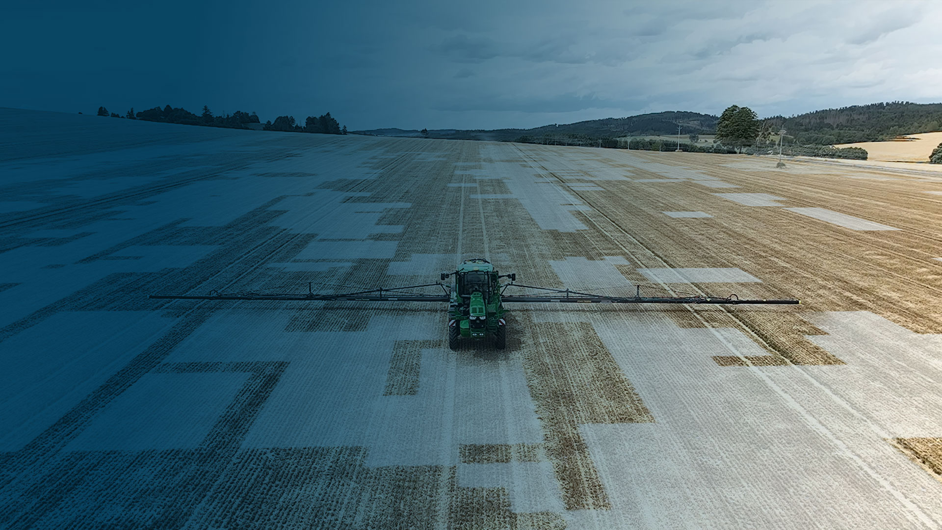
Saving time, money, and agricultural inputs has never been easier.


Available for Windows & macOS
Compatible with all machinery brands
Ready-to-use & customizable variable rate and spot spraying maps for spray drones, tractors, and field sprayers.
ISOXML for standard ISOBUS machine terminals


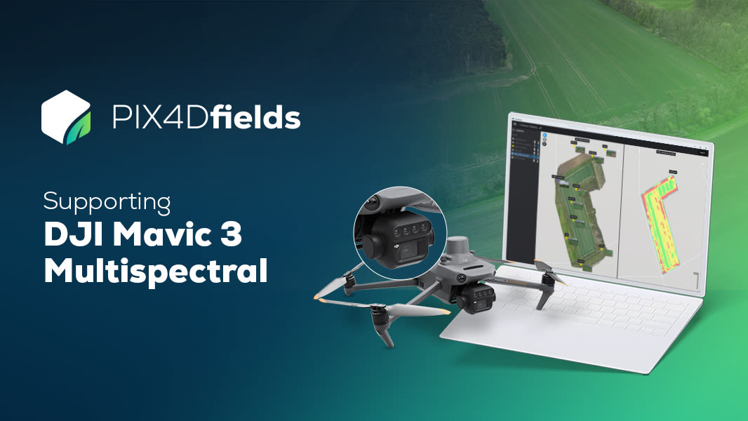
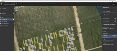
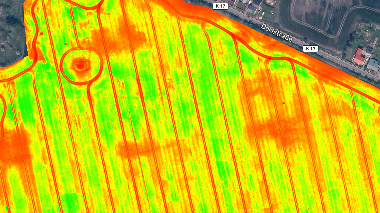
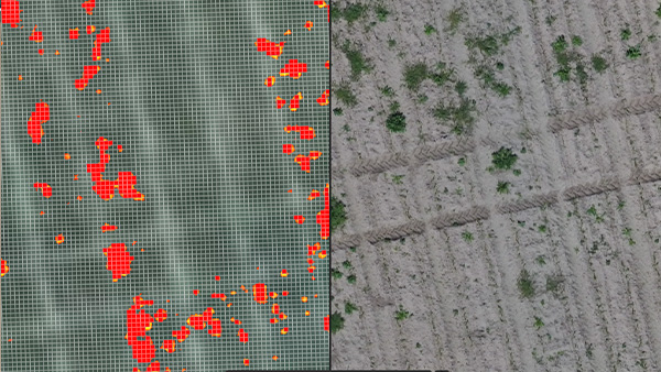
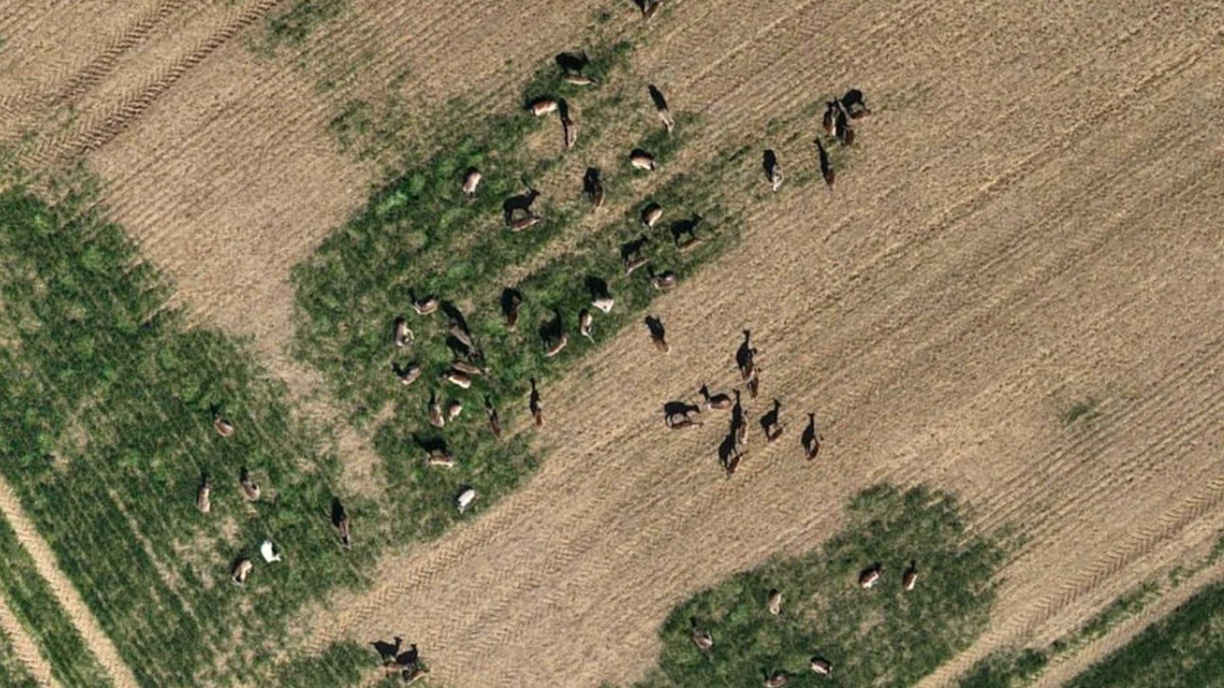
[DJI Mavic 3 Multispectral dataset]
Seeing beyond the surface with the DJI Mavic 3 Multispectral and PIX4Dfields
Try a DJI Mavic 3 Multispectral demo dataset yourself! Process it with PIX4Dfields and let the magic happen. Start saving time, money, and resources in your agriculture workflows today!
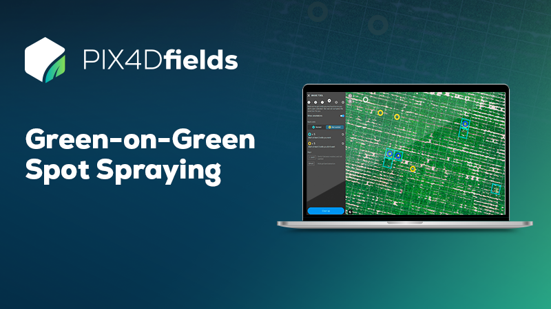
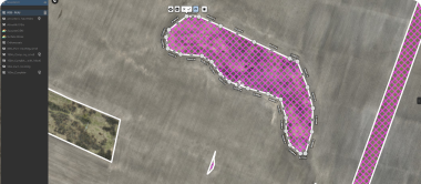
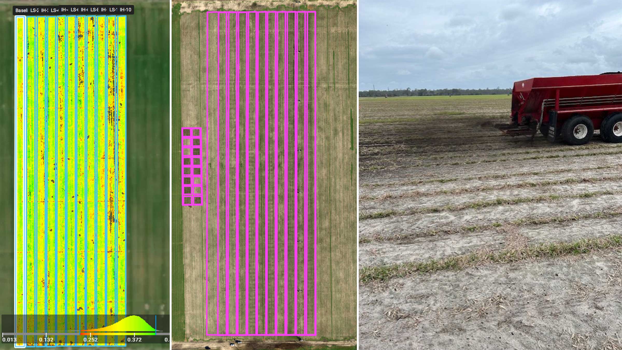
Green-on-Green Spot Spraying dataset
Helping Farmers Worldwide Save Money
Try a Green-on-Green demo dataset yourself! Process it with PIX4Dfields and see how you can instantly spot all weeds on the field with the Magic Tool and create a ready-to-use prescription map for a targeted herbicide application!
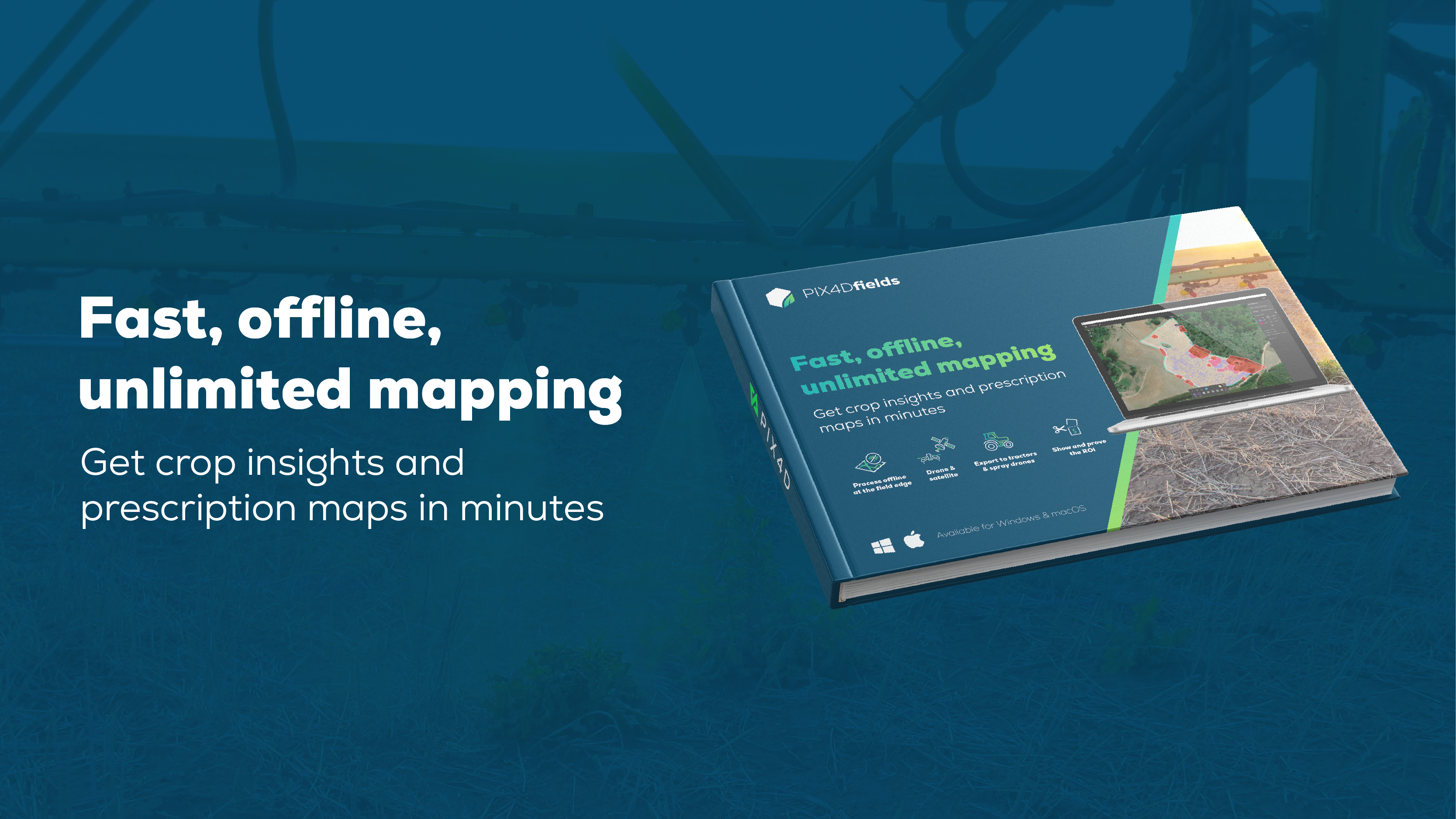
Fast, offline, unlimited mapping
Get crop insights and prescription maps in minutes
Discover how PIX4Dfields elevates precision agriculture by turning images (drone and satellite) into prescriptions and insights in minutes. Built for speed, it allows for fully offline, on-device processing at the field edge.
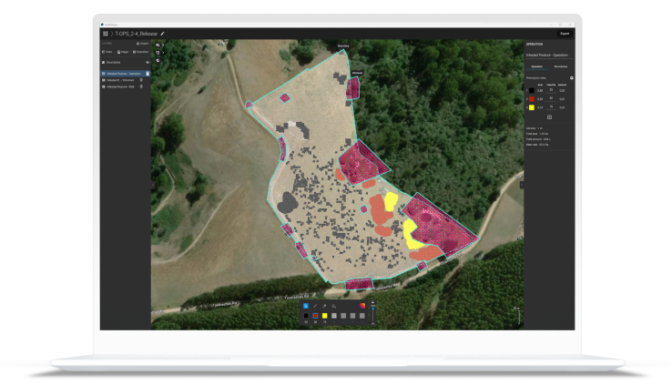
Create and use prescription maps directly with your machinery - no third party software needed
The ultimate agricultural toolkit


Check if your drone is supported here
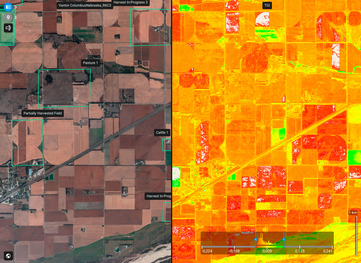
Access your fields from anywhere: High-resolution data and detailed insights
PIX4Dfields provides instant access to high-resolution satellite imagery. Generate detailed crop insights and vegetation indices in seconds, from anywhere in the world.
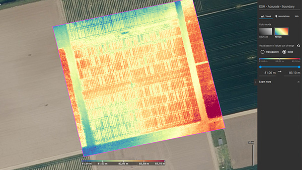
 Fast processing - Accurate processing
 Generate indices
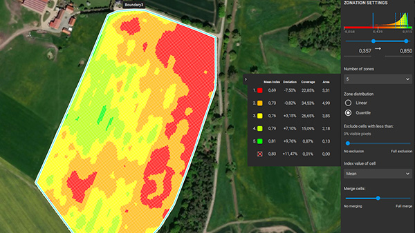
 Zonate and prescribe
 Measure and Annotate
 Magic tool
 Targeted Operations/Prescription maps
 John Deere Operations Center

“PIX4Dfields is simple to use and has a lot of possibilities for applications. It is constantly being updated with new, useful functionalities that bring additional value”
Digital Agro
“I was just amazed at the speed of the processing. I can work offline, so I can take pictures with the drone and process them on the spot. Another important point is that it can be used even on a PC with low specs.”
Northern Innovation
“PIX4Dfields is the easiest and the most practical software to create prescriptions based on the plant health maps. We use the software to execute variable rate applications, which we are the first ones to achieve in Turkey.”
Paksoy Technical Solutions
Create and analyze real time maps of your crops to enhance your agriculture workflow
Unlimited hectare mapping
WEBINAR
How to successfully plan your agricultural spray drone flight with PIX4Dfields
Join us for a discussion on how to use PIX4Dfields RTK field boundaries and obstacle editing for spray drone applications, and talk about the importance of ensuring an efficient and profitable flight.
Watch nowSmart farming use cases
Towards sustainable farming: cost-saving fertilization
Florida laws coordinate water resource development; protecting, conserving & restoring resources while meeting quality needs.
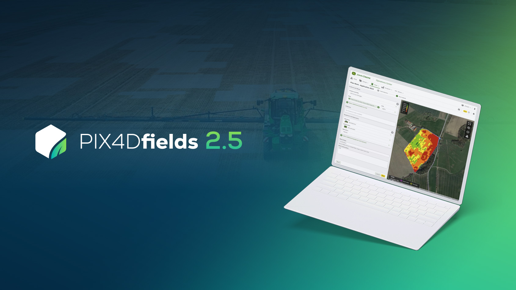
PIX4Dfields 2.5: John Deere integration and ISOBUS export!
PIX4Dfields 2.5 brings you integration with John Deere Operations Center, ISOXML agricultural data format, advanced zonation, and more
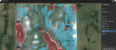
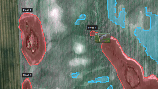
Crop damage assessment on a farmland with PIX4Dfields
Crop monitoring and damage assessment with accurate field data helps improve crop production in affected areas and prevents yield loss.
Read more PIX4Dfields use cases or sign up for our newsletters.