PIX4Dfields: vineyard disease detection and harvest planning
Producing high-quality grapes can be challenging nowadays, notably with changing weather patterns. Diseases and pests that affect vines can also play a critical role in grape harvest quality if not detected and treated in time. Winemakers are severely affected – 2023 marked the lowest world wine production in the last 60 years!
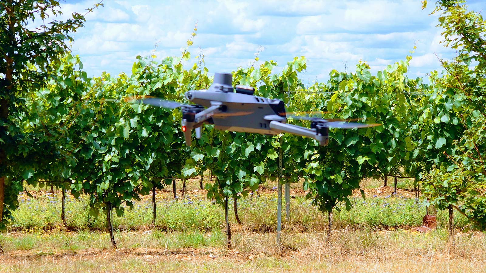
Low Altitude Ltd, based in Hampshire, UK, specializes in providing multispectral plant-health drone surveys to farmers and growers, with a focus on precision agriculture and viticulture. In 2023 they ran a proof of concept - a test experiment - to monitor both the acreage and the individual plots of a large vineyard. The project came about after a Sunday afternoon walk on the vineyard’s public footpath. Chris Crane, Director of Low Altitude Ltd, approached the Head Winemaker, who was open to trying new technology to monitor his vineyard his more effectively.
Vineyard monitoring using multispectral imagery allows faster action
The project’s aim was not only to define and test the most suitable vegetation indices for viticulture but also to demonstrate that the surveys would provide actionable intelligence to the Head Winemaker by contributing to faster decision-making and providing a monthly overview of the vineyard’s large site. This helped to monitor the progression of the vine in detail without having to be physically there.
The drone and data processed with PIX4Dfields formed a critical part of the vineyard’s management process. The Low Altitude Ltd team was keen to detect any issues in the vine as early as possible for the vineyard team to take remedial action. They learned early on that processing images of the vines and returning results within 24 hours are key to winemakers’ decision-making. The faster the action, the better for the vine, and consequently, the future fruit yield.
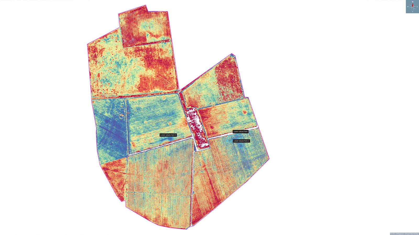
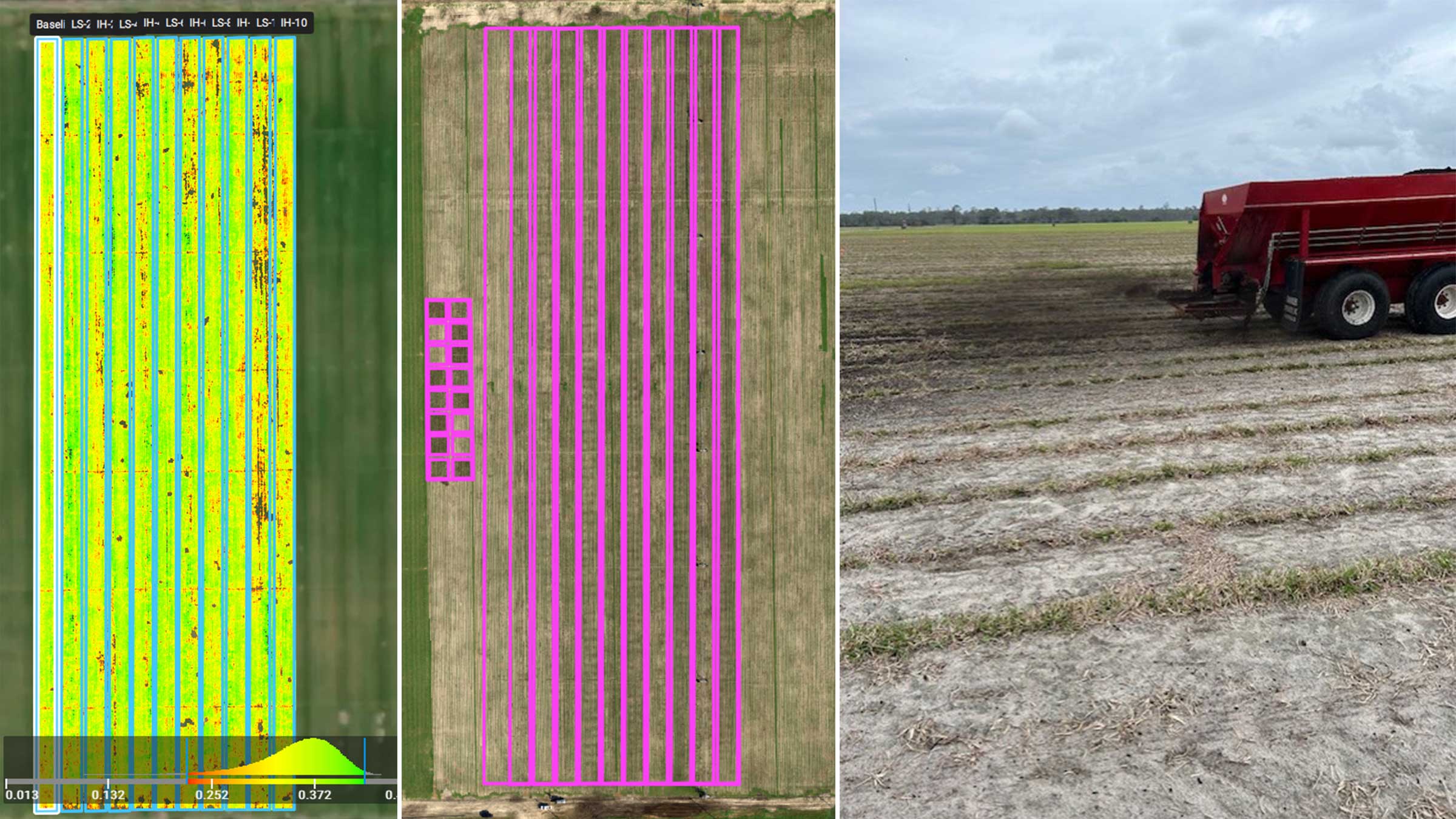
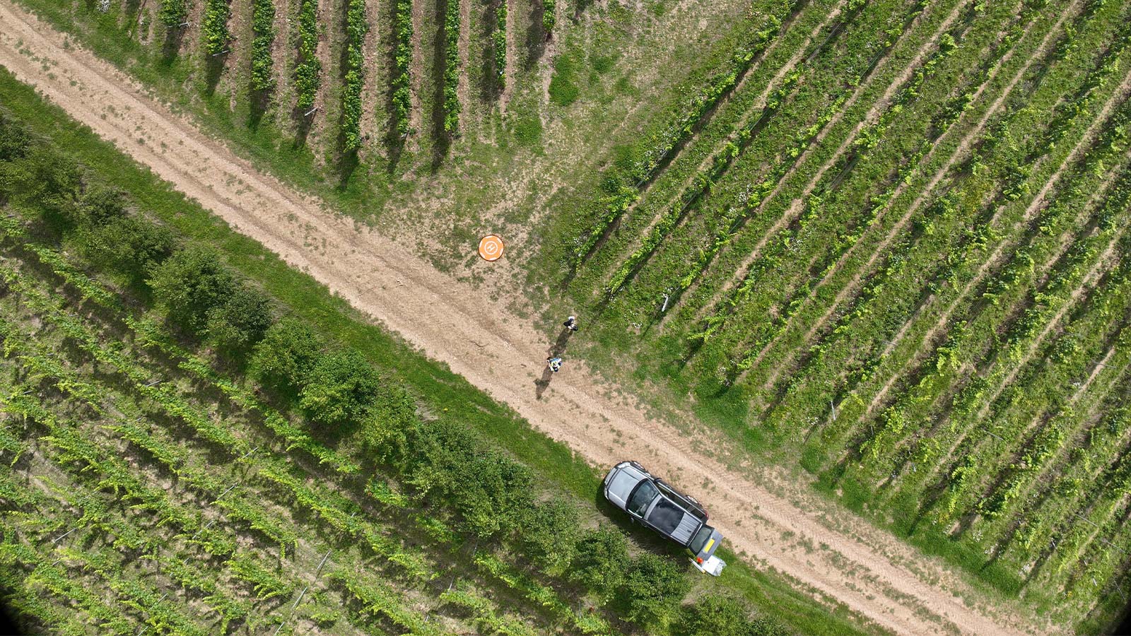
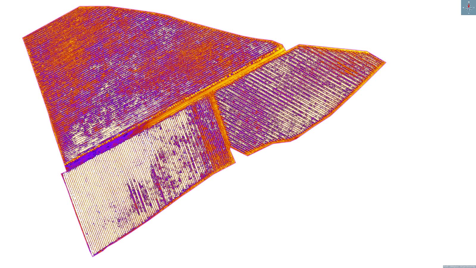
The team found the combination of using a multispectral drone and PIX4Dfields to be almost perfect. PIX4Dfields’ functionality to add custom indices proved to be vital for their work. The project involved different flight surveys consisting of the full site and individual plots of interest. The latter were at a lower altitude, higher GSD, and had a more detailed analysis. By creating boundaries for each row in a plot, they could filter out all the vegetation values from the plants between the rows.
Project details
| Location | Hampshire, UK |
| User | Chris Crane |
| Project duration | 6 months |
| Area surveyed | full site: 97 acres, individual plots:12 acres |
| Software used | PIX4Dfields |
| Hardware used | DJI Mavic 3 Multispectral |
| Processing hardware | CPU: 2019 i9 Mac, RAM:96GB, Graphics: 4GB Radeon Pro |
| Processing time | 1 hour for larger datasets and a few hours for accurate processing |
| Images captured | Each full site survey generated around 3500 images, which were then run through PIX4Dfields to present the output. |
| GSD | Full survey: 2.4 cm, Individual plots: 1.1cm |
Early disease detection, improved harvesting plan, and more!
Low Altitude saw some great results, such as:
Early detection of powdery mildew in certain plots, enabling the vineyard crew to take remedial action and limit the spread
Lower photosynthetic activity in certain patches of the vine, which enabled the rapid application of seaweed to give the plant a much-needed boost ahead of harvest
Better planning of the harvesting order by using the final survey. Helped in picking the ripest grape first which gave the other areas of the vineyard those extra few days to reach optimal harvesting quality
The team found PIX4Dfields very easy to use, considering they are beginners in the precision agriculture field. They also highlighted the fact that the software offered most of the features needed for their work.
“We’re really happy with PIX4Dfields; it’s simple to learn, easy to use, and is supported by a really knowledgeable team. The community forum is equally as important, as we can learn and share from our own and others'. We’re happy to continue to use PIX4Dfields as part of our workflow.” - Chris Crane, Director Low Altitude Ltd