Towards sustainable farming: cost-saving fertilization
Environmental Land Management Science (ELMScience) is an agricultural company founded by Jim Fletcher and Chuck Petz two years ago. Based in Melbourne, Florida, ELMScience specializes in utilizing sensors to develop tailored land and water management solutions for both private landowners and government entities. They use drone-captured images to develop reflectance maps for assessing plant health and algorithms that generate nutrient maps that are primarily focused on nitrogen.
Their current work focuses on St Augustine sod production. Florida uses Agricultural Best Management Practices (BMP’s) in agricultural production. BMP’s are defined by law as a means, a practice, or combination of practices to be the most effective way of improving water quality in agricultural and urban discharges.
Assessing nitrogen with ELMScience
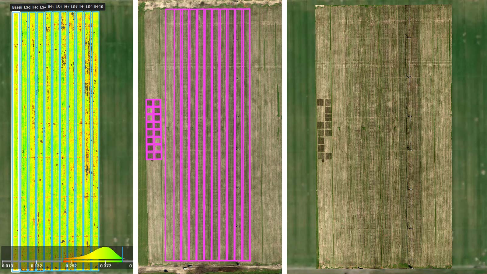
ELMScience was contracted by the University of Florida (funded by the Florida Department of Agriculture & Consumer Services) to perform eight drone flights, aiming to investigate potential correlations between a reflectivity index and nitrogen (N) levels from collected soil and tissue samples. The project took place on a farm in St John‘s County, Florida, not far from Jacksonville.
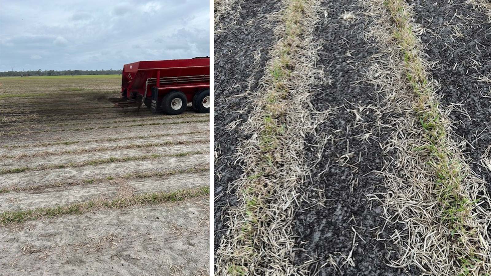
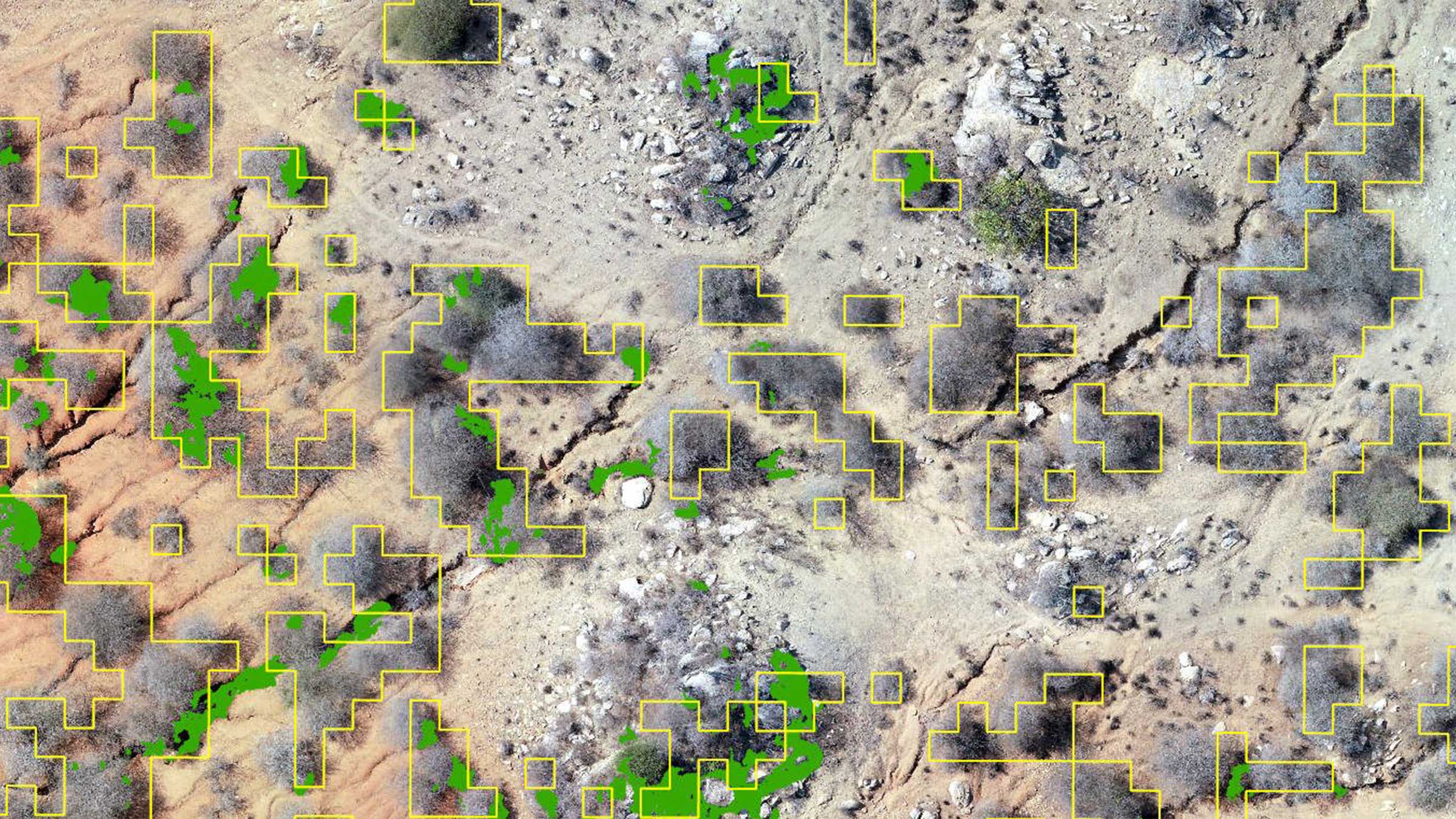
The first year of research consisted of four replicates of 0, 4, 6, and 8 tons/acre of compost application for a total of 16 plots. Commercial fertilizer was applied six times based on the producers' normal rate and schedule. Each research plot measured 30 feet by 30 feet and followed a randomized control block design. Soil and tissue were sampled with each flight and all samples were analyzed by a commercial lab.
Project details
| Location | Melbourne, Florida, USA |
| User | ELMScience |
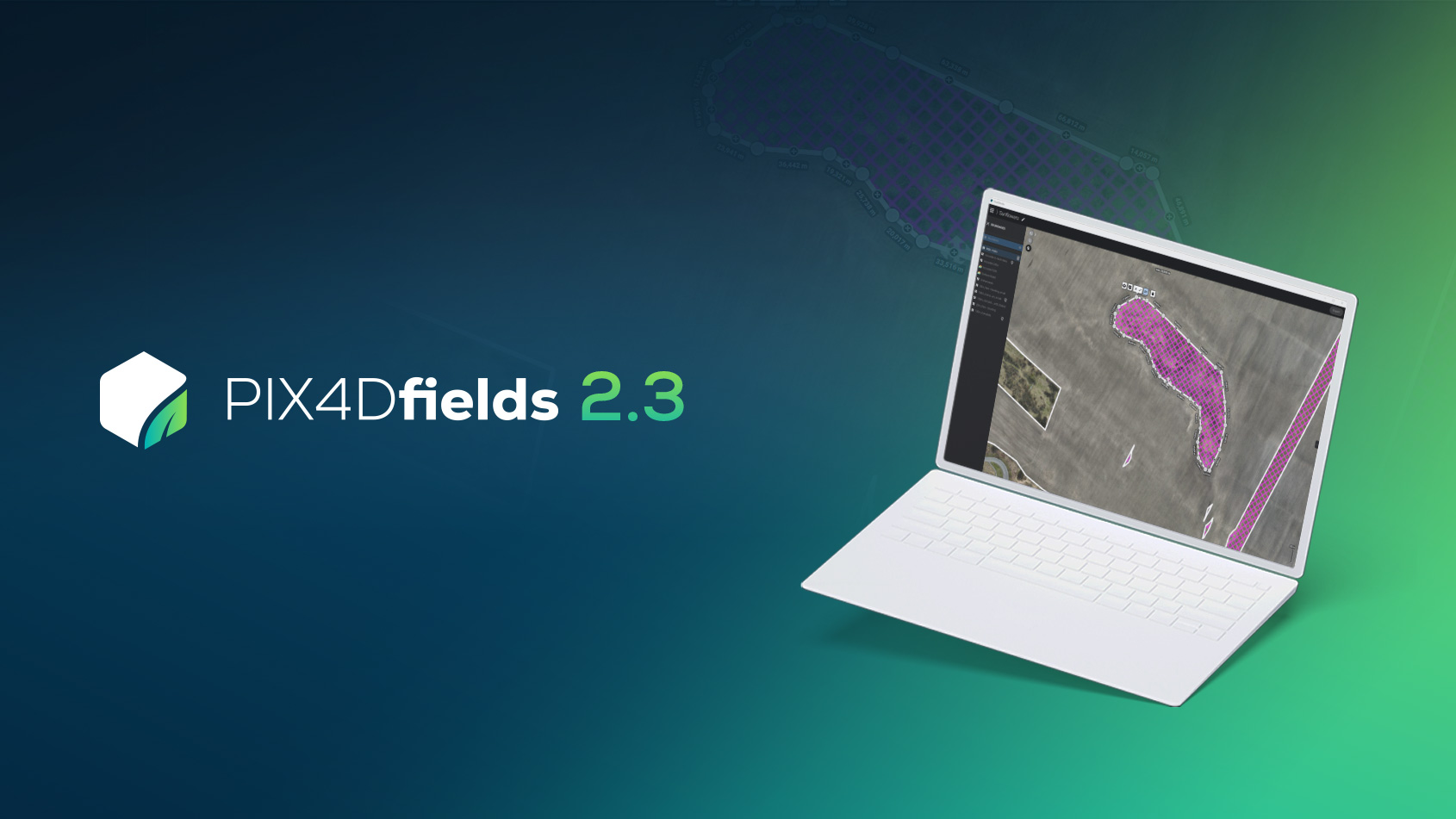
| Software used | PIX4Dfields |
| Hardware used | DJI P4 multispectral drone with RTK GPS/IMU with (RGB, Blue (450nm), Green (560nm), Red (650nm), Red-Edge (730nm) and NIR (840nm) |
| Area covered | 17 acres |
| Number of images | Approximately 1500 images |
| Data format | .jpeg, .tif |
| Project length | August 2022 - September 2023 |
| Processing time | Less than 10 minutes |
| GSD | 1.9 in/px |
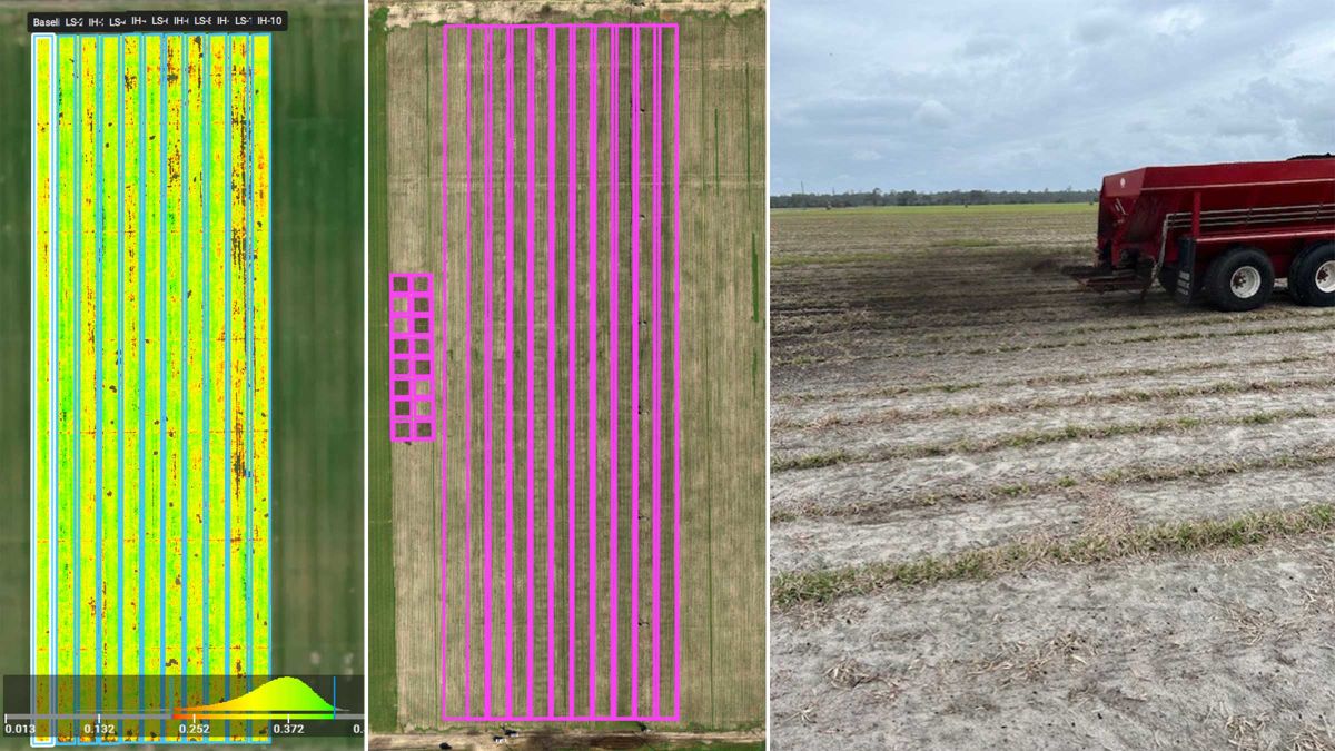
They covered 17 acres in total, which consisted of a 10.5 acre demonstration area and a 0.5 area for the replicated trial. They managed to collect around 1,500 images, including RGB and multispectral images. They achieved a 1.9 in/pixel image resolution. To ensure precision for the flights and data collection, they relied on the Florida Permanent Reference (FPRN) and CORS RTK network for support. To maintain data consistency, they used a Sentera radiometric calibrated reflectance panel before each mission.
Impact: advancing nitrogen assessment
ELMS has developed two promising algorithms for nitrogen assessment in St. Augustine grass. Impressed with the project results, the St. John’s River Water Management District has committed to a two-year cost-sharing project with the producer covering 25% of the costs and the district contributing the remaining 75%.
In the first year, the project will focus on further refining the algorithms through data collection, and during the second year, ELMS will use drone-captured imagery to create prescription maps for nitrogen application. The trial consists of two separate, replicated blocks, allowing ELMS to compare the producer's current fertilizer application with the prescription map approach to determine both optimal timing and potential cost savings.
ELMS found that PIX4Dfields offered several advantages:
- User-friendly
- Processes images rapidly for real-time results
- Allows the export of zonation or prescription maps for precision agriculture applications
After evaluating various products, they found that PIX4Dfields provided the most comprehensive solution for their requirements.
“Sod is produced on over 62,000 acres by 177 farms in the State of Florida and uses a significant amount of water and nutrients. The use of new and updated precision agriculture technologies will assist producers in making decisions on when and how much fertilizer to apply to a crop helping to mitigate the cost of fertilizer through more efficient use and allowing the producer to optimize returns to the farm while at the same time protecting Florida’s fragile ecosystem.” - Jim Fletcher, ELMScience
This project proved to be a significant step forward in precision agriculture. By collecting reflectance data from drone-captured imagery and developing algorithms to assess nitrogen levels in St. Augustine grass, they achieved impressive r-squared values. The promising results led to further funding. With three tiers established (low, medium, high) for tissue N levels and developing correlations with reflectance values, this project is set to optimize fertilizer use, protect the ecosystem, and enhance agricultural productivity, bringing the benefits of precision agriculture to Florida’s sod production industry.