Drone-driven construction monitoring with PIX4Dcloud
Monitoring the construction process is crucial, not just for boosting efficiency and quality control but also as a means to save time and money. Federico Pensa is the Innovation & Technology Director at Magil Construction in Montreal, Quebec. With a passion for integrating advanced technologies into the construction process, Pensa uses photogrammetry to optimize Magil’s construction projects. This includes generating detailed maps and 3D models to aid in planning, monitoring, and executing construction tasks, ensuring precision and quality in all projects.
Why is construction monitoring important?
As a prominent general contractor with projects across Canada, monitoring construction processes is paramount for Magil. They must ensure that projects adhere to planned schedules, budgets, and quality standards. Consistent monitoring means rapidly identifying and rectifying any issues, and ensuring safety and compliance with regulations.
Pensa says that using Pix4D technology has improved this process, especially Pix4Dcloud Advanced. PIX4Dcloud Advanced is an online platform designed for ground and drone mapping, progress tracking, and site documentation. Users can collect terrestrial data with a smartphone using the PIX4Dcatch RTK workflow, or drone data using a flight app such as Pix4D’s PIX4Dcapture Pro or DroneLink. They can then process, visualize, and share image data seamlessly from any device with survey-grade accuracy, eliminating the need for local computer processing power.
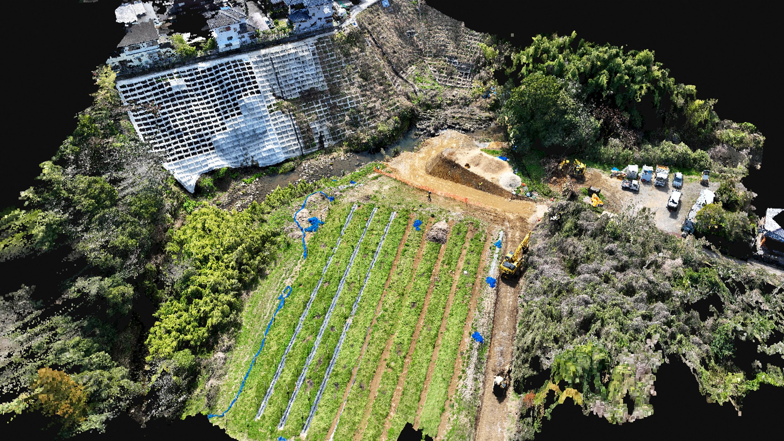
Sub-249 microdrones
A critical step for Magil has been the integration of microdrones into their mission plans. Their drone program flies weekly to monitor progress on all active sites. Using the popular DJI Mini series drones has allowed Magil to expand their drone program easily. Microdrones have many advantages including:
- Regulations are less strict for drones under 250 grams
- Lower cost
- Safer operations on active sites
- Easy deployment and pilot onboarding
Magil completes their missions with Dronelink, a drone flight control program that is integrated with PIX4Dcloud, streamlining Magil’s process further. Planning missions and uploading data to PIX4Dcloud becomes as simple as pressing a button in the Dronelink interface, saving time on data management and boosting overall efficiency.
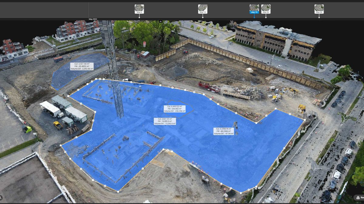
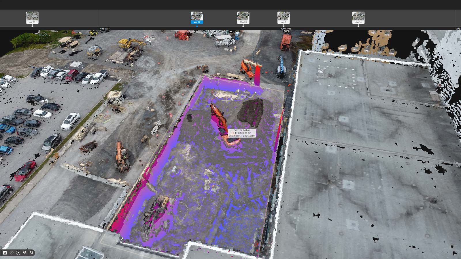
Once uploaded to PIX4Dcloud the data is processed into high-resolution maps and 3D models, made visible in the project timeline, and then shared online between all stakeholders. Designs can be overlaid for project management and two captures can be compared side by side with PIX4Dcloud Advanced’s Overlay Tool.
PIX4Dcloud Advanced for construction & collaboration
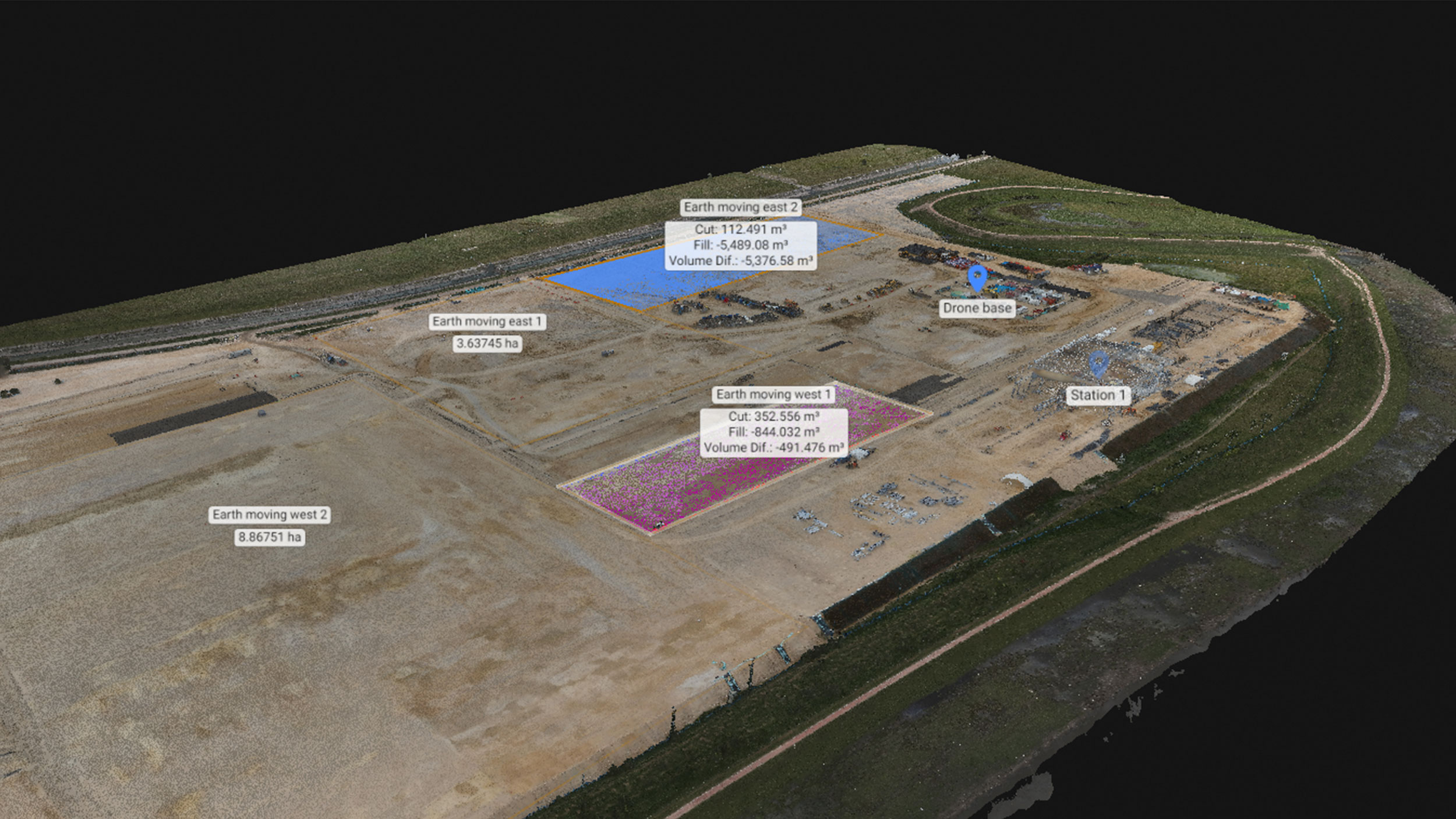
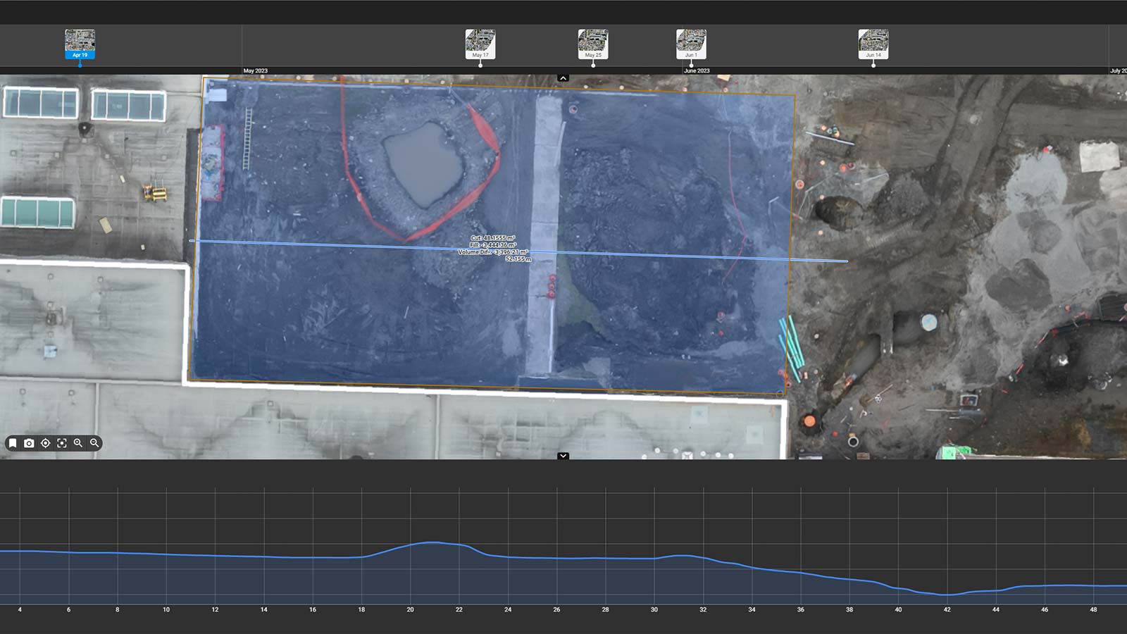
For Pensa, several PIX4Dcloud Advanced features have stood out as particularly beneficial. The Volume Comparison tool has allowed Magil to compare and monitor volumes over time.
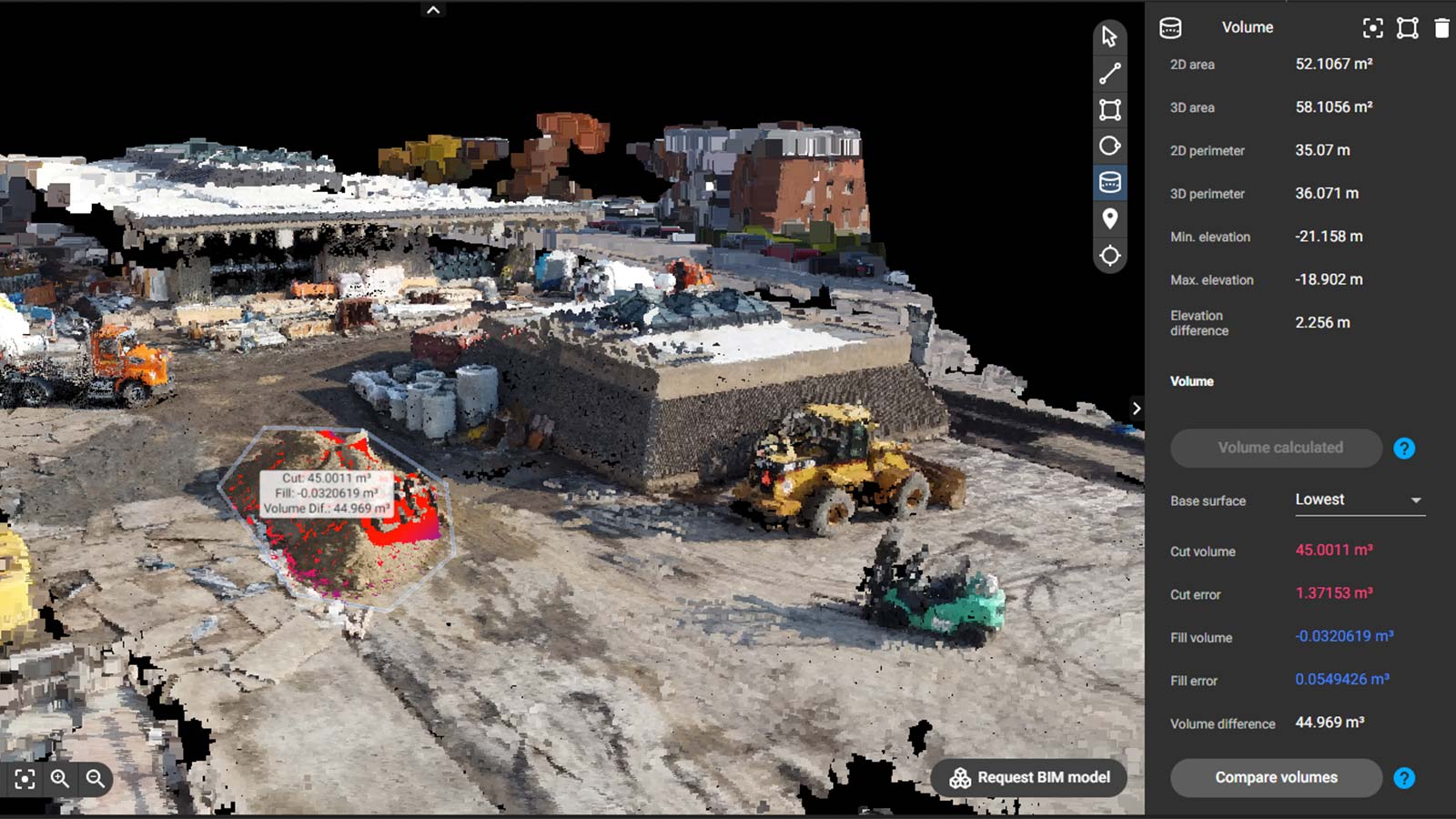
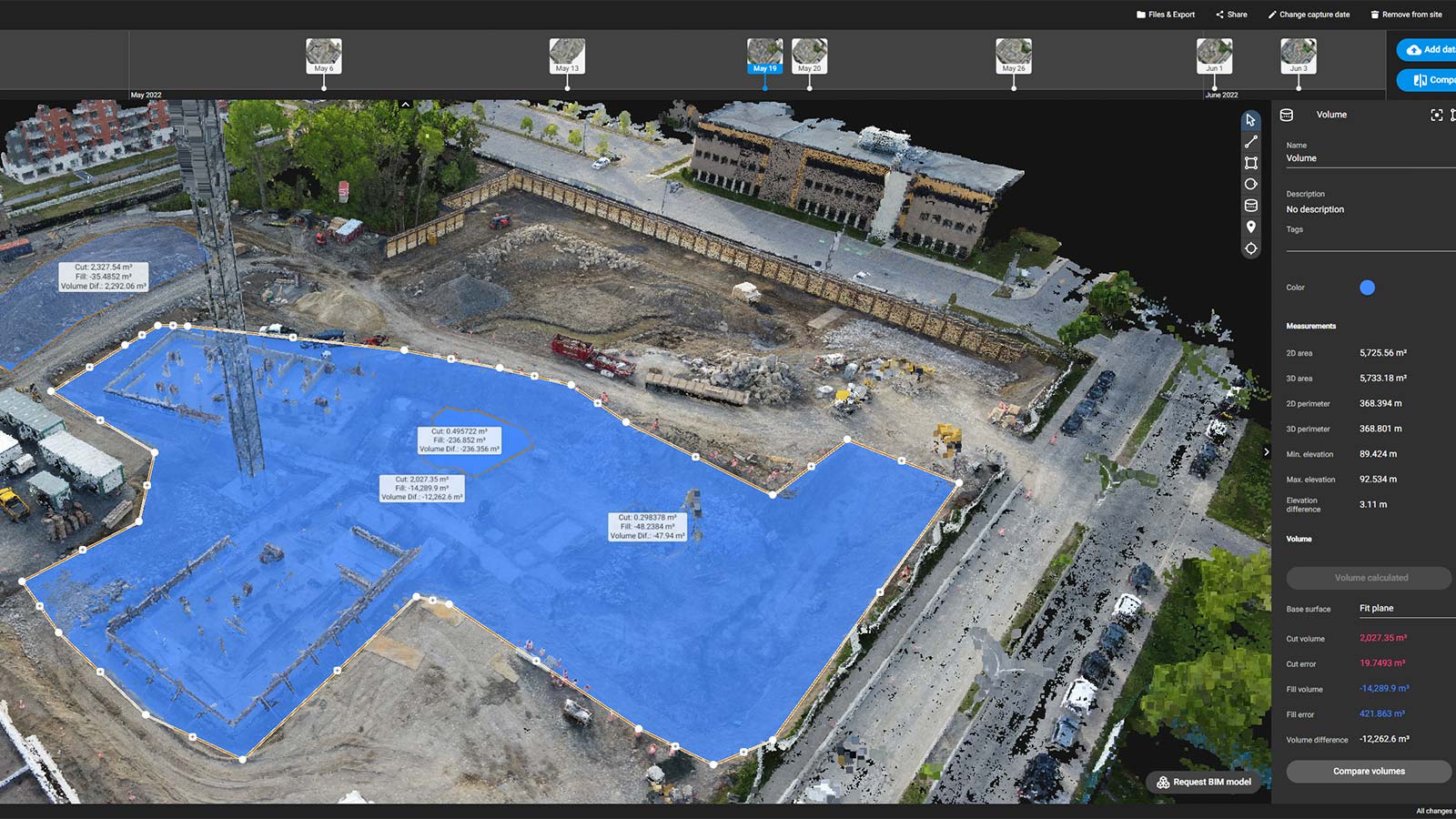
With the 3D Analysis tools they can analyze volumes, lengths, areas, quantities, slopes, excavation profiles, and more. The Annotations tools, such as the Annotations Report, has allowed them to automatically create customizable reports consisting of measurements, markers, volumes, notes, or inspections, enabling collaboration across projects and teams. Finally, the ability to export 3D point clouds has allowed them to integrate the data with their BIM models.
PIX4Dcloud has provided Magil with a centralized platform for storing and accessing project data. Team members can view and analyze information, regardless of their location, ensuring everyone is on the same page. The software allows for easy sharing of maps, models, and other data. Additionally, PIX4Dcloud’s ability to export data in formats compatible with other software aids in collaboration across different platforms.
“Pix4D has transformed our construction projects, bringing remarkable precision and improving teamwork, which is clearly reflected in the quality and efficiency of our work.” - Federico Pensa, Innovation & Technology Director
Magil finds the ability for team members to annotate and leave comments directly on the images and models particularly useful for highlighting areas of interest or concern, facilitating clear and effective communication. As Magil Construction continues to scale its drone program, its success story with photogrammetry and technology serves as a beacon for the construction sector's future.