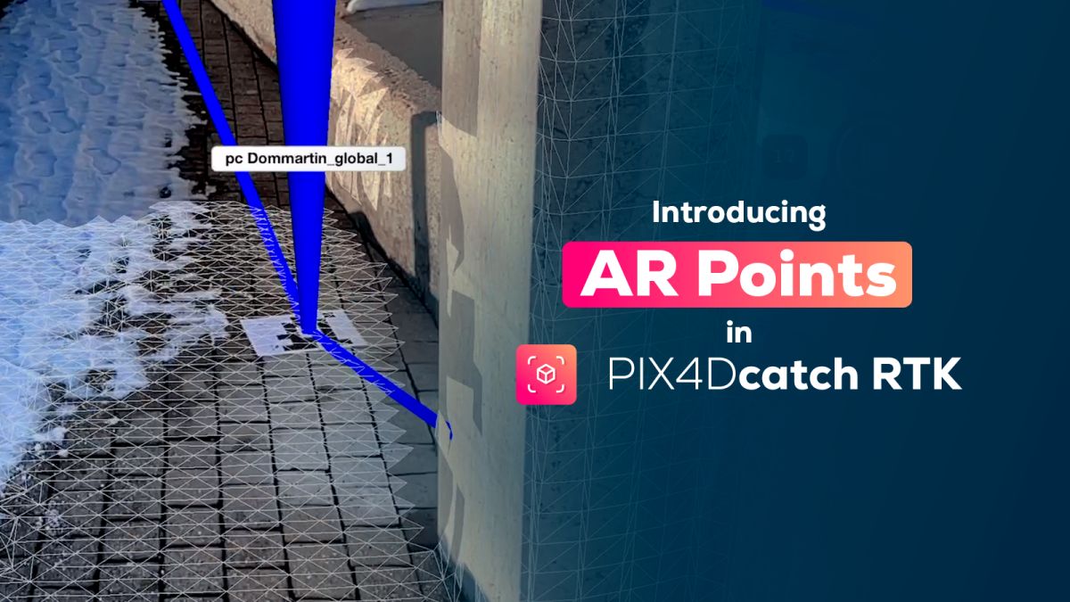
Introducing AR Points in PIX4Dcatch
In the evolving landscape of photogrammetry, PIX4Dcatch continues to push the frontiers with innovative features. Today, we're excited to introduce a game-changing addition: AR Points. This feature uses the power of augmented reality (AR) to transform how you visualize and capture Ground Control Points (GCPs) in the field.
What are AR Points?
AR Points in PIX4Dcatch provide an immersive experience, overlaying digital information onto the real world. With an intuitive visual 3D marker, AR Points make it incredibly easy to identify the precise locations of your GCPs. This feature is particularly beneficial with helping users to easily navigate the scene during capture, while observing the AR points and identifying the next GCP location. This significantly enhances consistency, if you need to do multiple 3D mappings of the same work site.
Main benefits of AR Points
Enhanced visualization See exactly where your GCPs are in the real world, ensuring they’re always included in your captures.
Consistent accuracy Maintain high accuracy in your mapping projects by repeatedly capturing the same GCPs in a series of sessions.
Efficient workflow Simplify your capture process by following a predefined path, ideal for collaboration between field and office teams.
How do AR Points work?
Step 1: accessing AR Points
Step 2: selecting a point collection
Step 3: activating AR Points
Now you can start walking and the AR points will be displayed.
Processed output
Settings and customizations
- Adjust the opacity of the points displayed in AR using the slider on the left of the capture viewer
- To turn off AR Points, revisit the tools menu, select AR Points, and then remove the point collection
- Customize your view by turning off the lines and/or the points' label names in the settings panel, where a dedicated section for AR is available
Additional Notes:
- If this distance exceeds 1km, the point collection will be grayed out
- The Tag Detection tool can run concurrently with AR Points, maximizing efficiency. In order to enable it, you need to use a projected coordinate system as geographic coordinate systems are not compatible with the Tag detection feature.
AR Points in PIX4Dcatch open up new possibilities for field 3D mapping, offering a blend of accuracy and ease of use. Whether you're managing long-term construction projects or coordinating between field and office teams, this feature ensures your GCPs are always captured precisely and efficiently.
Need more details?
For those who want more in-depth instructions, or need to download the tags for the AR Points feature, a wealth of resources awaits. Visit our comprehensive support document: How to use AR Points in PIX4Dcatch.