

Drone and terrestrial mapping:
Pix4D vs DroneDeploy
In the rapidly evolving world of drone and terrestrial mapping and photogrammetry, two prominent solutions, Pix4D and DroneDeploy, have gained recognition. Find out how these two solutions compare.
Photogrammetry software is utilized over a wide range of industries, optimizing time, reducing costs, and improving productivity. Two leading software providers, Pix4D and DroneDeploy, offer advanced features and capabilities, empowering clients to achieve their objectives with the use of technology. Join us as we compare both solutions, exploring the key aspects of each, to help you make the ideal choice for your needs.
Cloud vs desktop processing
A notable difference between Pix4D and DroneDeploy is, that while both offer cloud-based processing software, Pix4D offers desktop processing as well. This approach is advantageous, particularly for public safety operatives and those organisations who prioritize data security. And while it is possible to process vast amounts of data on a cloud-only product, in locations where a strong and stable internet connection is challenging or expensive, the desktop option is a failsafe solution.
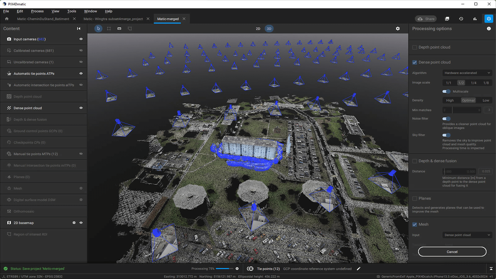
Moreover, with one of Pix4D’s desktop software, PIX4Dmatic, users can combine multiple projects in one master project, including aerial drone mapping and terrestrial datasets. By doing so users can document a whole project’s evolution, or even reconstruct a collision scene in 3D. Additionally, PIX4Dmatic enables efficient processing of large datasets, and users can easily share results with stakeholders through the Share-to-PIX4Dcloud feature. With Pix4D, users can enjoy the reliability of desktop processing alongside the convenience of cloud-based workflows.
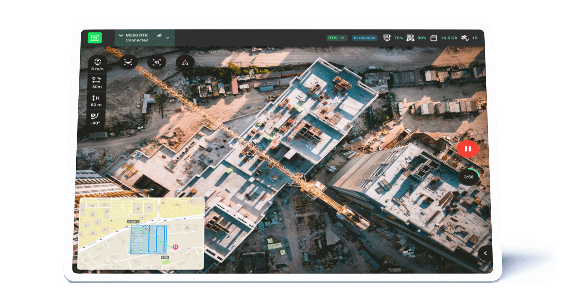
Flight Planning
When it comes to flight planning, both Pix4D and DroneDeploy offer excellent flight-planning apps, that are user-friendly and equipped with automatic mission capabilities, making them valuable tools for drone operators. Both Pix4D and DroneDeploy offer mission planning, which allows users to efficiently plan and execute drone missions. While there may be slight differences in their user interface and additional features, neither solution has a distinct superiority over the other. Ultimately, the choice between the two depends on user preferences and specific project requirements
Aerial and terrestrial mapping
In terms of terrestrial mapping, the PIX4Dcatch RTK workflow delivers scaled and georeferenced 3D outputs with survey-grade accuracy. While DroneDeploy offers 360 walk-throughs to complement aerial data, it lacks photogrammetry outputs, such as a 3D point cloud and 3D mesh, as well as terrestrial RTK for precise results.
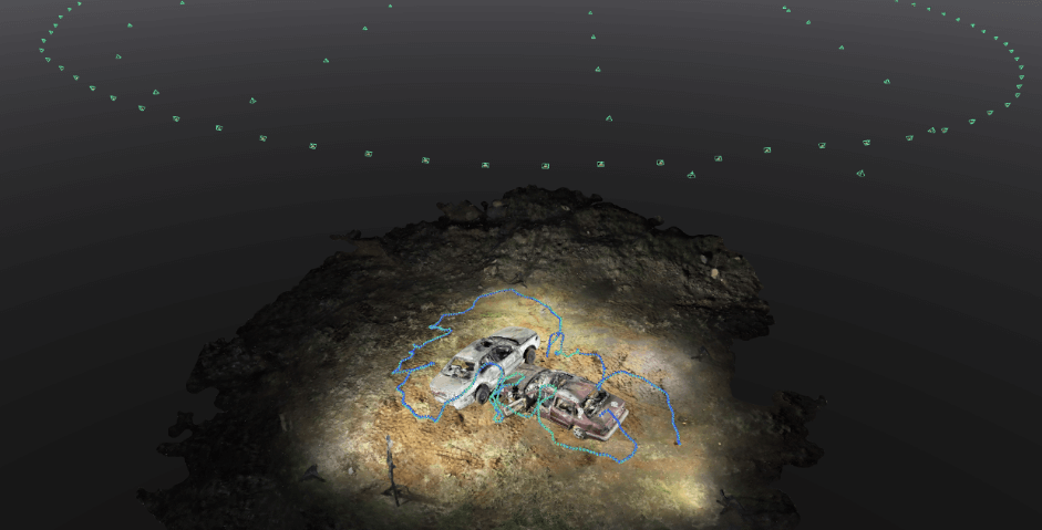
With Pix4D you have both, allowing you to accurately measure distance and volume, and providing precise documentation. This is crucial when measuring stockpile volumes, obtaining precise measurements for court presentations in vehicle crash scenes, or documenting utility pipes during trench closures.
Enterprise offering
Pix4D and DroneDeploy cater to slightly different business needs. While DroneDeploy focuses on larger companies, Pix4D’s enterprise solution serves companies of any size. Notably, Pix4D stands out with its flexible approach, allowing companies to customize their product package selection according to specific requirements, for example, desktop and/or cloud processing. Both companies are offering unique solutions to the market.
Pricing and user management
Pix4D offers highly competitive subscription plans, catering to different budget requirements. The PIX4Dcloud yearly subscription prices start at $49.20 per month, making it an affordable photogrammetry platform. Additionally, the PIX4Dcloud Advanced plan is available at $249 per month, providing advanced features at a competitive rate. DroneDeploy’s pricing starts at a higher point, with their plan beginning at $329 per month. Their Advanced plan is priced at $599 per month. When it comes to user management, Pix4D has an advantage over DroneDeploy. Pix4D’s basic plan allows for unlimited users, enabling collaboration and seamless access for teams. In contrast, DroneDeploy’s basic plan only provides one admin user access, limiting the number of users who can collaborate on the platform. Overall, Pix4D’s subscription plans offer competitive pricing with affordable options and advantageous user management capabilities.
Conclusion
While both Pix4D and DroneDeploy provide an array of beneficial features for drone mapping, Pix4D stands out with its hybrid desktop-cloud platform offering data security, professional-grade terrestrial mapping, competitive pricing, and unlimited user management capabilities, solidifying its position as the leading choice for professionals in need of reliable, accurate, and comprehensive mapping solutions.