Empowering the youth: drones for good with PIX4Dreact
Morocco Flying Labs leverages robotics and AI to address local challenges. They employ drones and photogrammetry to gather data and devise solutions for various industries. Their goal is to use drones for good, aiding institutions in proactive decision-making regarding issues like deforestation, floods, and environmental crimes such as illegal resource exploitation and forest fires.
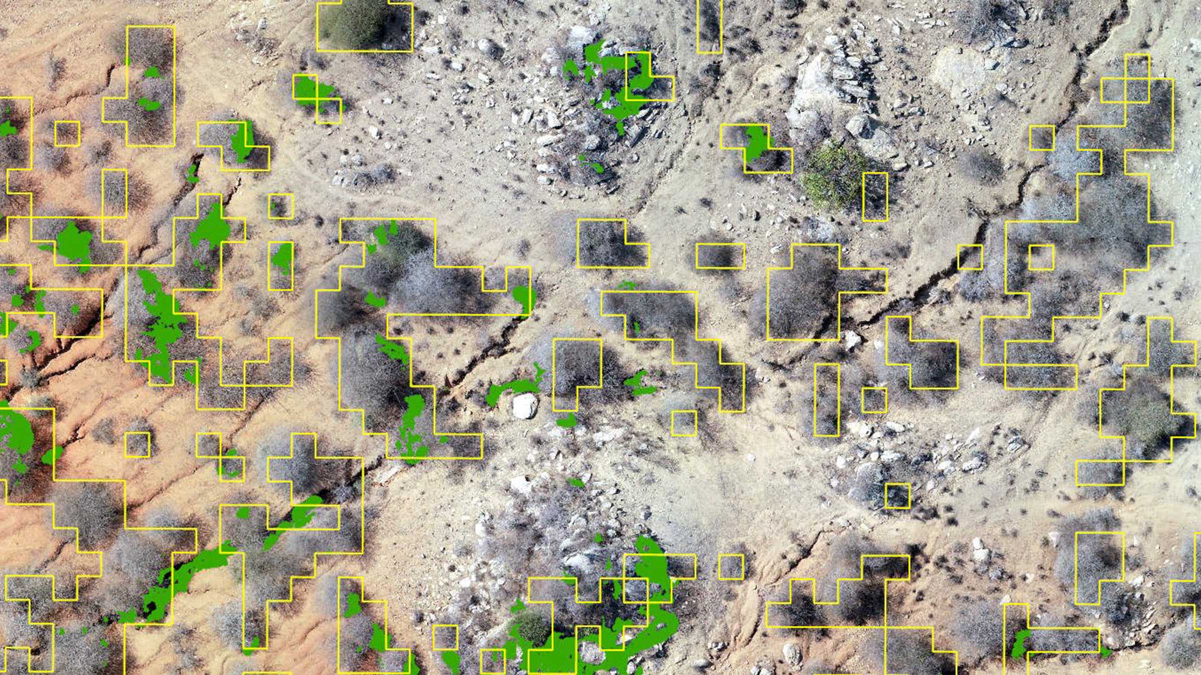
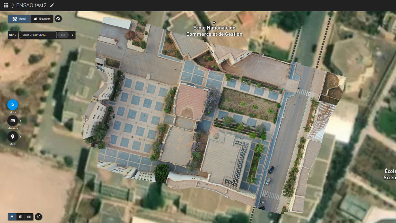
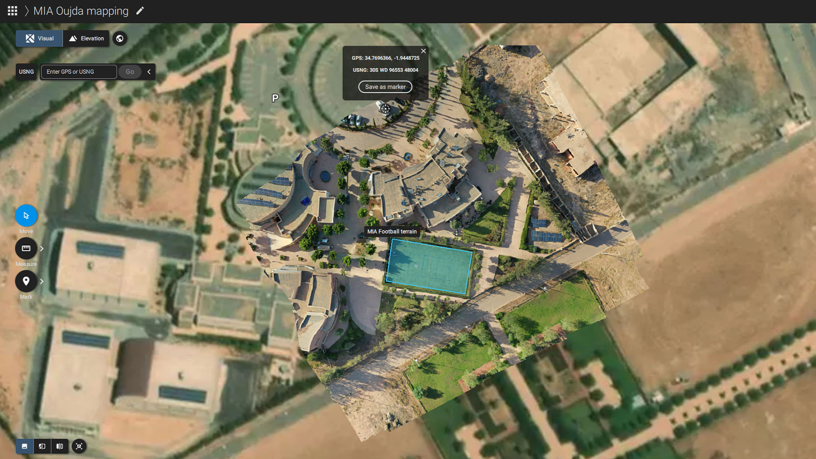
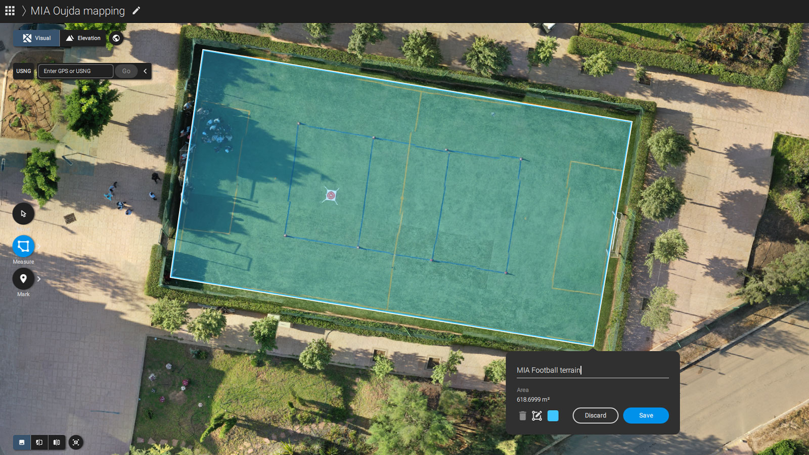
Morocco Flying Lab's aims to foster youth creativity, providing them with the necessary skills for emerging technologies such as photogrammetry so that future generations can discover practical solutions to tackle complex challenges. In this particular case, students from the Mohammed First University, Morocco mapped their school grounds with drones and then processed it with photogrammetry software.
The “Fly for the Future” project
Funded by Fondation Botnar, the “Fly For the Future” project empowers 7 Flying Labs, including Morocco Flying Labs. Fly for the Future aims to develop programs that introduce youth to both terrestrial and aerial technological solutions. Morocco Flying Labs organized three youth-led projects with the Mohammed First University, which was conducted over several days, engaging 65 youths between the ages of 21 and 25.
Exploring the positive: applications of drones for social good
These projects were structured into two separate parts – a theoretical session and a practical session. First, they learned about drones and their various applications, safety and risk management procedures, as well as career opportunities. They looked at applications such as forest fire prediction and monitoring, and wildlife studies like counting birds. In addition, ethical and social applications of drone use were also covered to ensure the drone projects aligned with local needs and adhered to local regulations.
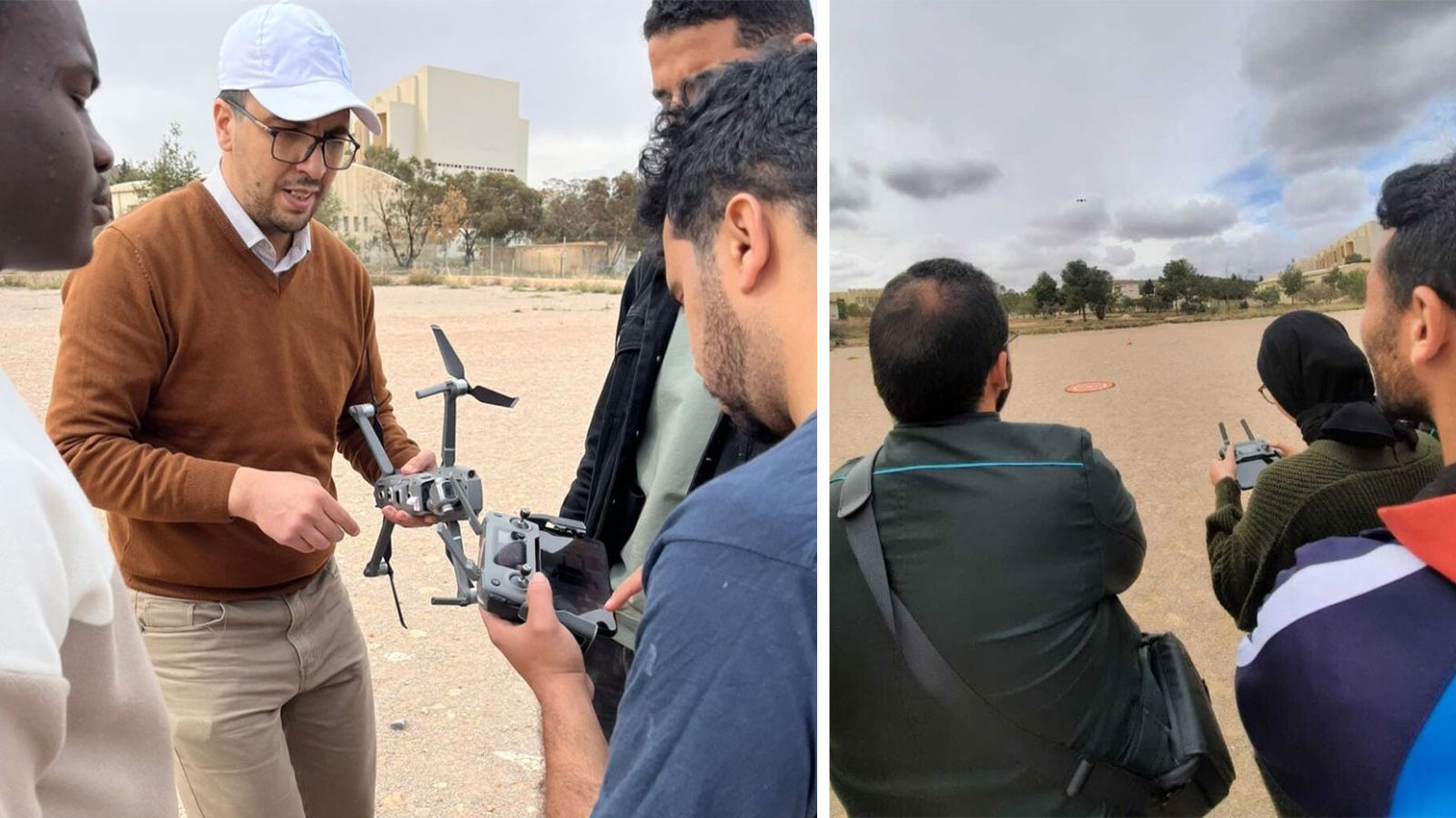
They then focused on hands-on activities such as manual drone flying sessions, automatic flight, data collection, flight planning, and much more. They processed the data with PIX4Dreact to complete the analysis.
During the second half of the session, students gained hands-on experience with drones. To ensure the data collection ran smoothly, students worked on several simple flight plans, practicing tweaking flight parameters and increasing situational awareness. The primary data was collected through the PIX4Dcapture app.
Planning campus expansion with drones
While the program usually focuses on ways to conserve energy, resources, and improve methods of waste disposal, this group focused on identifying locations for new buildings – the campus is running low on space. They flew two DJI Mavic Pro drones, where they analyzed land use and land cover maps, experimented with mapping multiple administrative buildings, and delineated potential new sites for parks and recreational activities.
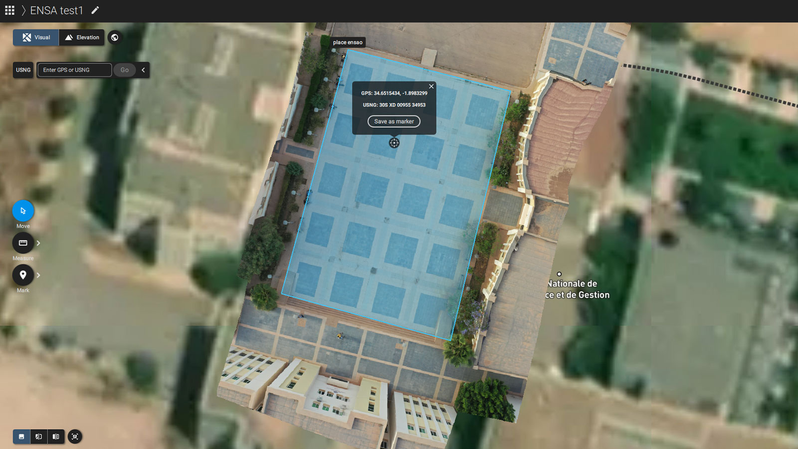
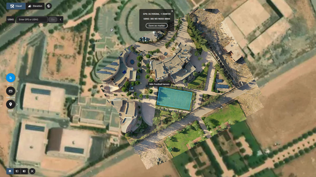
The students used the PIX4Dcapture app on their smartphones to program automatic missions, plan and then execute drone flights, and collect image data for mapping. After the drones were flown they processed the images into models and orthomosaics and turned them into maps. The students were shown how to visualize and analyze the results.
The project was a success; the students were enthusiastic and engaged and learned a lot about using drones for good. They gained hands-on experience in drone mapping and data processing thanks to PIX4Dcapture and PIX4Dreact. With PIX4Dreact, students were able to swiftly process their image data, which allowed them to quickly grasp the workflow and put things into perspective. Looking to the future, Morocco Flying Labs hopes to use photogrammetry to nurture a generation of drone-savvy professionals who can use technology and data to enact positive change.