Precise sediment measurement: Pix4D boosts accuracy by 70%
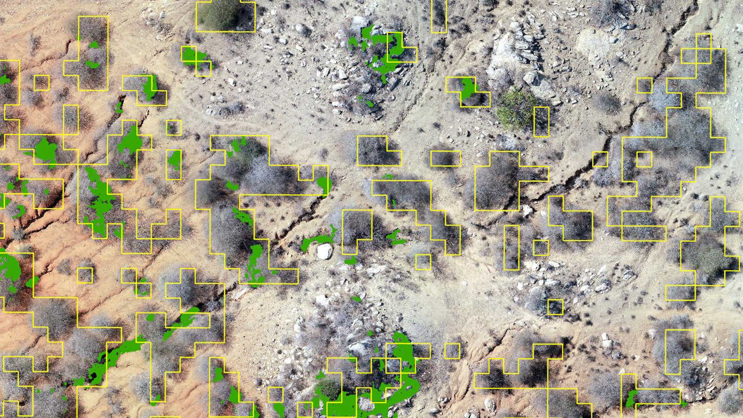
Sediment is matter that settles at the bottom of reservoirs, affecting water storage and quality. In order to ensure a reservoir’s extended lifespan, precise mapping and continuous tracking of sediment accumulation is crucial. The Toyama Prefecture Land Improvement Business Association Federation in Japan, commonly known as Midori Net Toyama, conducted a case study at an agricultural reservoir, assessing the impact of photogrammetry on accumulation tracking.
We spoke with an engineer and a manager from Midori Net Toyama, to gain further insights into the results. We were particularly interested in their experience of successfully merging terrestrial and aerial data using the PIX4Dcatch RTK workflow and drone imagery to increase accuracy.
What were the main insights gained from this case study?
The case study revealed three key insights:
By measuring the accumulated sediment in the reservoir using photogrammetry we managed to improve accuracy by 70% compared to the conventional approach of hiring a surveyor with cumbersome equipment
For areas that could not be captured by drone, we supplemented with a phone and PIX4Dcatch RTK, effectively merging the data for accuracy
Pix4D software made it easy to report and share the reservoir’s 3D model
Did you run into any issues?
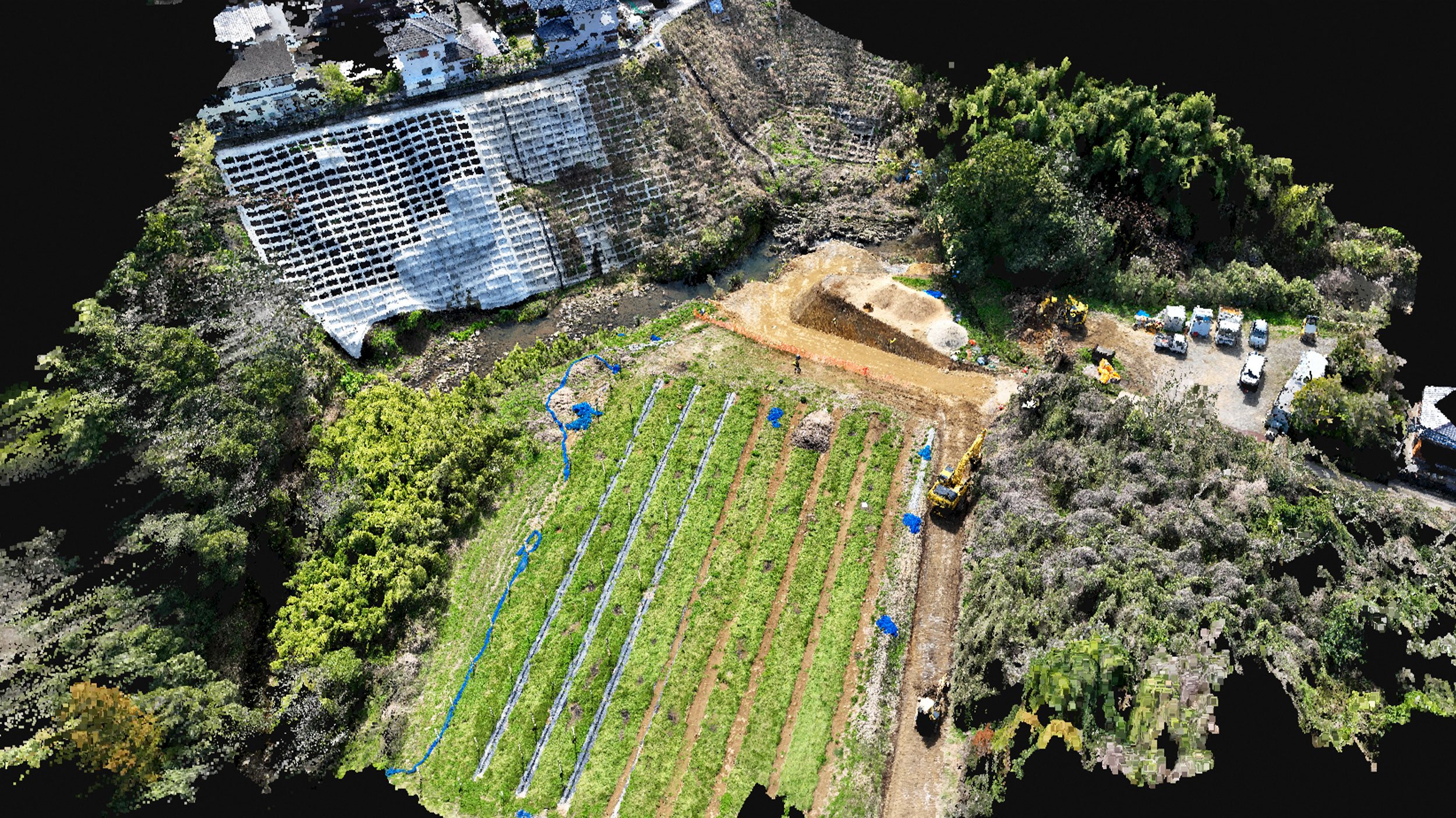
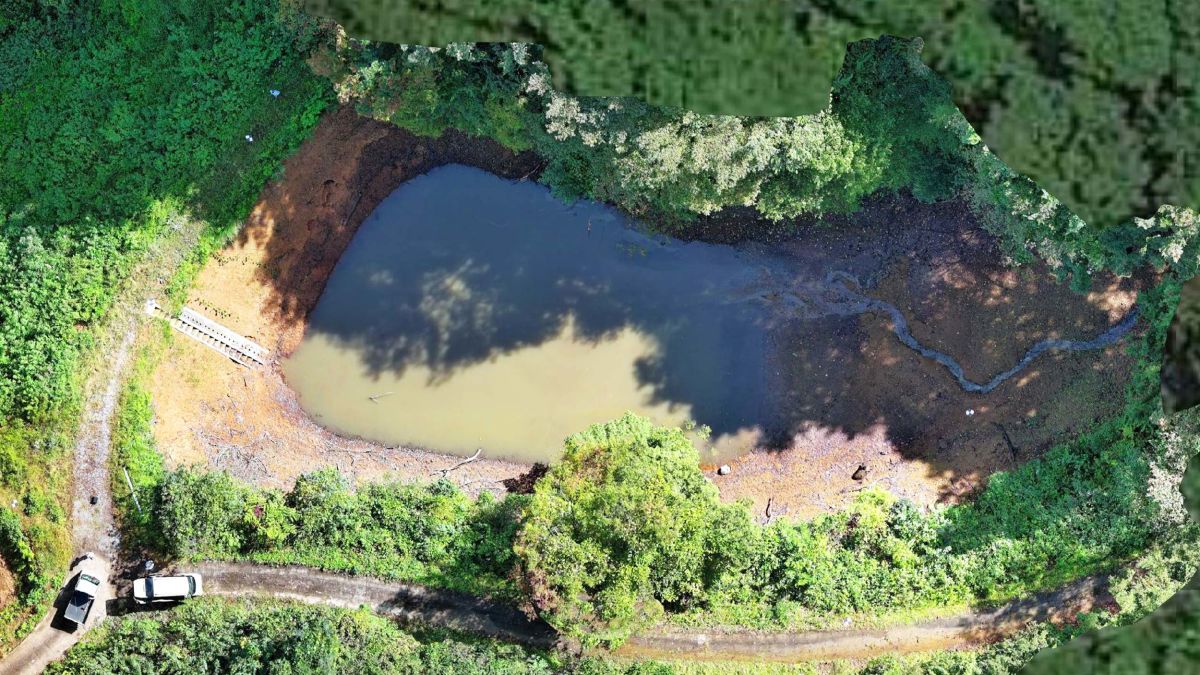
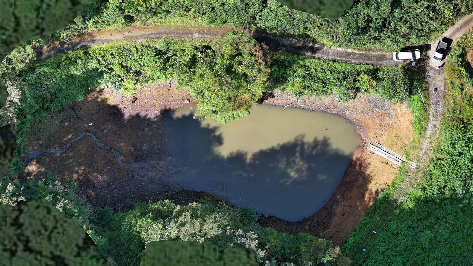
We aimed to calculate the amount of sediment at an agricultural reservoir in the mountainous area of Toyama City. These reservoirs are crucial for agricultural water supply and serve as vital infrastructure for disaster prevention, particularly flood control. To understand the decrease in water storage capacity, we first drained the water from the reservoirs, and then we measured the amount of sediment deposited on the bottom. However, capturing the images from above with a drone proved challenging due to obstructing trees. To address this issue, terrestrial scanning with a smartphone and the PIX4Dcatch RTK workflow became essential.
How did you create a 3D model from terrestrial and aerial imagery with Pix4D?
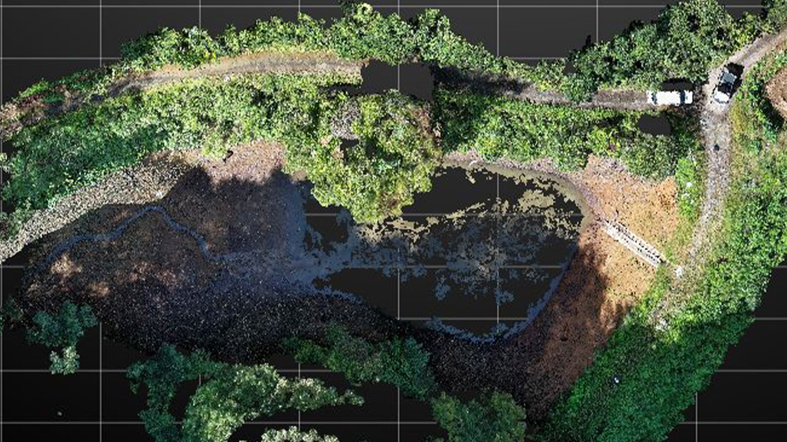
We took images from above using a drone and then scanned the ground using PIX4Dcatch RTK, creating a three-dimensional model from each (drone and phone), using PIX4Dmatic. The two models were merged and filtered using third-party software, and we could then calculate the volume of sediment.
We found the location of ground control points (GCPs) through PIX4Dcatch RTK’s single-point measurement function, eliminating the need for surveying equipment like a total station.* By simply attaching the RTK device to a smartphone and walking around the object, even young, inexperienced staff can quickly and accurately grasp the situation on-site in a short amount of time.
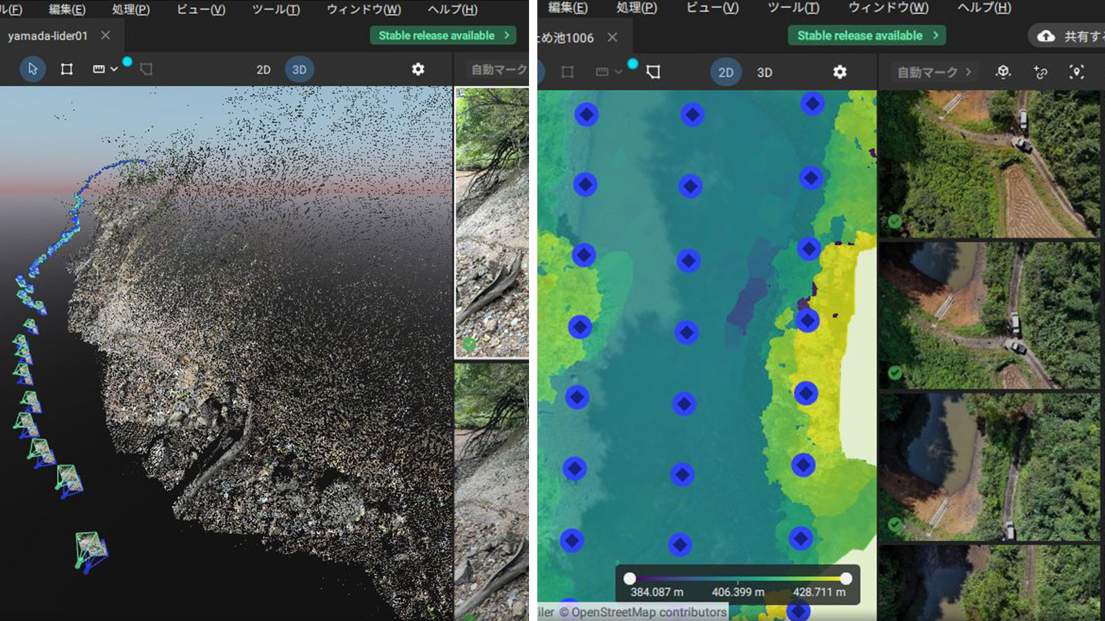
We used PIX4Dmatic for processing; it has a GUI that is friendly to beginners and is an easy-to-use SFM processing software that allows you to set items and place control points. I used to use photogrammetry software from other companies, but because of this I now regularly use PIX4Dmatic.
- *Finding ground control points is now even easier, with PIX4Dcatch's new AR Points!
What were the results of the case study?
Ground scanning allowed us to accurately reproduce areas that are difficult to photograph from the air. It took only 15 minutes to obtain GCP position information with PIX4Dcatch, reducing work time. Traditionally, a surveyor using surveying equipment would take an entire day (around 8 hours) – just to acquire the data. Using PIX4Dcatch RTK enabled us to drastically reduce the amount of work required.
The quality of the output also improved, and the ability to generate clear 3D models instead of 2D drawings with points and lines allowed for smoother reporting and facilitated information sharing. Agricultural infrastructure, such as reservoirs and agricultural waterways, are maintained at the expense of local farmers, and it helps to improve their understanding by showing the condition of the facilities using numerical values or 3D models.
Since we often conduct drone surveys at other sites, we feel that PIX4Dcatch RTK is useful in many situations to supplement areas that are difficult to photograph from the air. Overall, using photogrammetry and the integration of PIX4Dcatch RTK has helped reduce our workload whilst ensuring greater precision.