Using PIX4Dfields for multispectral conservation mapping
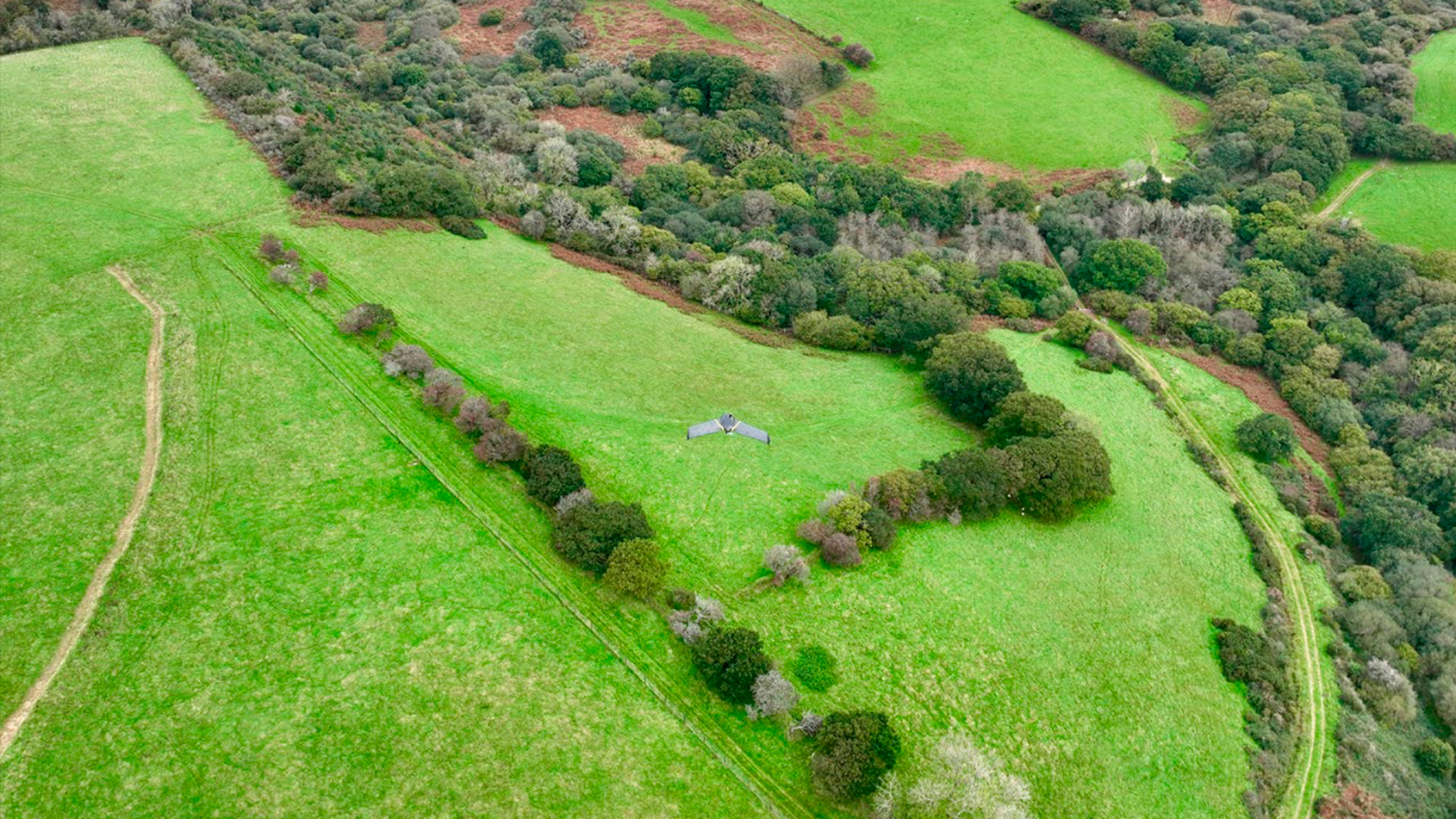
The Black Arrows has specialized in offering measurable drone surveys for over 7 years, primarily supporting landscape-scale mapping for renewables and conservation organizations. Based in Devon, they work throughout the UK, with most large-scale operations in Scotland, Wales, and Yorkshire, consistently delivering highly accurate and measurable mapping for very large-scale landowners.
Preserving Atlantic Rainforests
The Thousand Year Trust in Cornwall is a charity planting tens of thousands of trees in one of the UK’s last remaining Atlantic Rainforests!
They are proactively reforesting, rewilding, and diversifying their estate near Bodmin Moor, Cornwall, UK. These actions are part of a wider program to dramatically scale and translate the learnings to a much larger project (5000 acres!)
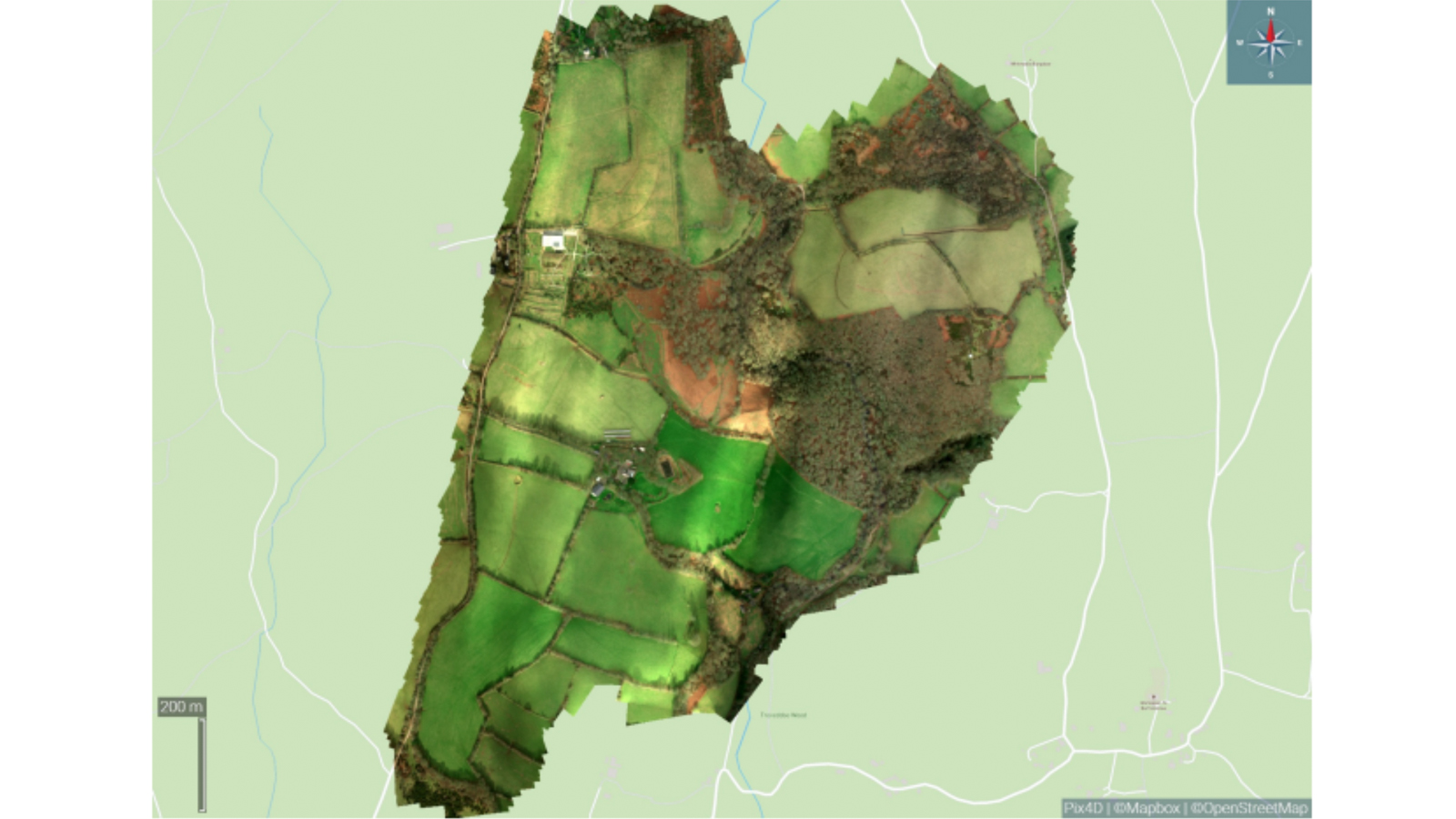
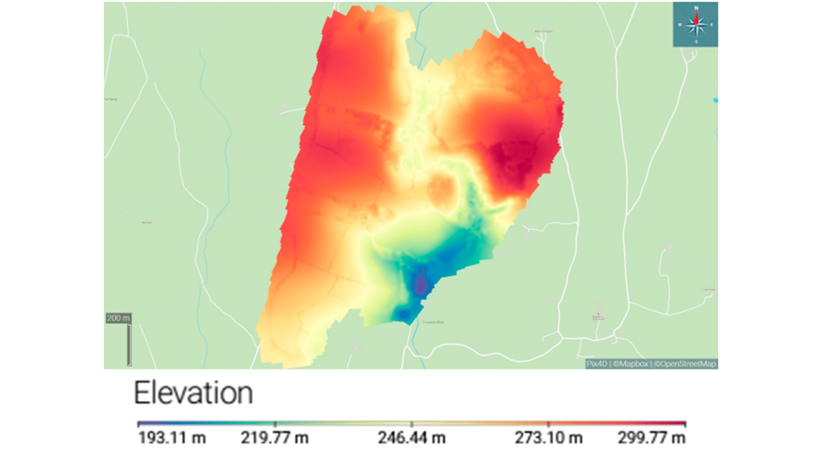
High-resolution maps for conservation
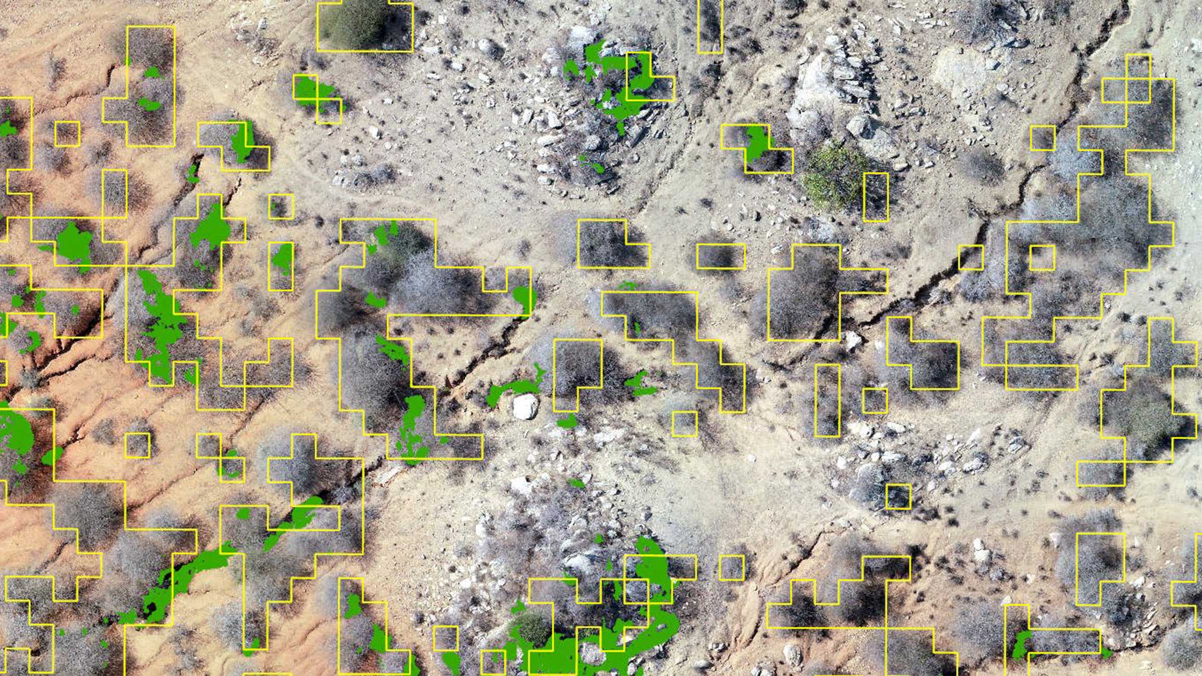
The Black Arrows mapped the estate, capturing it both in high-resolution 2D and 3D and with a multispectral payload. The surveys produced measurable high-resolution 2D maps, contour levels, DEMs, and vegetative indices.
All these outputs will be used by the Thousand Year Trust and their research partners: the University of Plymouth, the University of Exeter, the Eden Project, and the University of Zurich, to baseline their estate, track the impact of their work, and build the case for scaling their activities.
Multispectral Mapping
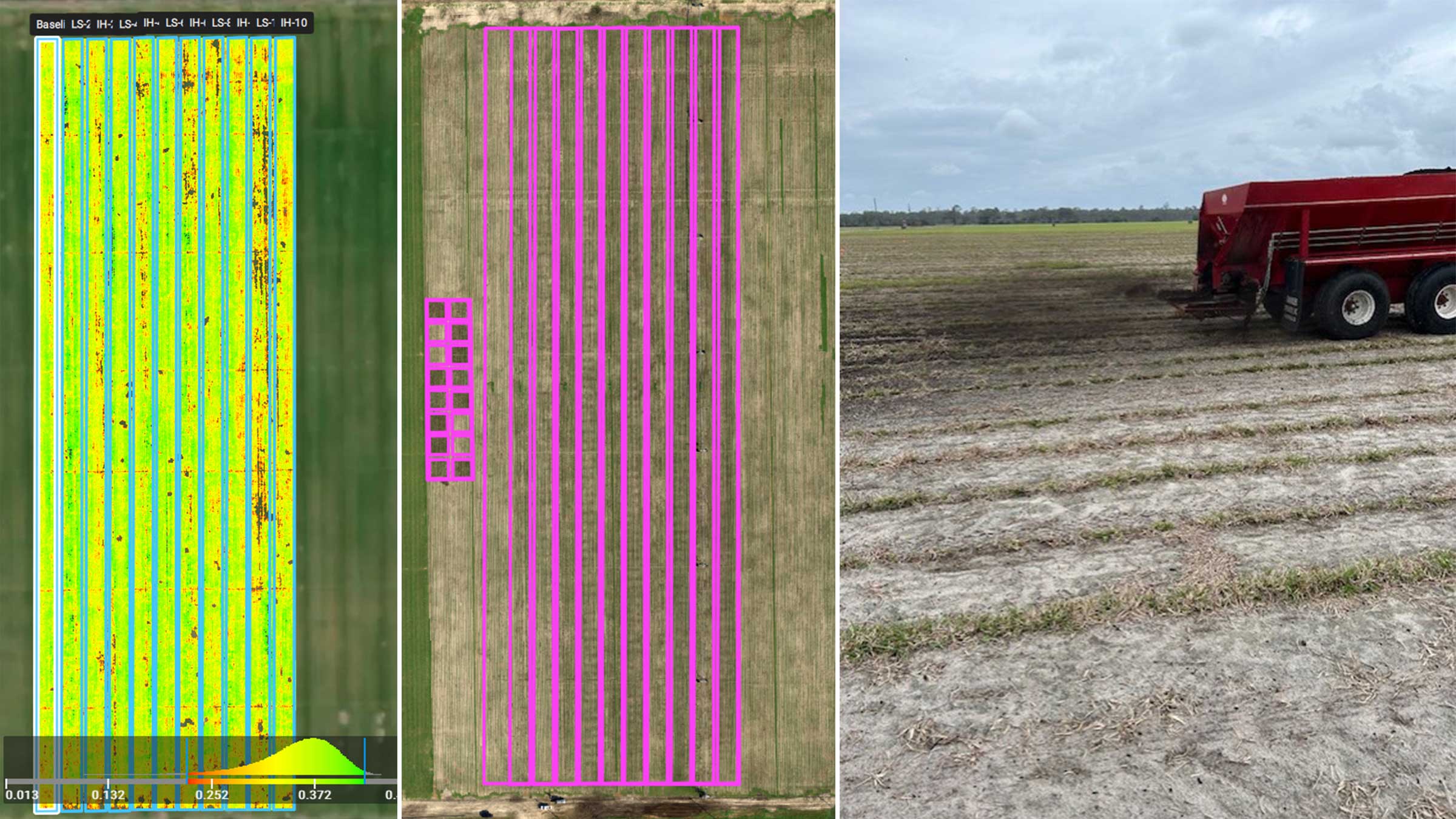
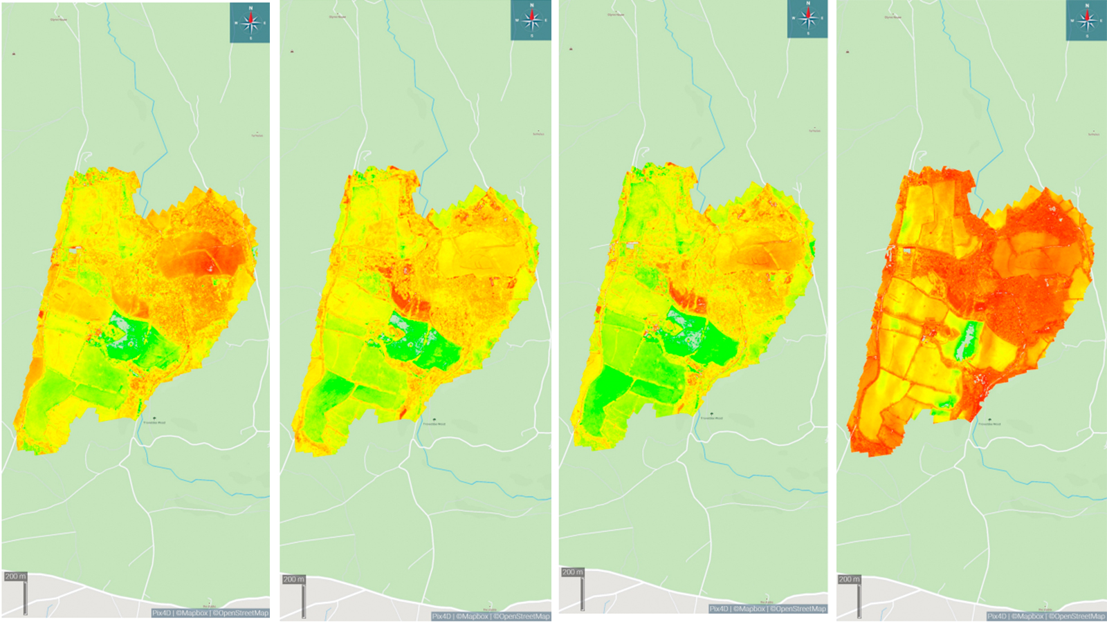
During the second stage of the program, they mapped the estate with a multispectral payload (Micasense RedEdge MX) to generate a number of vegetative indices. Without this data, achieving an accurate and measurable vegetative baseline snapshot across the estate would have been impossible—PIX4Dfields’ inbuilt calibration and vegetative index processing made swift work of the 50GB of captured data.
Weather is always the biggest challenge in-field, and several flights had been postponed due to unforecast high winds, but on the day of the multispectral survey, they had clear skies and low winds, which simplified the workflow.
They are still at the initial stages of this project and the data (which will form the baseline) is currently being analyzed by several research institutions. After the project is underway, they will re-fly the estate, allowing for comparative datasets.
Advantages of PIX4Dfields
From the data collected, they generated 9 vegetative indices including NDRE, VARI, and NDVI. They noted that PIX4Dfields offers a quick and intuitive workflow with multiple GIS-compatible outputs, allowing clients to start working with it instantly.
After processing and analyzing the images in PIX4Dfields, the team used PIX4Dfields’ customized PDF report to keep a record of all the important findings and detailed insights, such as vegetation indices and elevation modes, that were generated in PIX4Dfields.
PIX4Dfields allows clients to develop a deeper understanding of their lands, to better plan their conservation interventions, and to account for their impact over time: “it was comforting for us to know that PIX4Dfields’ precision agriculture tools allowed us to dive deeper into actionable insights like the creation of prescription maps.”
They found PIX4Dfields a stable platform capable of handling large volumes of data while delivering consistently accurate and measurable results. After testing various other software, they found many of the alternatives to be more inconsistent, unstable, and ultimately inefficient when working at scale.
For The Black Arrows, despite the emergence of more cost-effective survey-capable drones and a number of alternative desktop and web-based solutions that have entered the market: “we continue to test these alternatives to ensure we are delivering the best quality and value to our clients, but we still find that Pix4D remains the leader in its field.”
“The Black Arrows have used Pix4D’s suite of software for over 7 years, without it we simply wouldn’t be able to offer our conservation clients a consistent, accurate, and measurable level of data to support their estates and projects. The software is frequently updated and only gets faster and more feature-rich with each iteration. We find that Pix4D remains the leader in its field, and enables us to take vast amounts of drone-captured BIG data and generate SMART data for our clients.” - Daniel Green, Managing Director of The Black Arrows