Mapping the past: Pix4D and the future of archaeology
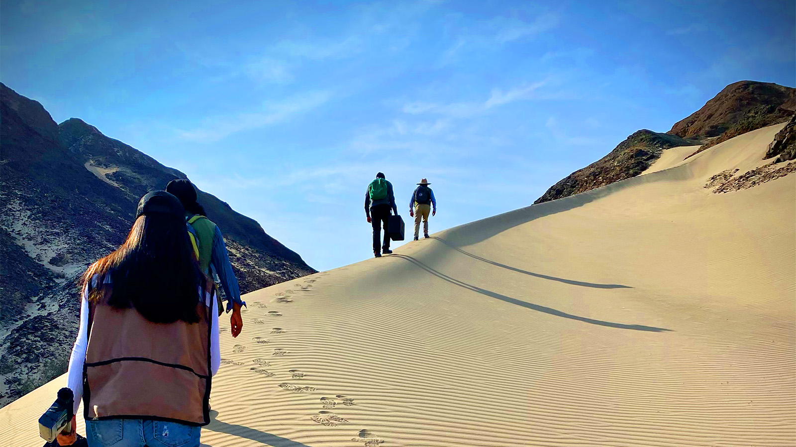
One of our team members had the unique opportunity to demonstrate the PIX4Dcatch RTK workflow at the Amykles Research Project near Sparta in Greece. The Amykles Research Project is an active archaeological excavation at the Sanctuary of Apollo, where the renowned Throne of Apollo is located. In showcasing the workflow, we provided a glimpse into its application and benefits for field archaeology.
The PIX4Dcatch RTK workflow proved to be indispensable for capturing and processing precise geospatial data in real time during the excavation. Its ability to accurately capture intricate detail, its non-intrusive approach, and the resulting datasets make it an invaluable tool for understanding and preserving archaeological remains, contributing to research and documentation efforts. We spoke to Professor Stavros Vlizos, Director of the Amykles Research Project, about the role of the PIX4Dcatch RTK workflow in the excavation process.
Tell us about your role as the Director of the Amykles Research Project
I am currently directing the Amykles Research Project, focusing on excavations at the Sanctuary of Apollo in Sparta with the support of the Athens Archaeological Society. I am an associate professor in the Department of Archives, Library Studies and Museology and the director of the Museum Collections at the Ionian University in Corfu, Greece. An aspect of my role is promoting and managing cultural heritage and museums, which is where the Amykles Research Project comes in.
How was the PIX4Dcatch RTK workflow introduced to the project?
As part of a funded research project in 2019, we acquired and used PIX4Dmapper for archaeological research at the site of Amyklaion in Sparta. In 2022, Pix4D contacted me about the new terrestrial workflow that they thought would be more suited to our needs: PIX4Dcatch RTK. We scheduled a visit with someone from Pix4D who would trial the use of this workflow during excavations.
Tell us more about your experience with the PIX4Dcatch RTK workflow
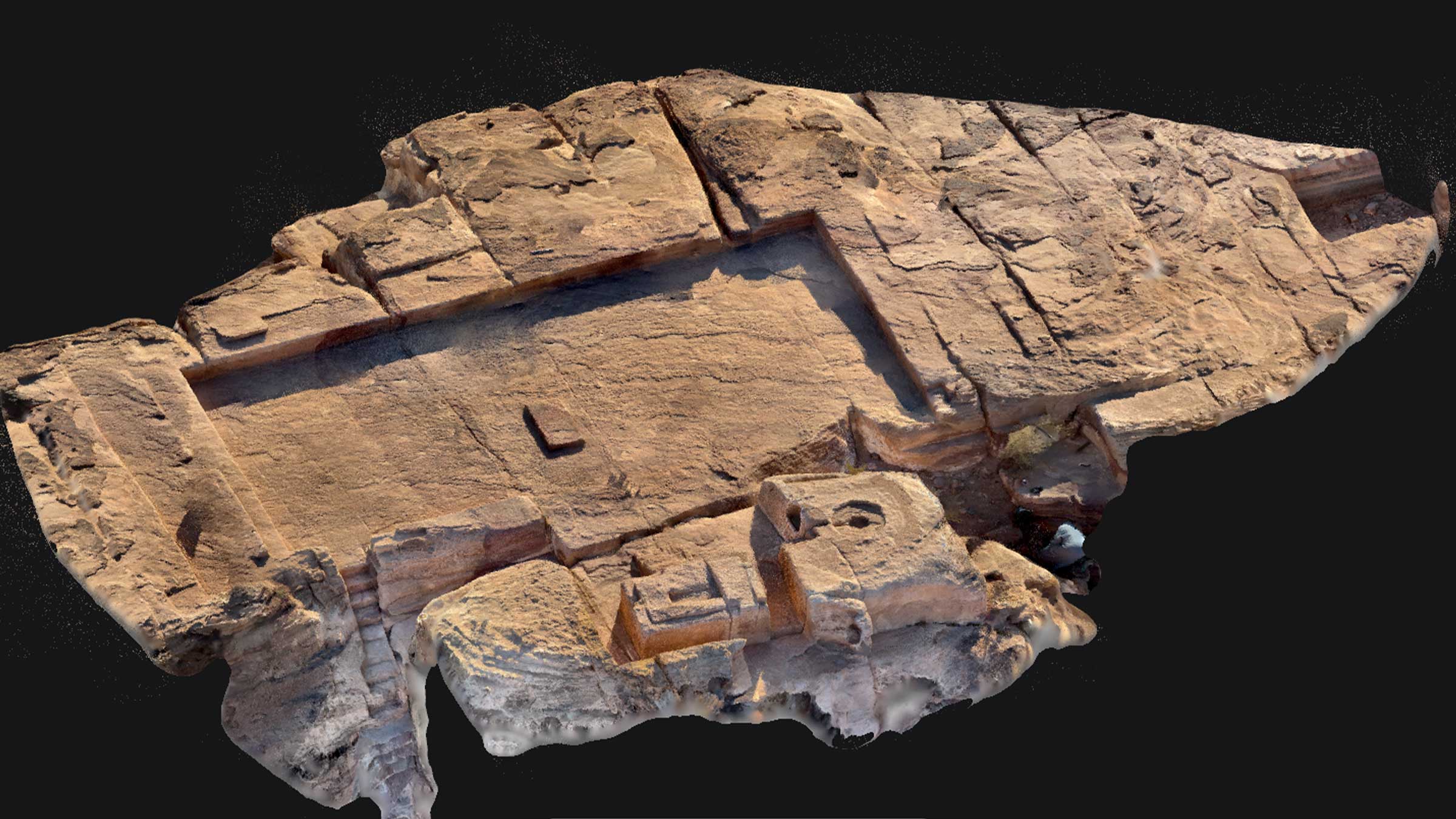
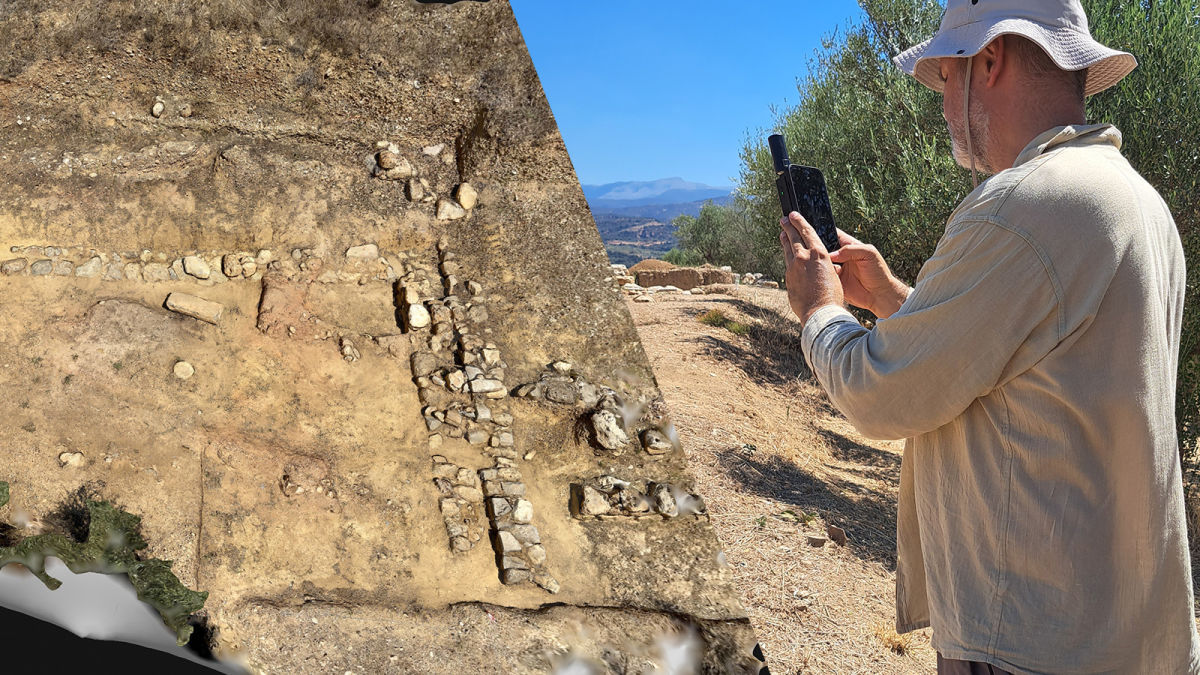
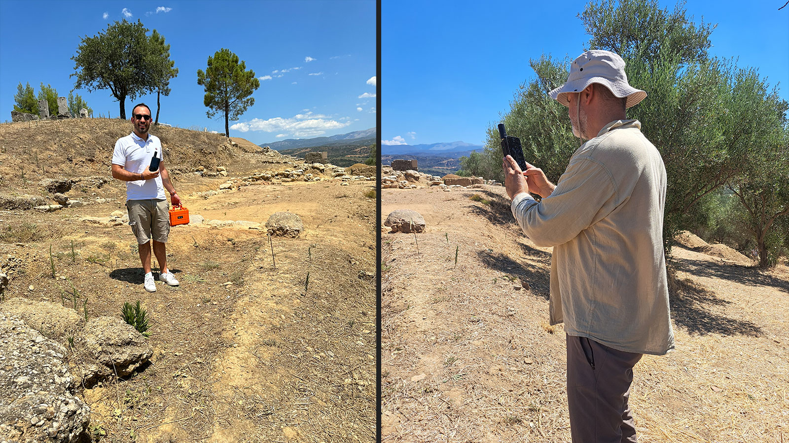
In August 2023, Christos Chatzitheodorou from Pix4D visited us at the archaeological site of Amyklaion. First, he showed us how all we had to do was place the RTK device on an iPhone and then start capturing! Following this initial demonstration, we got to work. We began by taking pictures of four monuments (cistern, platform, western rectangular building, and south building). Next, we transferred all the files to PIX4Dcloud and got a first impression of the project’s shape.
That afternoon, Christos gave a detailed presentation of the equipment, how to use it, the software, the possibilities it could provide to us, and how to process the 2D/3D models. The members of the excavation team had the opportunity to discuss special features of the process as well as to have hands-on experience with this equipment. The archaeologists were impressed by the easy way of use and the final results.
Project details
| Location | Amykles, Greece |
| User | Amykles Research Project |
| Software used | PIX4Dcatch RTK workflow PIX4Dmatic PIX4Dcloud |
| Hardware used | iPhone with RTK device, laptop |
| Area covered | 500m² |
| Number of images | Approximately 1500 images, between 300-400 per dataset |
What are the advantages of the PIX4Dcatch RTK workflow for archaeologists, and did you face any challenges?
The main advantage for Amyklaion is the immediate creation of georeferenced 3D models (cistern, platform, western rectangular building, and south building) and orthomosaics. Considering the volume of data, the process was within a reasonable waiting time. One of the difficulties encountered on-site was the RTK device overheating during use, which we resolved by implementing a few short breaks to lower the temperature.
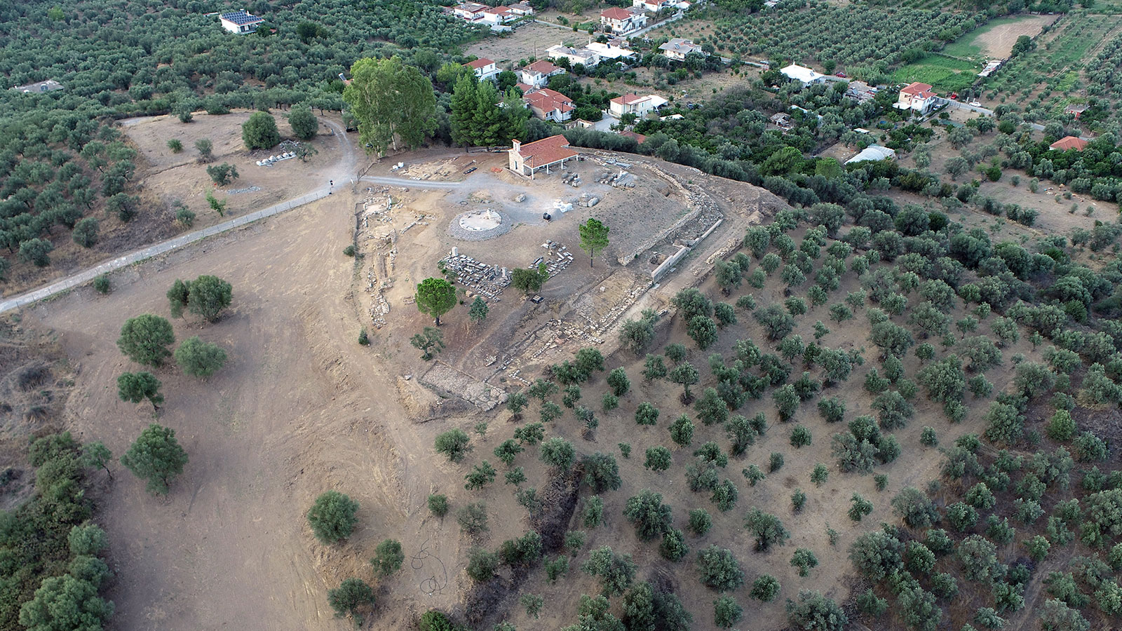
The impact of this workflow is that, in a short time, we managed to have georeferenced and three-dimensional mapping of monuments, with the possibility of processing and being able to measure distances, volumes, and areas. One of the many potentials for this application during excavation is how it accelerates archaeological research. It also improves the accuracy of publications, increasing their usability for other services and the general public.
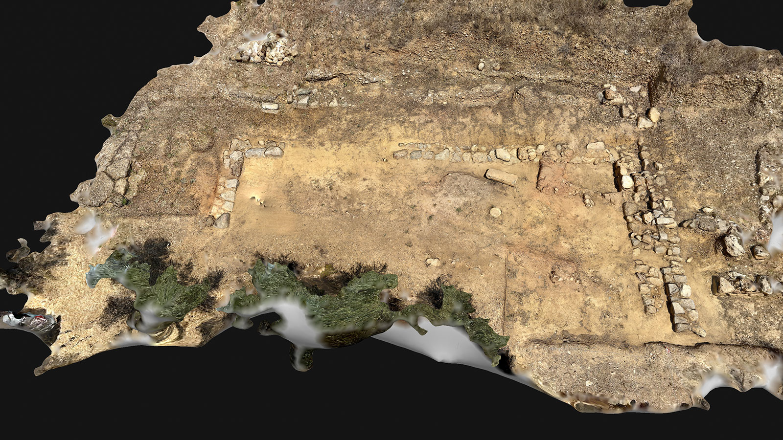
I think Pix4D’s main advantage for archaeology lies in comprehensively and efficiently digitalizing the excavation process. With simple steps, such as uploading a set of photographs, we have been able to produce 2D and 3D models of the structures which will enhance our research. Moreover, these digital models can be used to produce other products for the wider public. Pix4D provides a variety of feature packages, depending on the needs of each user.
“The creation of the orthomosaic and 3D model is a relatively simple and short process. However, utilizing all the possibilities may still be complicated for professionals like archaeologists and museologists. Nevertheless, Christos Chatzitheodorou, Pix4D - Channel Development Executive, provided us with valuable information and guidance, and allowed us to see the future of photogrammetry in archaeology.” - Prof. Stavros Vlizos, Director, Amykles Research Project