
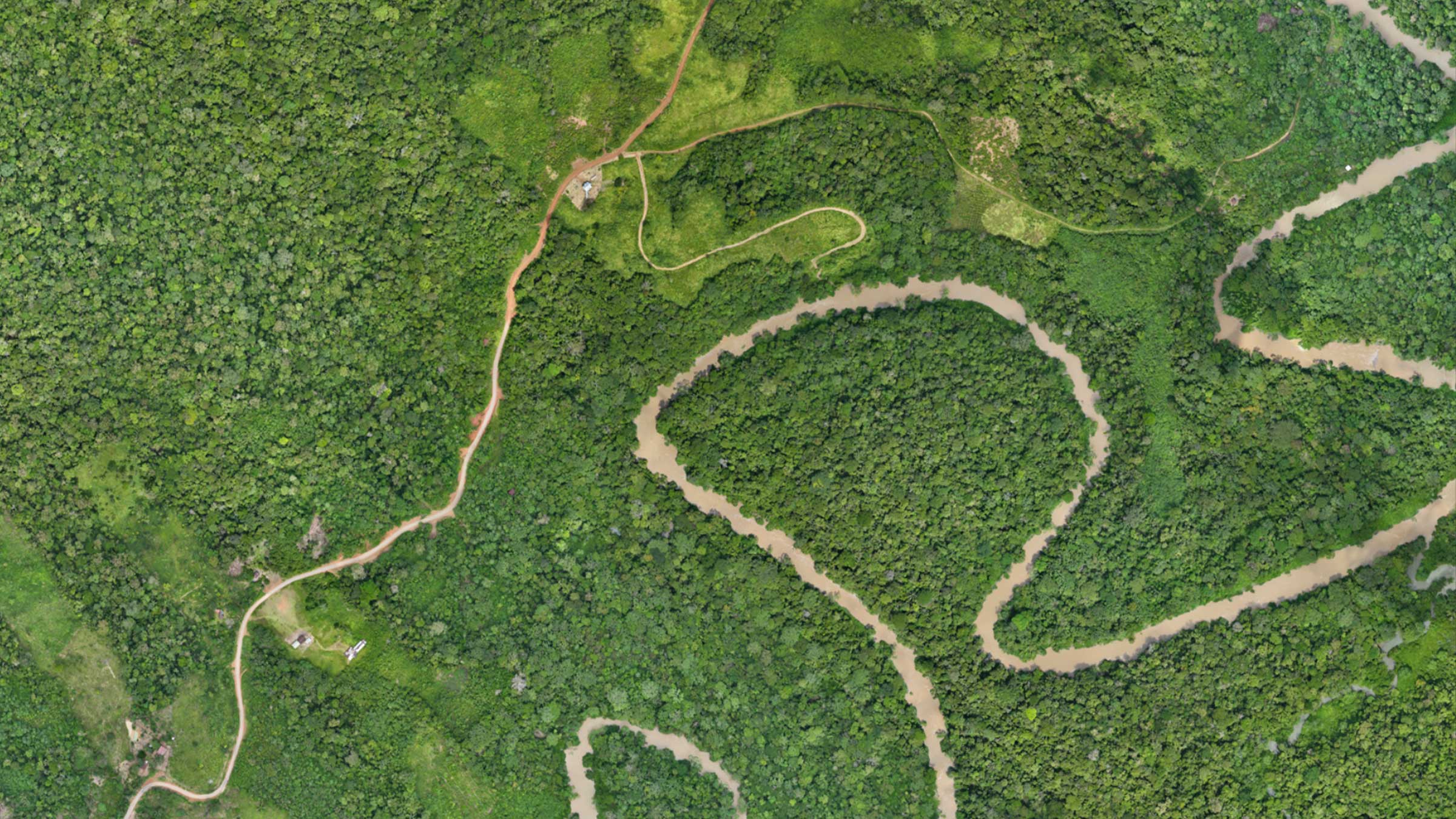
Mapping the Amazon Rainforest with PIX4Dmatic
PIX4Dmatic creates high-resolution maps for a sustainability project in the Amazon, tracking change over time to aid in restoration.
Read more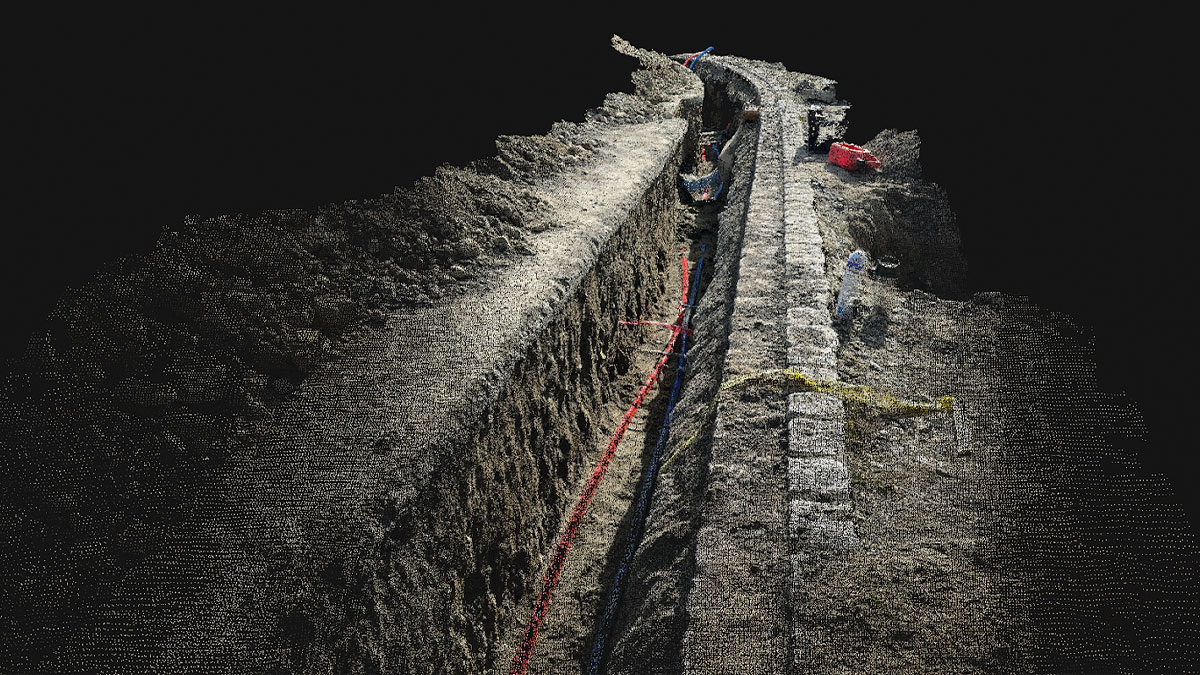
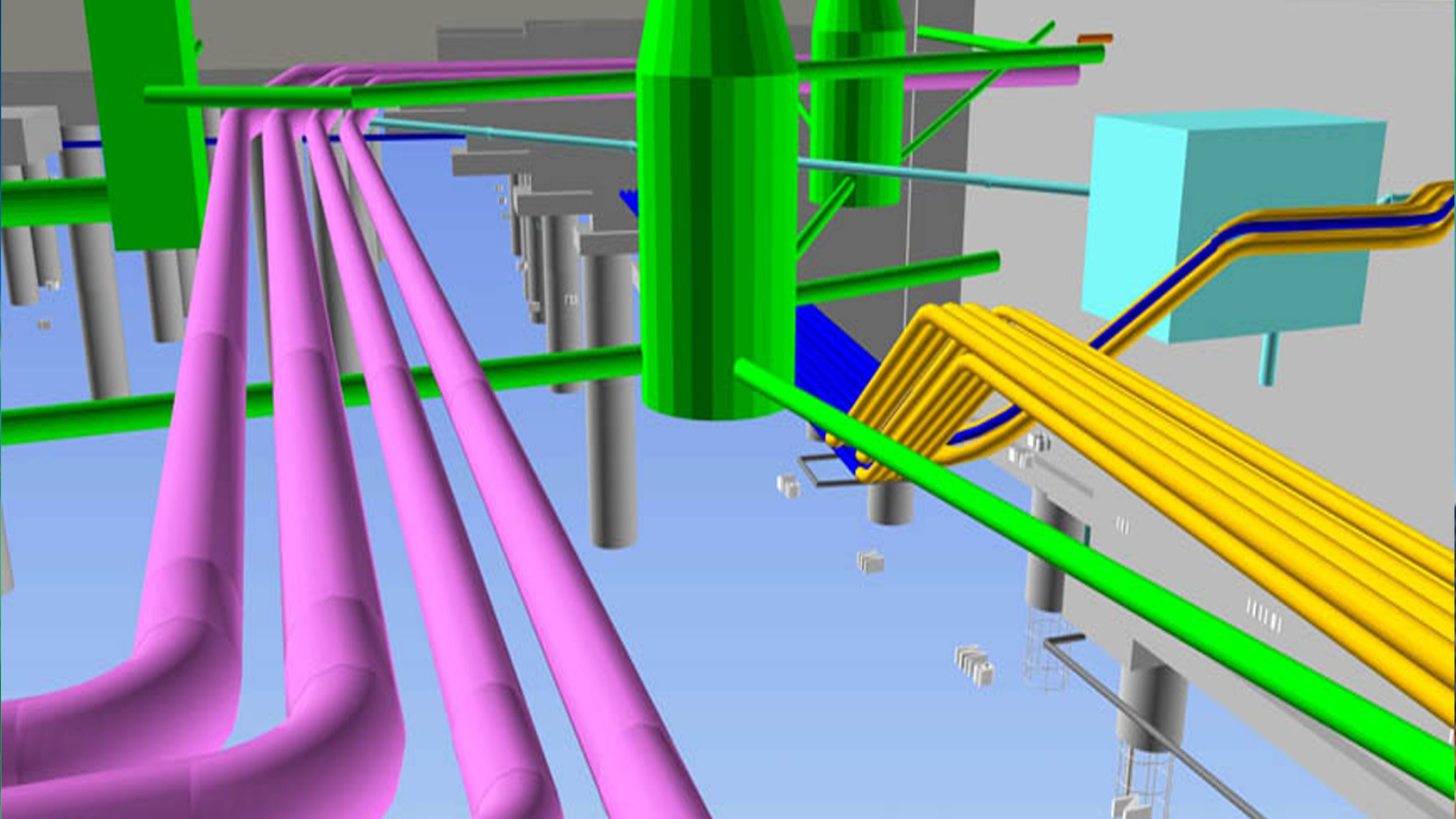
Documenting subsurface utilities with PIX4Dcatch
Accurate trench documentation is key in construction. A firm successfully implements mobile scanning app PIX4Dcatch for this purpose.
Read more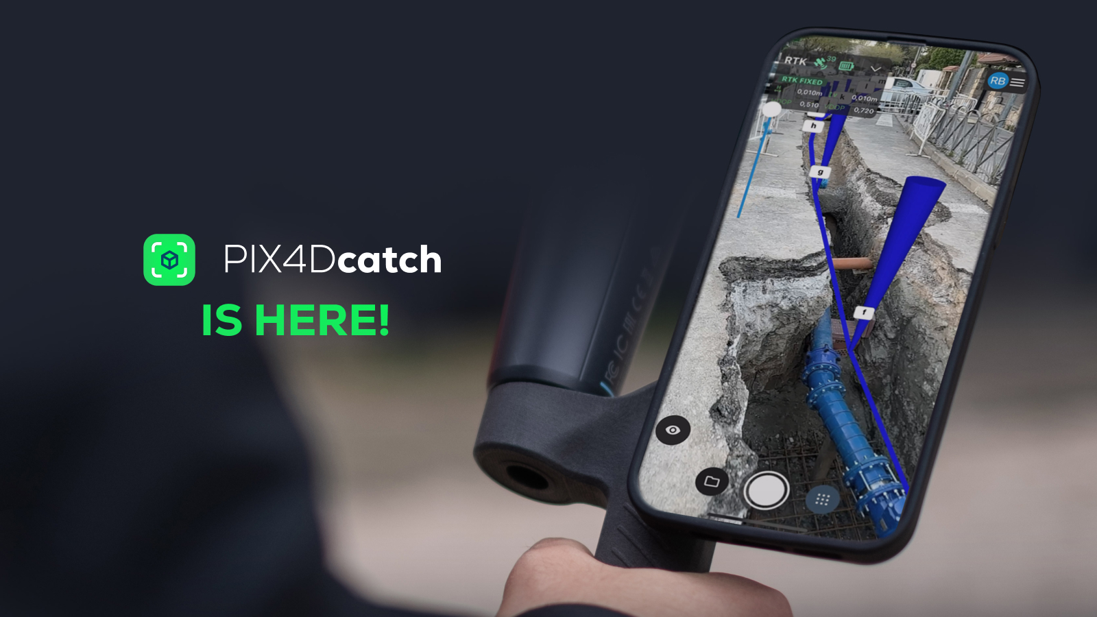
PIX4Dcatch 2.0 is here!
Introducing PIX4Dcatch 2.0 with new AR features that offer precision and efficiency to construction and surveying professionals.
Read moreMapping the Amazon Rainforest with PIX4Dmatic
PIX4Dmatic creates high-resolution maps for a sustainability project in the Amazon, tracking change over time to aid in restoration.
Documenting subsurface utilities with PIX4Dcatch
Accurate trench documentation is key in construction. A firm successfully implements mobile scanning app PIX4Dcatch for this purpose.
PIX4Dcatch 2.0 is here!
Introducing PIX4Dcatch 2.0 with new AR features that offer precision and efficiency to construction and surveying professionals.
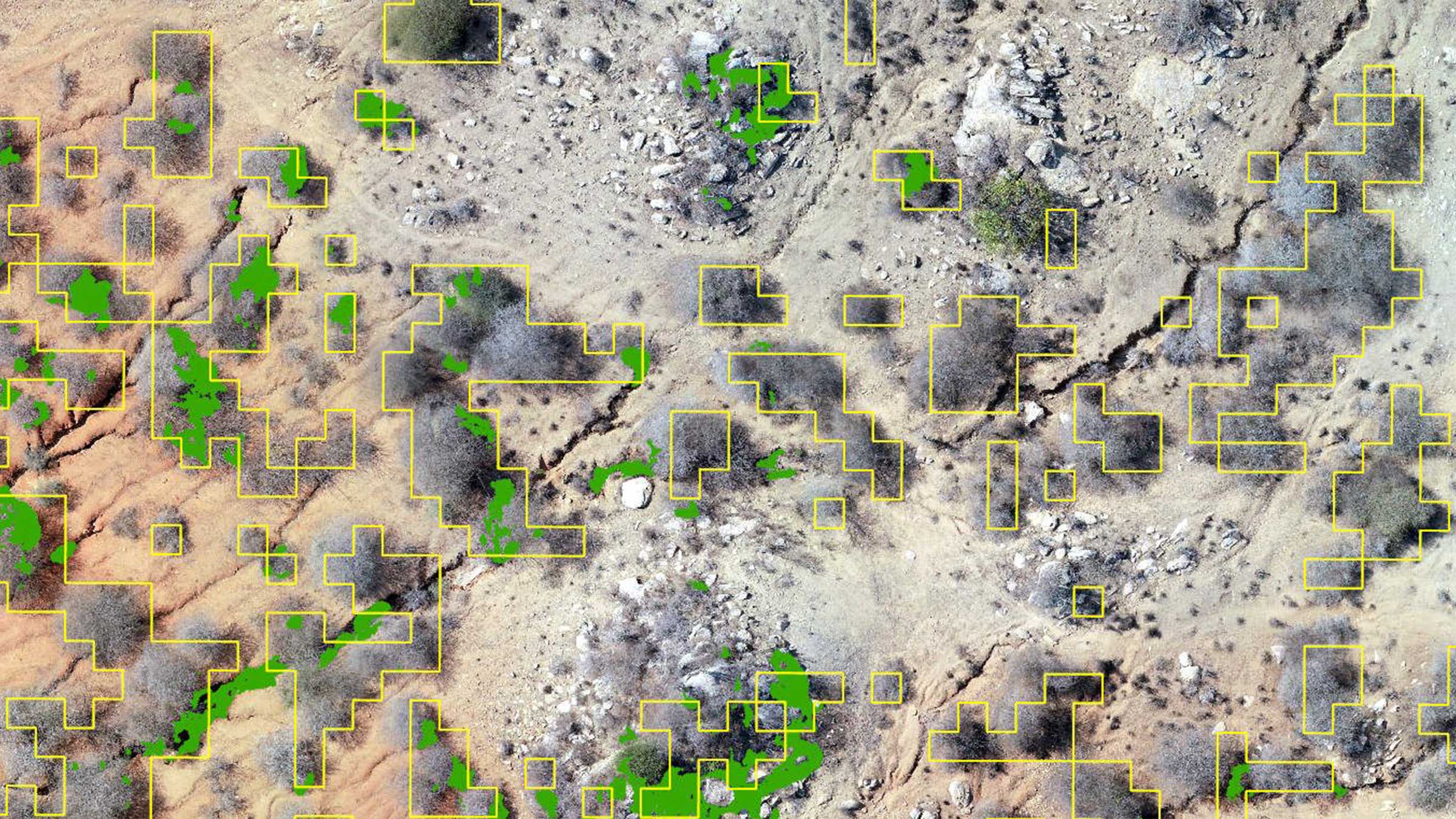
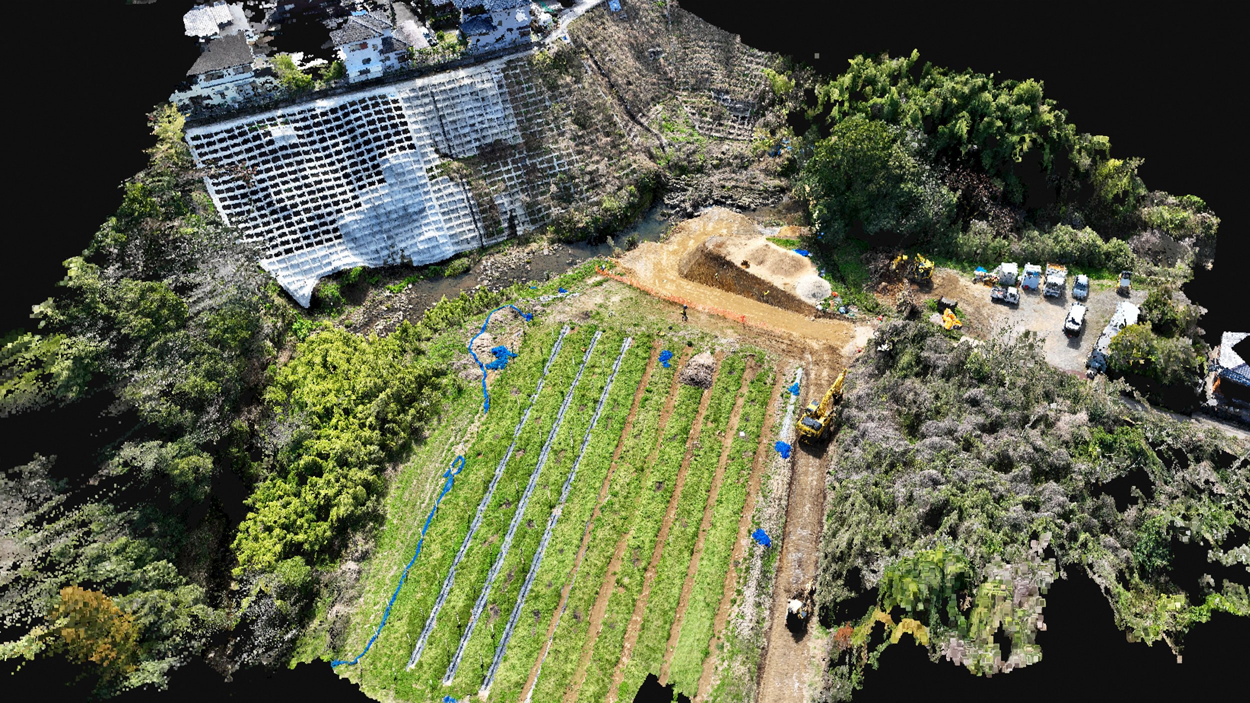
Regenerative farming solutions in Tanzania with PIX4Dfields
PIX4Dfields is used to monitor the regrowth of vegetation on barren land in Kongwa, Tanzania as part of regenerative farming.
Mobile 3D scanning and the advance of digital construction
Governments globally are adopting digital processes like BIM to increase collaboration and save time and money.
Usability meets accuracy with PIX4Dcatch mobile scanning
A construction company in Japan conducted a comparative accuracy test using a laser scanner, a drone, and PIX4Dcatch.
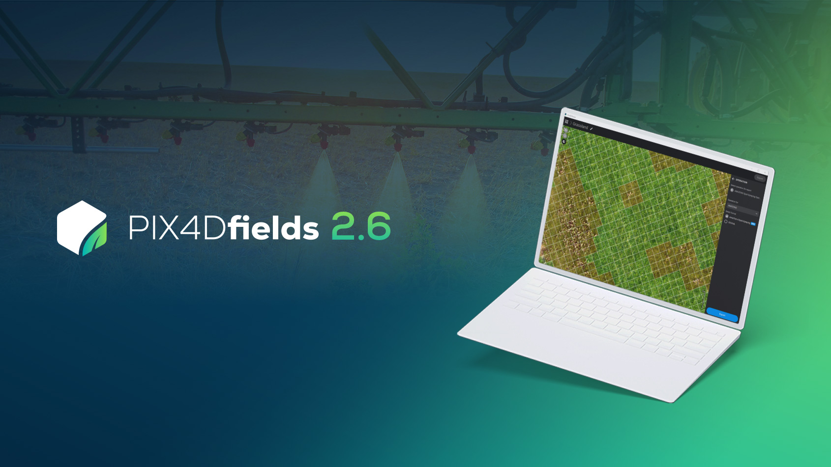
PIX4Dfields 2.6: AMAZONE spot spraying maps, and more!
PIX4Dfields 2.6 brings you AMAZONE spot spraying maps, improved zonation workflow, and more!
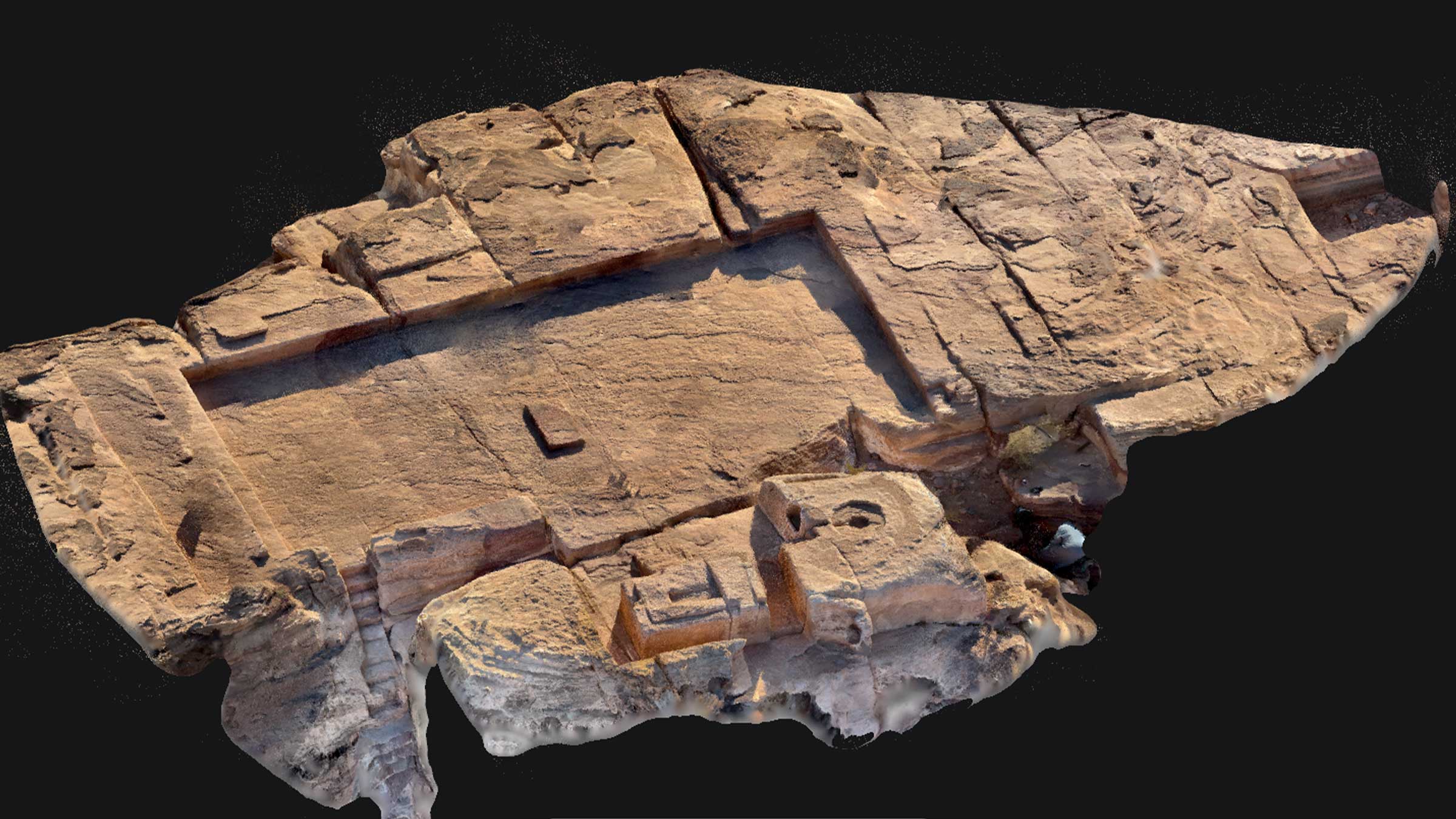
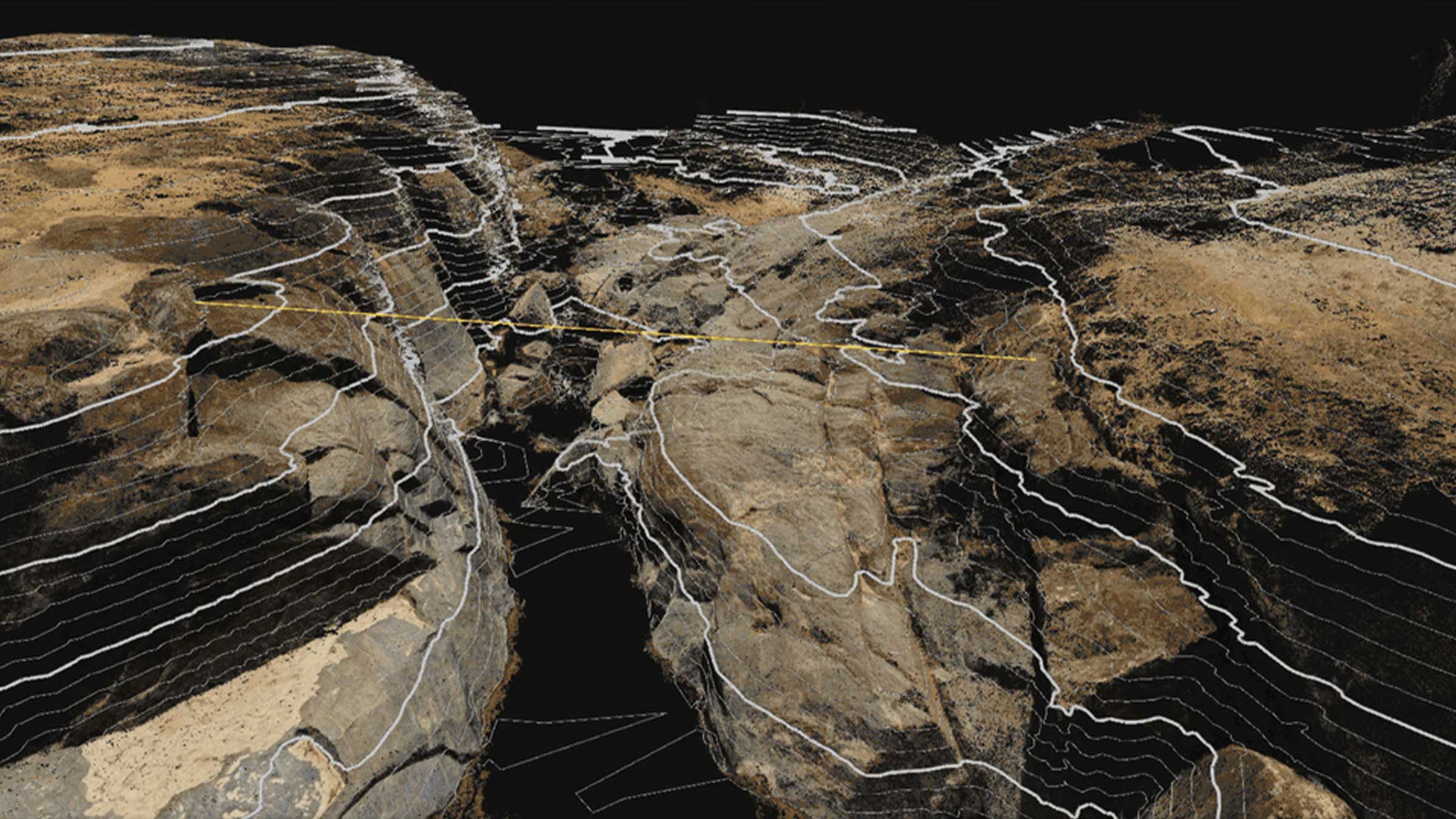
The Standing Stones of Petra: archaeology and Pix4D
Archaeologists in Petra, Jordan use PIX4Dcatch for research: investigating and recording details of the world-famous Nabatean site.
Building bridges in Malawi with drones and PIX4Dmatic
An Irish NGO uses PIX4Dmatic and drones to build a bridge, providing local communities access to vital resources in the rainy season.
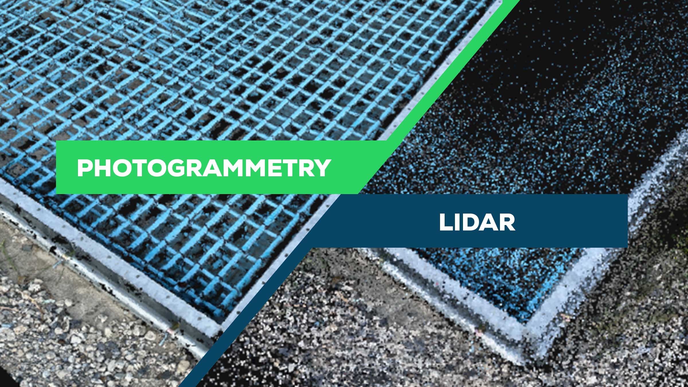
Point cloud comparison: photogrammetry vs LiDAR
We investigated the benefits of photogrammetry versus LiDAR for generating 3D point clouds.
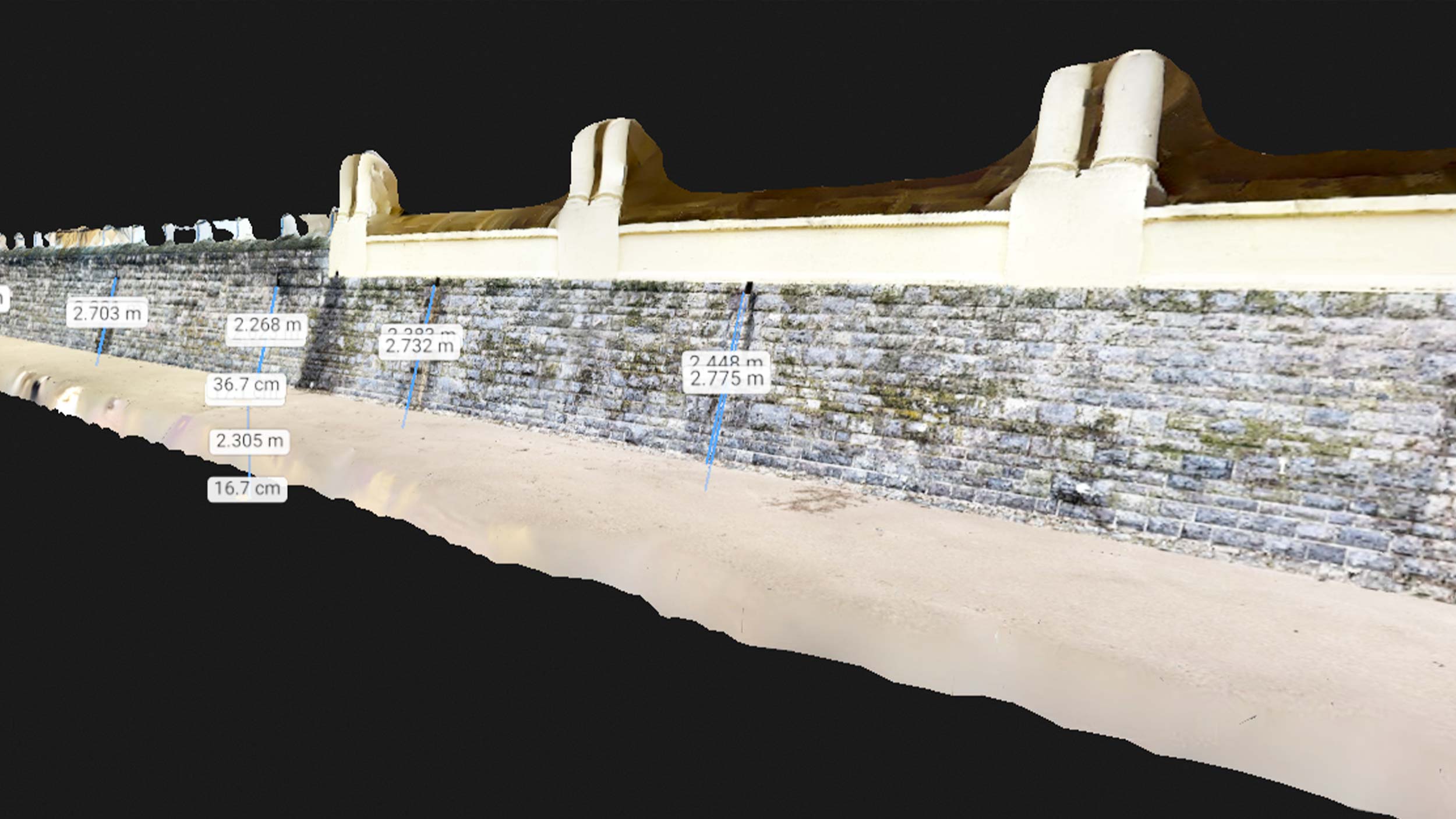
Climate action: tracking coastal erosion with Pix4D
Using photogrammetry, the Wales Coastal Monitoring Center supplies crucial data for flood and erosion risk management strategies.
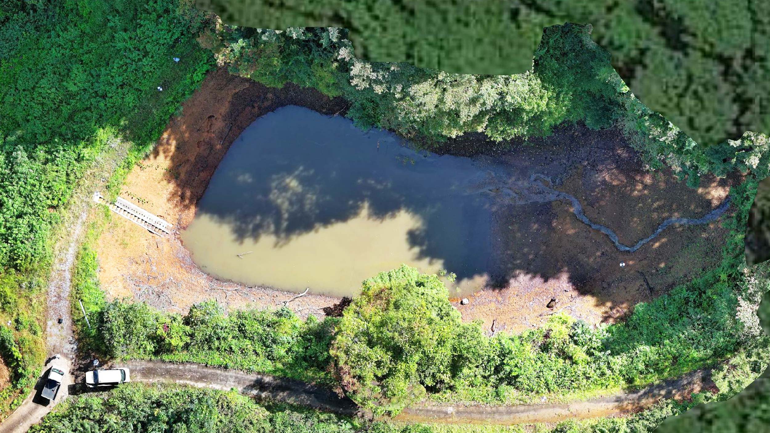
Precise sediment measurement: Pix4D boosts accuracy by 70%
PIX4Dcatch RTK was used to gauge sediment levels in a reservoir. We spoke to the project leaders about its effective application.