
Regenerative farming solutions in Tanzania with PIX4Dfields
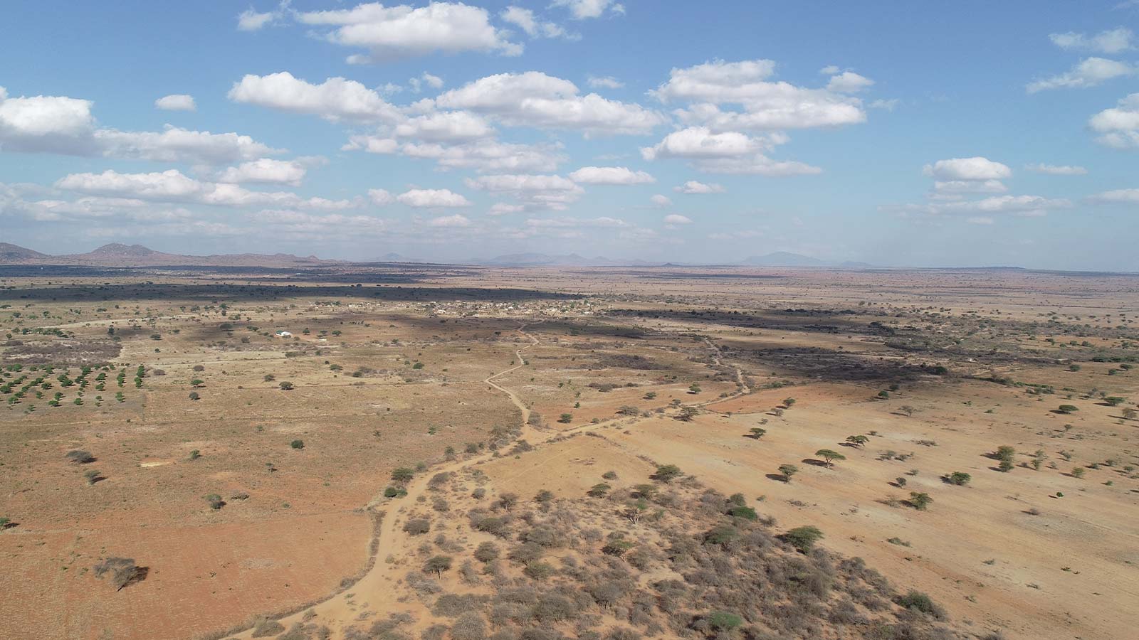
Farmer-managed natural regeneration (FMNR) is an affordable land restoration method used to counteract land degradation, achieved through pruning existing tree stumps. FMNR was introduced in Kongwa, Tanzania to mitigate food shortages and drought. Barren land which is stripped of its natural vegetation over time is regreened, by working with nature and using sustainable farming practices.
Using drones and PIX4Dfields for vegetation monitoring
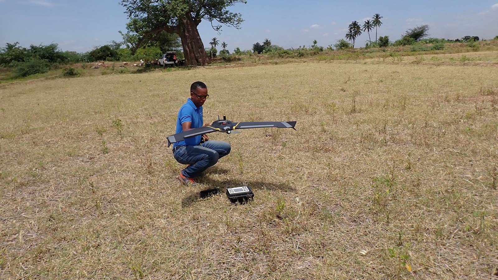
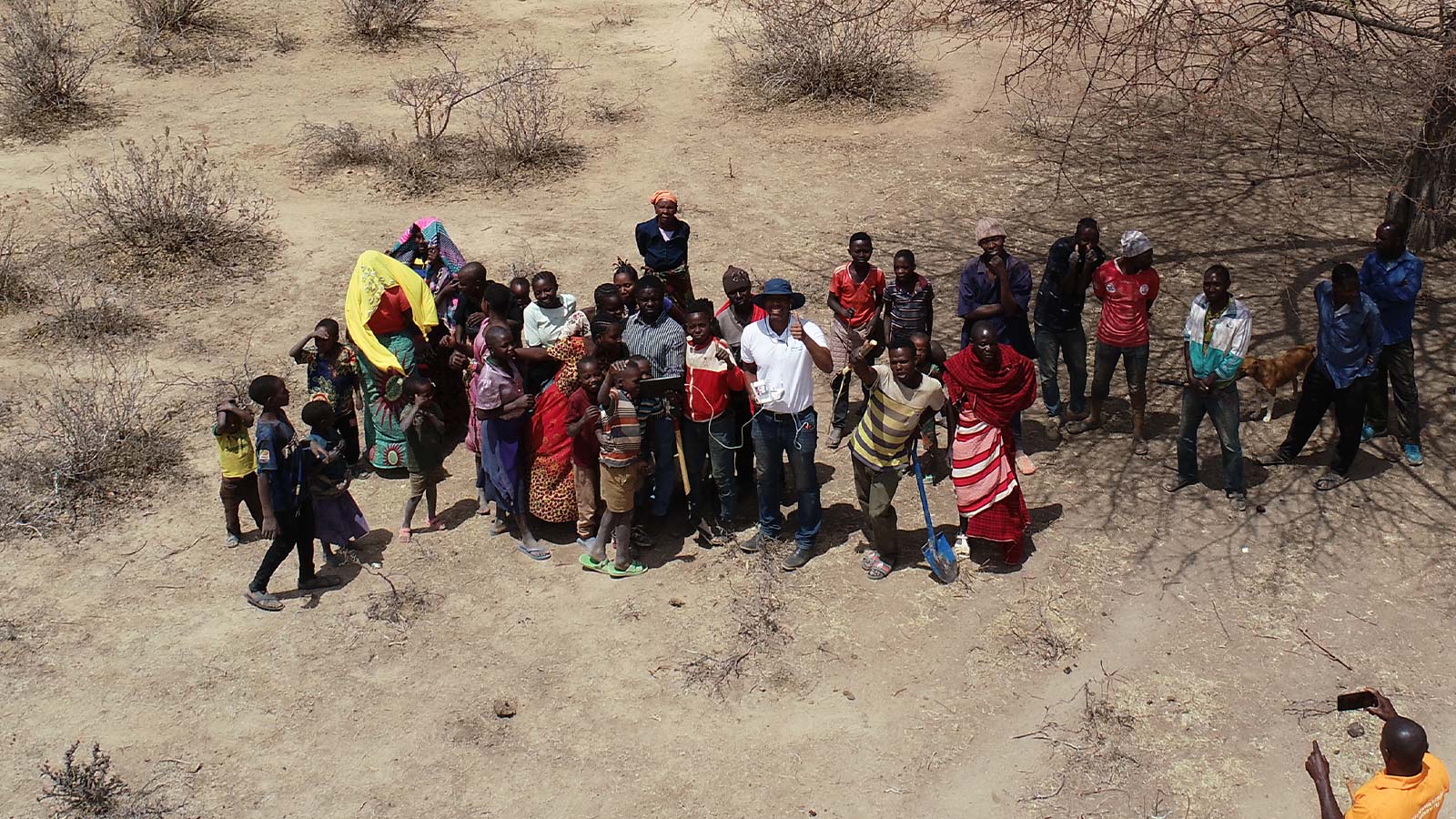
Tanzania Flying Labs has been assisting World Vision Tanzania (WVT) for several years by providing support in collecting and analyzing drone imagery. They are currently in the process of training WVT to independently carry out these tasks.
“PIX4Dfields operates efficiently with minimal computing resources and electrical power, rendering it indispensable for drone data analysts, particularly in regions with limited infrastructure in the Global South. Its AI-driven Magic Tool significantly enhances capabilities for tasks such as tree counting and similar analyses, making it an invaluable asset for professionals in the field.” - Leka Tingitana, Director of Tanzania Flying Labs
Developing local knowledge in geospatial and drone technology, Tanzania Flying Labs works on projects aligned with UN Sustainable Development Goals. They empower communities by upskilling them, and equipping them to analyze drone data for local development. To monitor the regreening of barren land in Kongwa, Tanzania Flying Labs and WVT decided to use near-ground imagery from drones.
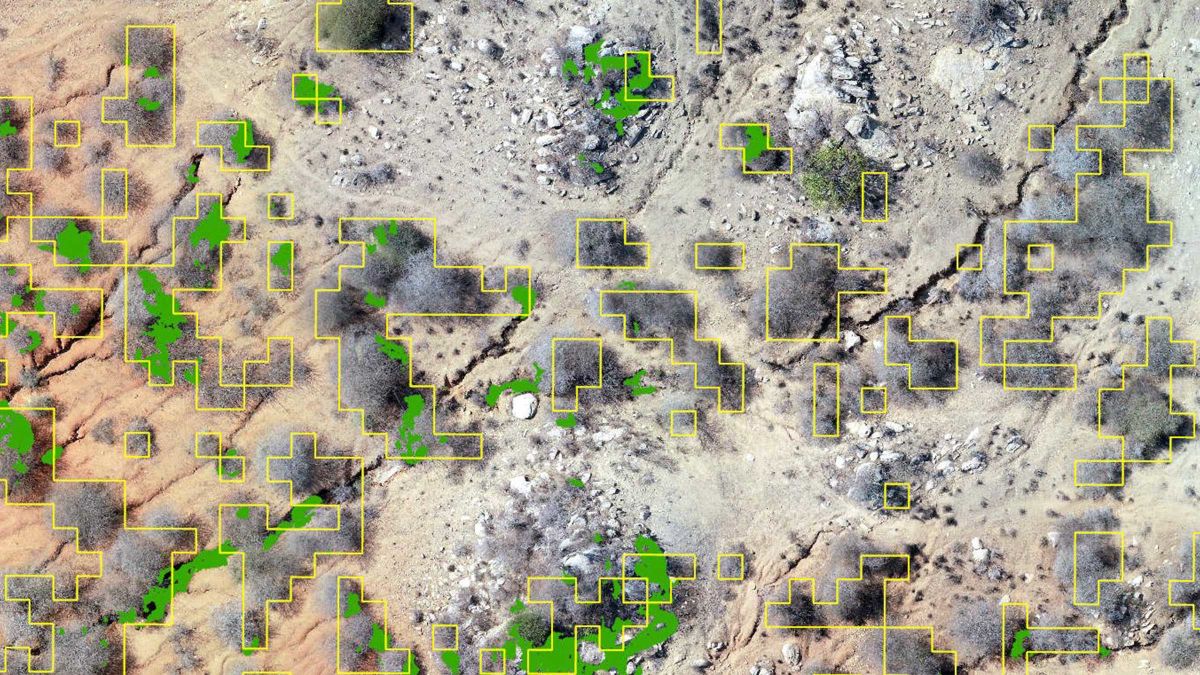
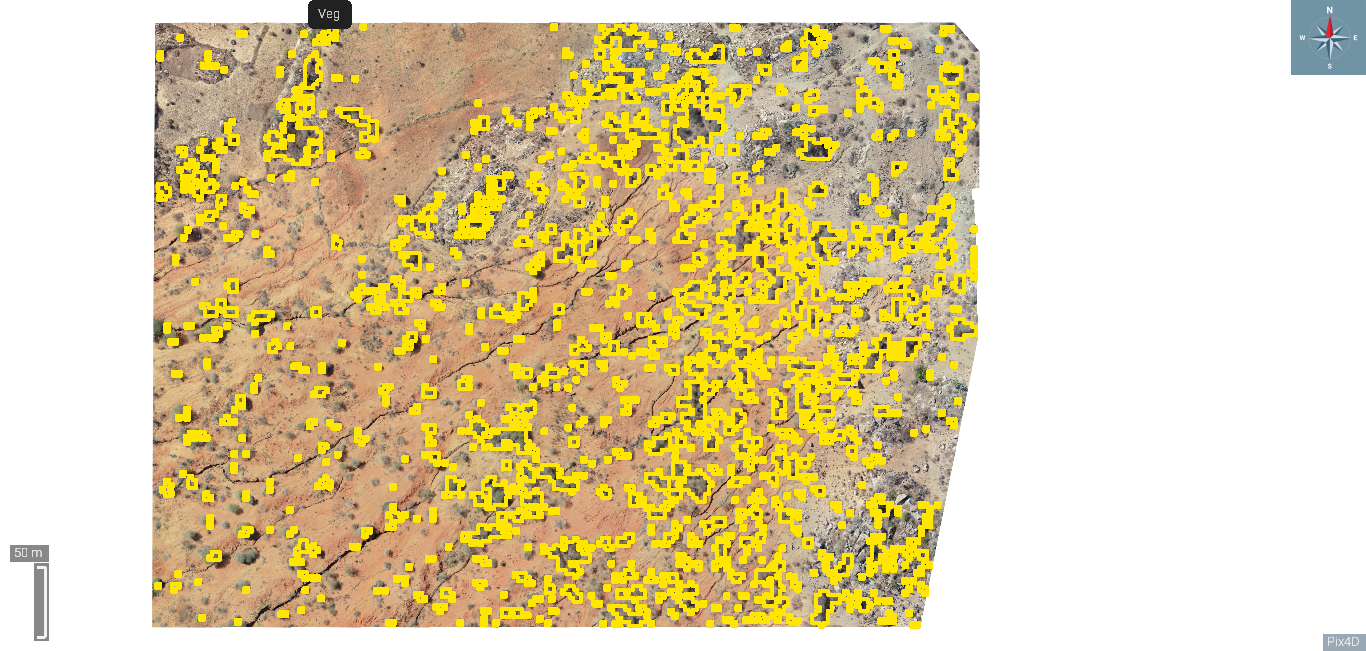
They needed a way to detect and visualize vegetation from the images, so they decided to use Pix4D software. The software has an algorithm that uses machine learning to identify vegetation within the demonstration blocks, allowing them to monitor changes over time.
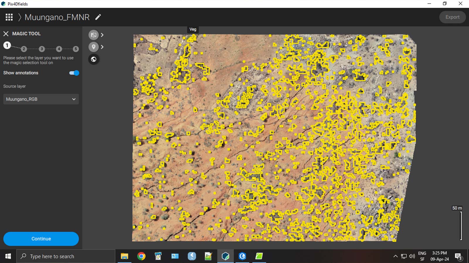
They also used PIX4Dfields to generate vegetation indices like the Visible Atmospherically Resistant Index (VARI), designed to emphasize vegetation in the visible portion of the spectrum. PIX4Dfields allowed them to rapidly process this data on-site.
Engaging the local communities
They encountered a challenge regarding the size of the demonstration plots, which were too large to easily monitor. They decreased the land sample size in villages from 500 ha demonstration plots to 20 ha demonstration plots, simplifying monitoring and evaluation efforts and allowing low-cost drones to be used.
A bigger challenge they faced was data literacy in the local communities, especially if they were to buy into the program. As a solution, they printed large posters of their farmland to show the before and after effects of FMNR intervention.
Sustainable development with PIX4Dfields
The ability to have drone image processing and analytics in one package was extremely useful for Tanzania Flying Labs, as it meant they didn't have to purchase or use any other software to handle their image classification tasks, enabling them to manage these tasks effectively.
Tanzania Flying Labs effectively used drones and PIX4Dfields to track vegetation regrowth in Kongwa's barren areas, demonstrating the potential of drones for good and the role of technology like photogrammetry and PIX4Dfields in sustainable development. They found PIX4Dfields especially valuable due to its low computing resource requirements, making it ideal for regions with limited infrastructure.
