PIX4Dfields 2.9:AI Magic Tool mais inteligente,e muito mais!
Magic Tool: precisão de deteção melhorada
Desde o seu lançamento inicial em novembro de 2022, a Magic Tool tem fornecido aos agricultores um meio viável de interpretar imagens de drones, permitindo a identificação de estruturas, ervas daninhas e anomalias através de algoritmos avançados de visão artificial. Temos o prazer de anunciar o lançamento de uma iteração atualizada da Magic Tool que incorpora melhorias significativas, formada por dados voluntariamente disponibilizados pelos usuários nos últimos dois anos.
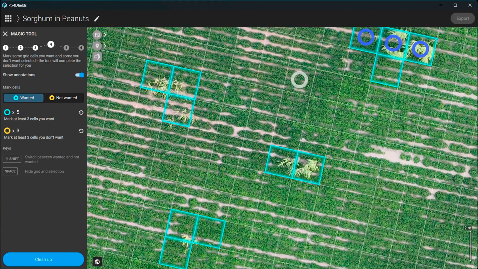
Com a ajuda dos dados que os nossos clientes contribuíram voluntariamente desde o seu lançamento inicial, a nova Magic Tool apresenta uma arquitetura de rede neural, oferecendo até 5 vezes menos falso-positivos e uma melhor deteção em casos difíceis (por exemplo, verde sobre verde). Isto é apenas o início. Com a nova arquitetura, a ferramenta irá melhorar ao longo do tempo através da sua utilização contínua. O desenvolvimento da Magic Tool foi apoiado pela integração de uma arquitetura de rede neural, o que resultou nos seguintes avanços:
Maior precisão: a ferramenta consegue agora reduzir até cinco vezes os falso-positivos, minimizando as detecções erradas e aumentando assim os resultados para aplicação prática.
Deteção melhorada em cenários complexos: a ferramenta demonstra um desempenho superior em condições difíceis, como a distinção entre ervas daninhas e culturas em situações de “verde sobre verde”, em que a diferenciação visual é difícil.
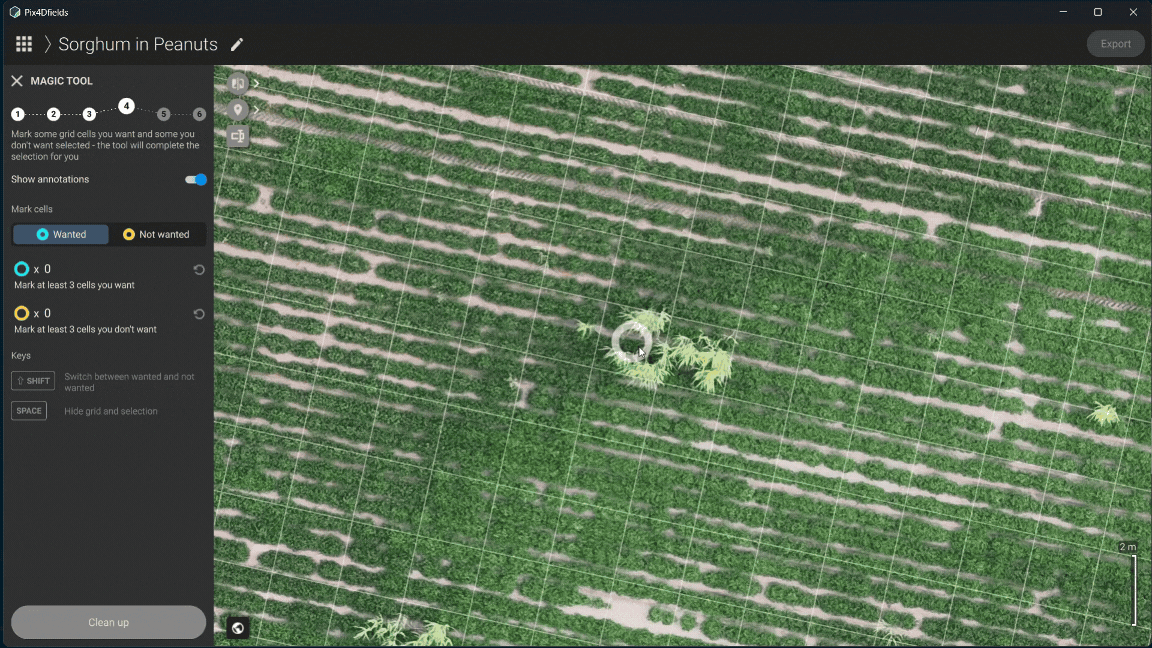
A nova arquitetura da Magic Tool foi concebida para se adaptar rapidamente e os usuarios podem optar por participar de um programa voluntário para compartilhar seus dados. Esta contribuição opcional permite-nos adaptar as futuras atualizações para melhor responder a casos específicos de utilização agrícola, assegurando que a ferramenta se mantém relevante para a nossa base de clientes.
Gestão da água e nivelamento do terreno
A gestão eficaz da água e o nivelamento do terreno são fundamentais para o sucesso agrícola, assegurando uma drenagem otimizada do campo, irrigação e crescimento das culturas. Estas práticas são fundamentais para as principais culturas, como o trigo, o milho e o arroz. São também especialmente vitais para as culturas que requerem sistemas de irrigação precisos, tais como as culturas especializadas como os legumes, as frutas e as vinhas. Os modelos digitais de superfície (DSMs) melhoram estes esforços fornecendo uma análise detalhada do terreno, permitindo sistemas de irrigação e drenagem eficientes, o nivelamento preciso do campo e a identificação de áreas alagadas que podem prejudicar os rendimentos.
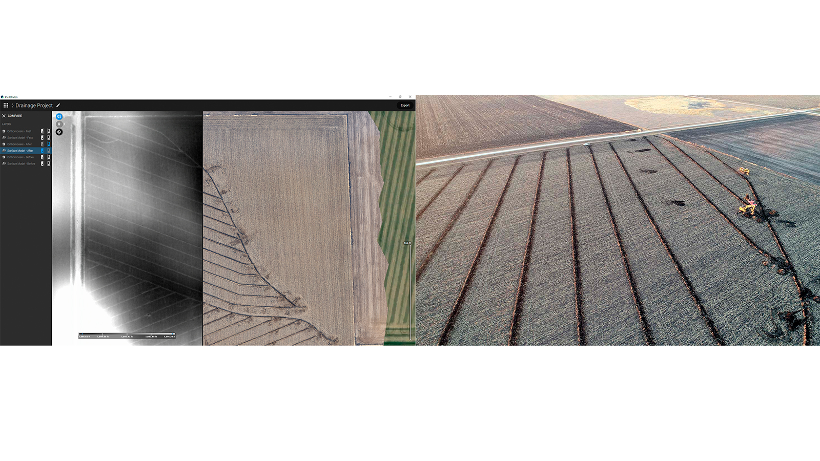
O processamento preciso do PIX4Dfields aproveita levantamentos de drones com RTK (Real-Time Kinematic) para produzir DSMs altamente detalhados. A precisão centimétrica da tecnologia RTK é ideal para nivelamento de terrenos e planejamento de drenagem, onde pequenas diferenças de elevação afetam significativamente o fluxo de água e a saúde das culturas. Diferentemente dos métodos tradicionais — como medições manuais ou GPS terrestre, que são lentos — levantamentos com drones no PIX4Dfields oferecem coleta de dados rápida e de alta resolução, otimizando fluxos de trabalho e reduzindo o tempo de planejamento.
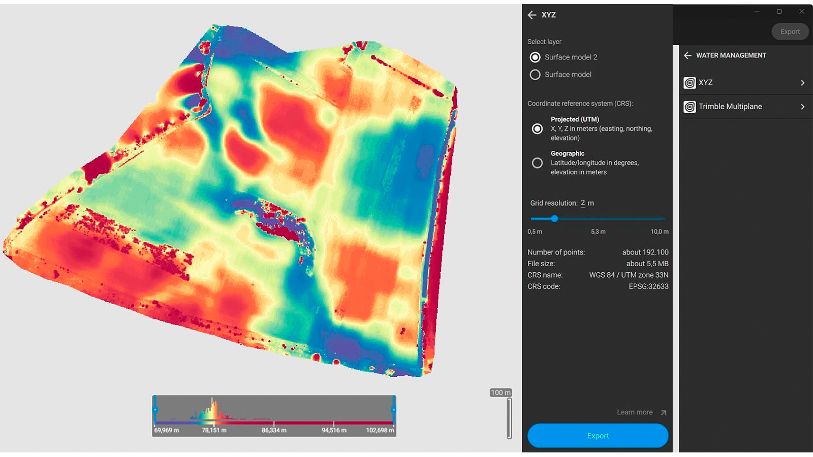
Este lançamento introduz suporte para exportação de DSMs nos formatos XYZ e Trimble MultiPlane, permitindo integração perfeita com ferramentas de modelagem de terrenos de terceiros, como Optisurface, Trimble Agriculture (PTx Trimble) e T3RRA Design. Essas opções de exportação simplificam a transferência de dados, permitindo que profissionais da agricultura incorporem insights de levantamentos em soluções de gestão de terrenos de forma eficiente, melhorando o uso da água e a produtividade.
Aprenda com nosso artigo de suporte.
Busca de localização, importação/exportação em lote e muito mais!
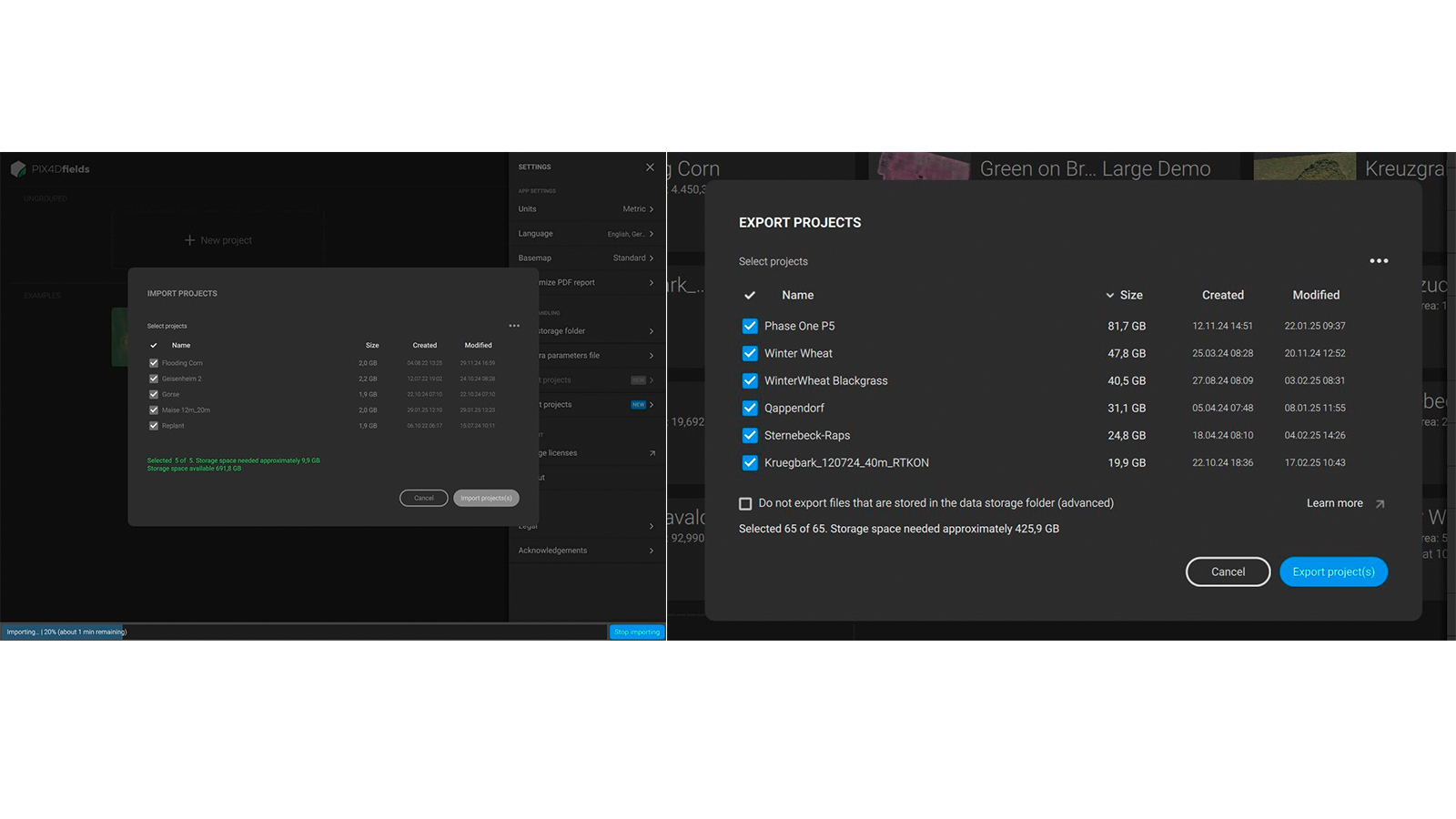
Agora você pode importar e exportar projetos em lote no PIX4Dfields! Este recurso permite ver o espaço ocupado por cada projeto em seu disco rígido, exportar vários projetos de uma vez, sendo ideal para arquivar projetos antigos para liberar espaço ou compartilhar muitos projetos sem esforço. Também suporta a importação de múltiplos projetos.
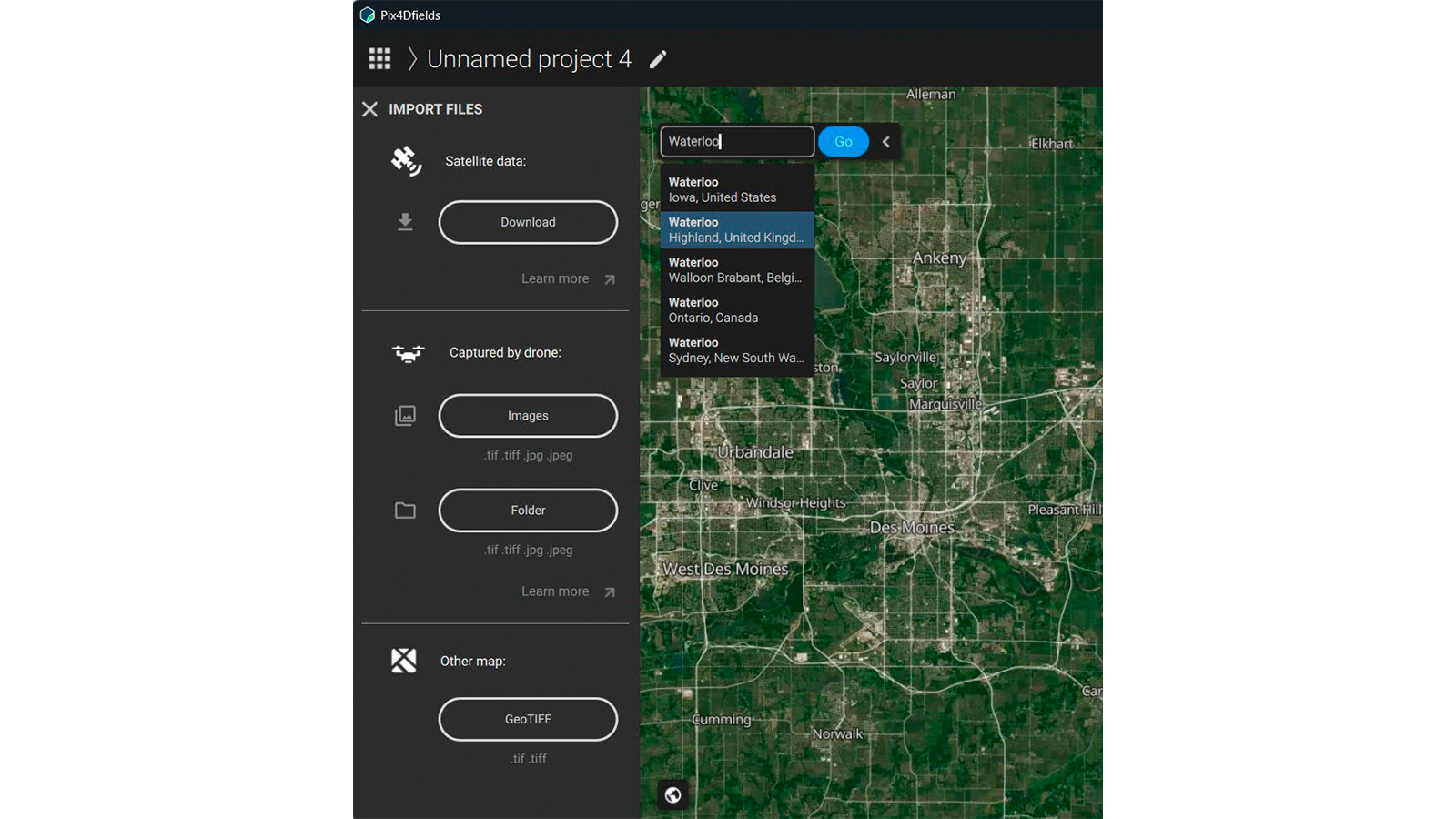
Localização por nome, CEP ou coordenadas GPS no PIX4Dfields também é possível agora! Esta nova funcionalidade é especialmente útil para usuários que usam apenas satélites e precisam desenhar manualmente os limites do campo, permitindo encontrar o local mais rapidamente, já que o PIX4Dfields detecta automaticamente a localização.
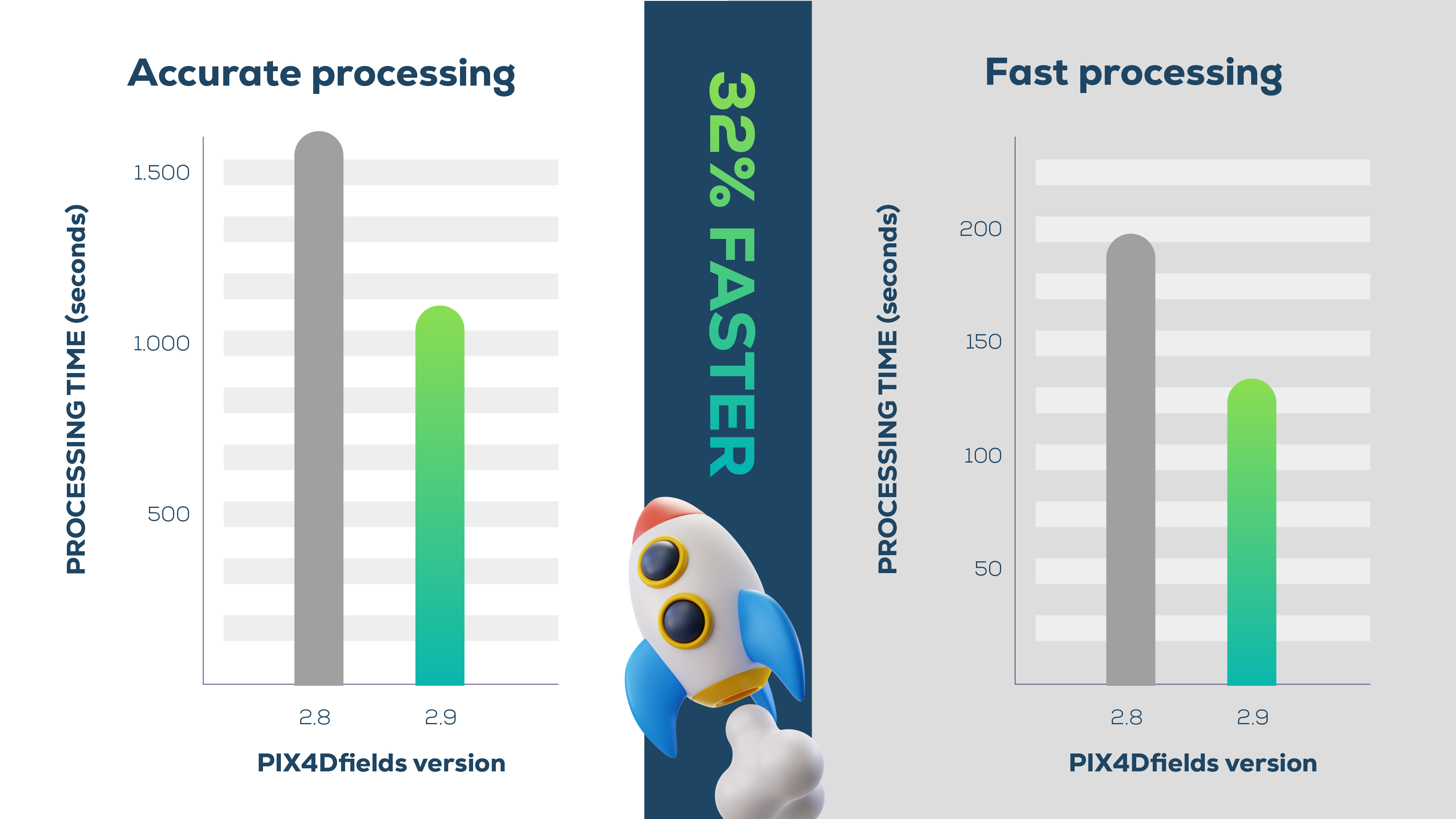
Mais atualizações empolgantes: Suporte para CPUs ARM da série M da Apple, melhorando a velocidade de processamento em média de 32%. Por exemplo, um conjunto de dados de 27GB capturado pelo DJI Mavic 3 Multispectral é processado em 17,7 minutos no PIX4Dfields 2.9. Com um Apple M1, 30,5 minutos na versão 2.8!
- Suporte ao idioma romeno!