Pix4Dbim Cloud tools for managing construction projects
Important update: Pix4Dbim cloud is now Pix4Dcloud Advanced
Construction project manangers need to be as efficient as possible while minimizing errors. Technology can help tremendously. That’s why we continuously strive to introduce tools that facilitate project monitoring and documentation.
1. Quickly compare the as-built situation to the design and keep your project on-track
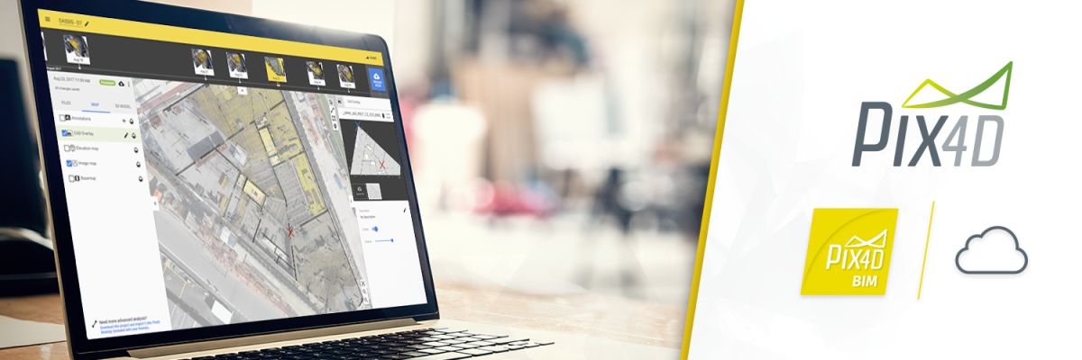
A key feature of the Pix4Dbim cloud is the ability to import and overlay CAD drawings on the 2D image maps. It helps you keep projects on track by being able to quickly compare the as-built situation to the design plans.
Freshly revamped to provide a user-friendly and intuitive process, you are able to precisely overlay your plans using matching checkpoints between the CAD drawing and the 2D map.
Zoom in, zoom out, identify and mark your checkpoints on the CAD drawing, and align those on the drone map, it’s very easy.
Did you know…
You can import different file formats, PDF, PNG, JPG, and upload multiple plans to be able, for example, to follow the progress of your site throughout all phases, or to compare your building evolution at each floor.
Although we call it CAD overlay, you can also upload other types of maps such as contour maps and utility maps.
2. Perform virtual inspections online and save time
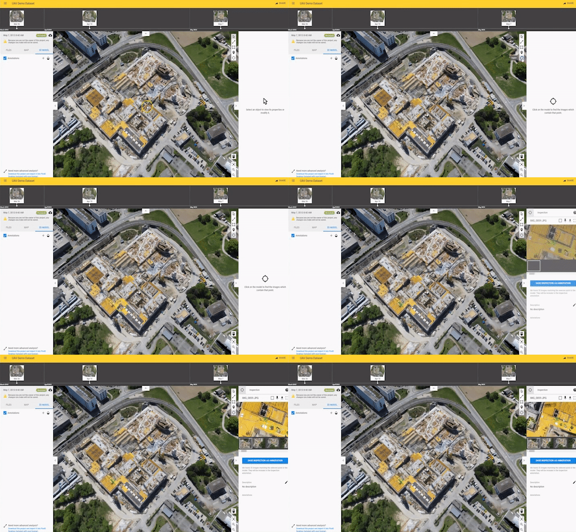
Virtual inspections are possible with the Pix4Dbim desktop software using our rayCloud functionality. Already popular because of its intuitive display of the connections between the original images and the reconstructed 3D model, this iconic feature is also available on Pix4Dbim cloud with our 3D Virtual Inspector.
Directly in your web-browser, view and interact with the detailed 3D models and the related original images. Virtually inspect any point of interest on your 3D model and on all the images that are used for the reconstruction.
Use this online inspector tool to collaborate and communicate more easily: identify and confine point of interest, zoom in specific images, pin and comment the images with detailed information or actions to take. After you’re done, easily share your close examination or tagged images only with your project teams or stakeholders.
To learn more
Read our Virtual Inspector support article for step-by-step instructions.
3. Communicate more and reduce errors
More content possibilities, more customization, and more export options: the Pix4Dbim cloud lets you add valuable information to your annotations, and then share with your colleagues to improve the communication and reporting within the project team.
Use this online inspector tool to collaborate and communicate more easily: identify and confine point of interest, zoom in specific images, pin and comment the images with detailed information or actions to take. After you’re done, easily share your close examination or tagged images only with your project teams or stakeholders.
Important information deserves space
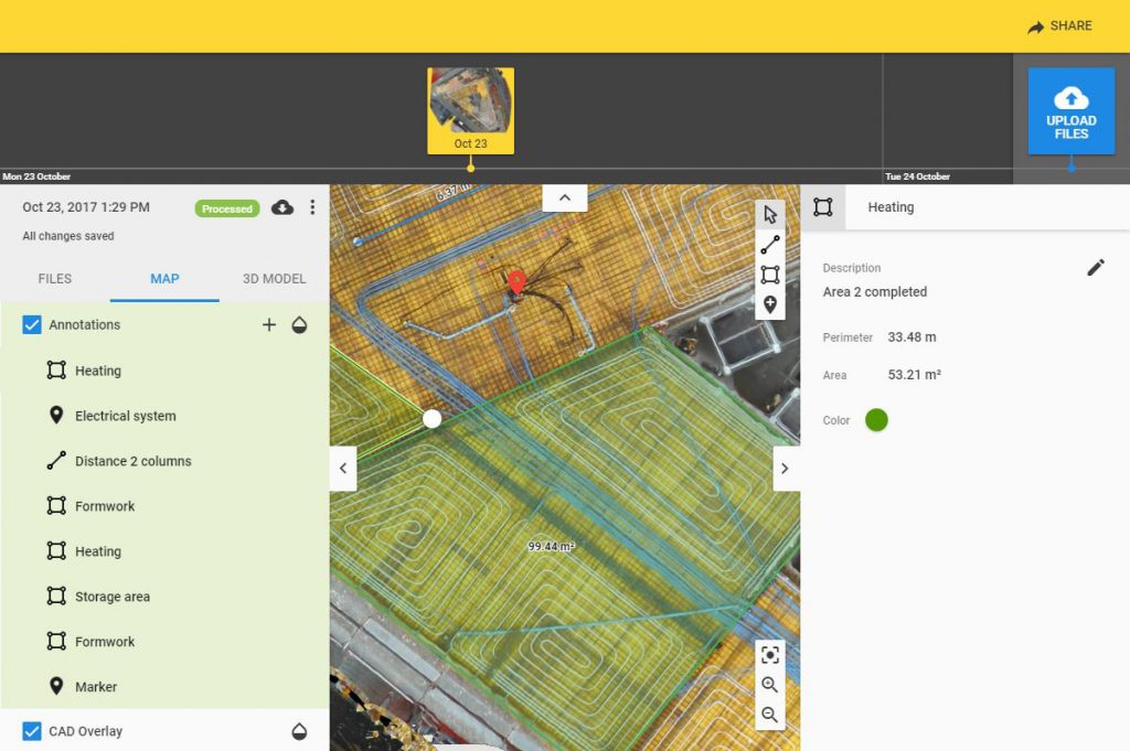
Efficiency is key and it’s easy for important details to be overlooked
Get more from your annotations and measurements:
- Insert descriptions and share annotations with your team
- Assign colors and group them into categories
- Add clickable URLs that can link to documents, reports and other resources
Imagine how much time you can save by finding all the information you need in one place.
Coordination of construction documents is a big challenge
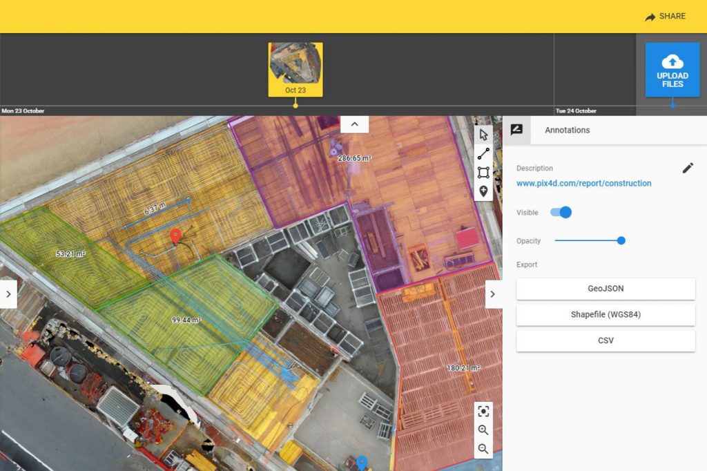
Export all your annotations and 2D/3D measurements as CSV, GeoJSON or Shapefile, then import into GIS and CAD software, facilitating more efficient workflows. And if you share your project with team members or stakeholders, they are also able to export all the annotations, simplifying collaborative work.
