Mapping and land surveying with drone images, terrestrial LiDAR and photogrammetry
Advanced mapping and land surveying software
Applications
Mapping
Benefits
- Get survey-grade deliverables
- Save operational costs by spending less time in the field
- Constantly update your maps, models, and projects


Land Surveying
Benefits
- Perform highly accurate topographic surveys
- Combine LiDAR and photogrammetry data
- Easily integrate data into CAD or GIS software

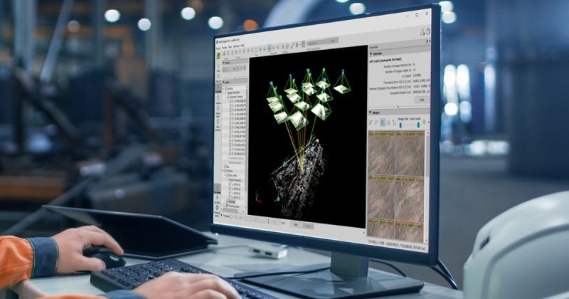
Photogrammetric mapping and modeling is more accessible than ever
Produce survey-grade deliverables such as 3D maps and models from images

Increase your productivity
Use drone mapping to save costs by spending less time in the field. Enhance your results with combined aerial and terrestrial data.
Get accurate results
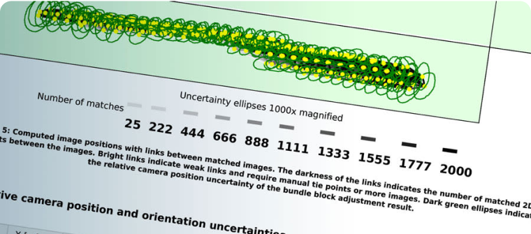
Ensure accuracy with your results. Use GCPs and RTK drone support to georeference your data, whilst the quality report and editing tools give you control over your project.

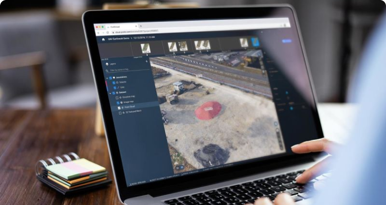
Collaboration with Unlimited users
Scale your operations effortlessly with __PIX4Dcloud__. Add as many team members as needed, control access centrally, and collaborate securely—without extra license costs.

Capture
Capture aerial and/or terrestrial images or LiDAR data.

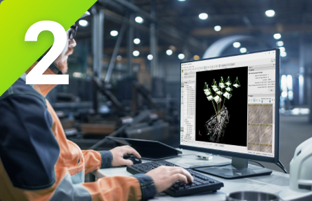
Digitize
Transform your images into accurate digital maps and 3D models.
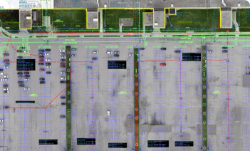
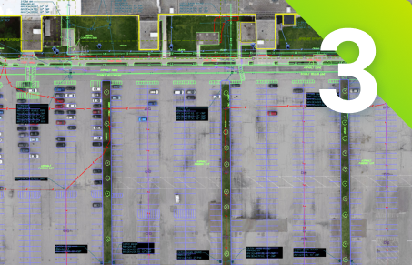
Check, measure, vectorize
Assess and improve the accuracy of your project, measure distances, areas, and volumes and extract key elements to CAD or GIS.

Share
Selectively and securely share project data and insights, with your team, clients, and suppliers using standard file formats.

Educational
We offer research and classroom licenses to educational institutions. Bring photogrammetry to your course with a special offer.
DiscoverProfessional
Take your work to the next level. Use photogrammetry to offer new services and set yourself apart from your competitors with accurate, fast results. Choose the perfect product for you.
DiscoverEnterprise
Use our products for your enterprise. Incorporate them with your platforms or customize our algorithms for your use. Discover custom offers for your company.
Discover
Map, model and measure in 3D
Explore example data sets