
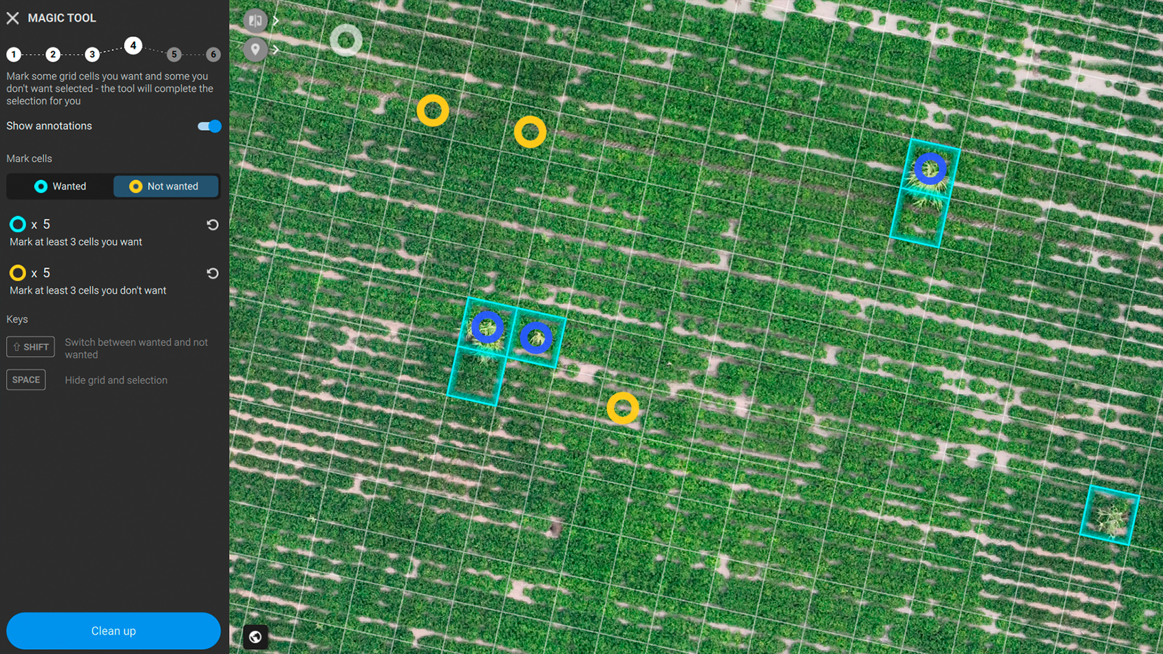
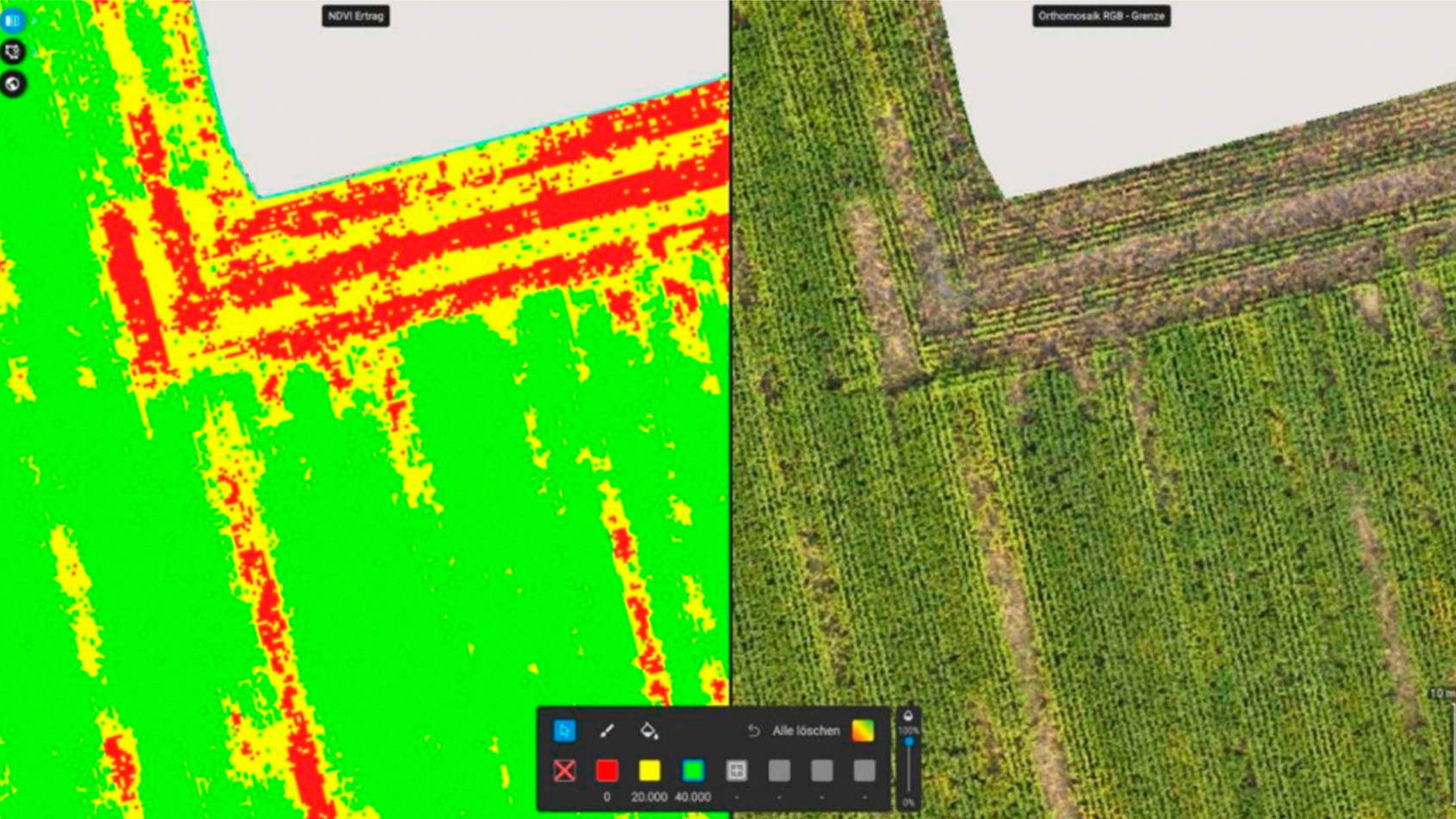
Green-on-green spot spraying in peanut crop
How PIX4Dfields is used in Argentina to detect weeds in peanut crops and save herbicide with spot spraying prescription maps
Read more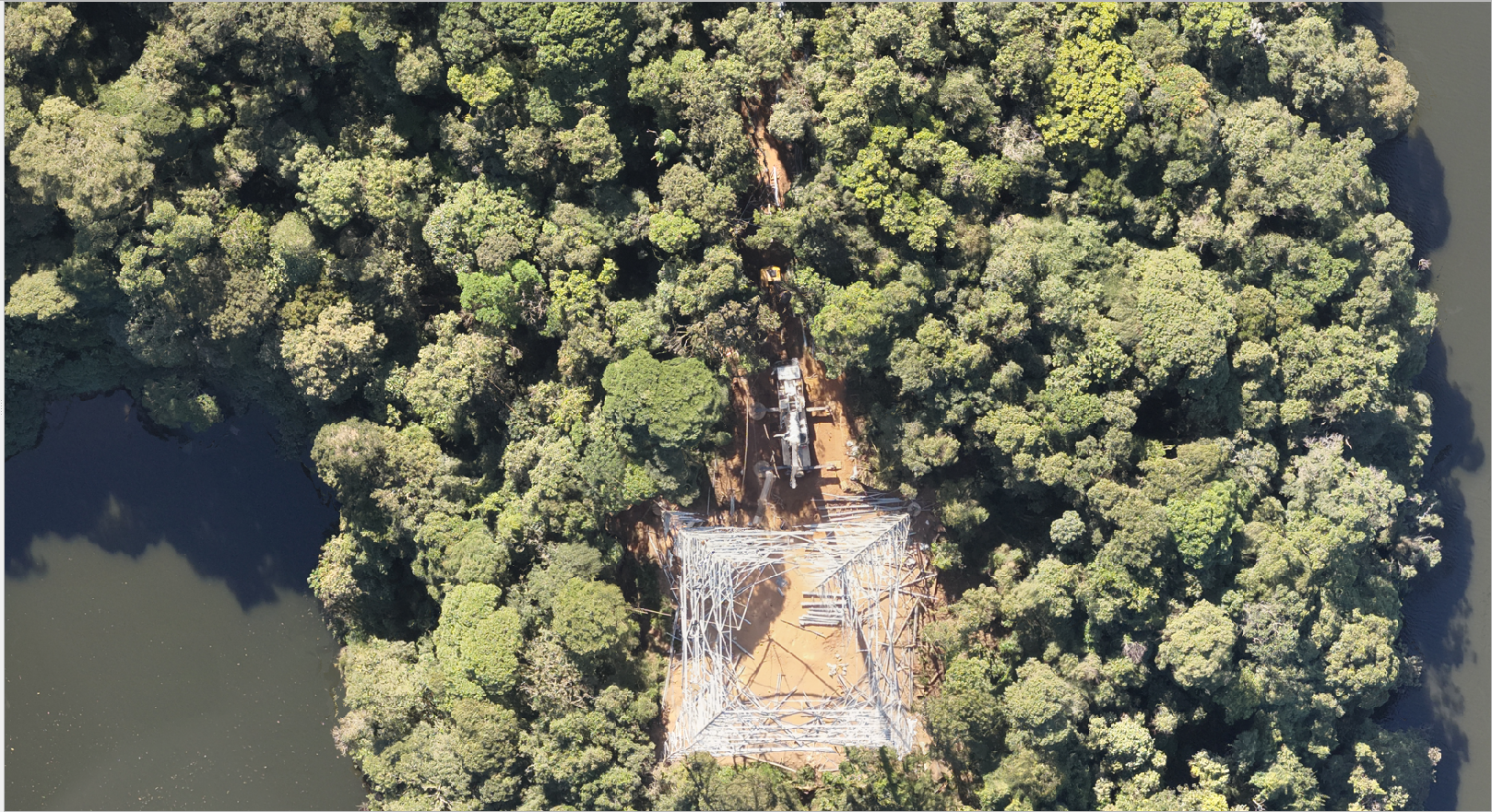
Drone mapping with PIX4Dmatic for a sustainable future
Drones for good and 3D mapping with PIX4Dmatic drive conservation efforts in Brazil to protect biodiversity and ensure a sustainable future.
Read more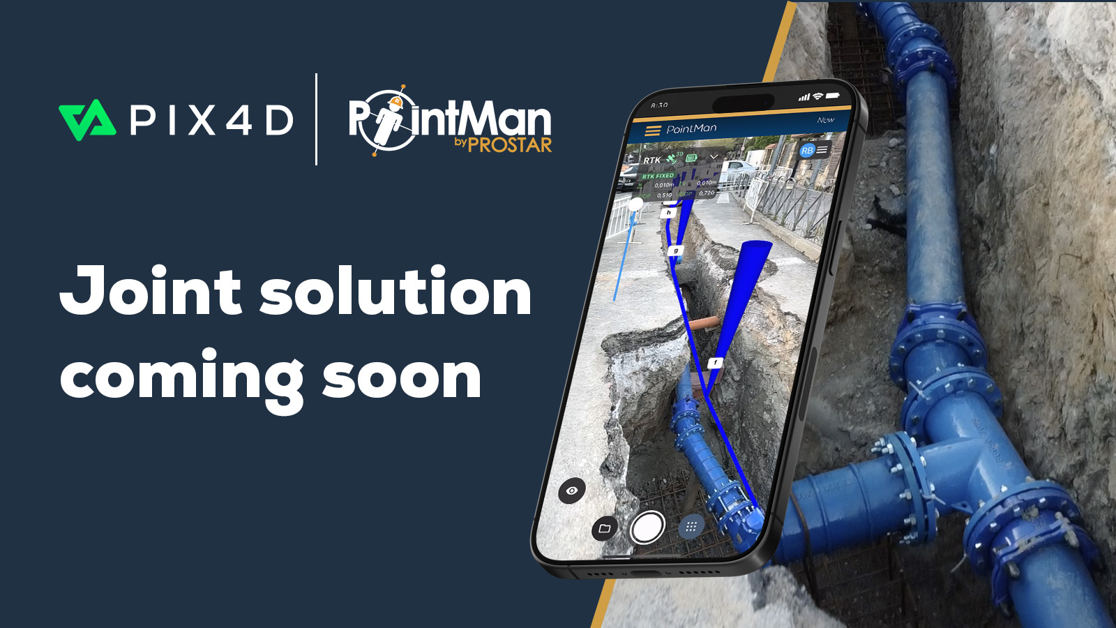
Pix4D and Prostar to provide underground utilities solution
This collaboration combines Pix4D’s advanced 3D modeling with ProStar’s PointMan® to support the next evolution for underground utilities.
Read moreGreen-on-green spot spraying in peanut crop
How PIX4Dfields is used in Argentina to detect weeds in peanut crops and save herbicide with spot spraying prescription maps
Drone mapping with PIX4Dmatic for a sustainable future
Drones for good and 3D mapping with PIX4Dmatic drive conservation efforts in Brazil to protect biodiversity and ensure a sustainable future.
Pix4D and Prostar to provide underground utilities solution
This collaboration combines Pix4D’s advanced 3D modeling with ProStar’s PointMan® to support the next evolution for underground utilities.
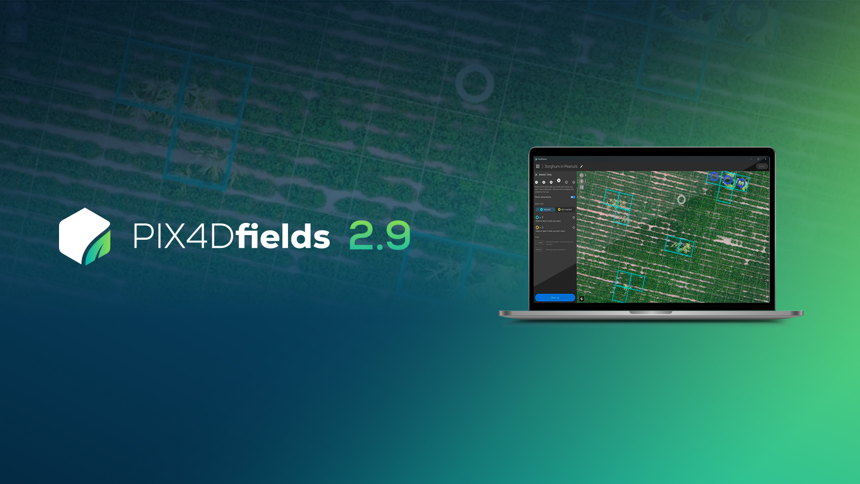
PIX4Dfields 2.9: Smarter AI Magic Tool, DSM exports, & more!
PIX4Dfields 2.9 introduces an improved Magic Tool, water management exports support, search map location, and more!
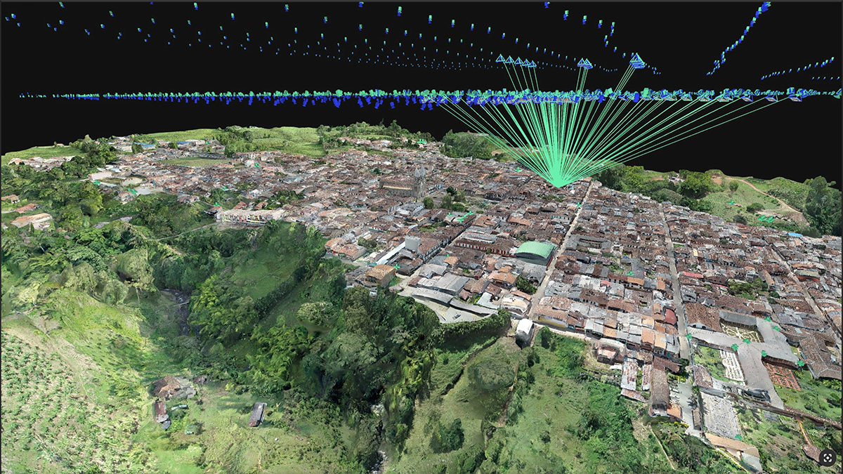
Cadastral digitization made easy with PIX4Dmatic
Processing and validating data for a cadastral survey with PIX4Dmatic reduced weeks of work to hours, reducing time spent on-site!
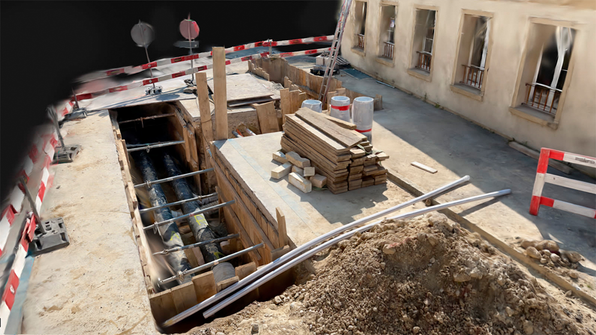
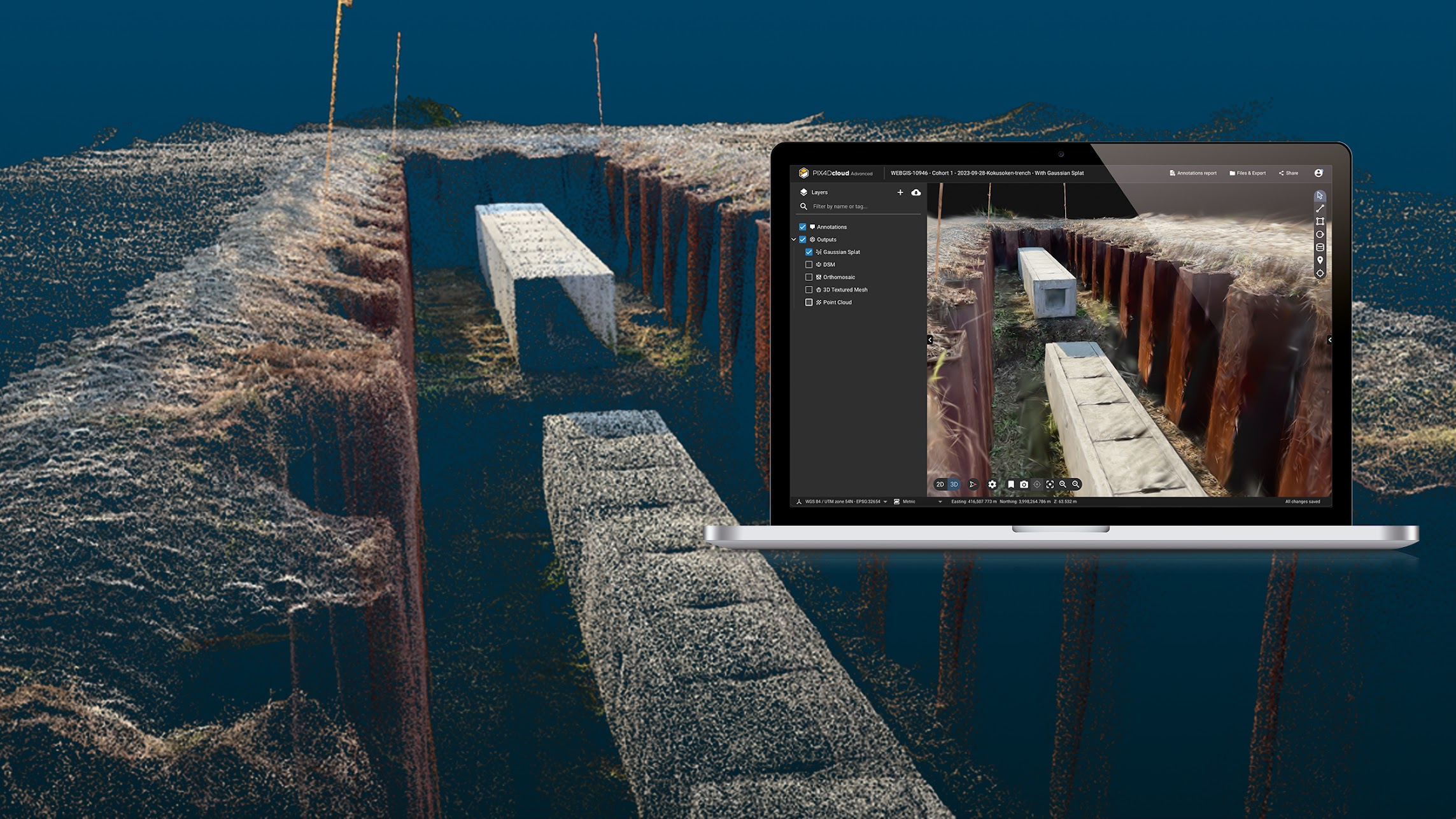
Beyond 3D models: why utilities need Gaussian splatting
Capture trench conditions on your smartphone and transform them into precise, georeferenced 3D models—thanks to Pix4D's Gaussian splatting
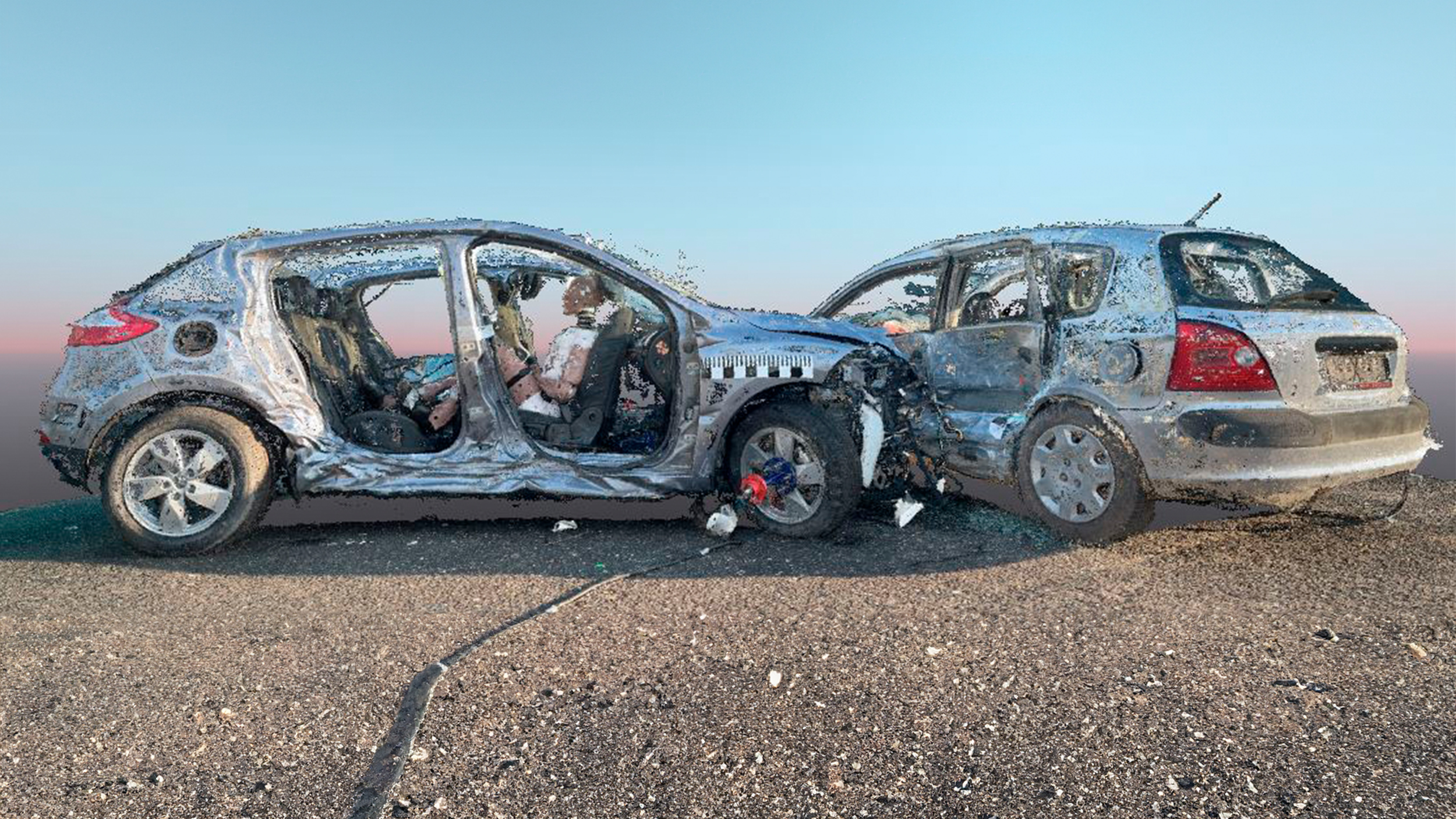
Crash scene analysis: testing Pix4D’s solution for forensics
Evaluating Pix4D’s solution, testing speed & accuracy, to confirm its use for professional traffic accident scene reconstruction & forensics
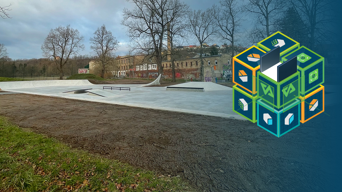
Managing construction projects — like solving a Rubik’s Cube
Pix4D’s mapping tools streamlined every step of building the world’s first carbon concrete skatepark from planning to final documentation.
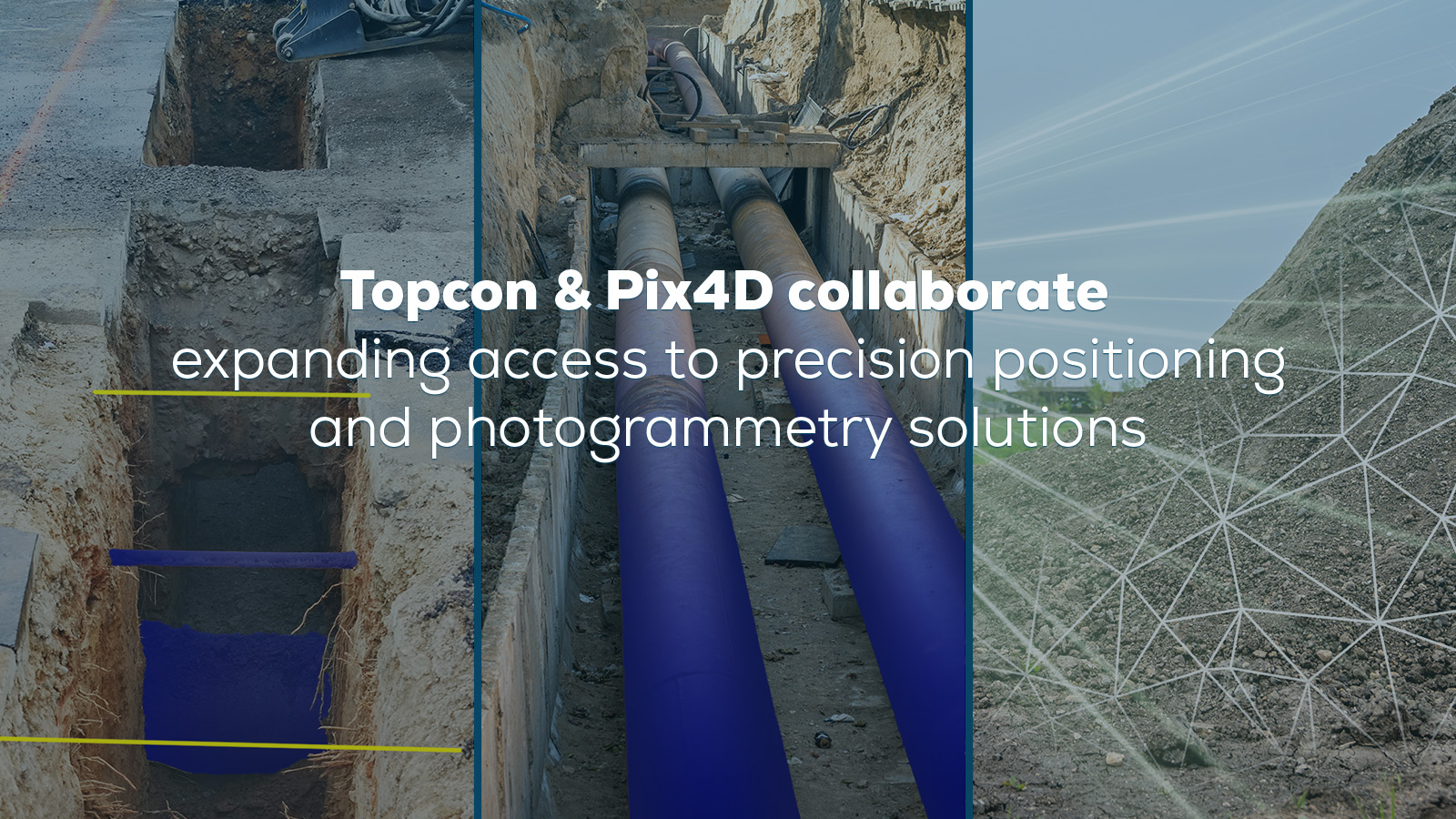
Topcon and Pix4D partner to advance geospatial solutions
Topcon and Pix4D partner to expand access to precision positioning and photogrammetry solutions for surveying, construction, and more.
Gaussian splatting at Pix4D: a new era of 3D visualization
You can now turn your PIX4Dcatch captures into highly detailed 3D models with Gaussian splatting in PIX4Dcloud.
Wildlife damage assessment for crop insurance
Wild boar damage on corn was quickly and accurately assessed before harvest with PIX4Dfields, helping a farmer with crop insurance claims.
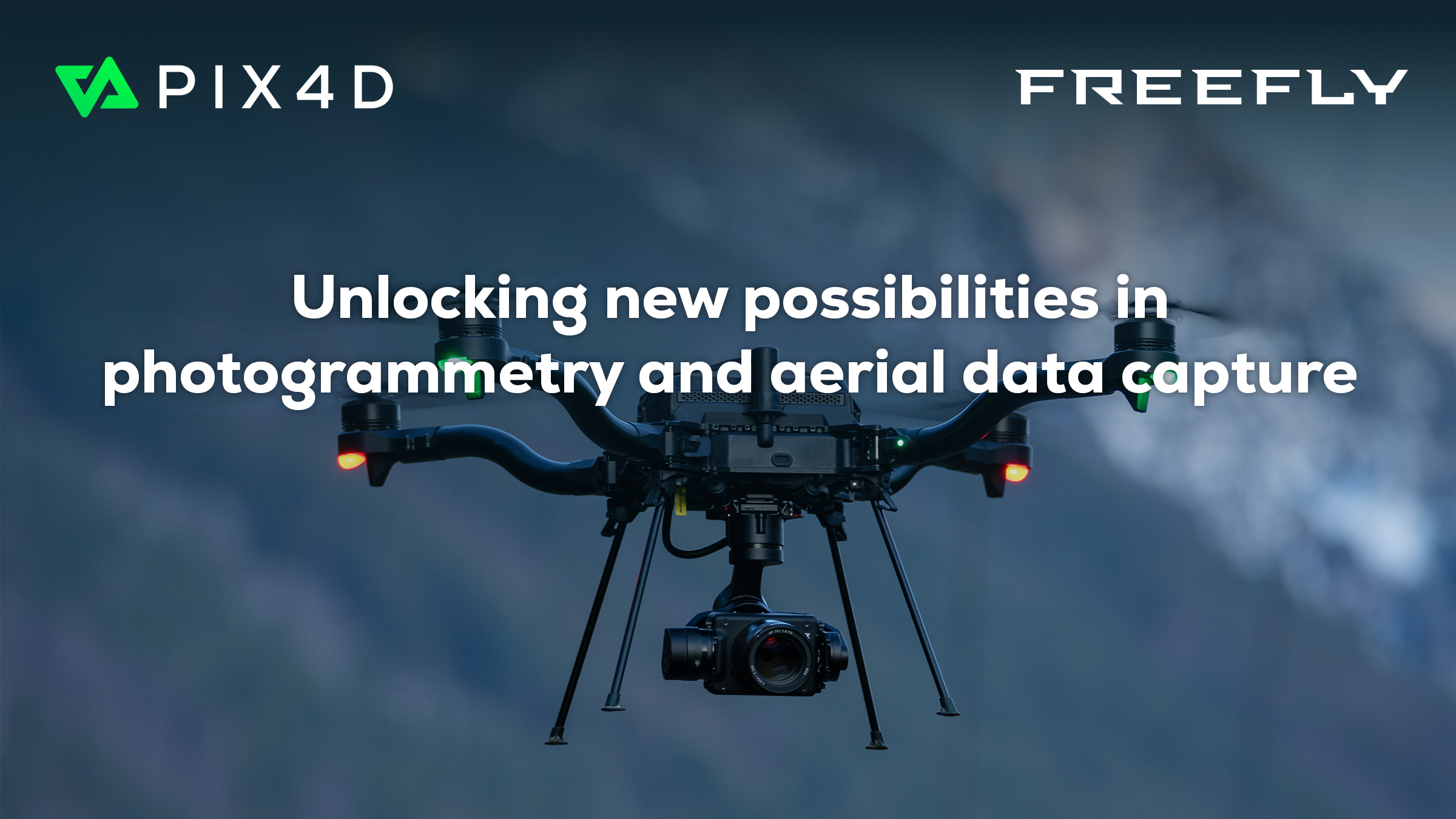
Pix4D and Freefly Systems to deliver drone-to-data workflow
Pix4D partners with Freefly Systems to offer a 1-year license for PIX4Dmatic & PIX4Dsurvey, PIX4Dcloud, or PIX4Dfields with select drones.