Surveyors achieve over 75% efficiency gains with Pix4D
Land and property surveyors are certified professionals who measure, survey, and create maps for property registration, prepare documents, and assist with legal filing procedures. Since its establishment in May 2008, Kubo Land and Property Surveyor Office, based in Nagano, Japan, has been using PIX4Dcatch and PIX4Dmatic to improve their workflow.
We spoke with a land and property surveyor from the office to explore how they have integrated Pix4D into their surveying workflow.
How does PIX4Dcatch make land surveying more efficient?
1. PIX4Dcatch accelerated our pre-survey inspection for boundary confirmation by up to 80%
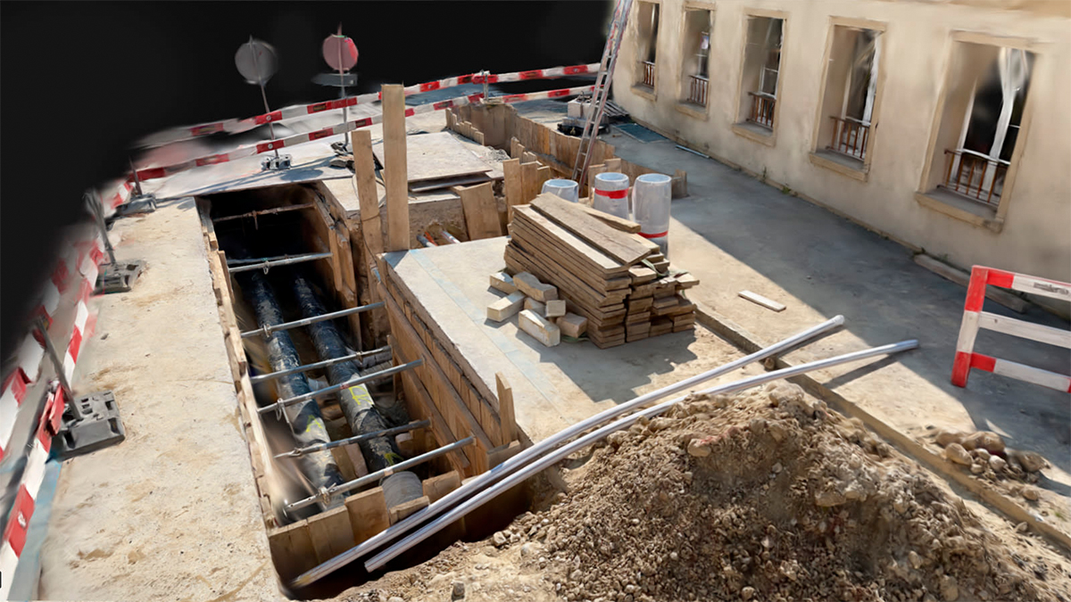
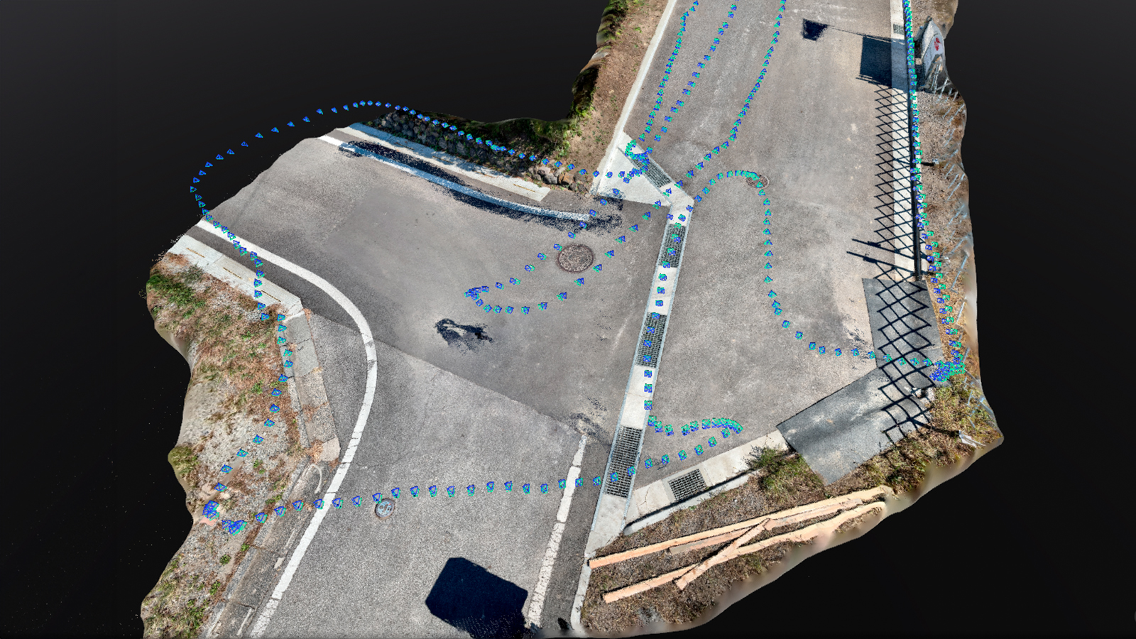
When conducting boundary measurements or confirmations, preliminary site surveys are essential. Previously when using only a total station, surveying a property of 300–400 square meters took about two hours. With PIX4Dcatch and an RTK rover, this process has been reduced to approximately 20 minutes—an impressive 75–80% reduction in time!
The workflow involves scanning the entire site with PIX4Dcatch to gather a comprehensive 3D dataset. Specific points are then measured with a total station for accuracy validation. This hybrid approach ensures data reliability while drastically reducing labor hours, making it ideal for small-scale projects where drone surveying might be excessive.
2. Enabled collaboration with builders
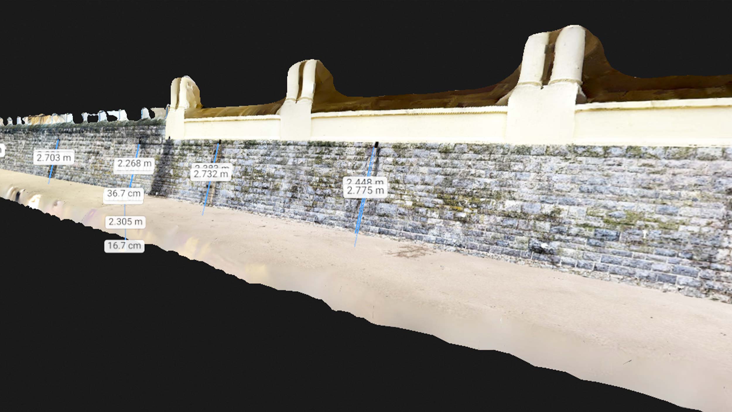
In partnership with housing developers, Kubo Land and Property Surveyor Office uses PIX4Dcatch for on-site inspections and existing-condition surveys. These projects typically involve confirmed boundary measurements where the necessary data points are already available. PIX4Dcatch simplifies this process, enabling a single surveyor to capture data efficiently.
Additionally, PIX4Dcatch’s ability to measure elevation differences allows the surveyors to assess features like the height of retaining walls, providing critical insights for construction planning. This capability has significantly eased collaboration with house builders, reducing workload and enhancing precision.
3. Created accurate maps with PIX4Dmatic
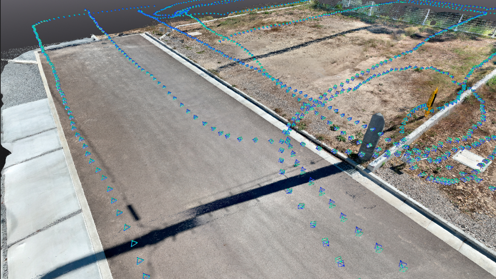
The data obtained through 3D scanning with PIX4Dcatch is processed using PIX4Dmatic and other tools to create accurate maps. Previously, manual techniques involving mirrors and point-by-point data integration were required to create these maps, now point cloud data generated from PIX4Dmatic enables surveyors to complete vectorized map creation tasks more quickly and efficiently, significantly cutting down office workload.
Why did you choose Pix4D?
- Ease of use: simple and intuitive operation for both field and office tasks
- Cost efficiency: high-quality tools at a competitive price point
- Precision with global coordinate systems: measurements aligned with global geodetic systems ensure high accuracy
- Advanced data integration:combining image and LiDAR data generates dense, detailed point clouds, making it easier to trace features using CAD software
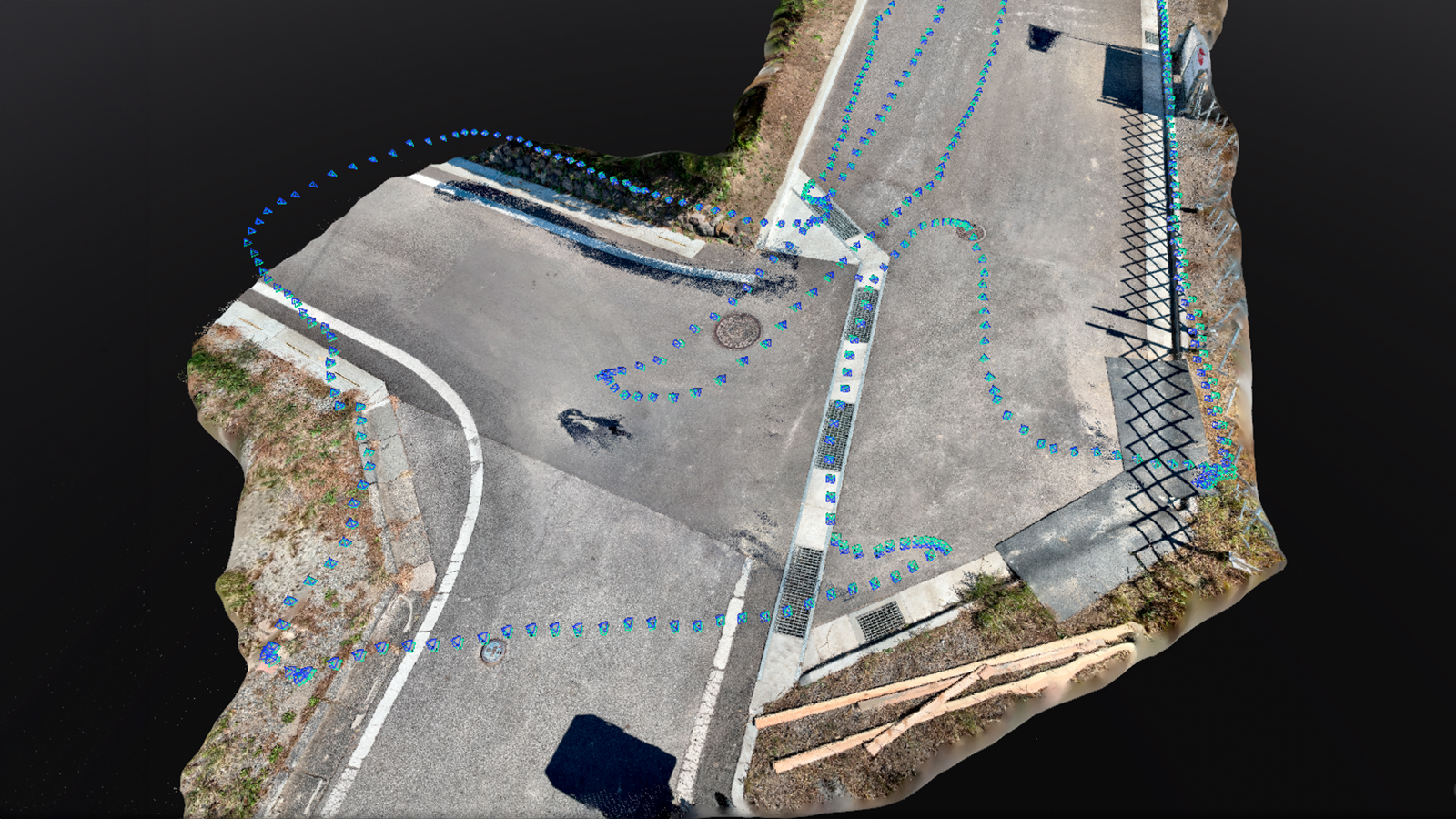
Transforming surveying practices with PIX4Dcatch
Traditionally, land surveyors relied on total stations for fieldwork, often requiring multiple traverse points for complex terrains. Difficult-to-access areas posed additional challenges. With the introduction of PIX4Dcatch, surveyors can now walk through sites with their mobile device and RTK rover attached, capturing accurate site conditions effortlessly.
The ability to conduct one-person surveys, thanks to GNSS receivers, further enhances productivity. From rapid site condition documentation with PIX4Dcatch to seamless map creation with PIX4Dmatic, these tools offer a groundbreaking alternative for improving efficiency and accuracy in land surveying tasks.
Kubo Land and Property Surveyor Office’s use of PIX4Dcatch and PIX4Dmatic showcases how technology can significantly reduce time and effort while maintaining accuracy. Pix4D opens new possibilities for land and property surveyors worldwide.

