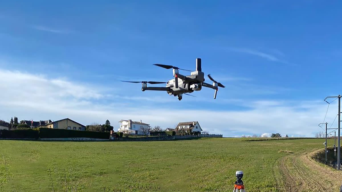
Flying camera to surveying tool: RTK/PPK drone upgrades
Drones have become so much less expensive and more accessible that they’re on every kid’s wishlist. Just about any drone can take great pictures - it’s the skill of the operator and the quality of the output that makes it a surveying tool.
In this article
- From flying camera to professional surveying tool
- What is an RTK drone?
- What’s the difference between RTK and PPK?
- How accurate is RTK?
- Why add RTK to an existing drone?
- Use case: Putting RTK enabled drones to the test in Finland
- Use case: Digitizing tough terrain
- Hardware meets software with the rolling shutter algorithm
- Explore an upgraded dataset for yourself
From flying camera to professional surveying tool
In the right hands, any drone, camera, or even cellphone can be a professional surveying tool. But there are a few extra tools that make the job faster, easier, and even more accurate. RTK/PPK equipped drones are one of them.
What is an RTK drone?
An Real Time Kinematic (RTK) drone doesn’t just capture images: it also automatically logs its precise position in space as it does so.
An RTK or PPK equipped drone can correct the camera positions up to two to three centimetres of accuracy, both horizontal and vertical. Our tests find RTK can be as accurate as placing ground control points: without taking this step. Cutting the number of ground control points cuts the amount of time spent in the field.
What’s the difference between RTK and PPK?
RTK stands for Real Time Kinematic, and PPK is Post Processed Kinematic
Both RTK and PPK systems correct the position of the captured images. With RTK this is done as the images are captured. With PPK, images are corrected after the flight. PPK’s major advantage is the drone can fly a longer distance from the base station (as much as 20 kilometers), while RTK drones must remain in the line of sight of the base station.
How accurate is RTK?
The typical accuracy for RTK is 1 centimetre ± 2 parts-per-million (ppm) horizontally and 2 centimetres ± 2 ppm vertically.
Why add RTK/PPK to an existing drone?
Adding RTK to an existing drone is an increasingly popular choice. The advantages of upgrading a drone to RTK include:
- Less expensive than a new drone. Drones are cheaper than ever - but professional UAVs are a significant investment for most businesses. An upgrade may still make a dent in a budget, but it will be a lot cheaper than buying the newest model drone.
- Cut down the learning curve. The RTK/PPK modules may be new, but your drone is the same familiar workhorse. An upgrade get the drone back in the sky much faster than a new model.
- Easy installation. In most cases, the new module will snap onto an existing drone, and does not need to be professionally installed. For example, the TOPODRONE RTK/PPK module can be easily installed in a matter of minutes.
Meet TOPODRONE
TOPODRONE is a certified Pix4D reseller. The company designs and manufactures survey drones and other solutions for aerial surveys, including GNSS receivers for DJI drones and ready-to-fly industrial RTK/PPK solutions. Find out more on the TOPODRONE website.
Putting RTK enabled drones to the test in Finland
Luonnonvarakeskus (or 'Luke' for short) is the Natural Resources Institute Finland. The non-profit research organization operates under the Ministry of Agriculture and Forestry and is the leading Finnish research institute in all areas of the bio-economy, including agriculture, food, forestry, natural resource management and biotechnology.The Luke team had a DJI Mavic 2 Pro drone, which TOPODRONE upgraded with an EMLID Reach M+ GNSS receiver. But before they took it to the field, the Luke team put it through its paces in a controlled environment to determine if a retrofitted RTK system is accurate.
Project details: testing the accuracy of retrofitted RTK
| Location | Joensuu city, Finland |
| Institution | Luonnonvarakeskus (Luke) the Natural Resources Institute Finland |
| Hardware | DJI Mavic 2 Pro upgraded by TOPODRONE with L1/L2 GNSS receiver EMLID REACH RS+ base station and rover |
| Software | Pix4Dcapture Pix4Dmapper photogrammetry software RTK LIB TOPOSETTER software |
| Ground control points | 8 |
| GSD | Less than 2cm |
| Total RMS error | Less than 3 cm |
The Luke team plotted the flight path in the free Pix4Dcapture flight planning app. The double grid had 80% front and side overlap, and was flown at 80 meters. 8 ground control points were laid in the test site, and their exact locations measured with the REACH RS+ receiver.
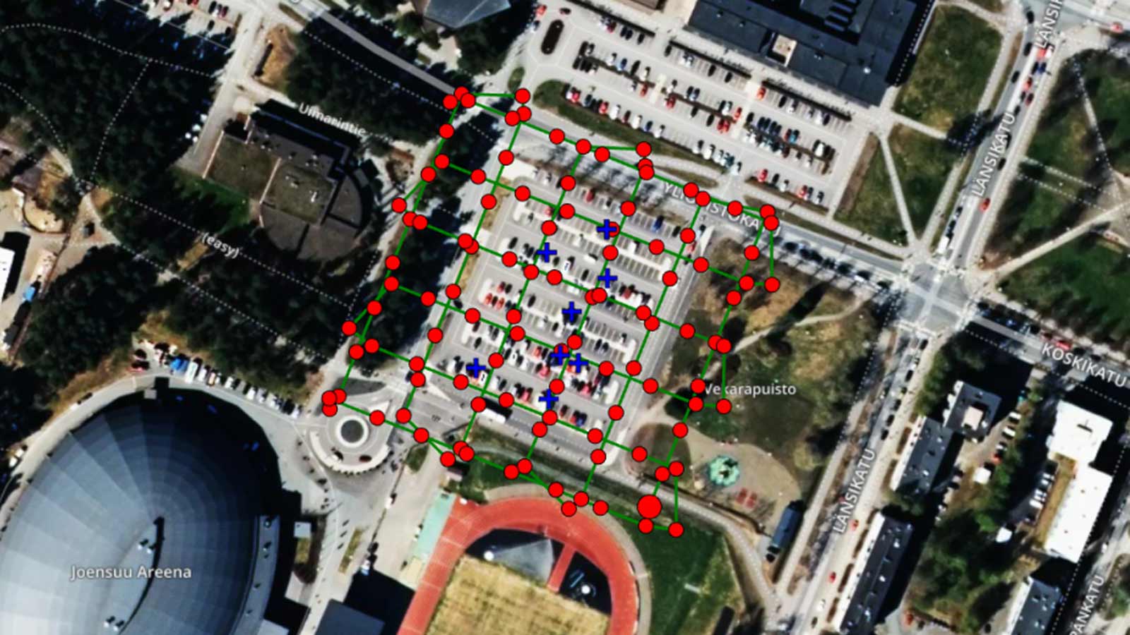
After the flight, the images were post-processed in RTK LIB and TOPOSETTER geospatial software to find the precise position of each image.
Luke's engineers then created a Pix4Dmapper project by importing both the images and a text file with precise image geolocation.
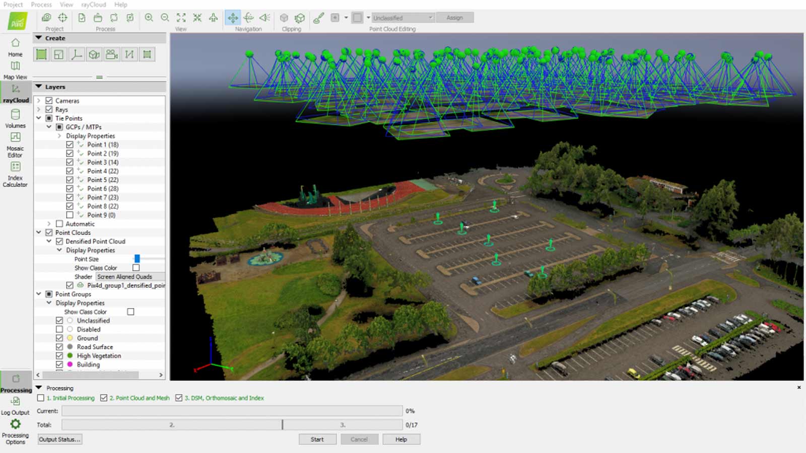
After the initial processing was completed, the eight control points were imported and marked in the project to verify the accuracy. The total RMS error was no more than 3 centimeters.
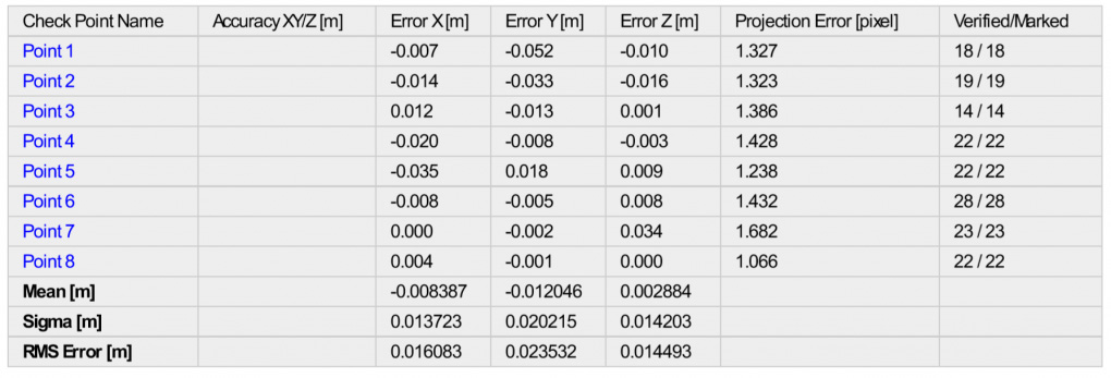
The results are clear. The Luke team’s drone with retrofitted RTK unit is as accurate as using ground control points.
"There is a great advantage in using a drone upgraded with PPK by TOPODRONE team,” says Eugene Lopatin, Luke Senior Researcher. “It allows us to spend fewer man-hours than on a traditional survey, now we don’t need to lay GCPs. And because of optimizing the resources of the team, we can deliver the best quality data to our clients promptly.
“What I also would like to add about PPK module is that it’s very easy to configure and use," says Lopatin. “The Reach M+ connected by TOPODRONE synchronization system… converts the drone into an affordable professional survey tool.”
Digitizing tough terrain
We’ve seen RTK/PPK drones in ideal conditions. But what about conditions closer to real-world environments?
Project details: Surveying with RTK/PPK
| Hardware | DJI Mavic 2 Pro upgraded by TOPODRONE with L1/L2 GNSS receiver EMLID REACH RS+ base station and rover |
| Software | Pix4Dmapper RTK LIB TOPOSETTER software |
| Area mapped | 180 hectares (1.8 square kilometers) |
| Ground control points | 4 |
| Total RMS error | Less than 6 cm |
To try the RTK/PPK upgrade in rugged, real-world conditions, the TOPODRONE team headed to an open-cast mine. Covering 180 hectares (1.8 square kilometers), the mine cuts into mountainous slopes, and is surrounded by buildings, plants and vehicles. All this combined with poor mobile coverage made surveying the site a challenge.
The flight was straightforward, although measuring ground control points on the large site took time. Where the team really stretched this project is in the outputs: they put everything to the test.
“PPK technology really simplifies processing large datasets with photogrammetry,” commented Maxim Baklykov, TOPODRONE CEO. “The images have their precise geolocation embedded in the metadata, so Pix4Dmapper automatically calculates the aerial triangulation. GCPs are only needed to check the accuracy of the project.”
First creating a dense point cloud, the team could manipulate the 3D scene, zooming and panning through the site.
As well as virtual site inspections, Pix4Dmapper photogrammetry software offers automatic classification of elements within a point cloud, for an easy-to-scan overview.
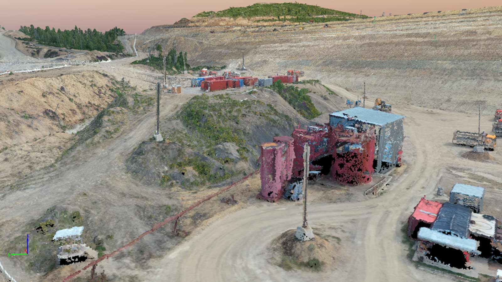
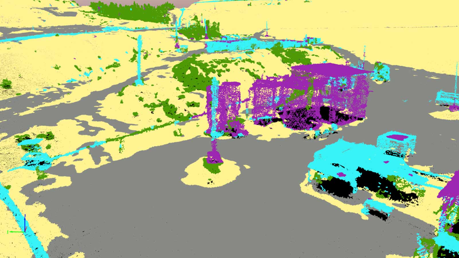
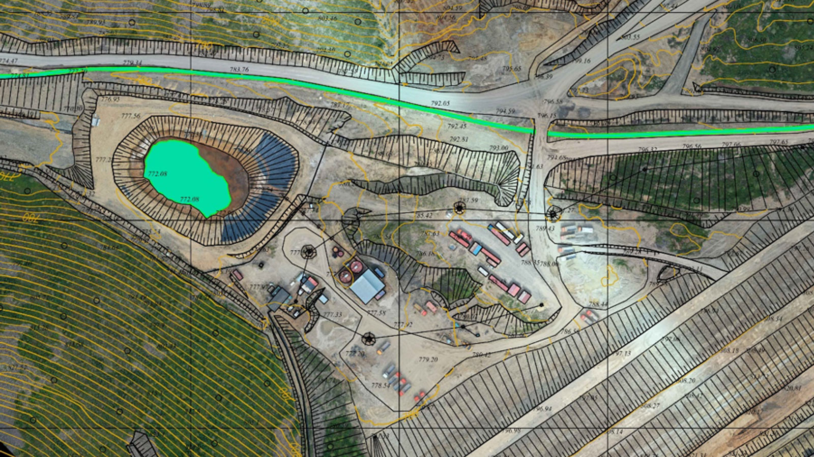
Other test outputs included contour lines, and a digital terrain model. The final output generated was a map generated with AutoCAD Map 3D from the vector information marked in Pix4Dmapper.
Hardware meets software with the rolling shutter algorithm
The accurate results were made possible thanks to a unique feature of Pix4Dmapper: the rolling shutter algorithm.
Like many drones, the DJI Mavic 2 Pro has a rolling shutter sensor. This can cause challenges when processing images captured by this drone, as rolling shutters can lead to distortions when the drone is moving rapidly.
Global sensors expose the entire camera sensor at once. In comparison, rolling shutters expose the sensor line-by-line.

Pix4D’s rolling shutter algorithm "shows a significant accuracy improvement."
Read more about the scientific research behind the rolling shutter algorithm, or how to use it to improve your projects.
Explore an upgraded dataset for yourself
Before upgrading your own drone, explore the data for yourself.
TOPODRONE have made available a real-world dataset for users to explore. In collaboration with engineering firm ATyges, the TOPODRONE team captured a hilly area in Malaga, Spain.
The hills and roads are common to both the area and sites around the world. The project is similar to those undertaken by surveyors across the globe.
Project details: RTK/PPK test data
| Collaborators | TOPODRONE ATyges |
| GSD | 1.82 cm / 0.72 in |
| Area Covered | 0.115 km2 / 11.5279 ha |
| RMS accuracy | Less than 5cm |
| Images | 191 |
| Checkpoints | 11 |
“Pix4Dmapper’s results are impressive when you don’t need to exclude trees, vegetation and cars from points cloud manually. The digital terrain model and contour lines were created totally automatically,” commented Maxim Baklykov, TOPODRONE CEO.
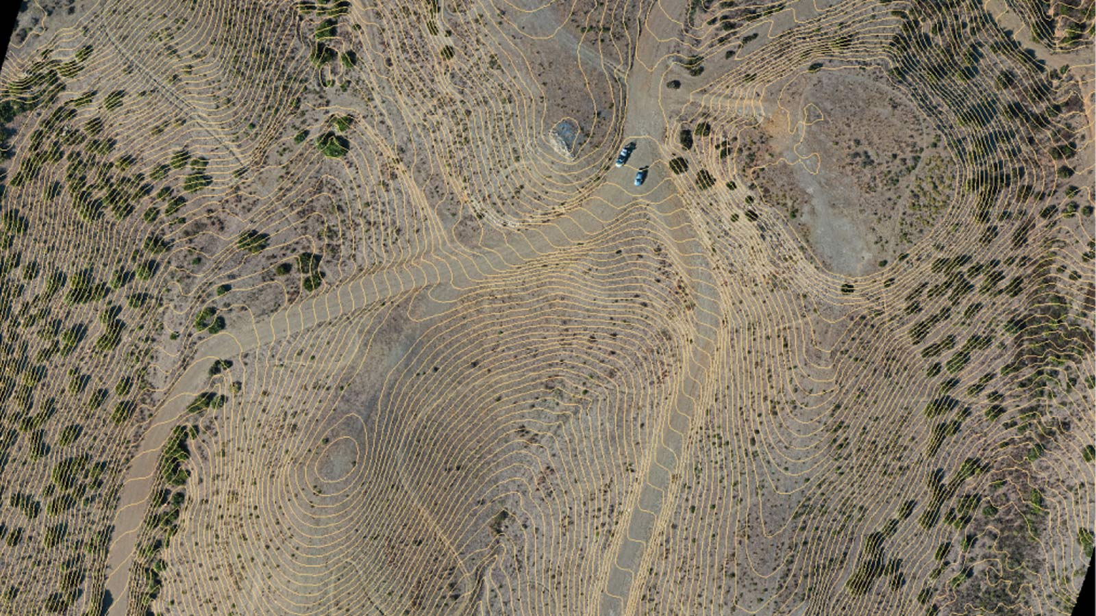
The team placed and measured ground control points, but the GCPs were used as checkpoints, not to reconstruct the model. Find out more about the difference between checkpoints and ground control points.
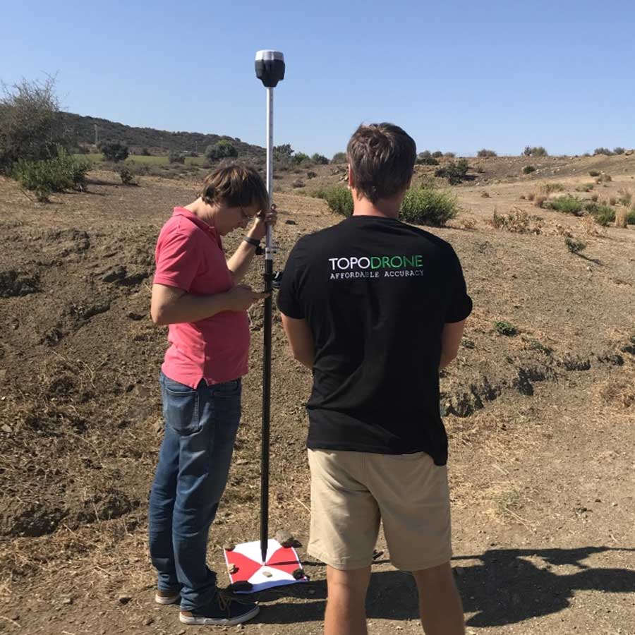
Try it for yourself. Download the dataset, courtesy of TOPODRONE.
Ready to take the next step?
Try Pix4Dmapper for free, or get in touch with TOPODRONE or one of our other resellers.
