Why precision agriculture is a game-changer for winemakers
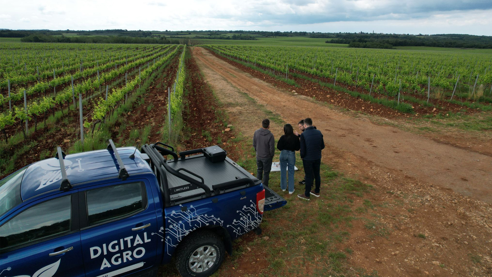
In our digital age, agriculture is evolving rapidly. Agrigentum - Digital Agro recently partnered with Agrolaguna, a leader in Istrian viticulture, olive growing, and livestock, on a large-scale vineyard mapping project in Croatia. Using PIX4Dfields, they aim to improve vineyard management, optimize grape harvests, and ensure top-quality wine through precision technology.
Vineyard monitoring throughout the season
The project aimed to monitor vine growth, improve harvest planning, and support future initiatives like productivity tracking, irrigation, and early disease detection, with harvest planning occurring from late August to mid-September. Agrigentum - Digital Agro focused on data analysis for resource optimization, while Agrolaguna contributed vineyard management and winemaking expertise.
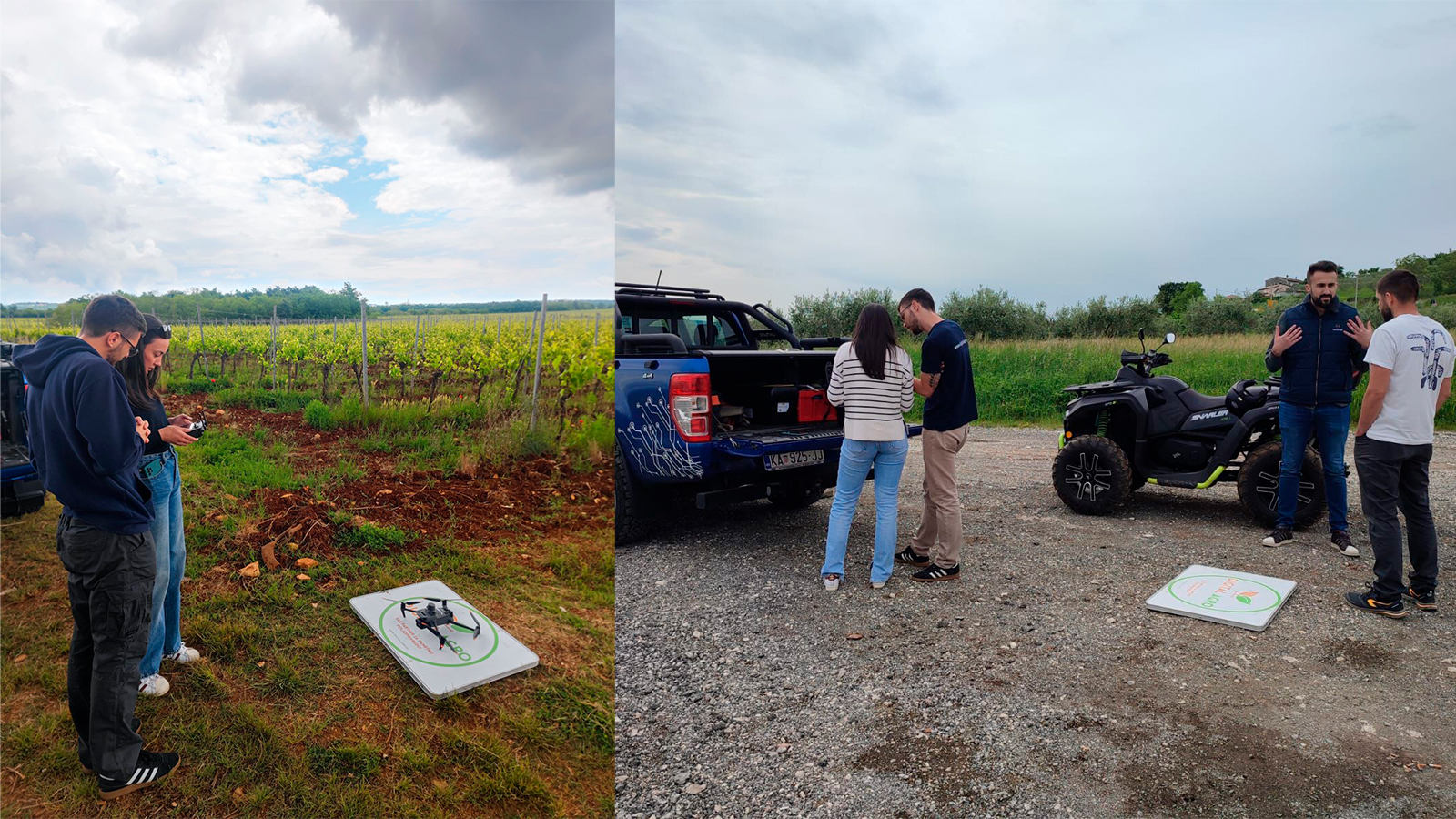
PIX4Dfields offered easy, offline, and fast processing of raw data in the field as well as useful tools like the Magic tool and Targeted Operations. The software played a crucial role in achieving the goals of the vineyard biomass zoning project:
- Accurate mapping and analysis: PIX4Dfields enabled precise mapping and categorization of vineyard areas based on vigor and development indicators. This accuracy was essential for identifying optimal harvest times and improving harvest planning.
- Enhanced data processing: the software’s advanced data processing capabilities allowed the team to extract high-quality information from drone-collected data. This facilitated better decision-making and resource optimization.
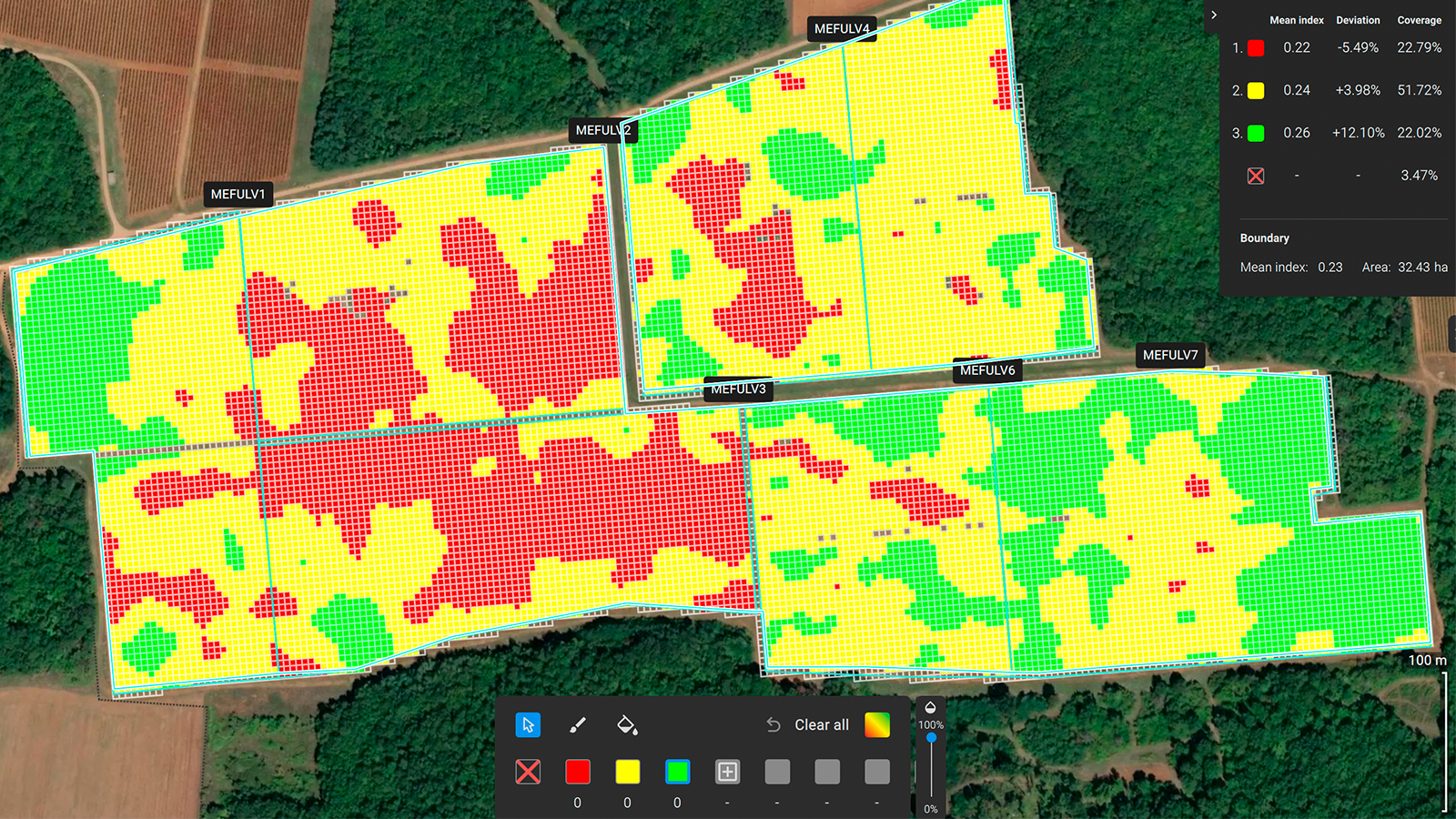
- Efficient zonation tools: the Magic tool and Targeted Operations were particularly useful for zoning areas with lower-than-average vegetation index values. This helped in targeting specific zones for interventions and improving overall vineyard management.
- Visualization and reporting: PIX4Dfields provided clear visualizations and comprehensive reports, making it easier to understand biomass distribution and plan targeted applications. This improved the team’s ability to manage resources like water, fertilizers, and labor effectively.
- Integration with other data: the software allowed the combination of yield data with biomass information, providing insights into potential total harvests and aiding in efficient resource management.
- Support for sustainable practices: by enabling targeted interventions based on precise data, PIX4Dfields helped reduce costs and improve the overall health of the vineyard, supporting sustainable agricultural practices.
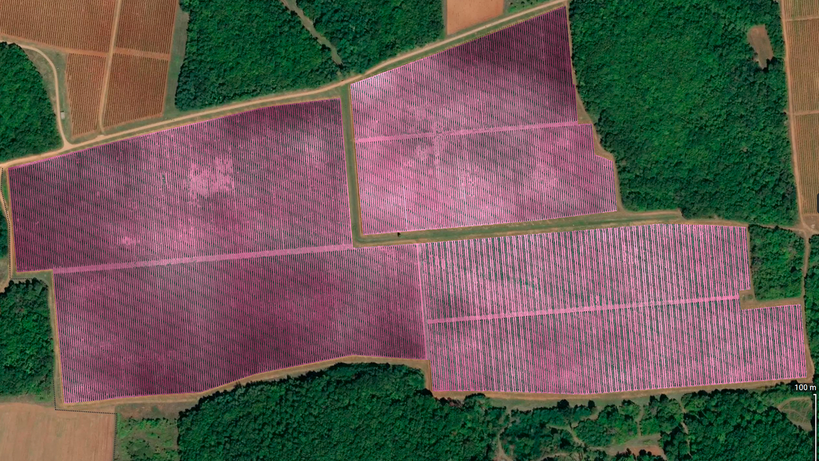
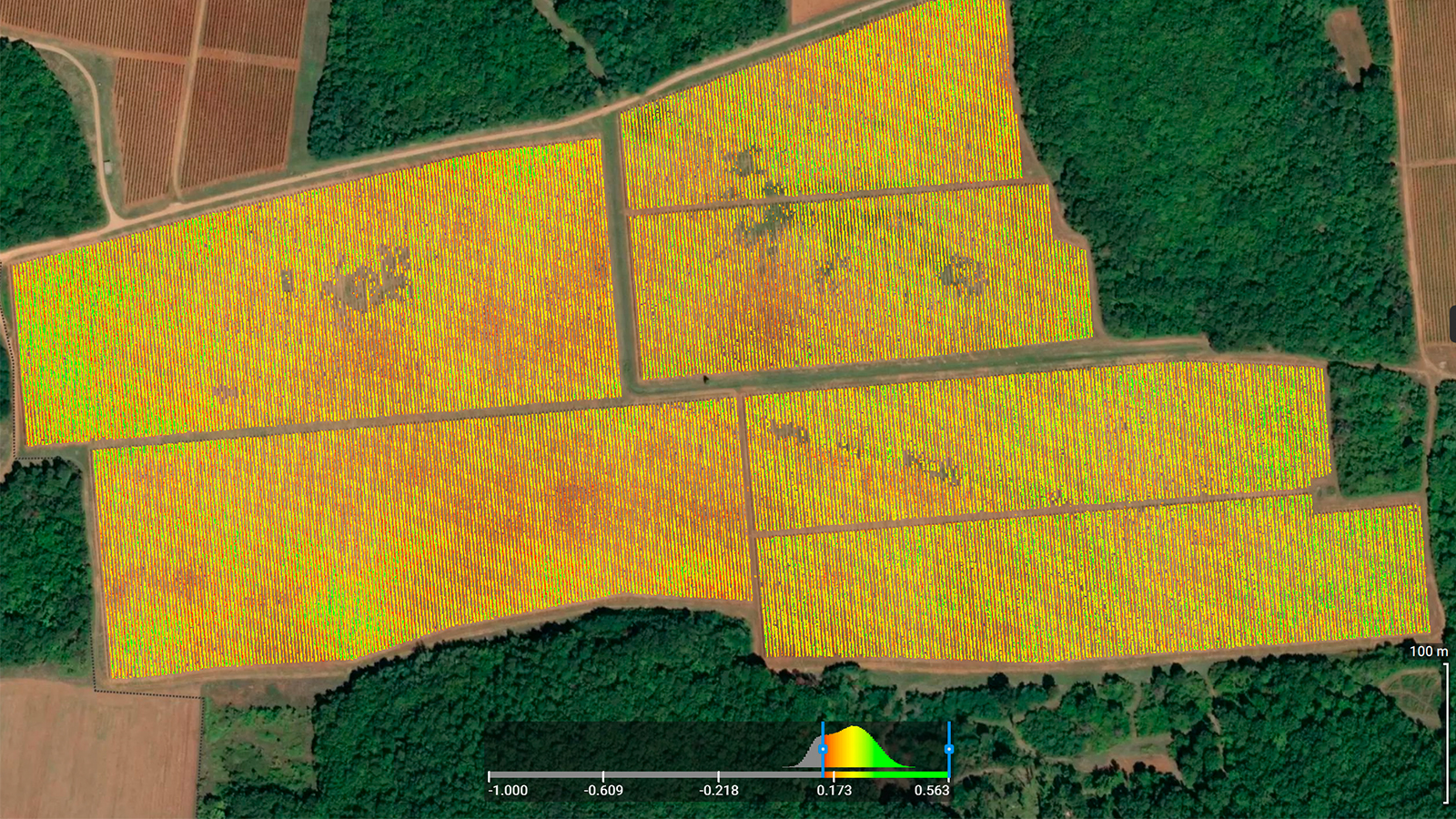
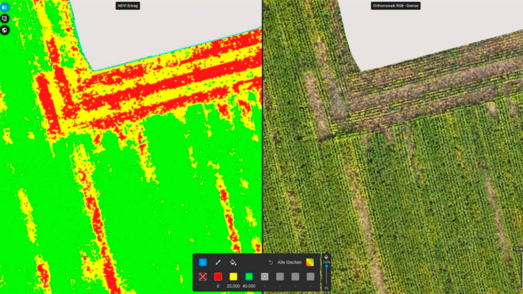
After processing the drone data, the team was able to see the areas with lower-than-average vegetation index values with the vegetation index generator tool in PIX4Dfields. The index indicated areas with unhealthy plants that needed treatment. It was clear what type of targeted application was needed and where to avoid potential problems that could affect harvest quantity and quality.
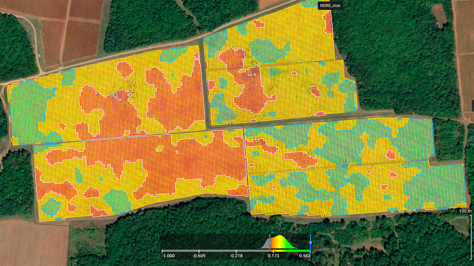
The team used PIX4Dfields’ zonation tool for enhanced harvest planning to achieve grape harvesting according to unified grape zones.
Project details
| Location | Croatia |
| User | Agrigentum - Digital Agro |
| Project duration | 4 months |
| Area surveyed | More than 120 vineyard plots, all vine varieties. Total area: 560 ha |
| Software used | PIX4Dfields |
| Hardware used | Mapping: DJI Mavic 3 Multispectral, several micro-SD cards, standard office computer for upload. |
| Processing hardware | Processing PC’s: Workstation laptops each having 2.5 TB M.2 SSD, NVIDIA GeForce RTX 2060, Intel i7 10750H |
| Processing time | 1 hour for larger datasets and a few hours for accurate processing |
| Images captured | 2 TB of raw data, over 200 000 images |
| GSD | Average GSD was 3.1 cm/px |
Ensuring high-quality wine production
By implementing vineyard biomass zonation, the team achieved several significant outcomes:
- Enhanced harvest planning: improved grape harvest planning by mapping and categorizing vineyard areas based on vigor and development indicators. This allowed them to identify optimal harvest times for different zones, ensuring grapes were picked at their peak ripeness.
- Quality control: differences in vigor indicated variations in ripening and chemical composition, such as sugars and acids. By identifying these zones, separately processing the grapes was possible, leading to better control over the winemaking process and the creation of diverse wine styles from the same vineyard.
- Efficient resource management: combining data with yield quantities per harvest zone provided insights into the potential total harvest, aiding in more efficient management of resources like labor and equipment.
- Targeted interventions: understanding biomass distribution enabled more effective resource allocation like water, fertilizers, and labor. This ensured each zone was managed according to its specific needs, reducing costs and improving vineyard health.
- Risk reduction: zoning allowed for gradual or selective harvesting, reducing the risk of picking overripe or underripe grapes. This led to more consistent wine quality.
- Informed decision-making: the project facilitated informed decisions about when and how to harvest, resulting in more efficient resource use and better raw material quality.
- Sustainable practices: targeted interventions addressed stress caused by diseases, water shortages, or nutrient deficiencies, enhancing the overall health and sustainability of the vineyard.
Overall, the project significantly improved the team’s ability to manage the vineyard, optimize resource use, and produce high-quality wine.
Digital Agro highlights several compelling reasons as to why they chose PIX4Dfields:
- Numerous functionalities: PIX4Dfields offers a wide range of features that cater to their diverse needs in digital agriculture. From precise mapping and analysis to advanced data processing and visualization, the software provides all the tools necessary for effective vineyard management.
- Stability and reliability: the software’s stability and reliability are crucial for their large-scale projects. They can depend on PIX4Dfields to handle extensive datasets and deliver consistent, high-quality results without interruptions.
- Constant Updates: PIX4Dfields is continuously updated with new features and improvements. This commitment to innovation ensures that they always have access to the latest tools and technologies, keeping them at the forefront of digital agriculture.
- User-friendly interface: the software boasts a friendly user interface and ease of use, making it accessible for users of all skill levels. This intuitive design helps streamline their workflow and ensures that theirteam can quickly and efficiently utilize the software’s capabilities.
“The support from the Pix4D team has been exceptional. Across different departments, their team has been responsive and helpful, ensuring that we can maximize the software’s potential and address any issues promptly” Tin Batur, precision agriculture specialist, Agrigentum - Digital Agro
Overall, PIX4Dfields software has proven to be an invaluable asset for Digital Agro, helping them achieve their goals and deliver exceptional results for their clients.
“Combining PIX4Dfields with a multispectral drone creates an ideal solution for vegetation analysis. It’s a match made in heaven and an essential tool for anyone in the field.” Tin Batur, precision agriculture specialist, Agrigentum - Digital Agro

