PIX4Dsurvey 1.30: tools for road mapping and new language!
The latest PIX4Dsurvey update includes exciting new developments for professional surveyors. Registering imported data (point clouds or photogrammetry projects) in an existing PIX4Dsurvey project is now done automatically, while any data can be used as a reference. In addition, circular objects on horizontal planes like intersections, tanks, public spaces, etc can easily be vectorized with the new vectorization tool. Finally, we are very excited to announce that PIX4Dsurvey is also available in Korean!
Road surveying made easier
Road networks are a very important element for infrastructure in every country and they require continuous development, maintenance, and control.
Surveying a road is a demanding project that requires detailed and accurate records of many elements, including road markings, signs, curbs, road dividers, boundaries, and manholes. Long roads can require surveys that are kilometers long and need them to be repeated frequently. PIX4Dsurvey has previously introduced automation features like road marking and manhole detection that save hours of vectorizing long roads and detects hundreds of manholes in the images in a fraction of the time. Now, the road surveying workflow of PIX4Dsurvey is expanding to include two new tools: curb detection and road point cloud classification.
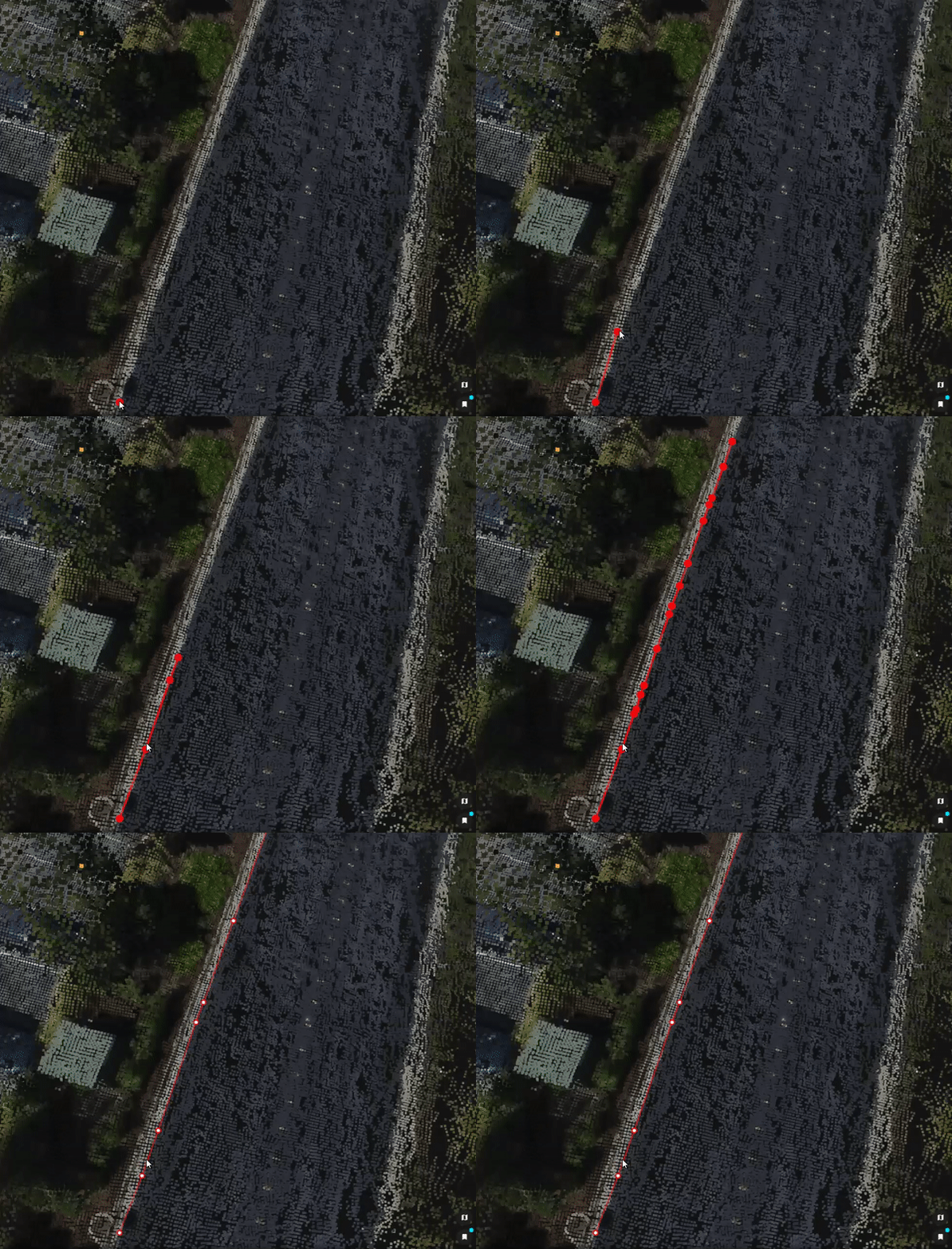
Curb extraction, when done manually can be labor-intensive, time consuming and costly. With the assisted curb extraction, PIX4Dsurvey users can quickly vectorize curbs with less manual effort by just clicking twice to show the start and road direction and, based on the images, the rest of the line is vectorized automatically. Try out this “Beta” function first on an intersection, or elsewhere on a complex curve.

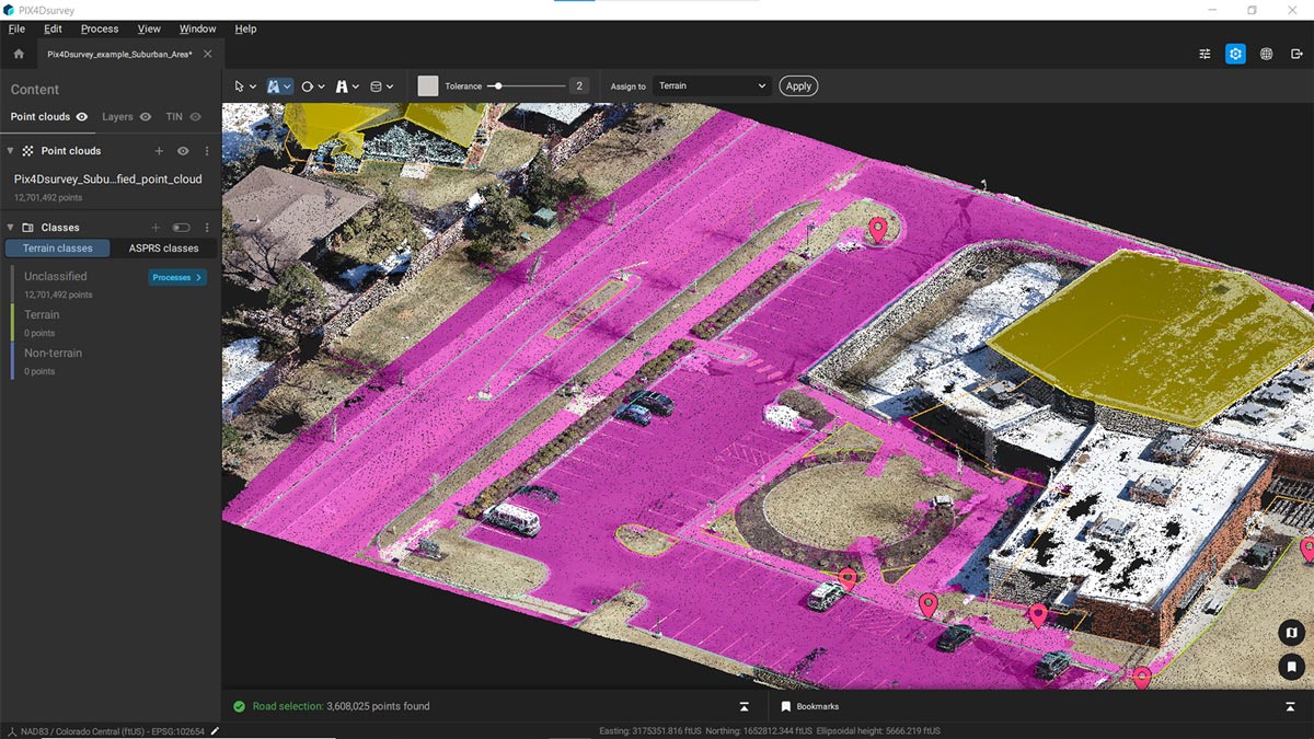
Color-based selection in PIX4Dsurvey helps the user to better understand the point cloud and refine classification by defining relevant parameters. The road selection is a more specific selection tool for road surfaces and thus has tailored parameters for these objects, which are: color, color tolerance, elevation, and continuity. This feature provides an easy and quick way to select and classify roadway point cloud points in a project that is adjustable via a color threshold.

Text file imports
Text files can now be imported as markers. With flexible header selection and support for standards like PNEZD format, this gives surveyors the option to convert the coordinate system during importation and define the correct column contents. PIX4Dsurvey users will have even more control over their projects with this change and can tailor their outputs to their needs for specific assignments.
And this is not all!
In the latest release of PIX4Dsurvey, the polyline properties include slope value in degrees or percentages, the file management is made easier with improved file names export (using timestamps or suffixes) and there is also performance improvement because PIX4Dsurvey now uses the best available graphics card by default. Furthermore, the volume measurement workflow now includes volume base polygon exports as DXF, .shp, GeoJSON. PIX4Dsurvey is a fast-developing product and more features will be coming before long to enhance professional workflows and make point cloud vectorization an accurate, fast, and seamless process. There is an ongoing Geospatial Offer for PIX4Dsurvey and PIX4Dmatic, in addition to online workshops where our trainers teach surveyors how to get the most out of PIX4Dsurvey.


