PIX4Dmatic 1.15: Arbitrary Coordinate Systems and more!
We are halfway through 2021, and our software developers have been working hard to regularly update our products. PIX4Dmatic 1.15 was released just this week, with several new and exciting features. Here are the latest changes and updates to PIX4Dmatic.
Konnichiwa!
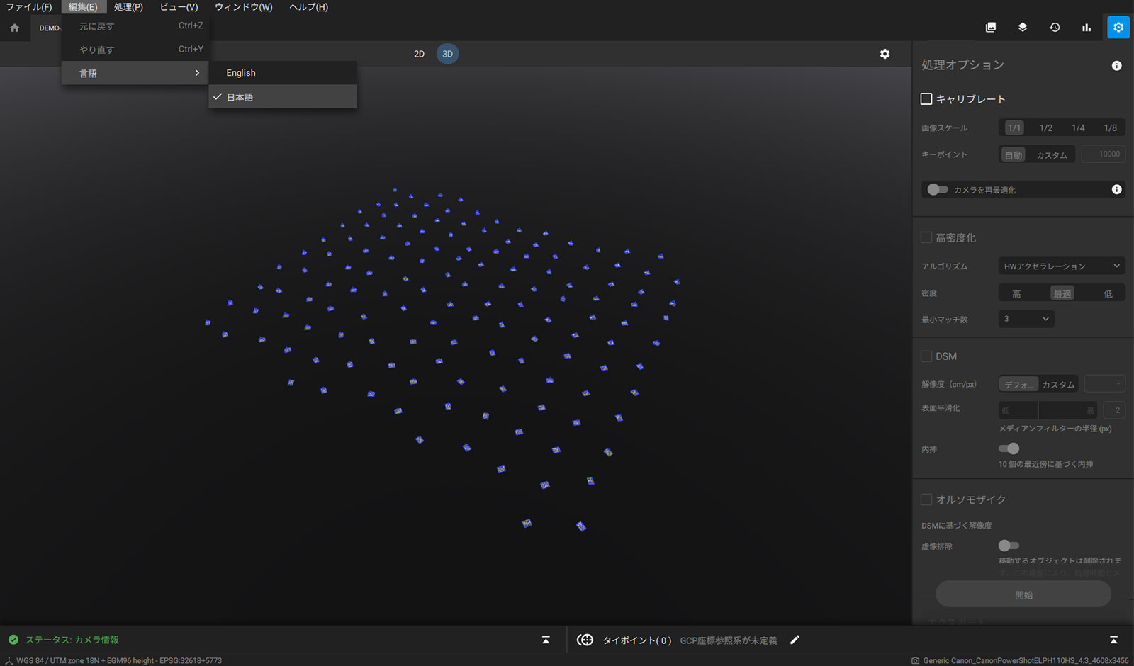
PIX4Dmatic is available for users who speak Japanese. The entire user interface and all commands have been translated, so users who prefer to work in Japanese can take advantage of the software in their native tongue. Stay tuned for more language updates.

Arbitrary coordinate system support
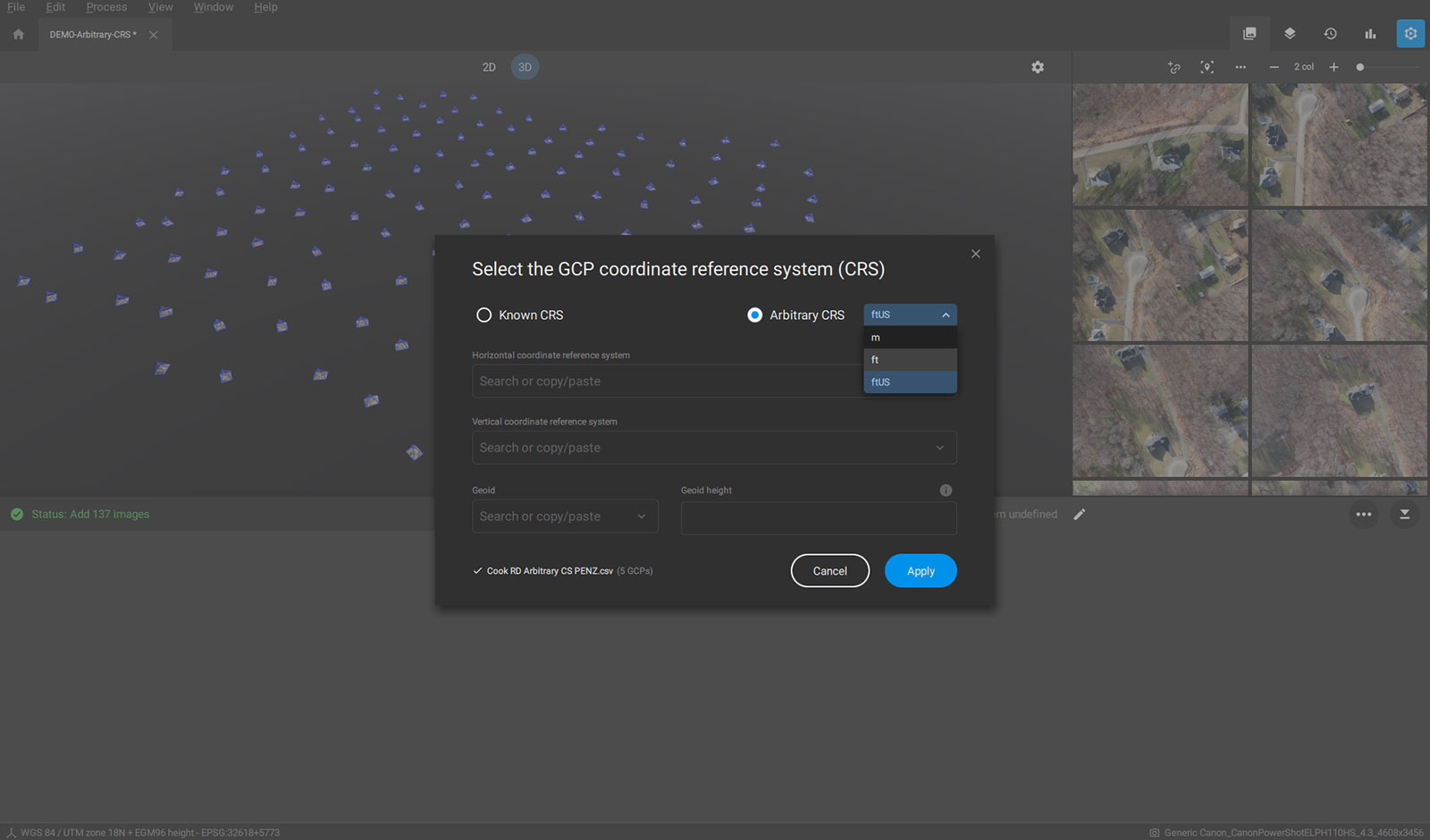
PIX4Dmatic now supports arbitrary coordinate systems. Users can have a coordinate system specific to their site as they can now work with any coordinate system and reference the projects with Ground Control Points (GCPs).

This is ideal for large construction and mining sites, where there is a big area being surveyed but there is not a known coordinate system. Users can ensure accuracy and precision by basing their measurements on GCPs.
AutoGCPs come to PIX4Dmatic
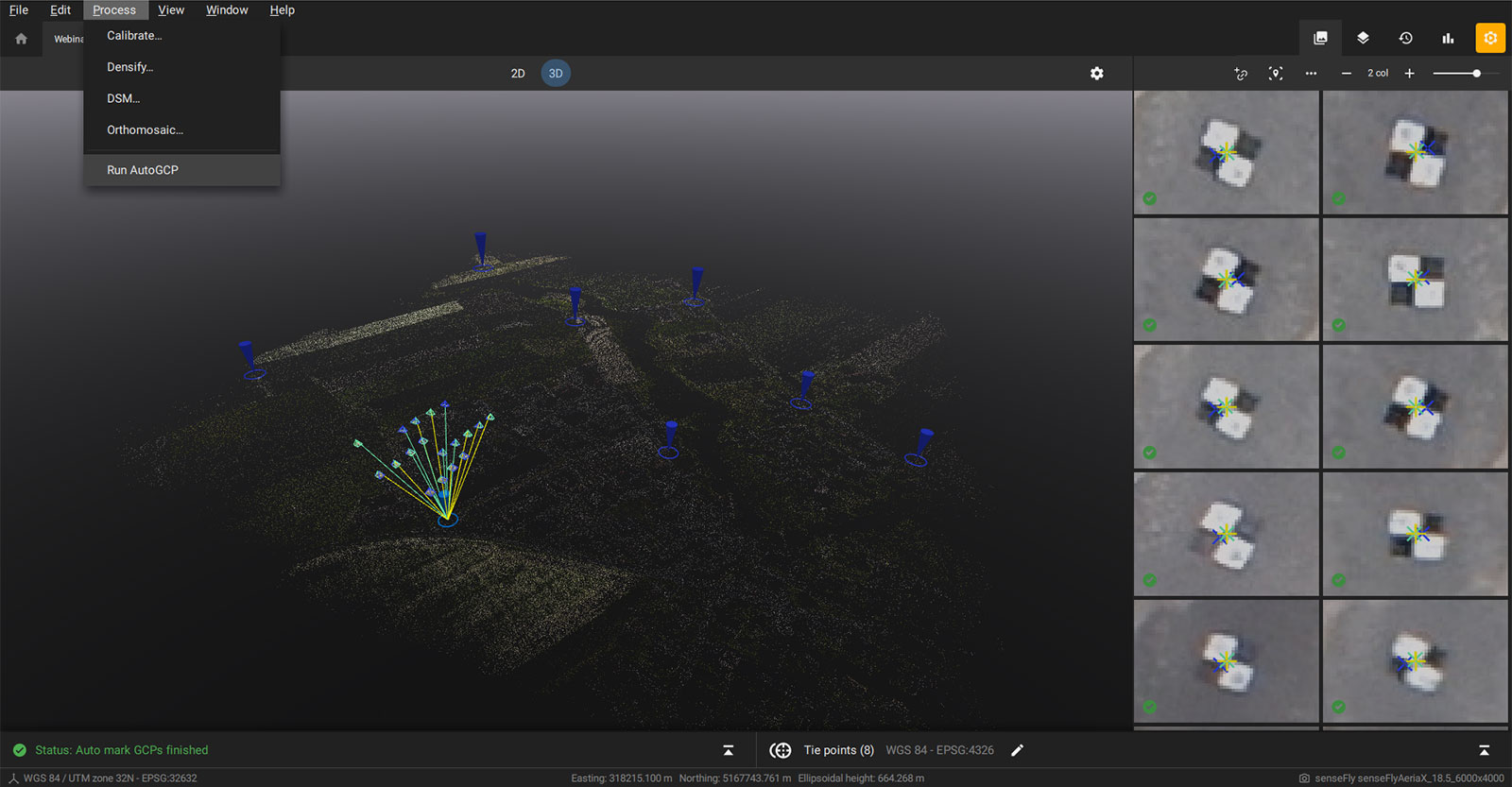
If you’ve ever used PIX4Dcloud Advanced, you’ll have an idea of AutoGCPs. The AutoGCP algorithm has now been incorporated into PIX4Dmatic, providing users a great new feature for streamlining workflows.

The AutoGCPs algorithm automatically locates targets in images and detects their centers with pixel-level accuracy. This reduces the time spent marking tie points. AutoGCPs are only available in a few Pix4D products: PIX4Dcloud Advanced, PIX4Dengine, and now PIX4Dmatic.
Deghosting: editing moving objects
When you are mapping an area, chances are there are ground-level objects moving around that you do not need in the final orthomosaic. Moving objects like cars and people can cause distortions.
This has changed! With PIX4Dmatic 1.15, users can now remove moving objects, as they do not truly represent what you’re mapping. The software will do it automatically, removing that object from the orthomosaic.
Set HW accelerated densification
Following the theme of making your workflow faster and smoother, PIX4Dmatic now has improved speed for densification. The HW accelerated is the default setting for densification on PIX4Dmatic and is now 52% faster than the Standard option, and produces slightly more points in certain projects. This reduces the overall required processing time - although the GPU of the processing hardware can also affect this.
Finally, quality report as a .pdf, and a new camera
Finally, PIX4Dmatic quality reports can now be exported as a .pdf file on Windows computers - we are working on extending this to macOS devices too. The quality report includes a summary of your project, including the GCPs, hardware the data was processed with, settings used for processing, and coordinate systems. Being able to share it as a .pdf allows users to succinctly communicate their work and outputs with clients alongside the models or orthomosaics they create.
In addition to this, PIX4Dmatic now supports the DJI Zenmuse P1 camera. This modern camera packs a powerful punch, capable of capturing images with a resolution of 45 megapixels. It is ideal for large scale mapping projects, which is where PIX4Dmatic thrives. This camera’s being supported by PIX4Dmatic is a new door opening to pushing the limits of surveying.
Those are the updates we have for now! If you haven’t tried PIX4Dmatic yet, start your free trial now to get the specialized software for large scale and corridor mapping.


