PIX4Dfields 2.9: Smarter AI Magic Tool, DSM exports, & more!
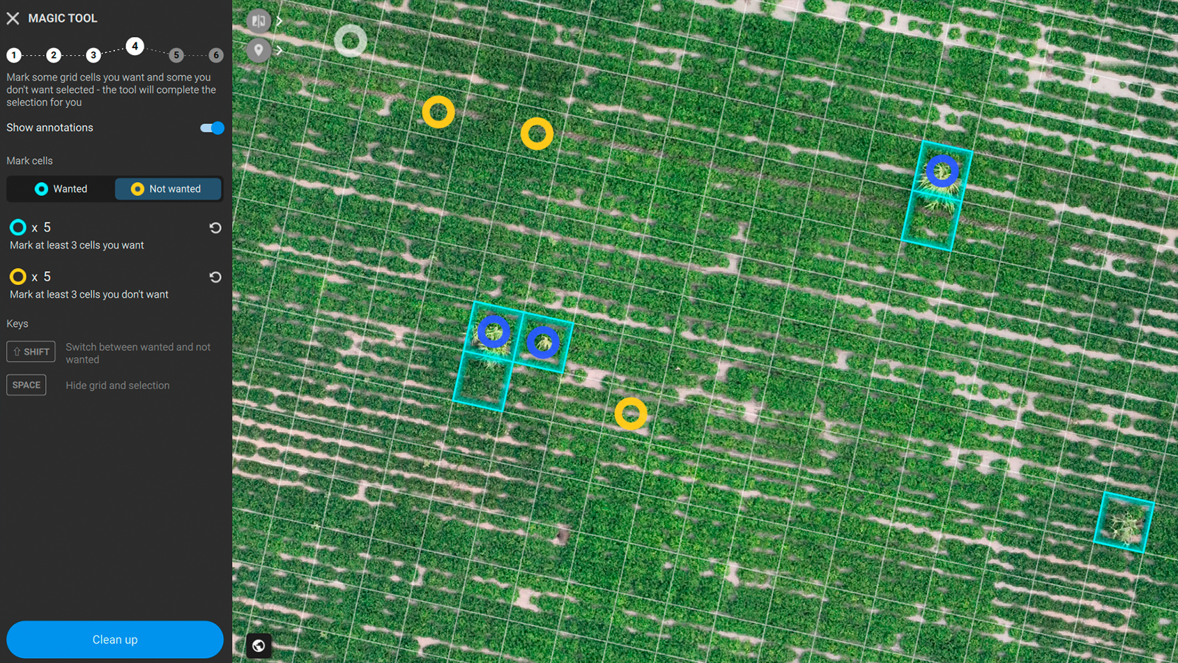
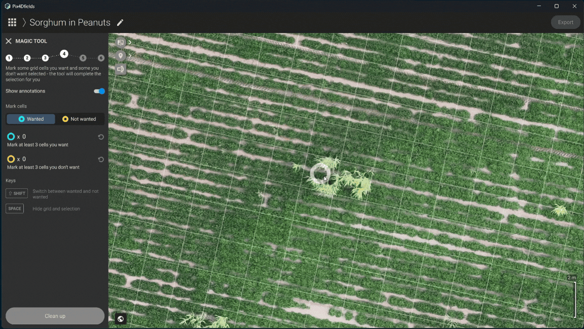
Magic Tool: improved detection accuracy
Since its initial release in November 2022, the Magic Tool has provided farmers with a reliable means of interpreting drone imagery, enabling the identification of structures, weeds, and anomalies through advanced machine vision algorithms. We are pleased to announce the release of an updated iteration of the Magic Tool that incorporates significant improvements, informed by data voluntarily contributed by users over the past two years.
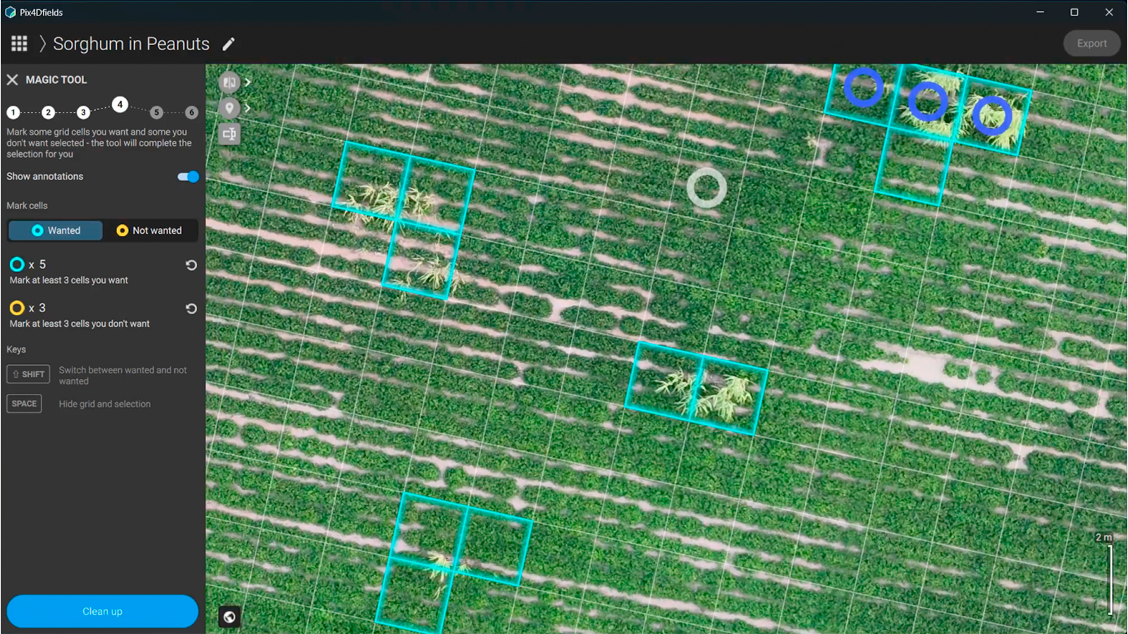
With the help of data our users contributed voluntarily since its initial release, the updated Magic Tool now features a neural network architecture, offering up to 5x fewer false positives and improved detection in challenging cases (e.g. Green on Green). This is just the beginning, with the new underlying architecture it will improve over time through continued use. The development the Magic Tool has been supported by the integration of a neural network architecture, resulting in the following advancements:
Increased accuracy: the tool now achieves up to a fivefold reduction in false positives, minimizing erroneous detections and thereby enhancing the reliability of results for practical application.
Enhanced detection in complex scenarios: the updated tool demonstrates superior performance in challenging conditions, such as distinguishing weeds from crops in "green-on-green" situations, where visual differentiation is difficult.
The new architecture of the Magic Tool is designed to adapt rapidly and users may opt to participate in a voluntary data-sharing program. This optional contribution enables us to tailor future updates to better address specific agricultural use cases, ensuring that the tool remains relevant to our user base.
Water management and land leveling
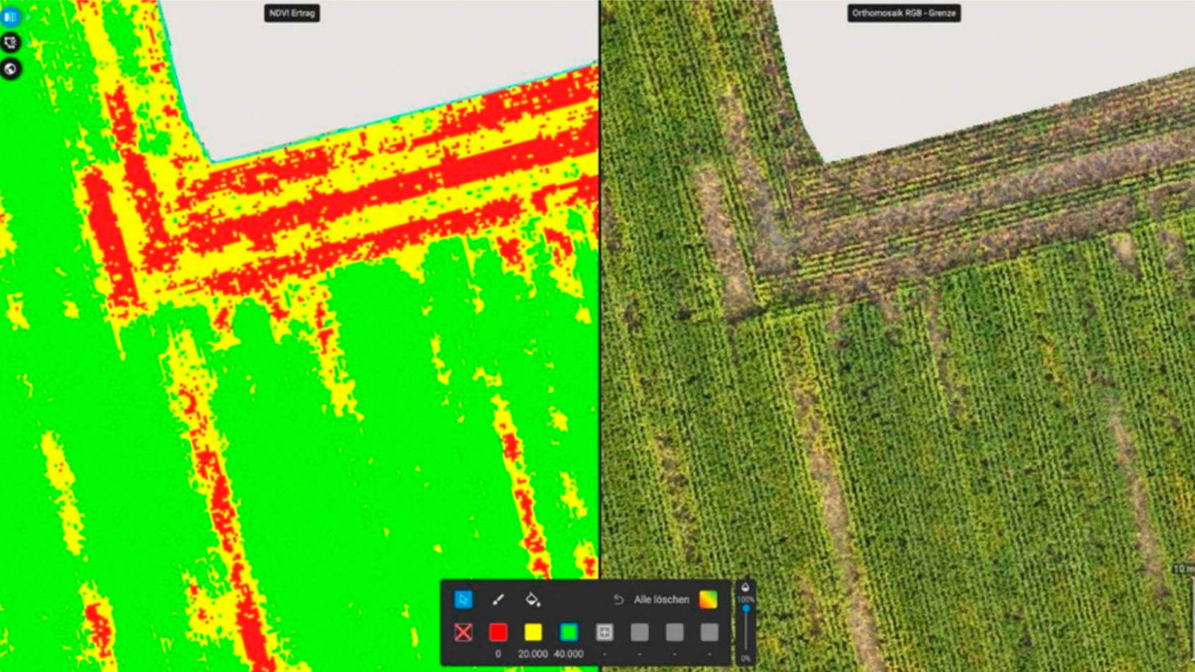
Effective water management and land leveling are foundational to agricultural success, ensuring optimal field drainage, irrigation, and crop growth. These practices are critical for major crops like wheat, corn, and rice. They are also especially vital for crops requiring precise irrigation systems, such as specialty crops like vegetables, fruits, and vineyards. Digital surface models (DSMs) enhance these efforts by providing detailed terrain analysis, enabling the design of efficient irrigation and drainage systems, precise field leveling, and the identification of waterlogged areas that could harm yields.
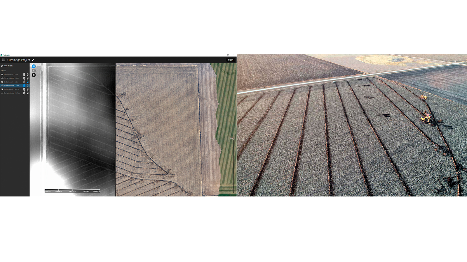
PIX4Dfields’ Accurate Processing leverages RTK (Real-Time Kinematic) drone surveys to produce highly detailed DSMs. The centimeter-level accuracy of RTK technology is ideal for land leveling and drainage planning, where small elevation differences significantly affect water flow and crop health. Unlike traditional methods—such as manual measurements or ground-based GPS, which are slow —drone surveys with PIX4Dfields deliver rapid, high-resolution data collection, streamlining workflows and reducing planning time.
This release introduces support for exporting DSMs in XYZ and Trimble MultiPlane formats, enabling seamless integration with third-party landforming tools like Optisurface, Trimble Agriculture (PTx Trimble), and T3RRA Design. These export options simplify data transfer, allowing agricultural professionals to efficiently incorporate survey insights into land management solutions, ultimately improving water use and productivity.
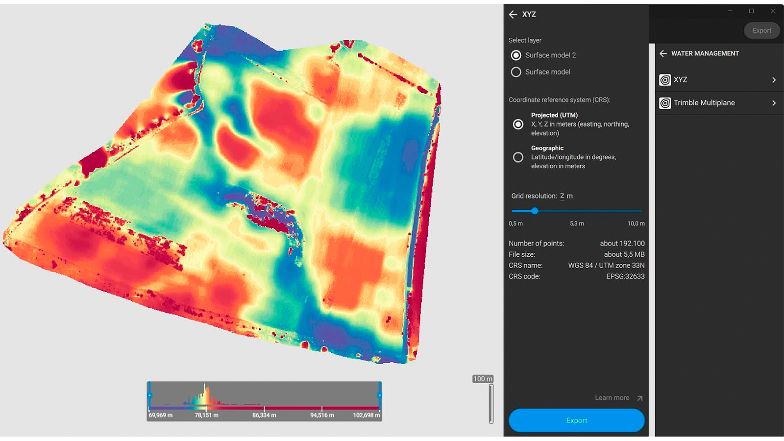
Learn more from our support article.
Location search, batch import/export & more!
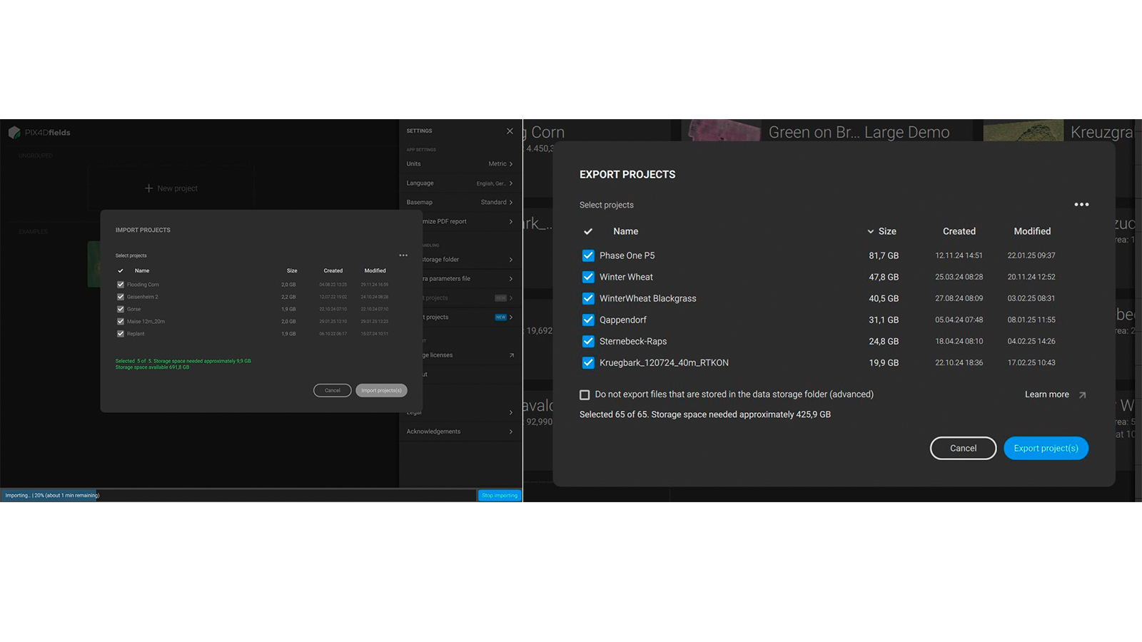
You can now batch import and export projects in PIX4Dfields! This feature lets you see the space each project occupies on your hard drive, export multiple projects at once, and is ideal for archiving older projects to free up space or sharing many projects without effort. It also supports importing multiple projects.
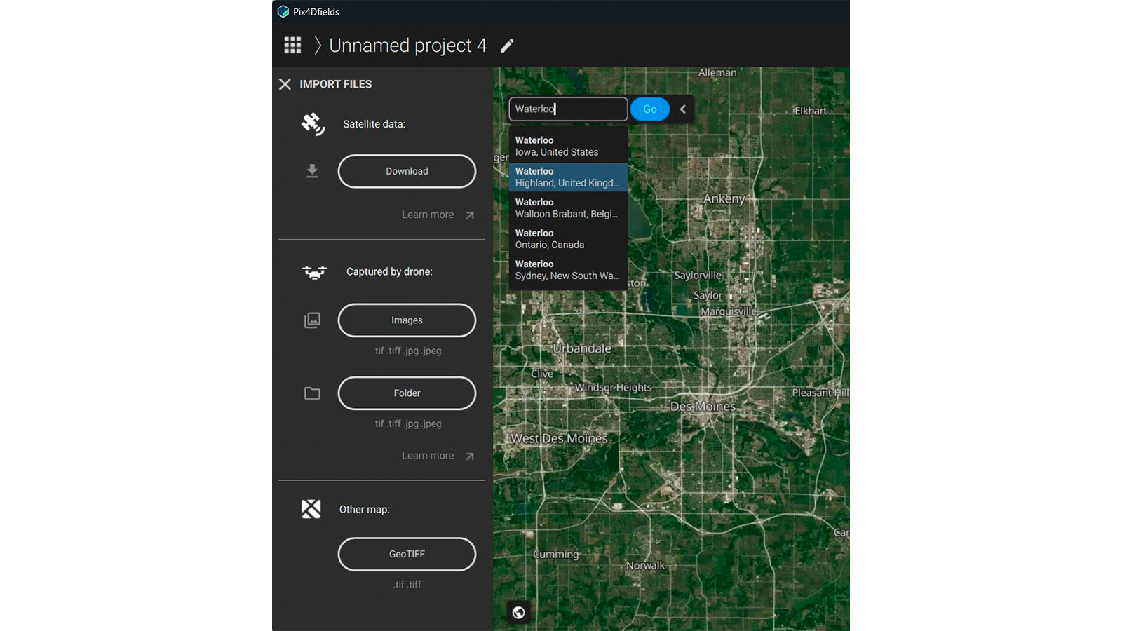
Location by name, postal code, or GPS coordinates in PIX4Dfields is also now possible! This new functionality is especially useful for satellite-only users who need to manually draw field boundaries, allowing them to find the spot faster as PIX4Dfields automatically detect the location.
More exciting updates:
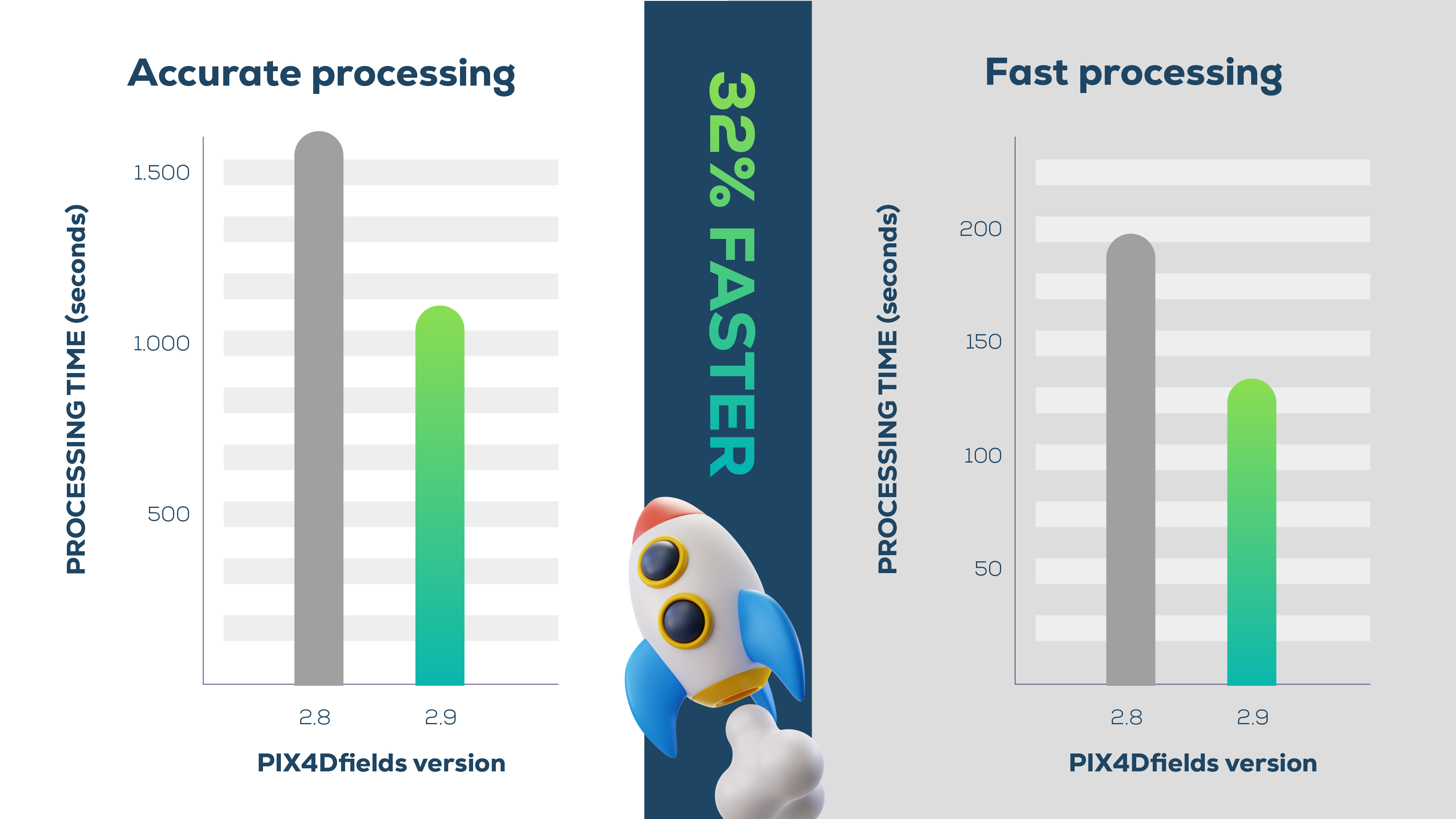
Apple M-series ARM CPUs support, improving processing speed by an average of 32%. For example, a 27GB dataset captured by DJI Mavic 3 Multispectral processes in 17.7 minutes on PIX4Dfields 2.9 with an Apple M1, compared to 30.5 minutes on version 2.8!
Romanian language support!