Pix4D and drone mapping uncovers unregulated gold mining
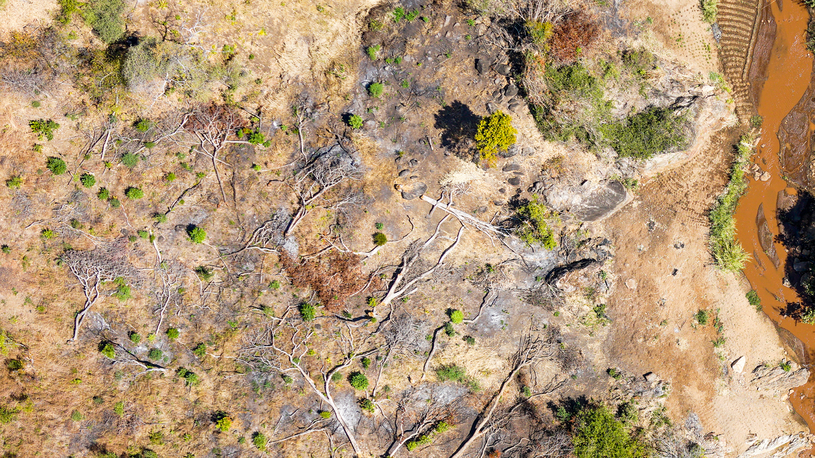
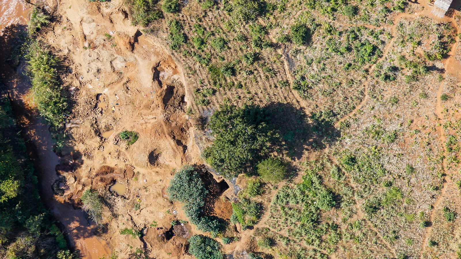
Illegal gold mining in protected natural reserves presents a complex environmental challenge. Beyond the immediate disruption to soil and riverbed integrity, these activities often introduce mercury into waterways and contribute to local deforestation, particularly in ecologically sensitive riparian zones (the natural areas along rivers or streams).
These zones often have plants and trees that help protect water quality, prevent erosion, and support wildlife. Monitoring such activity on the ground can be difficult due to accessibility and safety concerns. Drone mapping offers a solution.
Drone maps revealed unusual activity
A long-standing international nonprofit involved in the case used Pix4D software to help identify signs of illegal gold mining in a protected forest area (they wish to remain unnamed).
At the request of local forestry authorities, the nonprofit conducted drone mapping on-site and contributed to the analysis of the data. While drone and data training efforts have grown in the region, mapping large landscape corridors still requires access to advanced drone equipment, high-performance computing, and user-friendly photogrammetry software such as PIX4Dmatic. The non-profit planned, flew, and processed the drone data.
We spoke with the scientific advisor for the charity, Kevin Delferth. “Going from the field to a high-resolution drone map where every bucket of sand can be counted in less than a day is remarkable," he told us, "especially when compared to the challenges of accessing high-resolution satellite imagery. Not only is drone data faster to obtain, but it also offers the level of detail required to support meaningful analysis and informed action. In sensitive and fast-changing environments, that speed and clarity can make all the difference."
The resulting maps were used to document indicators of illegal gold mining in the remote area. Through drone mapping the presence of hand-dug riverbeds, tree loss, and makeshift shelters near the river was recorded, which provided enough visual evidence for response efforts.
The mission
The mission itself was planned using Wingtra Hub and flown using a Wingtra One with the RX1RII 42MP Camera. The data was then geotagged using WingtraHub and then processed in PIX4Dmatic.
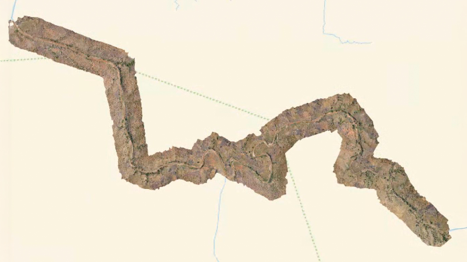
Connection was lost during one flight due to the terrain, but they completed about 80% of the mission, which was enough for the case. The planning took them significantly longer than capture, as flying a drone in a National Park had to be discussed in advance with the respective authorities. Altogether the planning, flying, and post-processing data took about 2-3 days of work.
Drones for good
While the drone map itself does not stop the gold mining, it can raise awareness and allow a systematic management approach, as well as periodic systematic comparisons of landscape change. The hope is that this data will be leveraged to continuously engage in preventing illegal activities.
“Real ownership begins when local people can harness their own power, like using technology to gain valuable insights. Teaching local drone pilots how to analyze drone data in a clear and useful way can make a huge difference. If PIX4Dmatic weren’t as user-friendly, it would become a major barrier—one that only a few could get past." - Kevin Dalferth, Scientific Advisor, Nonprofit charity