Optimizing harvest schedules for Thai sugarcane fields
When we talk about drones in agriculture, we are talking about more than just taking aerial photos with UAVs. Drones are valuable tools for providing a birds’ eye view, but it is what you do with the images you capture that makes a difference. By using drone photogrammetry software that is tailored for precision agriculture, growers can gain insights into their crops year-round, from germination rate to primary yield estimation.
One team taking advantage of this technology is led by Associate Professor Khwantri Saengprachatanarug at the Khon Kaen University. She is the head of the Bio-sensing and Field Robotic Laboratory (BSFR), which belongs to the department of Agricultural Engineering within the faculty of Engineering at Khon Kaen University, Thailand. The BSFR works on developing various models related to agriculture by using hand-held NIR instruments, as well as UAVs. Working with private companies outside of the University, they use remote sensing technology to improve agriculture practices for crop management.
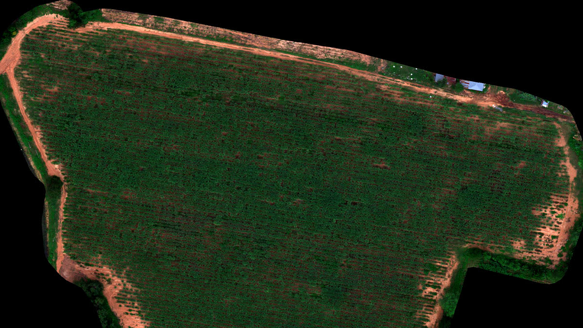
They took on a project to analyze an 8-month old sugarcane field located in Khon Kaen province, Thailand. The objective of the project was to estimate Brix content and the primary yield of sugarcane. This data would be used to optimize harvest schedules.
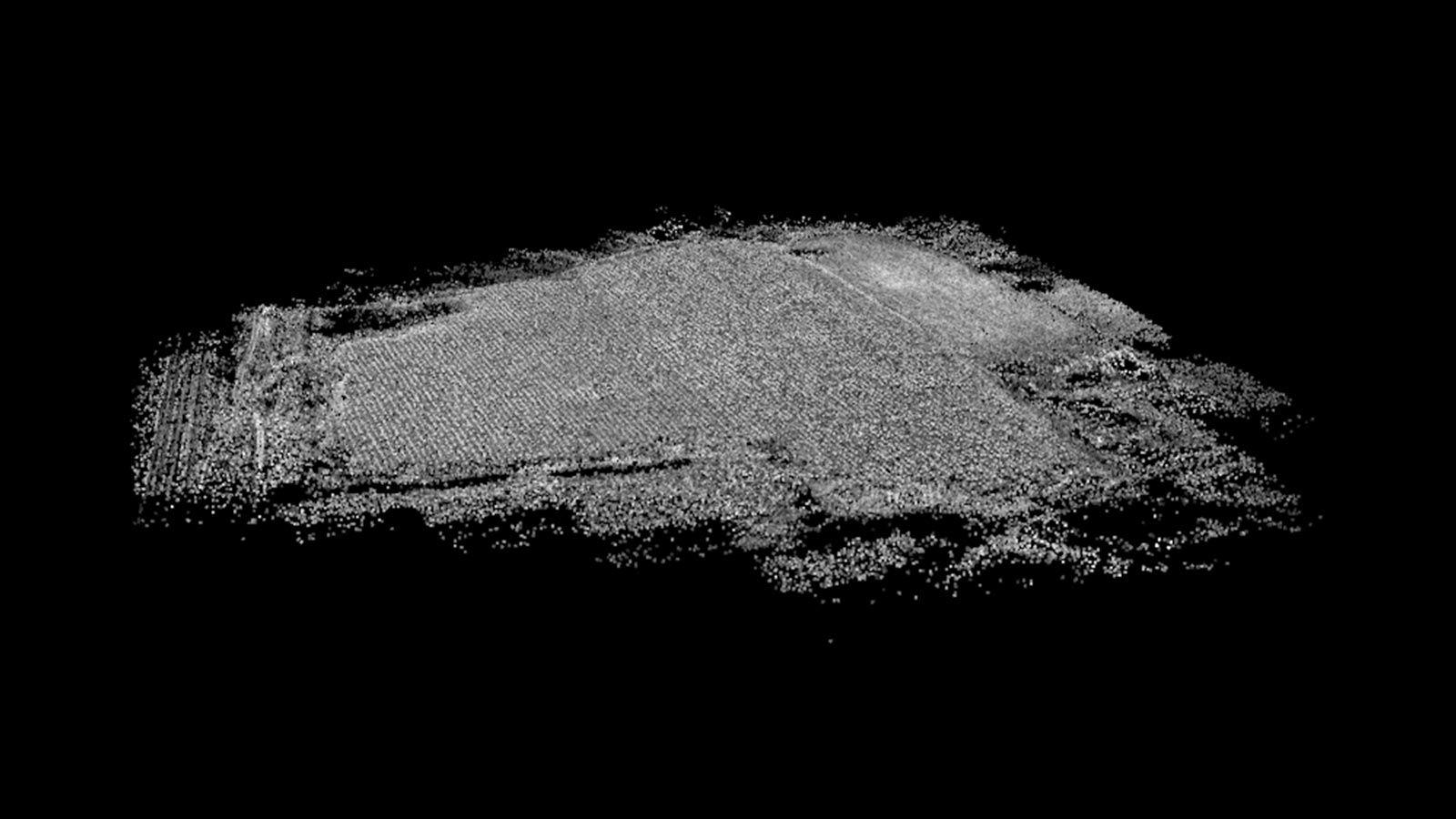
Project details
| Location | Khon Kaen province, Thailand |
| User | BSFR lab at Khon Kaen University |
| Crop mapped | Sugarcane |
| Area mapped | 3.7 hectares |
| Total images | 295 |
| Software | PIX4Dmapper |
| Hardware | Micasense RedEdge MX VESPA HEX |
| Processing time | 16 minutes |
Drones at work in agriculture
The first part of this project was the Brix measurement of the field, using drones and multi-spectral imagery.
What is Brix?
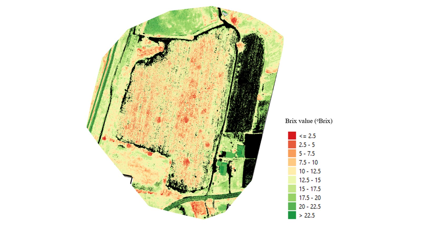
Brix, also known as the soluble solid content, is a value used to indicate the maturity of sugarcane. Brix is conventionally measured using a handheld refractometer and randomly sampling sugarcane around a field. However, Brix estimation can be done with UAV technology by evaluating the whole field which can accurately represent the sugar content and crop maturity across the field.
Measuring primary yield estimation with drones
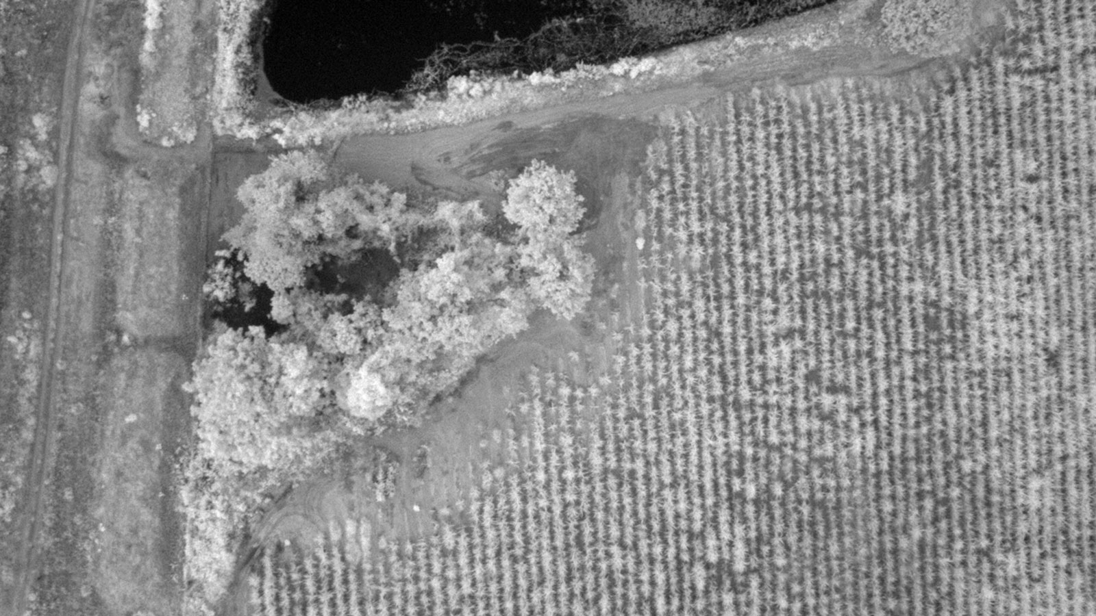
The researchers used specific outputs from PIX4Dmapper to measure the height of the sugarcane as part of calculations for the primary yield of the crop. They used six-rotor VESPA HEX drones equipped with the MicaSense Rededge and MicaSese Rededge MX cameras to capture images of the field, totaling 295 photos. The images were imported to PIX4Dmapper and the multi-spectral images were used to produce reflectance maps as well as a digital surface model (DSM).
Analysis of results at the BSFR laboratory
Currently, The BSFR laboratory has been developed a Brix model using various potential vegetation indices, such as the chlorophyll index rededge (Cirededge) which was extracted from the reflectance maps generated by PIX4Dmapper. The root mean square error of prediction (RMSEP) of Brix model is about ±1 degrees Brix. For sugarcane yield estimation, the laboratory has taken advantage of the DSM produced by PIX4Dmapper and BASFR's own image processing techniques to calculate the height of sugarcane in fields with a single flight, and without using ground control points (GCPs) or RTK GPS. The estimated sugarcane height has RMSEP ± 0.3 meters, and this height data is used for predicting the primary sugarcane yield, while the developed yield model provides the total yield prediction for multiple fields with a range of error up to about 5%.
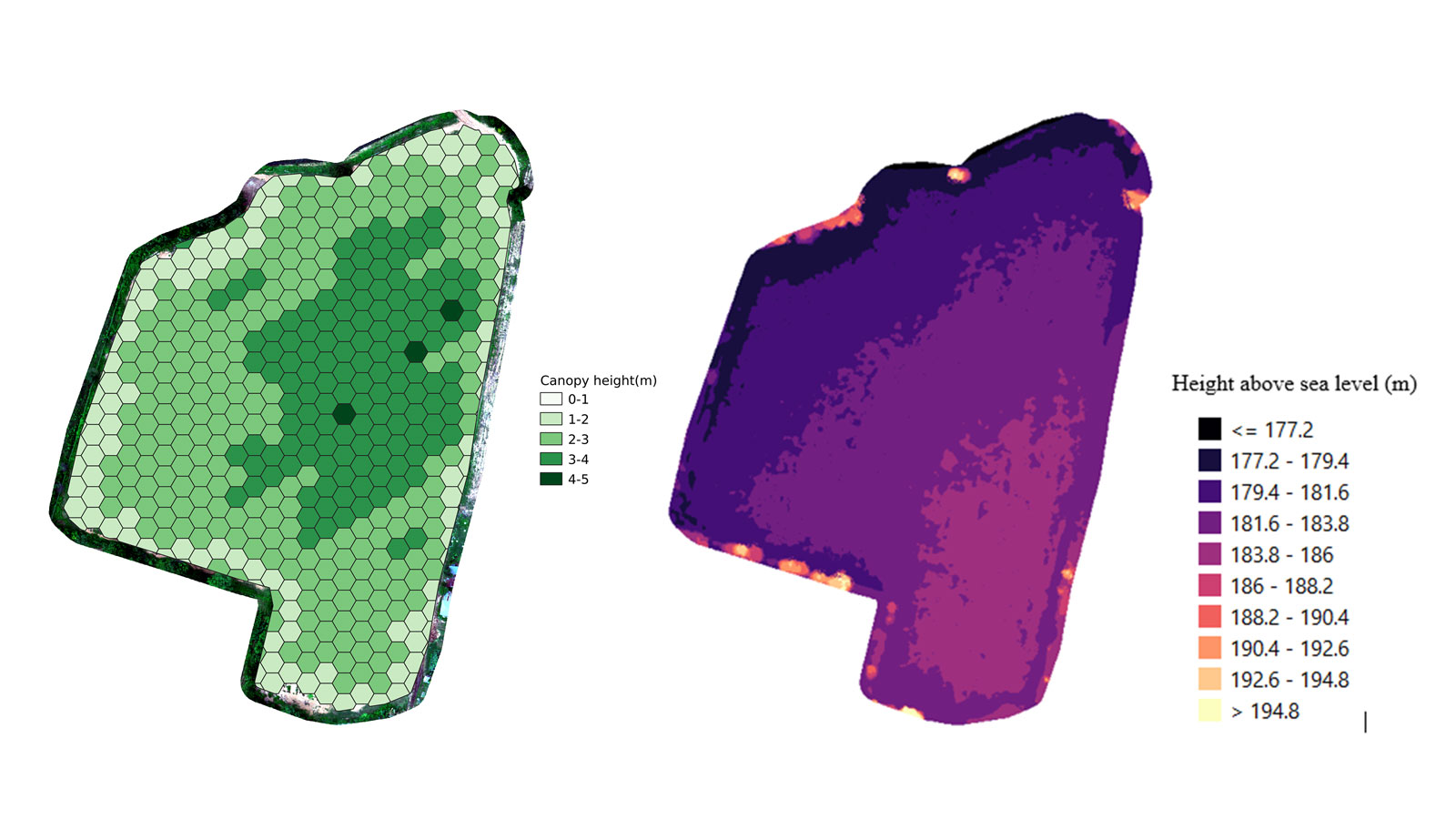
The BSFR team has collaborated with HG Robotic who invented the application HiveGrid for fleet management, which includes all developed models by the BSFR laboratory. Images captured by quota managers, contractors, or interested users can be uploaded to get insights into the vigor of their sugarcane fields by viewing the percentage canopy of sugarcane fields which indicates the germination rate, and a height map of sugarcane which shows the health and state of the crop in fields, a Brix map, and a yields map. Additionally, users can compare the current conditions of sugarcane fields with previous flight missions.
Precision agriculture with drones and Pix4D
All of the models created through PIX4Dmapper and the Hivegrid app have provided high-accuracy outputs that can be relied on.
“We use PIX4Dmapper for our projects because the software provides clear information about each step of map generation which facilitates us understanding the process of map generation.” - Chanreaksa Chea, research assistant at BSFR laboratory
The value provided by outputs from PIX4Dmapper is significant and a successful return on investment for the BSFR team. Agronomists, growers, and farmers who are only working in agriculture can also use the specialized agriculture photogrammetry software PIX4Dfields rather than the all-round surveying tool that is PIX4Dmapper. For those wanting to learn how to use either software, there is an online community and knowledge base available in multiple languages.
Thanks to the power of photogrammetry, the BSFR team was able to use their outputs to plan a successful harvest that will provide the best possible yield because it is being planned around the health of the crop. Discover more success stories on drones in agriculture on the Pix4D blog or download our free agriculture eBook.
