Meissa adds PIX4Dengine to platform for image processing
Pix4D is teaming up with Meissa, a Korean-based spatial data platform provider. The collaboration offers a solution designed to drive the digital transformation of the global construction market.
The solution
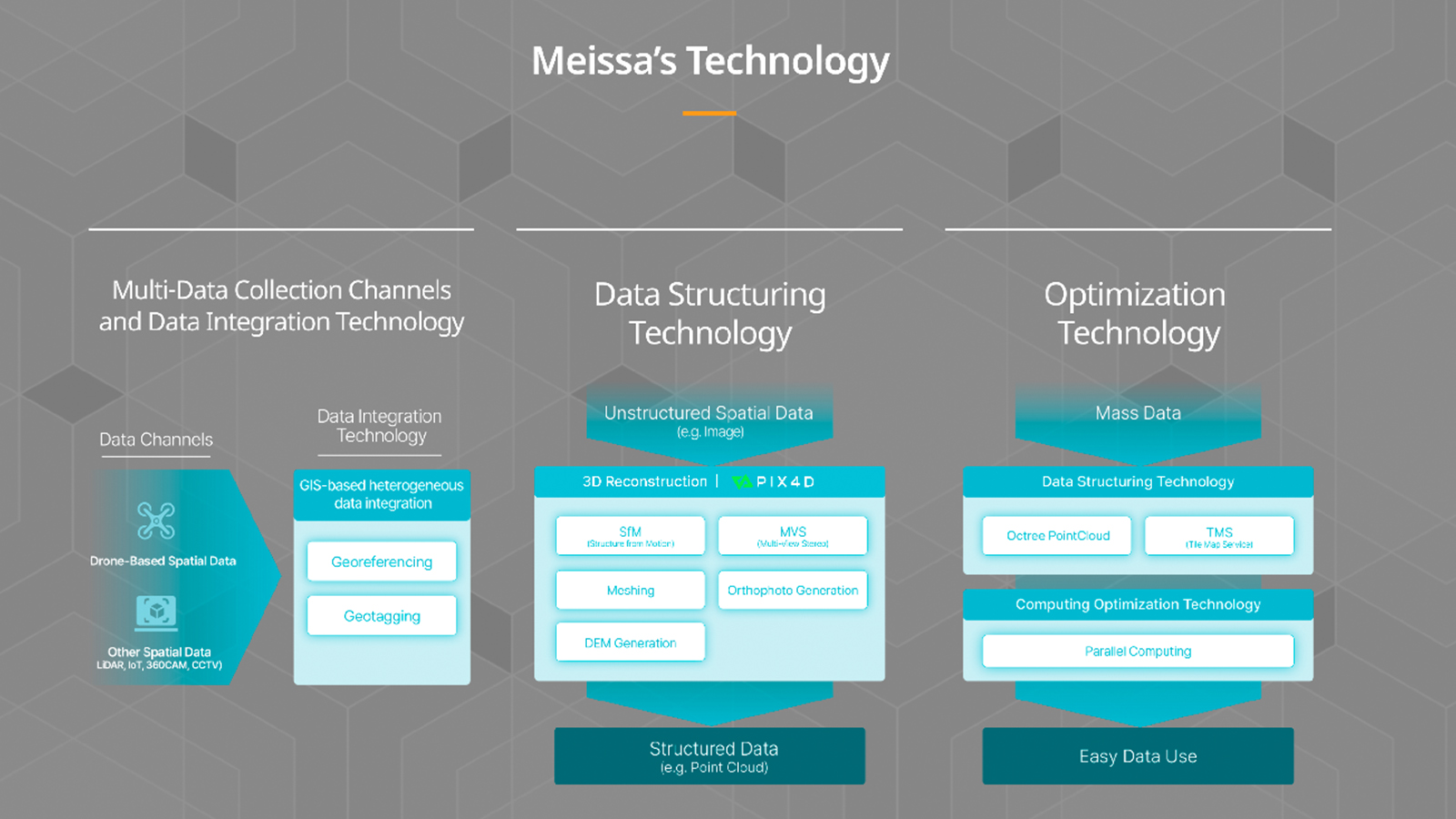
Meissa provides a spatial data platform for safe and collaborative construction site management. The platform automatically creates optimized flight plans for drone mapping and processes drone-collected images into useful data (eg. orthomosaics, 3D mesh, etc.). Users now have the option to process their data using PIX4Dengine .
Pix4D and Meissa’s collaboration provides solutions that simplify earthwork management at construction sites, support remote site monitoring and communication, and facilitate better decision-making through the use of up-to-date site imagery including 2D orthomosaics, DSMs, point clouds, and 3D mesh data.
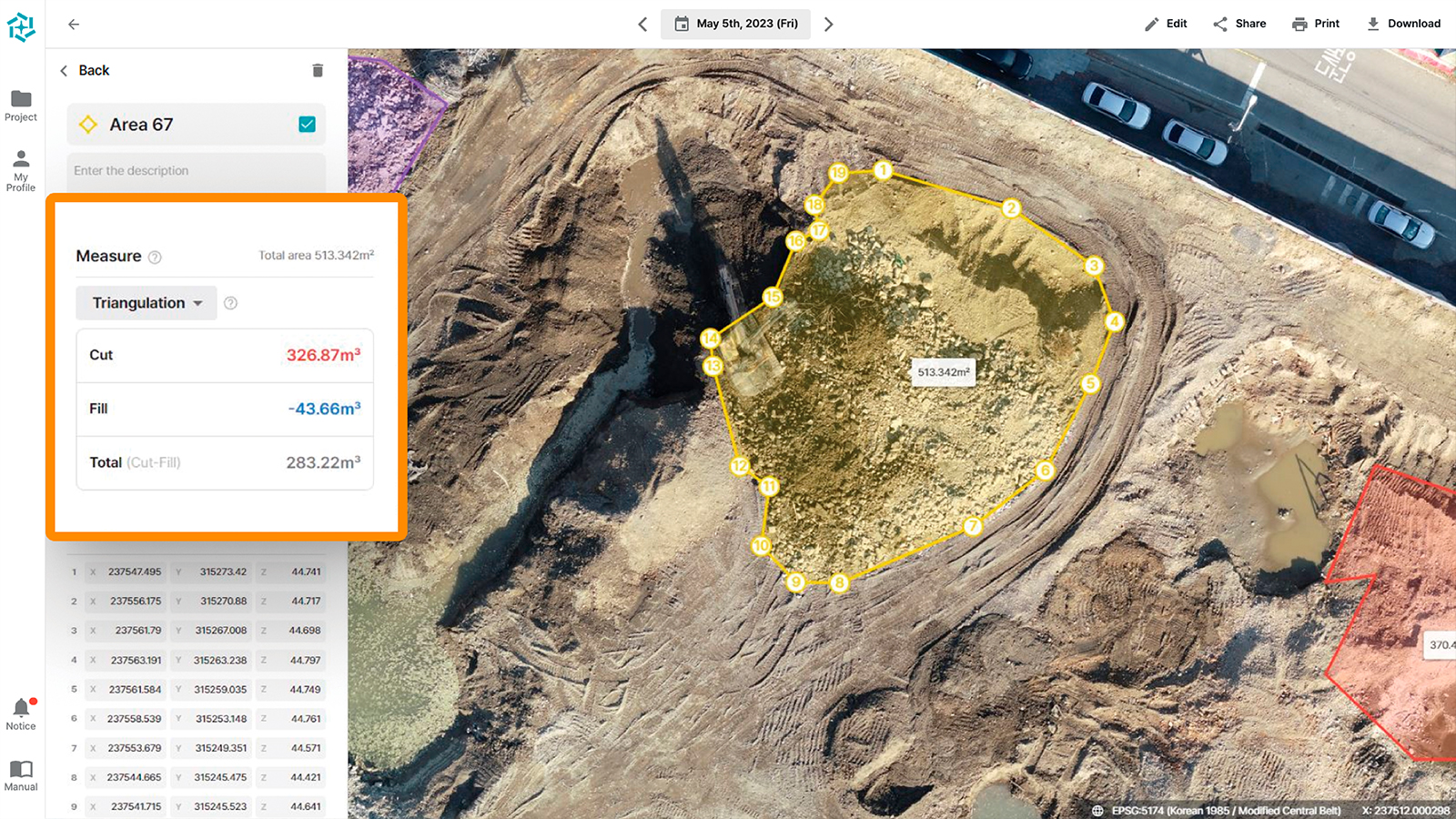
Compared to traditional on-site surveying methods, drone-based earthwork surveying can achieve around 90% savings* in time and costs. Meissa's solution offers specialized features such as DTM creation, earthwork volume calculation, zone-based earth management for construction sites, and the ability to upload cross-sectional data in Excel for civil engineering sites. Meissa platform have adopted PIX4Dengine to provide users the option of choosing PIX4Dengine for photogrammetry processing. *according to Meissa's research
PIX4Dengine offers a flexible photogrammetry solution for developers. By providing accessible programming modules and SDKs, it empowers businesses to customize image processing workflows and integrate them into existing systems. Additionally, features like AutoGCPs automate tasks, increasing efficiency and accuracy in data processing.
Through this collaboration, Meissa plans to integrate various data sources, including 360-degree cameras, CCTV, drones, and satellites, to provide comprehensive spatial data. This will support more efficient site management and lead the digitalization of construction sites.
About Pix4D
Pix4D is the market leader in photogrammetry software technology. Their products enable the digitization of reality and measurement of images taken from planes, drones, phones, or other cameras. PIX4Dengine is a fully customizable photogrammetry reconstruction engine, built for automation and integration into any enterprise system. Allowing companies to build the photogrammetry they need, streamline data management, and automate at scale.
About Meissa
Meissa is a spatial data startup that digitalizes construction sites to promote industrial innovation. Its drone mapping platform supports quantity estimation with survey-level accuracy. It is primarily used in construction sites for earthwork volume estimation, monitoring, and inspections by matching with design drawings. Users can upload existing data such as design drawings and BIM, and compare it with the latest site data obtained through drone images, enabling site management and construction progress monitoring.