Good boundaries: Surveying property with drone mapping
Kyoto is the cultural capital of Japan. For over a thousand years, the city was the seat of Japan’s Imperial Court, and it is famed for both its food and its architecture.
The Ajibiru Kashin Kawaramachi restaurant complex on Kawaramachi Street is popular with tourists and locals alike, who come for sushi or the views from the seventh floor shabu-shabu restaurant.
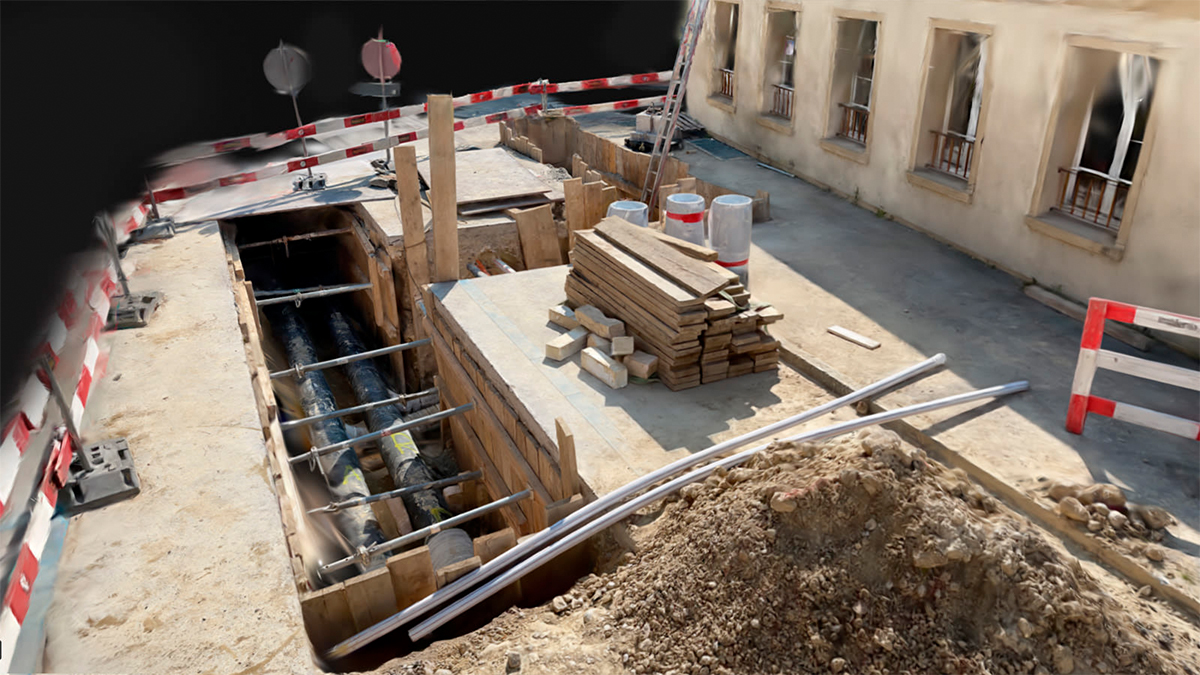
In 2016, the owners of the complex ordered something new: a survey of the property captured by drones.
“I believe this was the first commercial image capture by drones in the country,” says Kazuki Yanagi, CEO of Yanagi Civil Engineering Design Office Co., Ltd.
Project details: off the wall
| Drone service providers | Yanagi Civil Engineering & Design Co., Ltd |
| Location | Kyoto, Japan |
| Hardware | DJI Inspire 1 Drone TOPCON GNSS receiver |
| Software | Pix4Dmapper Pix4Dcloud |
| Outputs | 3D model Interactive point cloud |
Kawaramachi Street has been a busy route for centuries, and the day selected for the drone flight was no different. The team picked their time carefully to ensure the safety of pedestrians and the drone pilots.
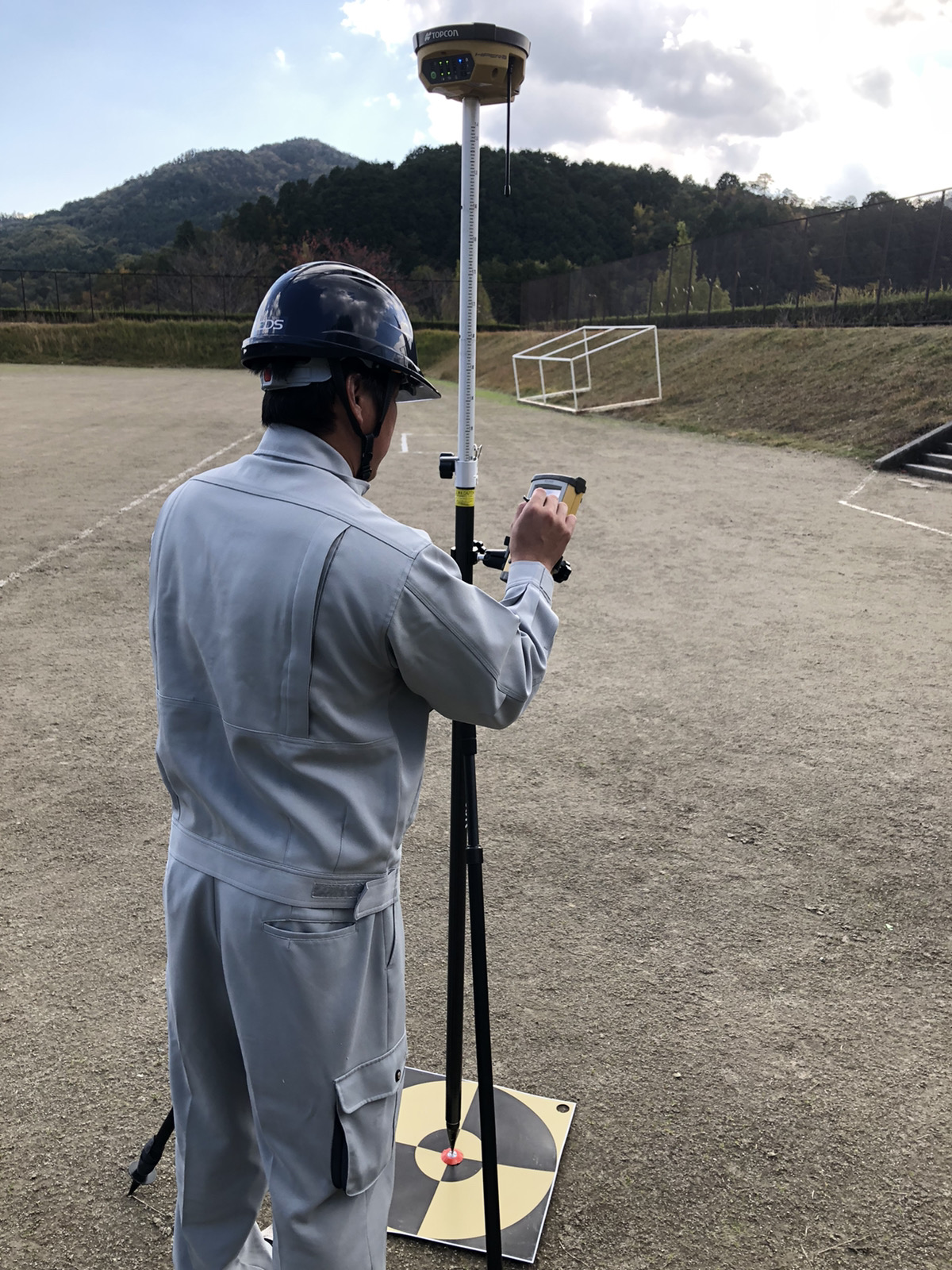
Before takeoff, the survey team plotted their precise locations with a Topcon GNSS positioning machine. To accurately capture the building’s facade, the team relied on high image overlap, which was supplemented by a series of straight-on shots.
Back in the office, the Yanagi Civil Engineering & Design Co., Ltd team loaded the dataset into Pix4Dmapper photogrammetry software.
The team had tested other photogrammetry software solutions, but prefer Pix4Dmapper. “In comparison to other software, Pix4Dmapper’s stability and accuracy is high,” says Kazuki Yanagi.
The reconstructed point cloud data was shared with the client on Pix4D cloud. It is used as presentation materials for clients, demonstrating the potential of photogrammetry.
Ongoing innovation
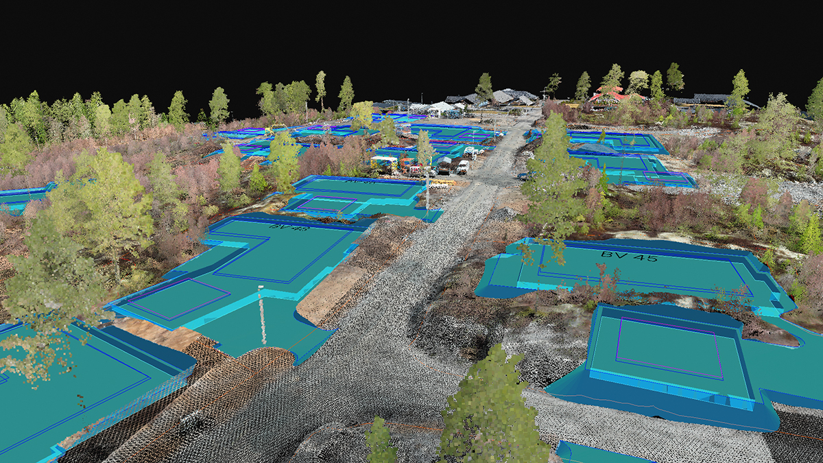
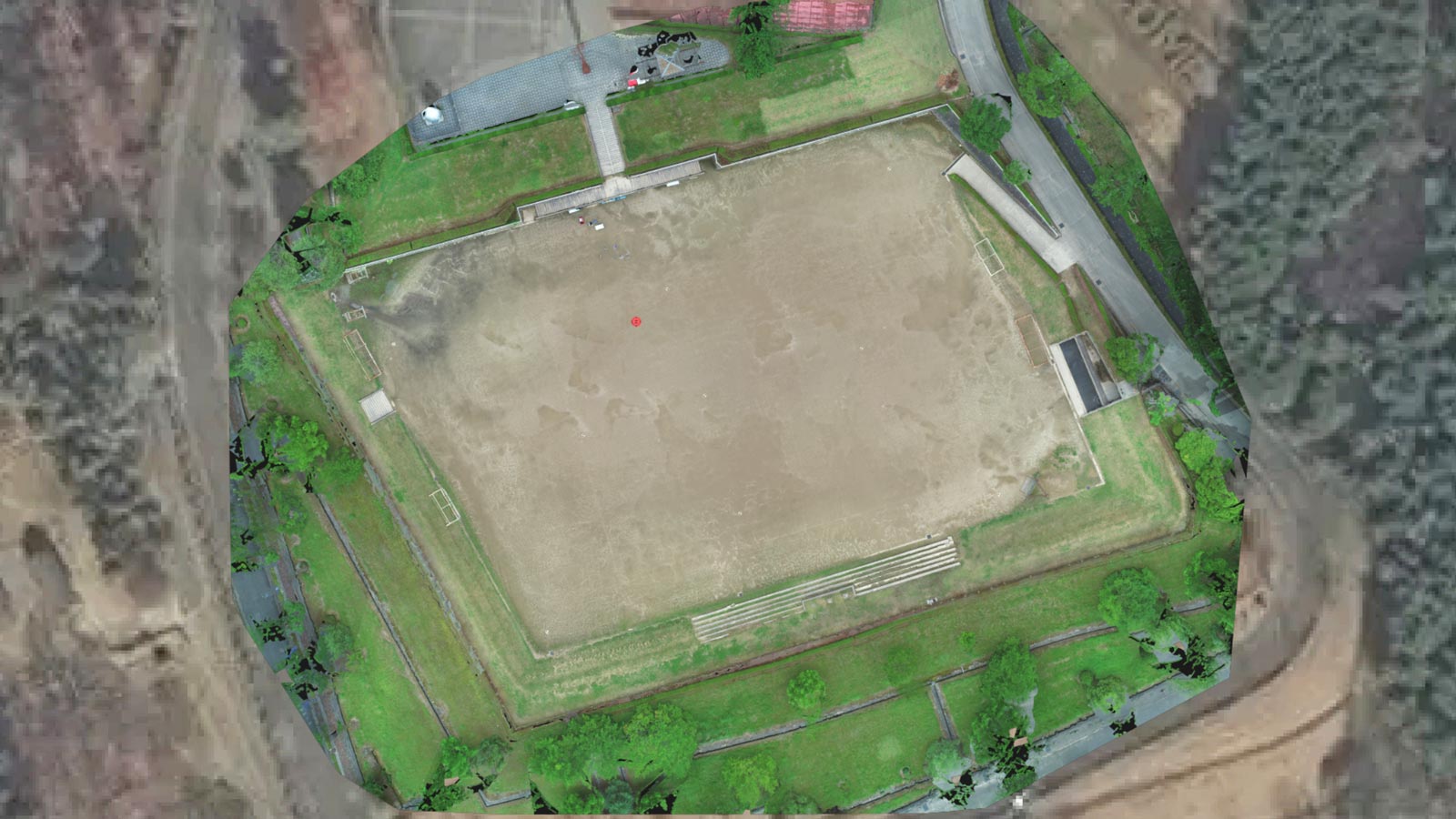
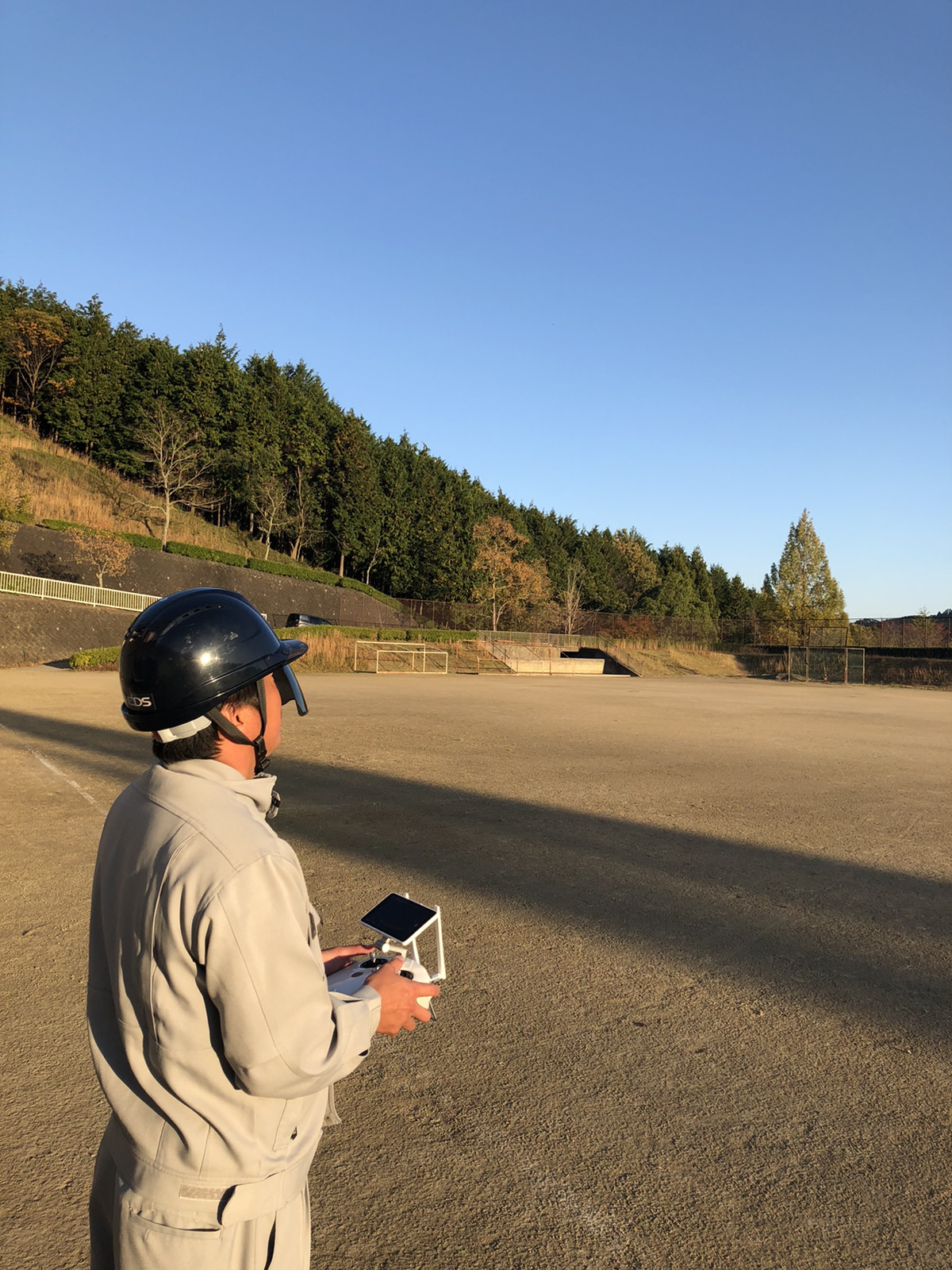
To demonstrate that drone mapping is a viable alternative to traditional surveying methods, Yanagi continues to test and experiment on the Kameoka City International Bocce Ball Court.
All their projects follow the draft guideline for public surveying using UAVs of the Geospatial Information Authority of Japan, and the results obtained must comply with the national standards set by this national institution.
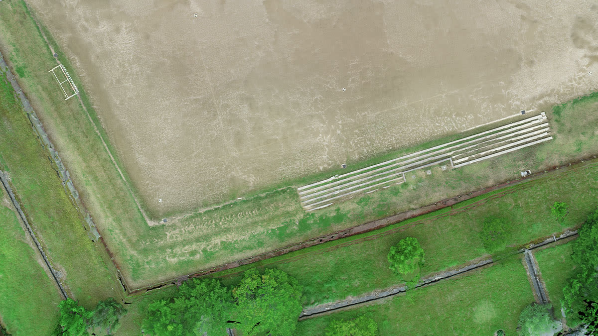
Project details: proof positive
| Location | Kameoka city International Bocce Ball Court, Kyoto Prefecture, Japan |
| Hardware | DJI Phantom 4 RTK TOPCONGNSS Surveying Instrument |
| Software | Pix4Dmapper Pix4Dcloud |
| Area | Approximately 15,000m² |
| Number of pictures | 158 |
| Accuracy verification | 5 ground control points 6 manual tie points |
| GSD | Approximately 1cm |
The bocce court is more than a space for games: it’s a space for experimentation. With the court at their disposal the Yanagi team can train new team members, test new equipment, and ensure all their methods are both legal and centimeter-accurate.
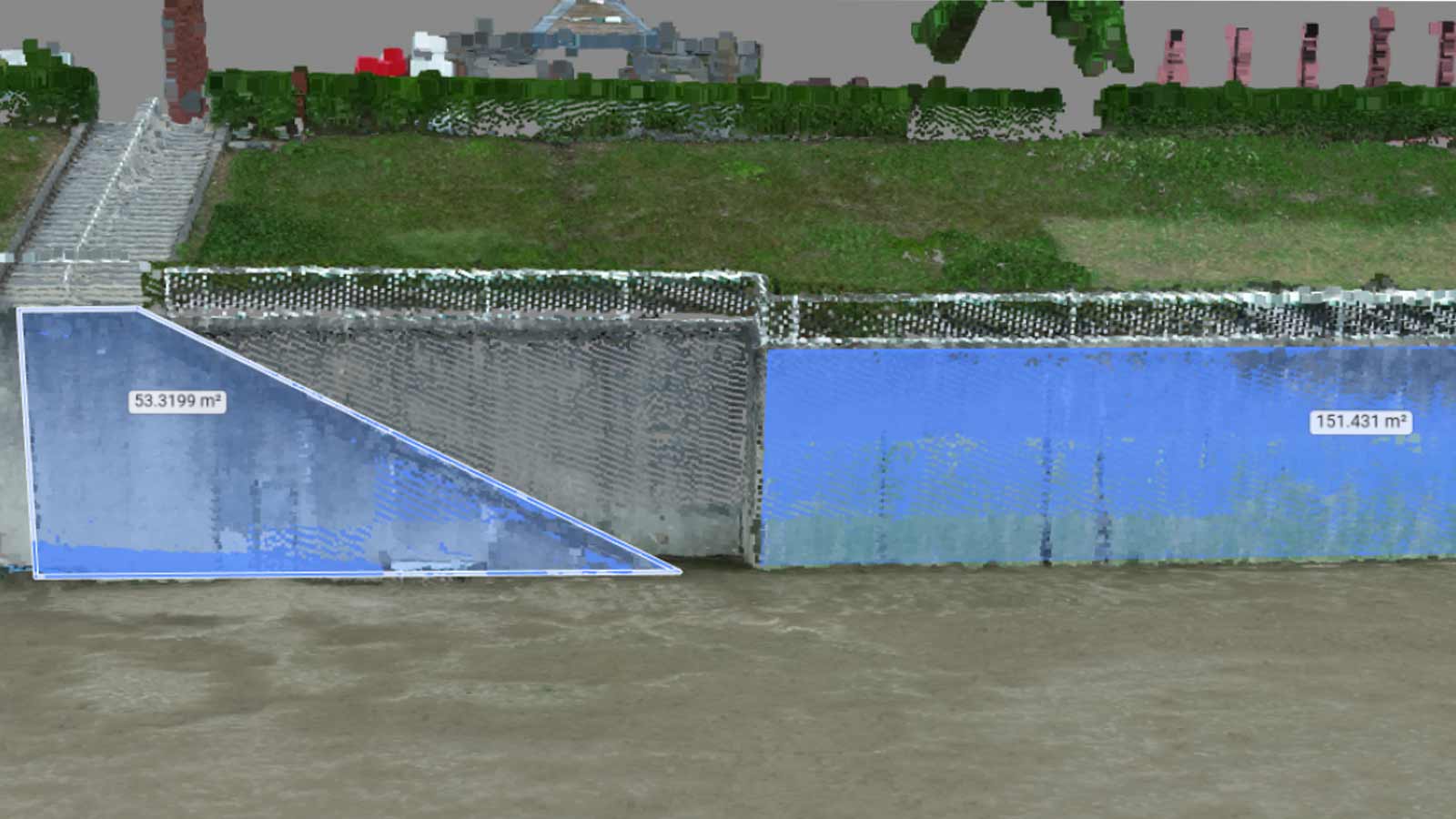
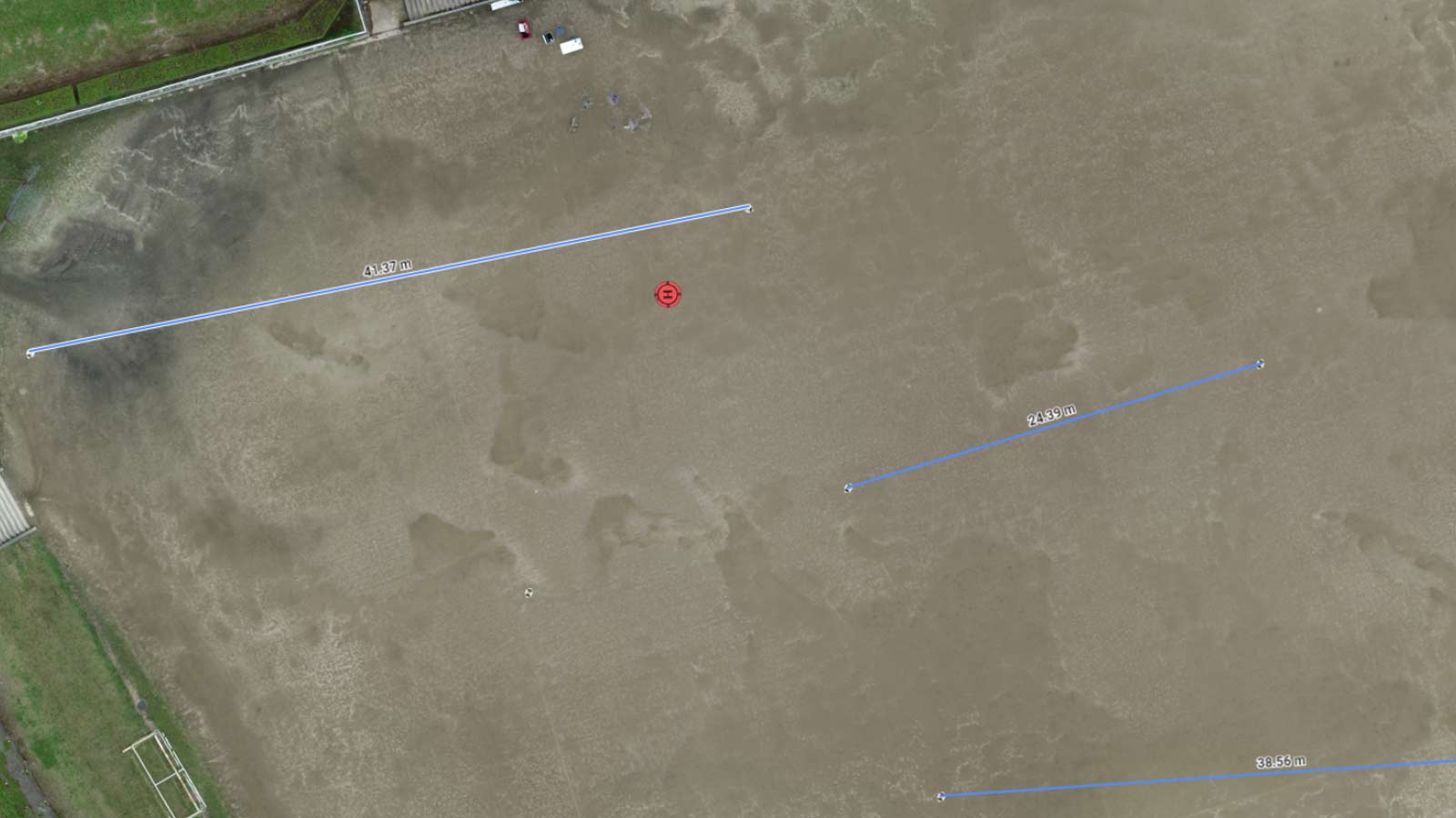
The results are uploaded to Pix4Dcloud, where the team can double-check dimensions against known coordinates.
The potential of photogrammetry in Japan
Surveying used to be very time-consuming. But as technology has improved, surveys which used to take weeks can be completed in days or hours. “With drone surveying, very accurate data can be obtained in a short amount of time,” says Kazuki Yanagi.
And it goes beyond the surveying business. “Drone mapping can be used for land and building registration,” explains Kazuki Yanagi. In a busy and evolving city like Kyoto, boundary determination is big business, and Kazuki Yanagi sees a large potential market, especially in the real estate business.
“The survey of land and houses using drones is just beginning,” says Kazuki Yanagi. “Going forward, we will continue to pursue research and development, aiming for optimal proposals to customers while improving accuracy and productivity.”
| We would like to thank Yanagi Civil Engineering & Design Co., Ltd., President and Representative Director of Yanagi Land and House Investigator Corporation Kazuki Yanagi for help in preparing this article. |