85% savings with PIX4Dfields & DJI Mavic 3 Multispectral
Drone-based remote sensing offers substantial benefits across agricultural practices, like enhancing crop health assessment, enabling precise field boundary mapping, or effective weed detection for targeted treatments. The cyclical and demanding nature of agriculture—marked by short seasonal time windows and peak workloads (planting, fertilization, crop care, and harvesting)—often leads to last-minute changes of plans or client requests. This can be challenging for drone service providers. This is why fast and efficient data acquisition is critical for the success of drone service providers and farmers themselves.
An effective precision agriculture solution
Combining DJI Mavic 3 Multispectral’s mapping times of 20-28 minutes, good sensors (20 MP RGB and 5 Megapixel 4 band multispectral), and RTK precision with PIX4Dfields’ fast & offline capabilities and powerful tools gives you the possibility to rapidly create actionable data for agriculture. This data includes field boundaries, scouting maps, as well as variable rate and spot spraying application prescription maps.
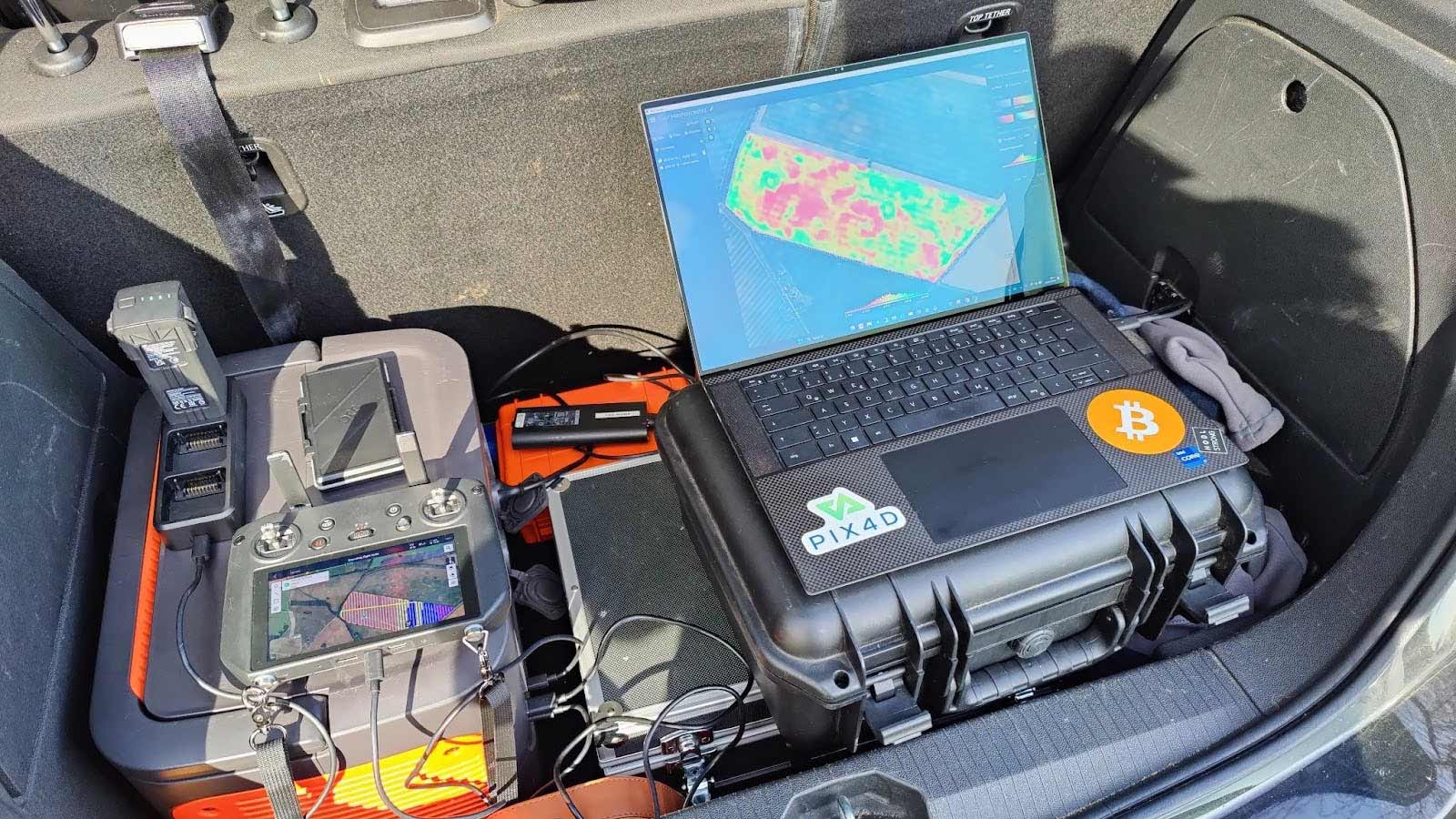
Drone configuration
- DJI Mavic 3 Multispectral with 4 batteries
- 2 x 256 Micro SD
- Power station with 2 DJI 100W charging docs for continuous charging and flying
- Mobile RTK correction signal: SAPOS
- Ground control app / flight app: DJI Pilot 2 on DJI Smart Controller
Processing equipment
- XPS 15 9510
- CPU: i7-11800H @2,3Ghz
- RAM: 32Gb Ram
- GPU: RTX 3050ti
Fast identification of areas for variable rate growth regulator application on a wheat field
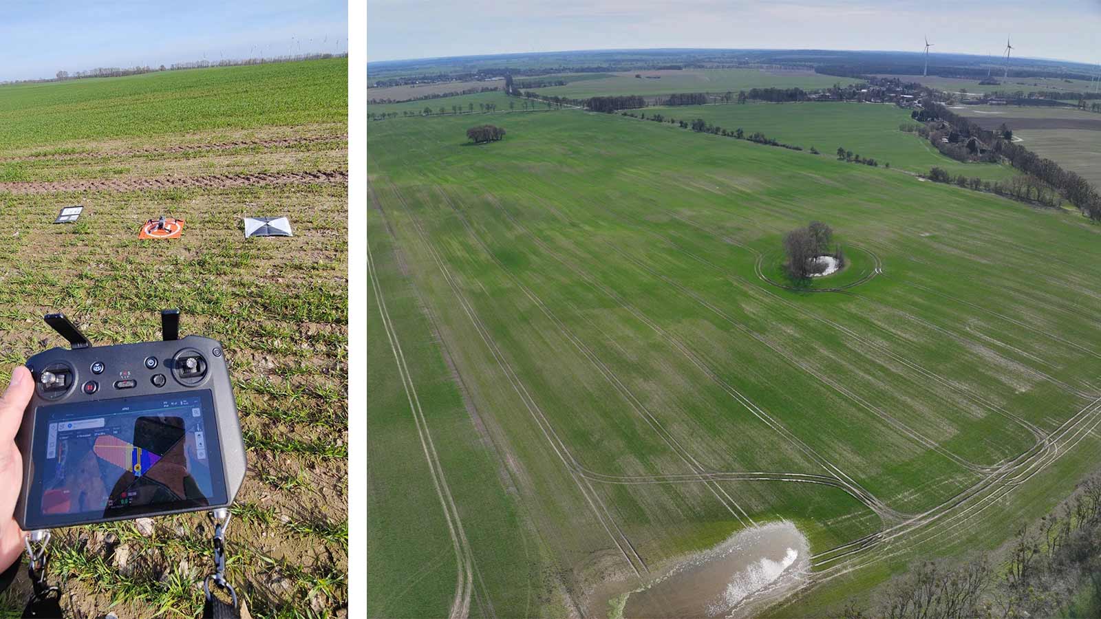
This case study covered a 50-hectare (124-acre) winter wheat field in Germany. The aim was to assess the overall crop health and development of the winter wheat after the first nitrogen fertilization on March 26, 2024.
Mapping and processing details
| Location | Germany |
| Field size | 50 hectares (124 acres) |
| Flight altitude (AGL) | 90 meters (295 ft) |
| Overlap (side/front) | 70% |
| Total flight time | 32 min |
| Data collected | 727 RGB images (6.5 GB), 2908 Multispectral images (27.6 GB) |
| Processing time | RGB: 4 min 30 sec, MSP: 6 min 54 sec |
| Map GSD | RGB: 2.24 cm/pixel, MSP: 3.73 cm/pixel |
| Overall time | 51 min 30 sec |
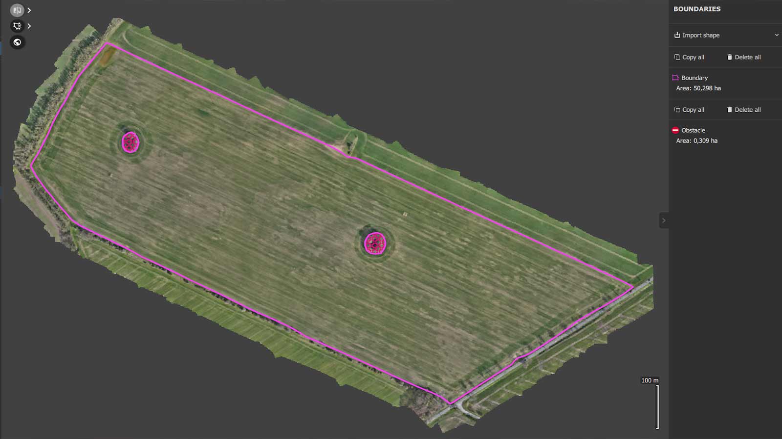
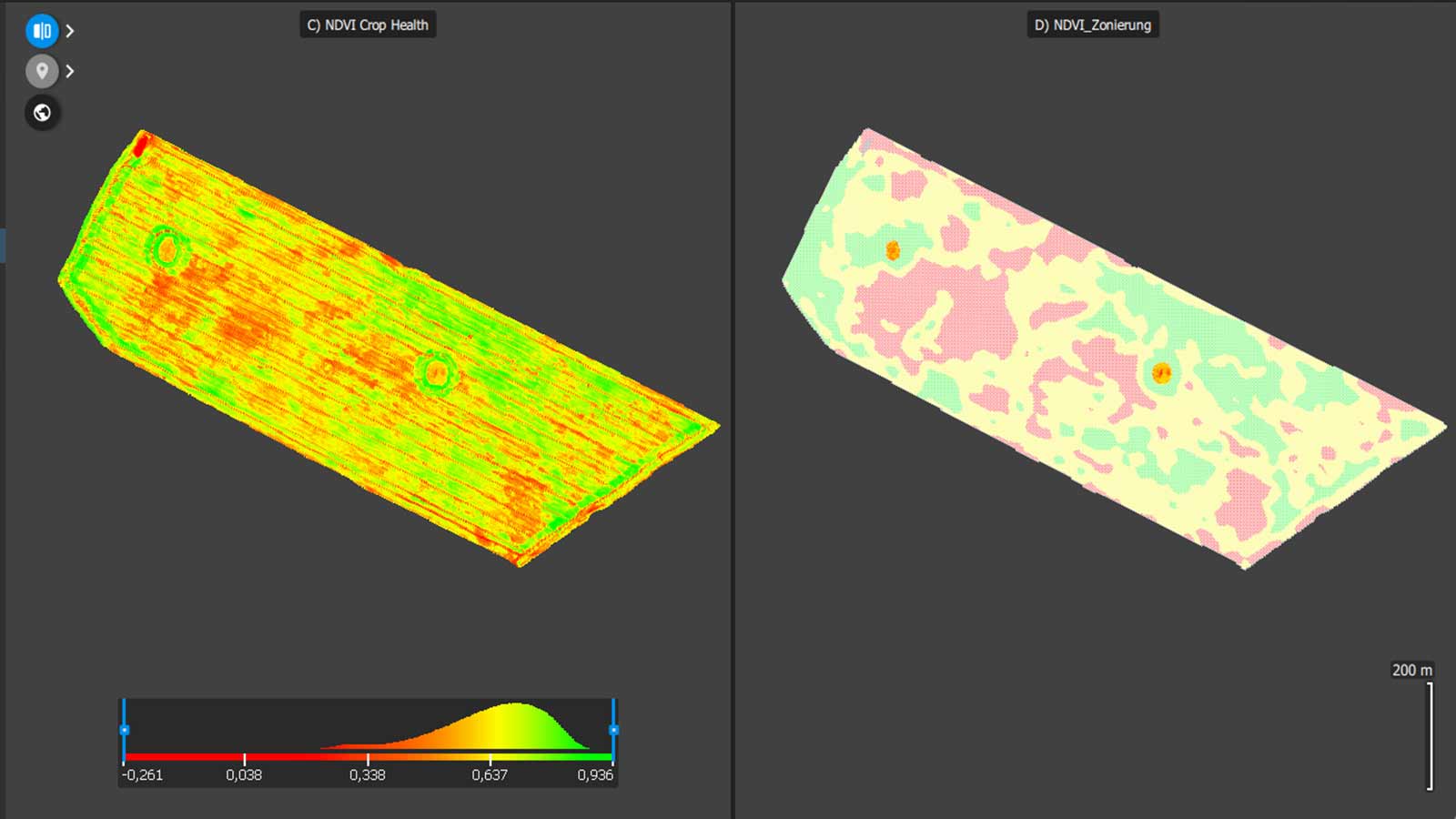
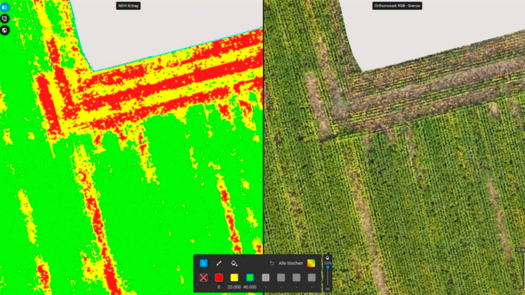
The detailed data from this flight pinpointed variations in crop growth. Waterlogged areas could be identified and measured and areas with weak growth based on soil heterogeneity were mapped and used by the farmer for a site-specific growth regulator application. Setting up the drone and transferring data to PIX4Dfields took just 8 minutes. On-site data processing with PIX4Dfields was completed swiftly: 4 minutes 30 seconds for the RGB data and 6 minutes 54 seconds for the multispectral data.
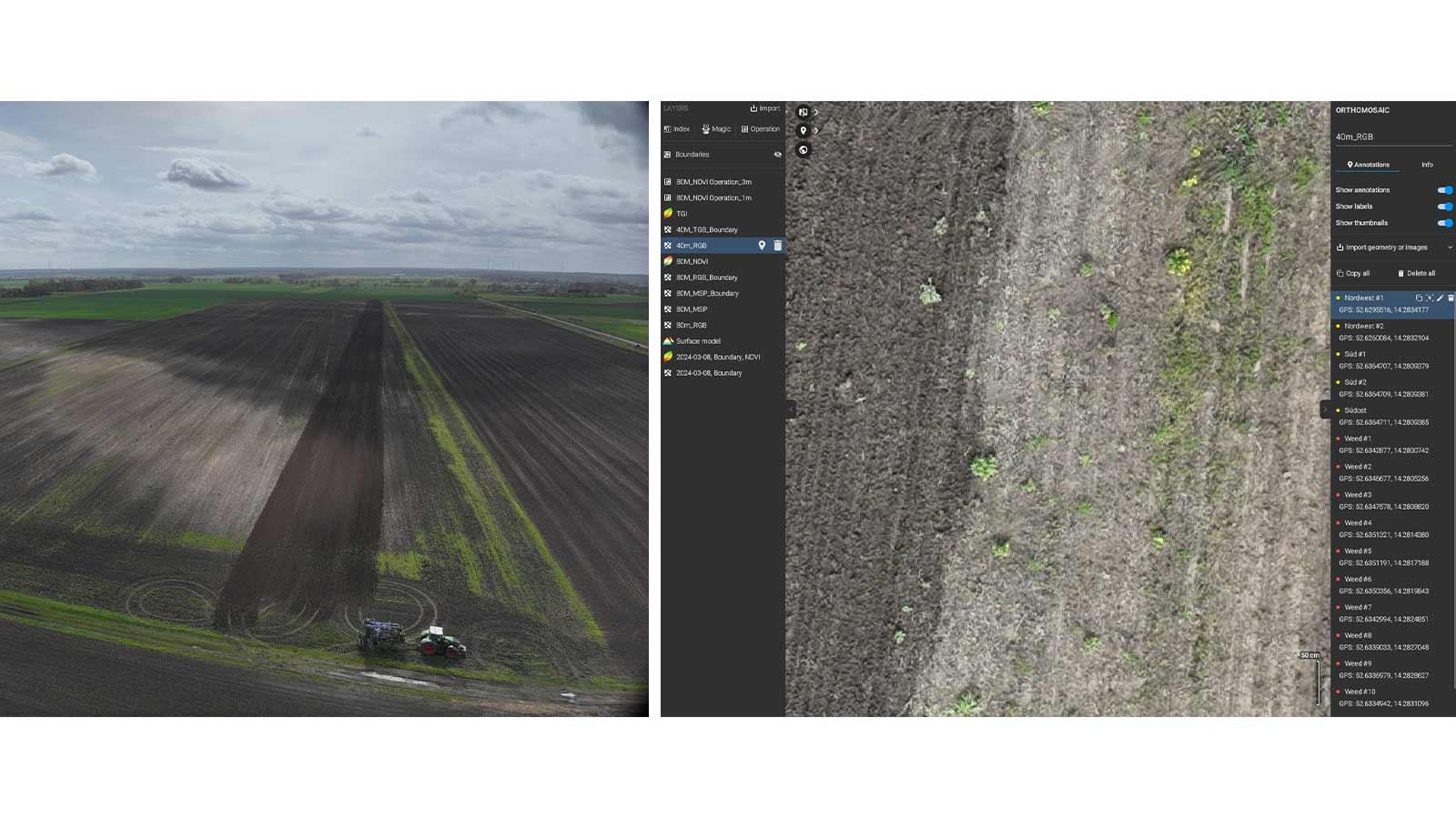
Herbicide spot spraying application on a corn field
This case study was performed on a 40-hectare (99-acre) corn field in Germany before planting on April 5, 2024.
Mapping and processing details
| Location | Germany |
| Field size | 40 hectares (99 acres) |
| Flight altitude (AGL) | 45 meters (148 ft) |
| Overlap (side/front) | 50%/80% |
| Total flight time | 53 min |
| Data collected | 1652 RGB images (13.7 GB) |
| Processing time | 14 min |
| Map GSD | 1.18 cm/pixel |
| Overall time | 1 hr 13 min |
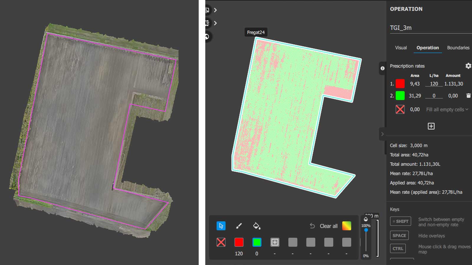
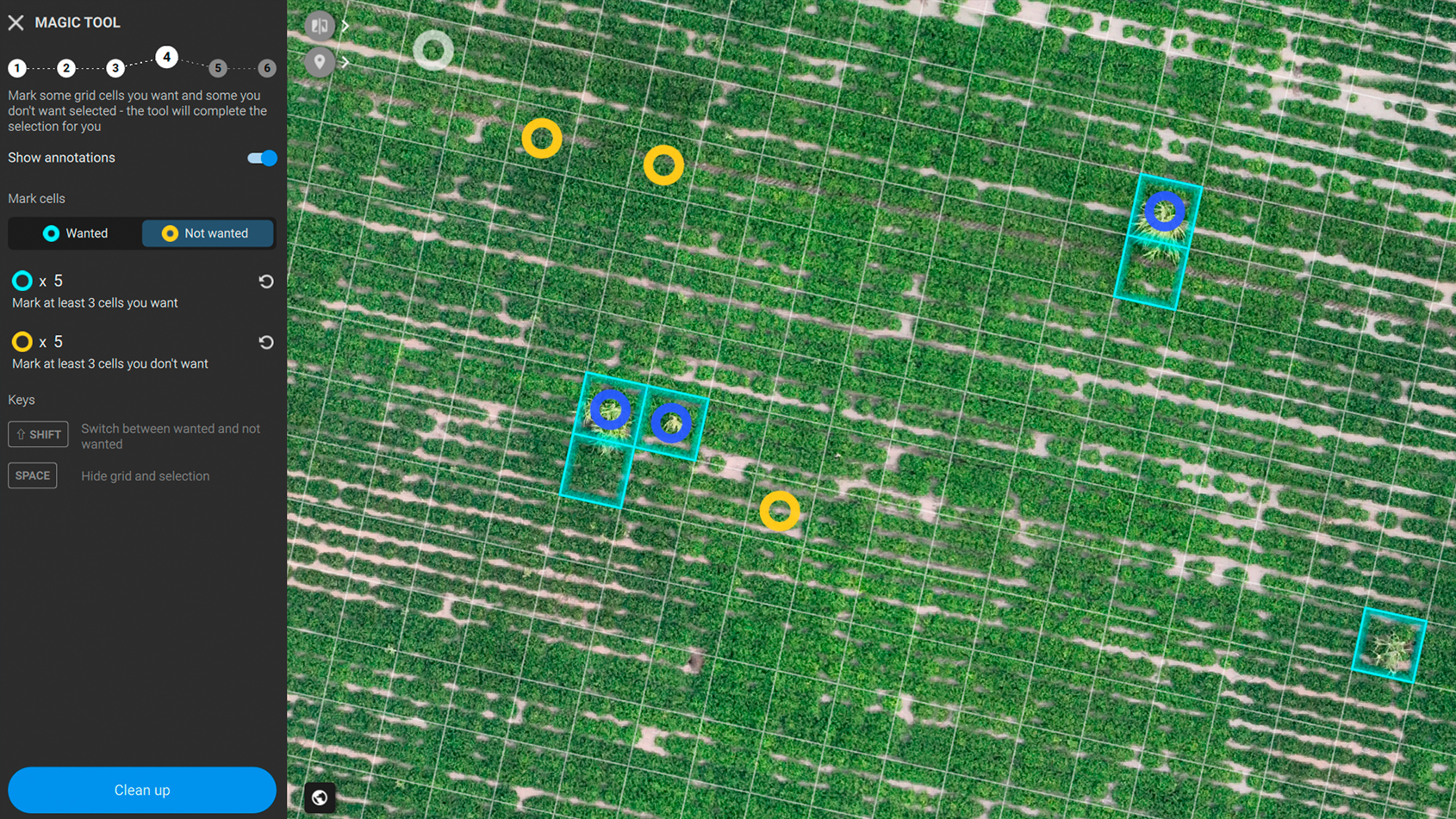
The drone setup and data transfer to PIX4Dfields only took 6 minutes and on-site data processing 14 minutes—overall, data acquisition and processing took just 1 hour and 13 minutes. The flight resulted in a high-resolution aerial weed map, which can be converted via the VARI/TGI RGB indices or the Magic Tool into a prescription map for herbicide spot-spraying. Using the prescription map created in PIX4Dfields for herbicide site-specific application resulted in 85% input savings!
Saving on agricultural inputs within minutes
This precision agriculture workflow with DJI Mavic 3 Multispectral drone and PIX4Dfields offers accuracy and speed for large-field mapping with practical applications like crop scouting, variable rate applications, spot-spraying, and more! Large 50-hectare (124-acre) fields can be mapped and analyzed within an hour from arrival at the site. This is only possible due to PIX4Dfields’ fast, offline processing pipelines. Rural agricultural regions with limited or no mobile data connections can also benefit as PIX4Dfields offers fast and offline processing! This combination unlocks an amazing return on investment for farmers worldwide!
This is especially true and a game changer for rural agricultural regions with limited or no mobile data connections, allowing you to process your data faster! The analytical and prescription map capabilities of PIX4Dfields allow you to produce actionable insights within minutes, to keep a cool head under the usual time pressure and last-minute change of plans in agricultural applications.