Managing construction projects — like solving a Rubik’s Cube
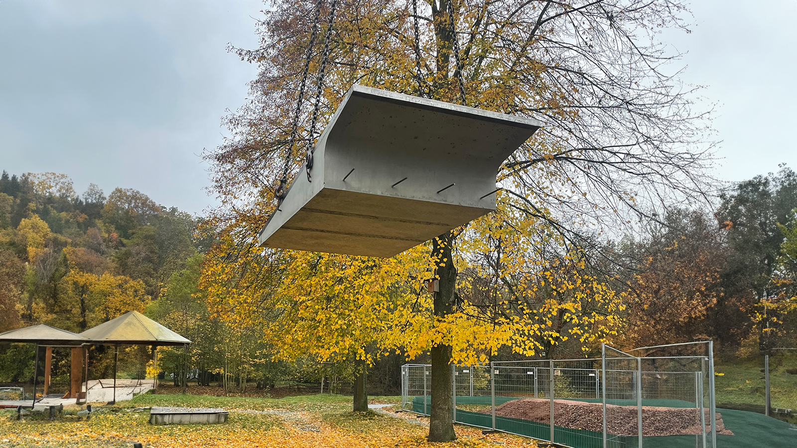
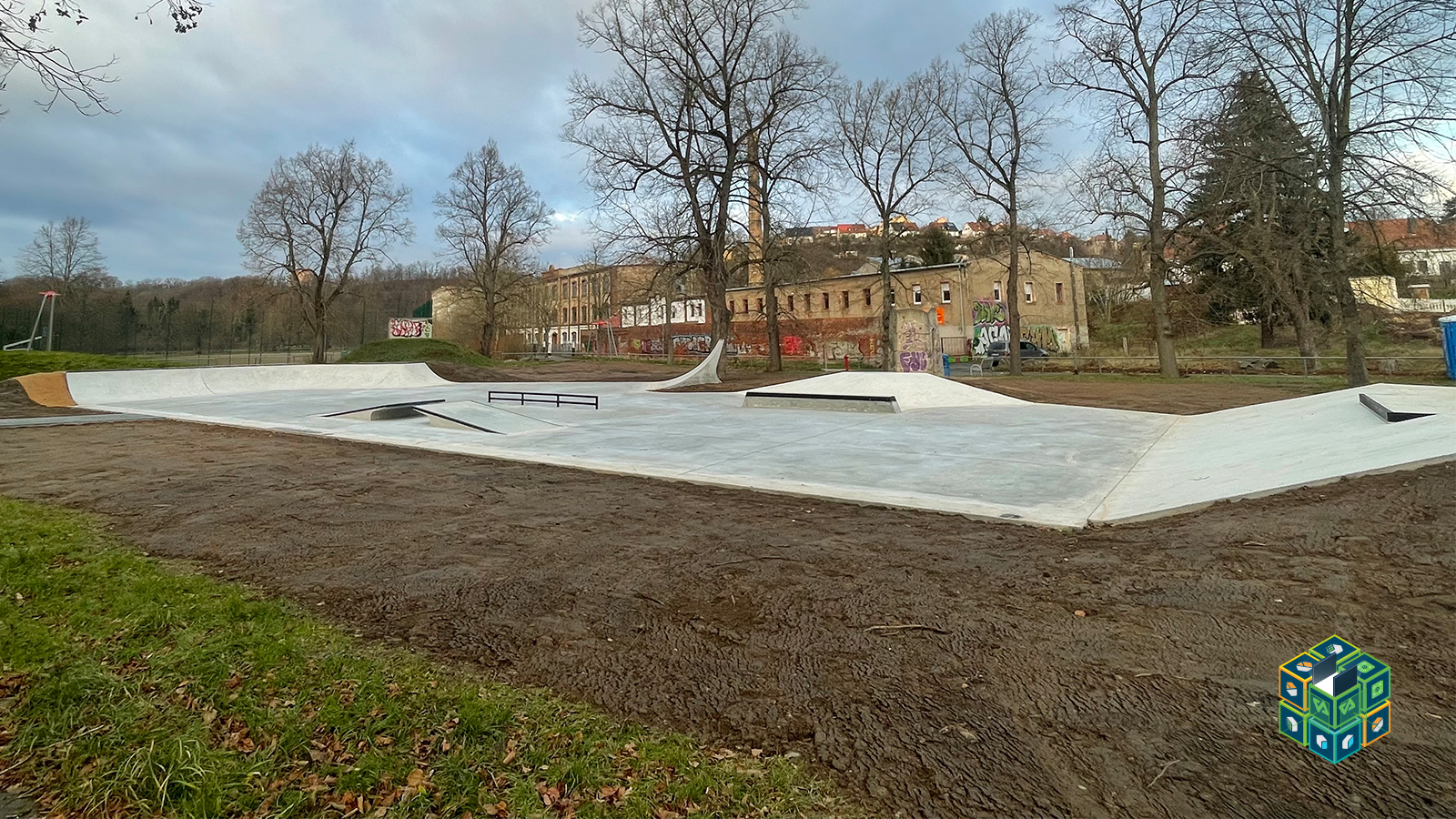
Carbon concrete is transforming the construction industry. Lighter, non-corrosive, and incredibly durable, it allows for thinner, stronger structures while reducing environmental impact. One of its latest applications is the world’s first carbon concrete skatepark, built in Roßwein, Germany.
Octacon Geotechnik GmbH (OCGT) brought over a decade of expertise in geotechnics, photogrammetry, and infrastructure development to support the construction project. Commissioned by Berlin-based skatepark planners Urbanum Design—with guidance from The Fraunhofer Institute about the building material carbon concrete—OCGT played a pivotal role in bringing the project to life. We spoke with Manuel Allinger, CEO at OCGT, to learn more about this project.
Pix4D’s ecosystem for a seamless workflow
Managing complex projects is like solving a Rubik’s Cube—each piece needs to be in the right place to see the full picture. With this approach in mind, OCGT turned to modern technology to assist with the construction of this unique skatepark. For OCGT, whether it was capture, processing, or sharing tools, there was a solution to fit each stage of the project in Pix4D's software ecosystem.
Planning & design: using drones, PIX4Dmatic, and PIX4Dsurvey, they captured and processed every detail of the site. Digital surface models created in PIX4Dmatic supported planning months before construction began.
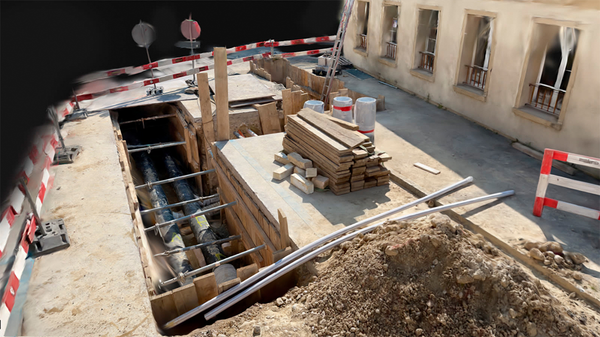
Construction monitoring: with PIX4Dcloud, they tracked progress and compared as-built vs. as-designed to ensure accuracy.
Final data collection: PIX4Dcatch will be used to scan areas and catch details the drone missed—stay tuned for the next installment to see the results!
The team used Pix4D products at every stage of this construction, with solutions adjusted to fit the needs of each phase.
Early planning with PIX4Dmatic and PIX4Dsurvey
OCGT conducted an initial site survey, using a DJI Mavic 3 Enterprise drones, Leica and Emlid GNSS, and tachymeters to document construction progress. They provided weekly updates to monitor the site comprehensively.
One of the key challenges was accurately determining the position, height, and gradient of surface and terrain details. By leveraging drone surveys, OCGT supported quality assurance, documented construction progress, and verified invoices—ensuring transparency and accuracy at every stage.
During the planning phase, PIX4Dmatic and PIX4Dsurvey were used.
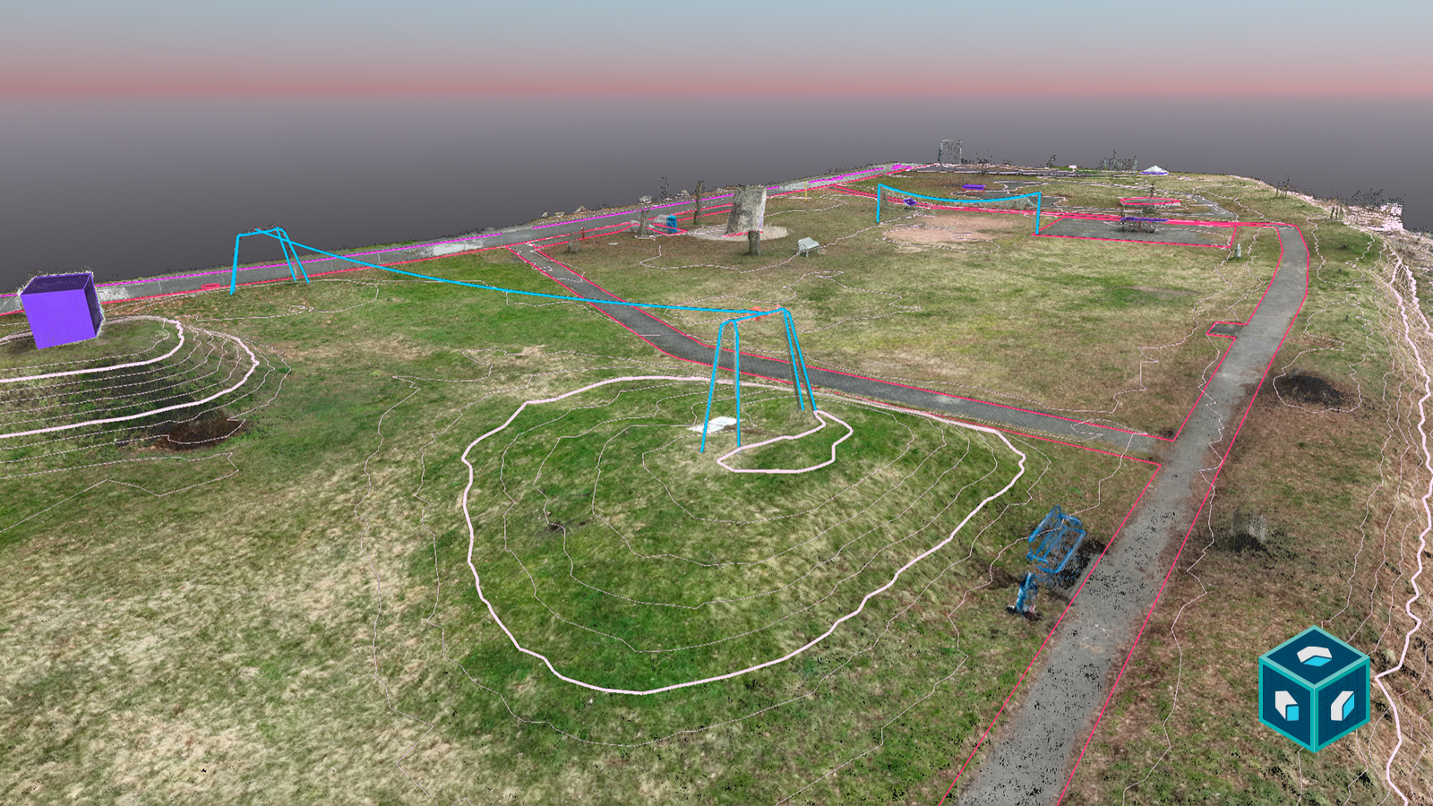
While architects typically don't work with point clouds, PIX4Dsurvey bridges the gap—allowing users to digitize georeferenced point clouds and integrate official site data. This served as the foundation for site planning, ensuring accuracy and informed decision-making from the start.
Project details
| Location | Roßwein, Germany |
| User | Octacon Geotechnik |
| Project duration | February 24 - November 24 |
| Area surveyed | 4500 m2 |
| Software used | PIX4Dmatic, PIX4Dsurvey, PIX4Dcloud |
| Hardware used | DJI M3M _ M3E, Leica and Emlid Reach RX |
| Processing hardware | CPU: 12th Gen Intel® Core™ i9-12900K (1 CPU, 24 threads), RAM: 127.75 GB, GPU: NVIDIA GeForce RTX 3090 (Driver: 4.1.0 NVIDIA 560.94), OS: Windows 11 |
| Processing time | Around 3 hours (PIX4Dmatic) |
| Images captured | 7 datasets: 726, 454, 1052, 880, 872, 457, 463 |
| GSD | Average of 1cm/pix in nadir, 1.2cm/pix in oblique |
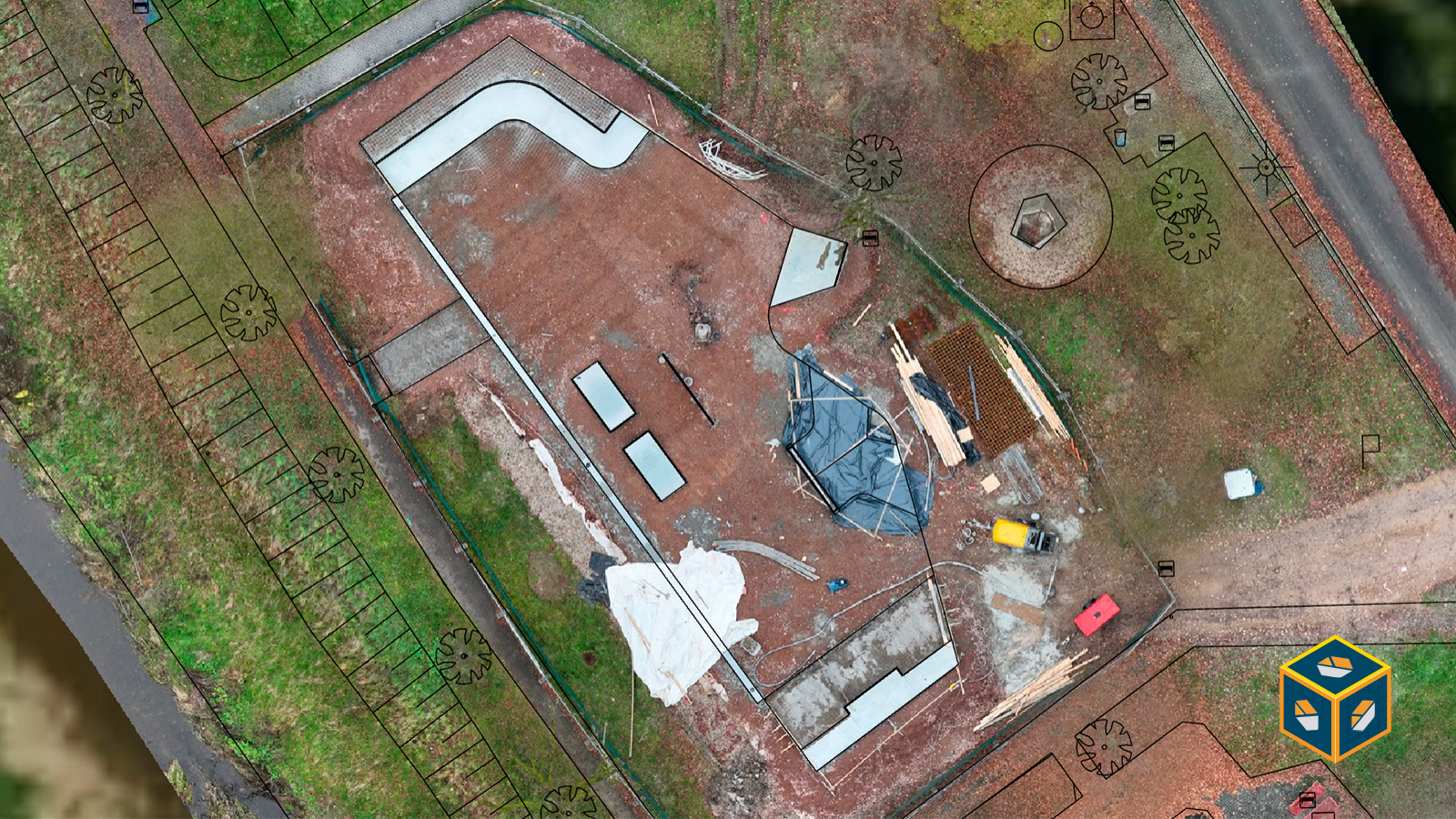
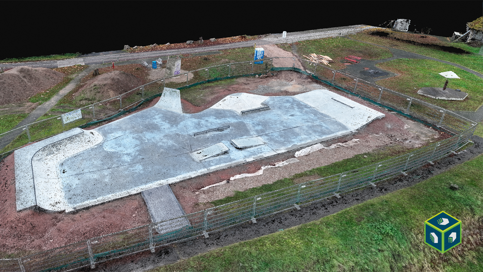
Construction monitoring with PIX4Dcloud
Making sure that construction projects align precisely with plans is an ongoing challenge on job sites. It's crucial to verify that structures are built in the correct location, on schedule, at the expected quality, and within budget. To streamline this process, PIX4Dcloud provided an efficient as-built to as-designed comparison, ensuring accurate site documentation at every stage.
Thanks to RTK drone data and ground control points (GCPs), says Manuel, the software consistently achieves horizontal accuracy within 2-3 cm—a level of precision that would require significant time and resources with traditional measurement methods.
Without digital tools, resolving discrepancies often requires a surveyor to confirm accuracy—a process that can take hours. But, Manuel explains to us, once my data is georeferenced, I can open PIX4Dcloud—on my computer or even on my phone—and verify progress in under a minute.
Another key advantage of PIX4Dcloud is the ability to import and export IFC files, ensuring smooth integration with BIM methodology and making projects BIM-ready with minimal effort.
“If your project includes DXF or IFC files in a BIM workflow, Pix4D provides a powerful feature. If you ensure that all your data is georeferenced in the same reference system, it allows you to work, measure, and compare all in one space." - Manuel Allinger, CEO, Octacon Geotechnik GmbH
Pix4D: visualizing change in 4D
OCGT used Pix4D and PIX4Dcloud's Compare mode to capture and document construction on the skate—tracking both the progress in 3D while also capturing its evolution in 4D over time. Data was processed in PIX4Dmatic and then uploaded to PIX4Dcloud, giving project stakeholders seamless online access to all information for monitoring progress, planning next steps, and improving collaboration.
The video below captures weeks of site evolution through detailed orthophotos and includes a fly-through of the 3D point cloud and mesh—clearly illustrating the project’s progression from design to completion.
The final steps
Throughout the construction of the world’s first carbon concrete skatepark, the Pix4D software suite played a crucial role in documenting and analyzing each stage. From initial drone surveys assisted by PIX4Dmatic and PIX4Dsurvey to continuous site monitoring with PIX4Dcloud, each solution contributed to a seamless and interconnected workflow.
However, the final step is still ahead. Once the landscaping is complete in a few months, OCGT will return—this time not just with drones but also with a PIX4Dcatch mobile scanner. By capturing the intricate details that aerial surveys may have missed, this last step will ensure a fully detailed 3D reconstruction of the skatepark, filling in any remaining gaps and delivering a comprehensive digital model of this groundbreaking project.
Stay tuned for part two of this use case!
“Pix4D has developed great products that fit together seamlessly. With PIX4Dmatic, data processing is simple and efficient. For extended functionality, adding a PIX4Dsurvey license integrates perfectly into the workflow. Additionally, with PIX4Dcloud, our customers benefit from a user-friendly interface and effortless access to their data." - Manuel Allinger, CEO, Octacon Geotechnik GmbH