Compare stockpile volumes over time, online
A construction site is an ever-changing landscape. Buildings grow and material piles are depleted and replenished. It’s a similar story in quarries, mines and more.
In fast-moving industries, accurate and timely estimates of changes are essential.
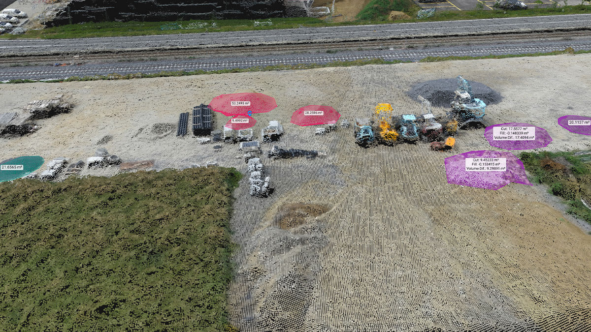
Avoid the traditional, time-consuming walk-through of your site with drone mapping. Once you’ve collected the images, you can compare volume changes over time with just a few clicks and in a fraction of the time of traditional methods, using Pix4Dcloud Advanced.
Why use drone mapping to calculate and compare volumes?
Drone mapping is a cost-effective alternative to traditional ground-based surveying methods which rely on total stations, GNSS techniques or laser scanning. Large areas can be mapped from the air in less than an hour while with traditional methods, surveyors must go on site to measure the coordinates and elevations of multiple points. Measuring large stockyards often can require days to complete. After the data capturing, surveyors need to generate surface models and compare them with previous versions, a manual and time consuming process.
With drone mapping and the Volume Comparison tool, comparing volume over time is quick and efficient. Whether the data is captured by a drone or autonomously by a
Crane Camera, data is automatically processed on the cloud and ready for volume comparison whenever you are.Comparing volumes on Pix4Dcloud Advanced is simple
In the 2D or 3D view, select the Volume tool and create the new volume or select a pre-existing one.
Important: You need to have a digital surface model (DSM) for all datasets you want to compare. For this purpose, process your project on Pix4cloud Advanced and get DSM automatically, or upload a georeferenced digital surface model (DSM) processed on your desktop device.
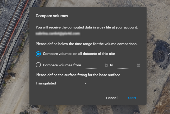
Choose Compare volumes from the right panel and select the appropriate time range for you - compare either all datasets of the current site or specify a custom time range. Click Start and within a few minutes, the owner of the project will receive a .CSV file with the results by email.
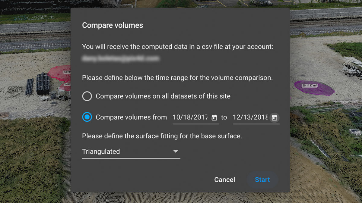
Check out our support site for more information about Volume comparison.
One tool, different applications
In fast-moving industries, being able to measure volume changes can be the difference between profit and loss. Miscalculations in stock quantities, or paying for earth/volume moving that has never been done, are not uncommon, and they can significantly increase costs.
The Volume Comparison feature can be used across a wide variety of projects. Some of the most common applications are:
- Measure stockpiles - for active stockpiles knowing the change of volumes over time is important. The Volume Comparison tool of Pix4Dcloud Advanced allows you to measure the difference and know exactly what was moved and how much. Avoid disputes or paying for a job which was never done.
- Мanage site inventory - measure changes in quantity of sand, gravel, rock or other materials you have in your inventory and know when is the right time to refill in your stock. Better forecast production, and have full overview of your inventory.
- Monitor road construction - often infrastructure projects have significant length and go through difficult terrain which leads to complex and costly earthworks. With Pix4Dcloud’s new tool, such projects can be kept under control. Monitor the volume change and know the status of your project, better predict the time left to finish it and achieve better cost control.
- Keep track of vertical construction progress - measure the building while it is being built. Measure how much concrete was poured the previous week, month or whenever you need. Be able to avoid having excessive or insufficient concrete and prevent unforseen costs.
The volume comparison tool is now availible in Pix4Dcloud. Log in and try it for yourself.
