Design verification: compare as-built to as-designed
Roger Johansen from Universalprosjekt Geosystemer AS specializes in high-precision data solutions for every stage of construction. Roger uses Pix4D mapping solutions to check designs align with reality and to track and identify potential problems early on in the construction period. We spoke with Roger about how PIX4Dcatch and PIX4Dcloud have become indispensable in his workflow.
Identify discrepancies by checking designs with reality
PIX4Dcloud's Design Overlay tool enables Roger and the team to compare the original design with the model generated from collected drone or phone data. It offers a powerful and intuitive solution for integrating complex data from different formats into their projects. This helps:
- Provide an efficient way to ensure design aligns with reality
- Identify discrepancies between plans and real-world execution
- Simplify project management and documentation
- Enhance collaboration between designers, engineers, and project managers
- Communicate clearly with teams and stakeholders about necessary adjustments
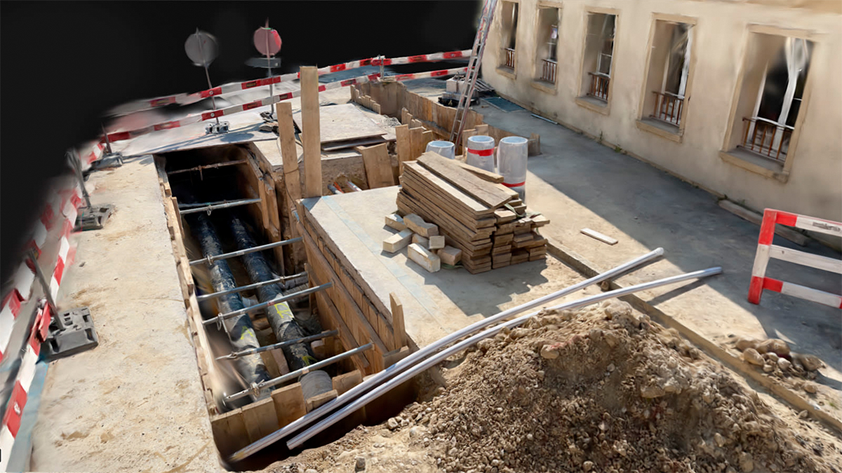
Using PIX4Dcatch to capture accurate data and then processing it with Pix4D software, Roger has created an efficient workflow. With tools like the Design Overlay feature in PIX4Dcloud, he can seamlessly visualize and validate complex design files, such as DXF and IFC, directly within georeferenced 3D models — comparing as-built with as-designed. With this workflow, he has delivered exceptional value to his clients and partners.
The workflow
3D scanning made simple with PIX4Dcatch
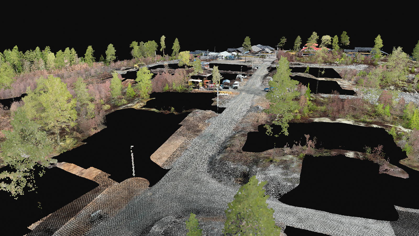
Roger uses the 3D scanning application PIX4Dcatch to collect ground images which he complements with aerial data from drones. “What makes PIX4Dcatch particularly valuable to us is its powerful documentation capabilities,” says Roger. “This is crucial for our projects, where precision and visual overview play a key role.” Uploading to PIX4Dcloud allows his company to deliver highly accurate and comprehensive documentation that meets even the most demanding project specifications.
“This combination of simplicity and power makes PIX4Dcatch a natural part of our workflow and a tool we benefit greatly from in both daily and long-term projects. It’s an investment that truly delivers!" - Roger Johansen, CEO, Universalprosjekt Geosystemer AS
Through PIX4Dcloud, we share models and data via a simple URL, meaning recipients aren’t required to have specialized software. This saves time and eliminates technical challenges. This seamless integration with our workflow allows us to quickly update and share new results as projects progress.
Combining 2D and 3D views for comprehensive project insights
PIX4Dcloud’s 2D and 3D views allow Roger to showcase project data effectively. This provides their partners with a visual and intuitive way to grasp the scope and details of projects. Roger shares insights from a construction project involving 21 residential units.
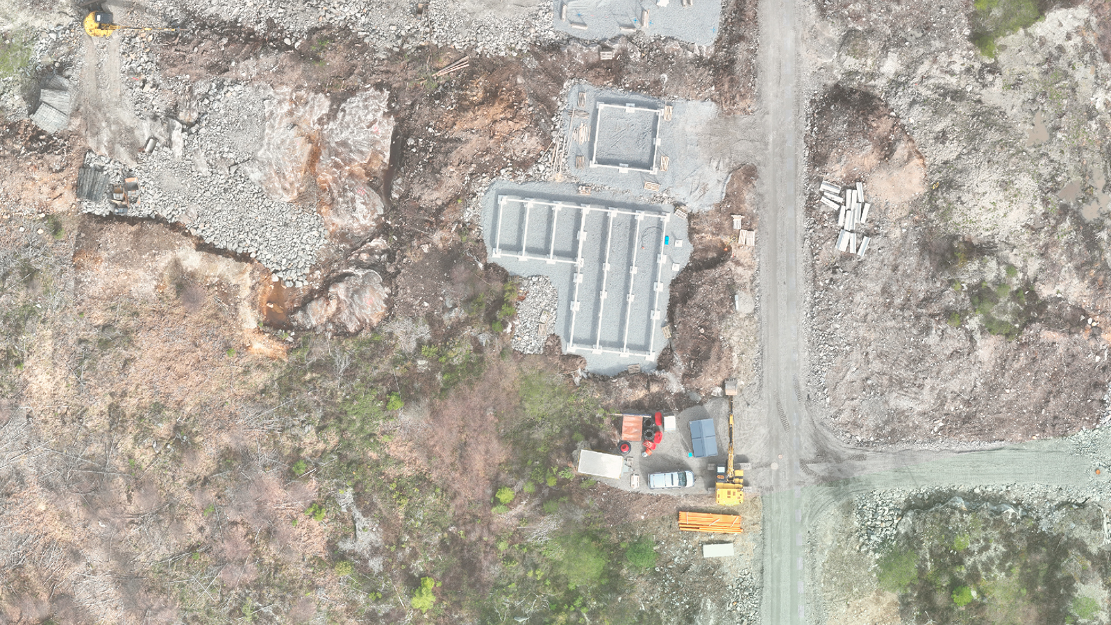
2D views are essential for analyzing surfaces and land planning. Roger combines CAD data, orthomosaics, and PDFs, and displays them as a unified view with adjustable opacity. This offers a comprehensive overview by showcasing the planned and as-built conditions within their real-world context. Using this material, Roger and his team have identified several errors caused by discrepancies in the projected designs.
3D models offer realistic and detailed representations of terrain and structures. They send the 3D materials (excluding the point cloud) to the excavator operator, who has full control over the construction site directly from their machine controller. Simultaneously, they upload to PIX4Dcloud, which allows all involved parties to use the 3D model as a visual guide for project execution and communication.
Using the Design Overlay tool
Roger and his team use the Design Overlay tool in PIX4Dcloud to visualize and compare DXF and IFC files within their georeferenced 3D models and orthomosaics. This tool allows them to integrate design files into their projects for better understanding and decision-making.
Workflow with PIX4Dcloud’s Design Overlay tool
- Import files
We upload relevant design files, either DXF files (for technical drawings and floor plans) or IFC files (for BIM data, including structural details, material information, and 3D models)
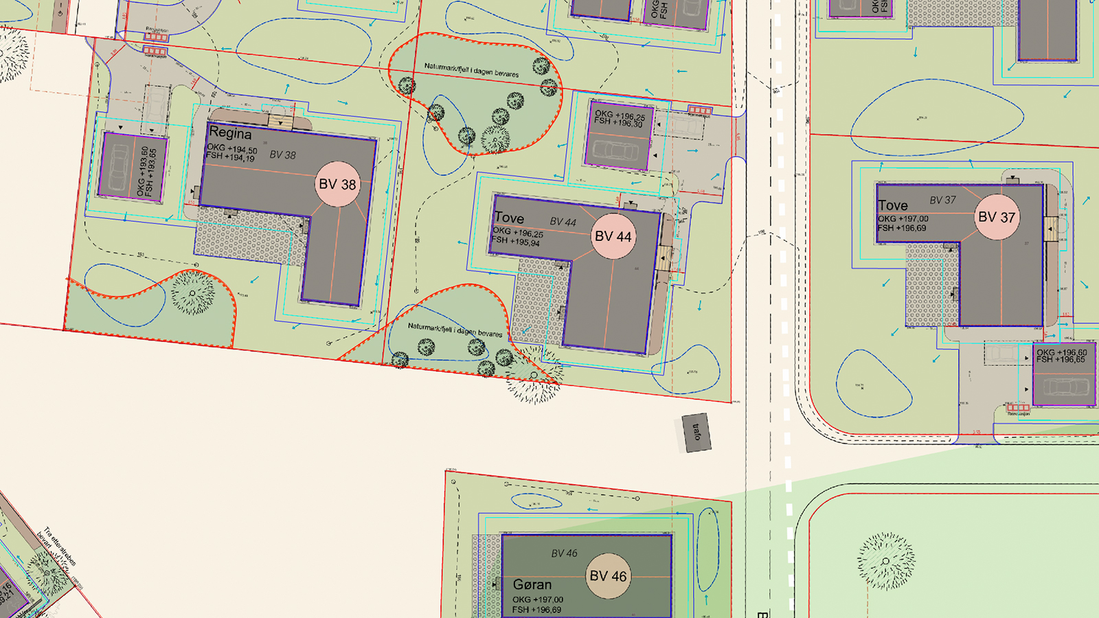
- Position and alignment
Once the files are imported, we use the Design Overlay tool to accurately position the files over the existing model. DXF files are particularly useful for floor plans or topographical data, while IFC files provide more complex and detailed visualizations of buildings or structures
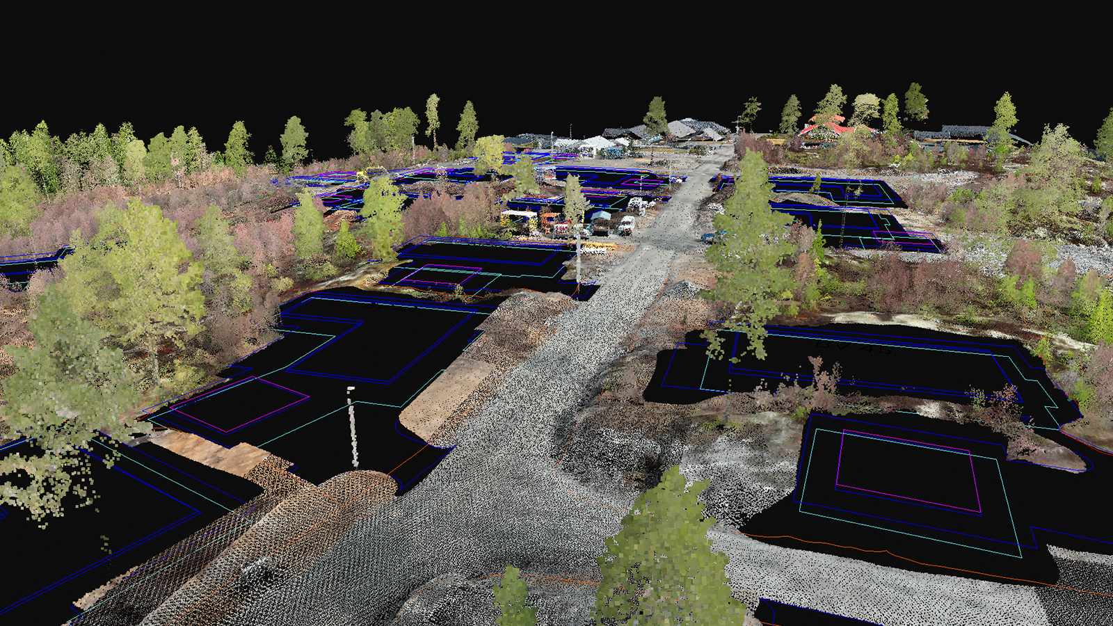
- Working with layers
DXF files: we activate specific layers within the DXF files to visualize only the elements relevant to the analysis, such as contour lines, utility networks, or building layouts
IFC files: we can show or hide various elements (e.g., walls, columns, or HVAC systems) depending on the project's focus
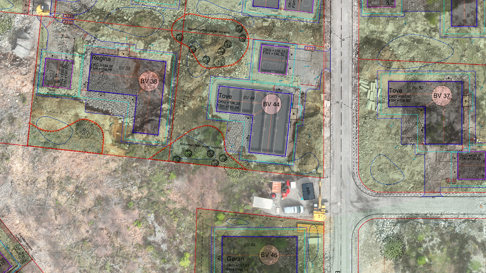
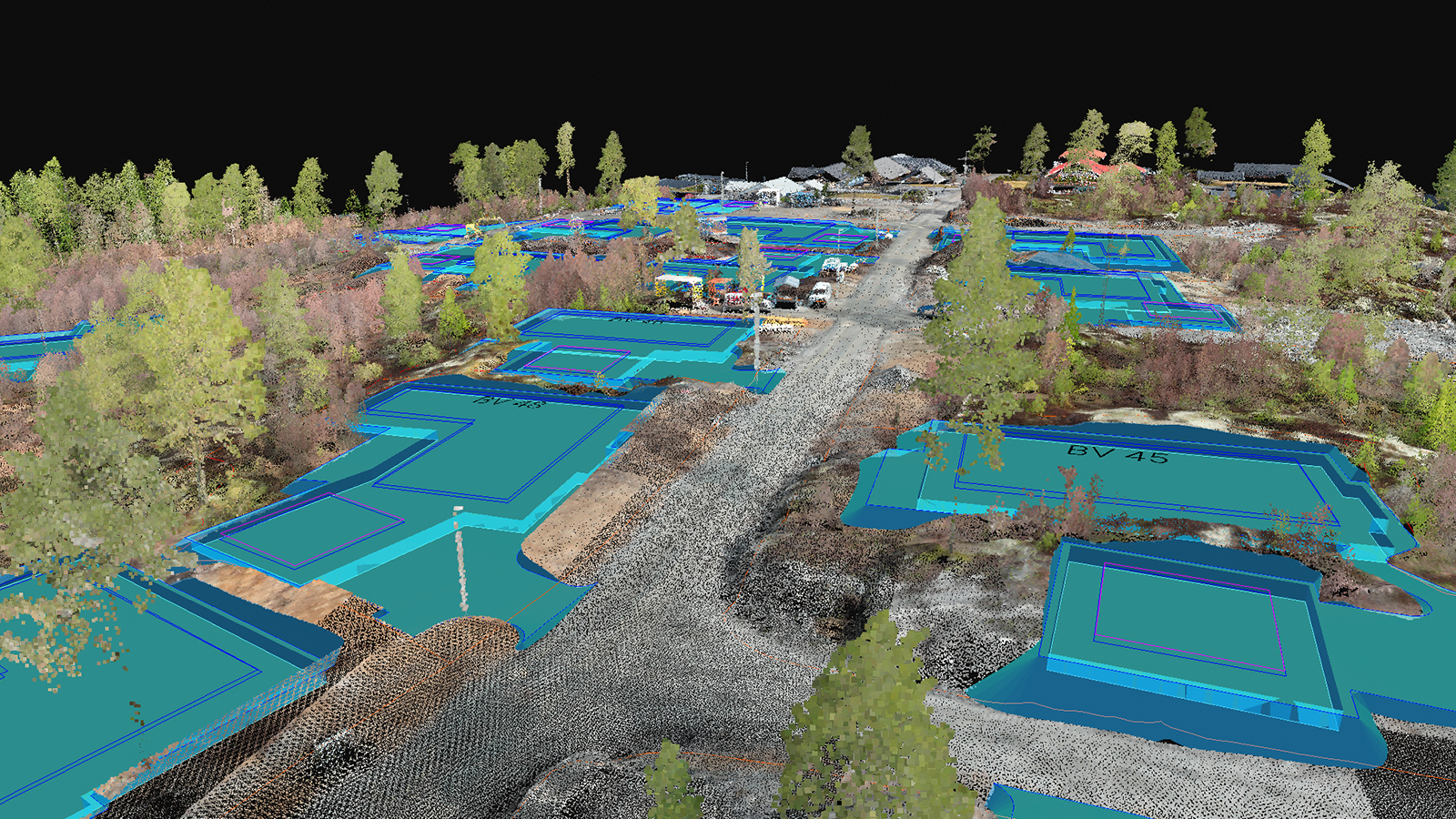
The Design Overlay tool has proven to be a huge asset in Roger’s work. This combination of technology enables them to tackle complex challenges, maintain high standards, and deliver superior results. The integration of these tools into their workflow represents a significant advantage, empowering them to provide more value to our clients and partners.
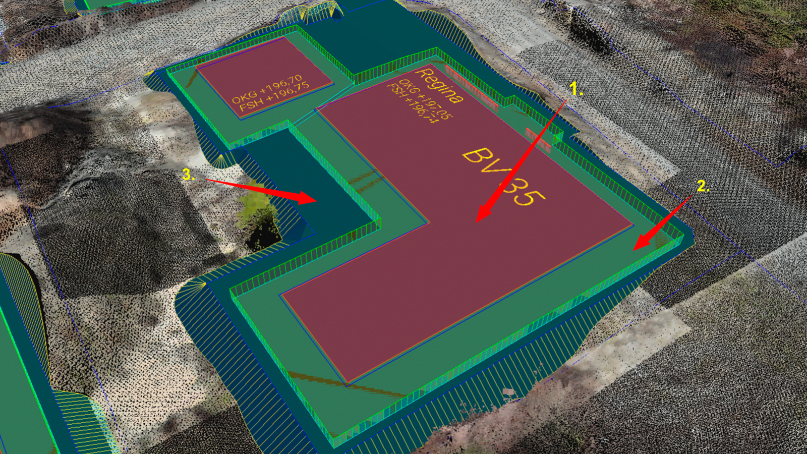
“The collaborative approach of PIX4Dcloud ensures confidence among all parties involved and helps us deliver high-quality results efficiently. In short, PIX4Dcloud is a tool that not only simplifies our day-to-day operations but also elevates the standard for how we present and communicate our projects." - Roger Johansen, CEO, Universalprosjekt Geosystemer AS

