A year in highlights from the Pix4D Agriculture team
How it all started: a new agricultural solution
When we decided to create a mapping product for agriculture, we wanted to go beyond research and development and create a solution that truly understands the industry. So in July 2017, Pix4D opened a new office in Berlin fully dedicated to doing exactly that: understanding the agricultural industry, listening to users, and creating a product that caters to all the main agricultural practices.
Fast forward to today, Pix4D Agriculture team has 26 talented individuals, we have launched not one but two products dedicated to agriculture and are now pieces of the complete agricultural solution. Read more about the team’s journey below.
Confirming our ideas at Agritechnica
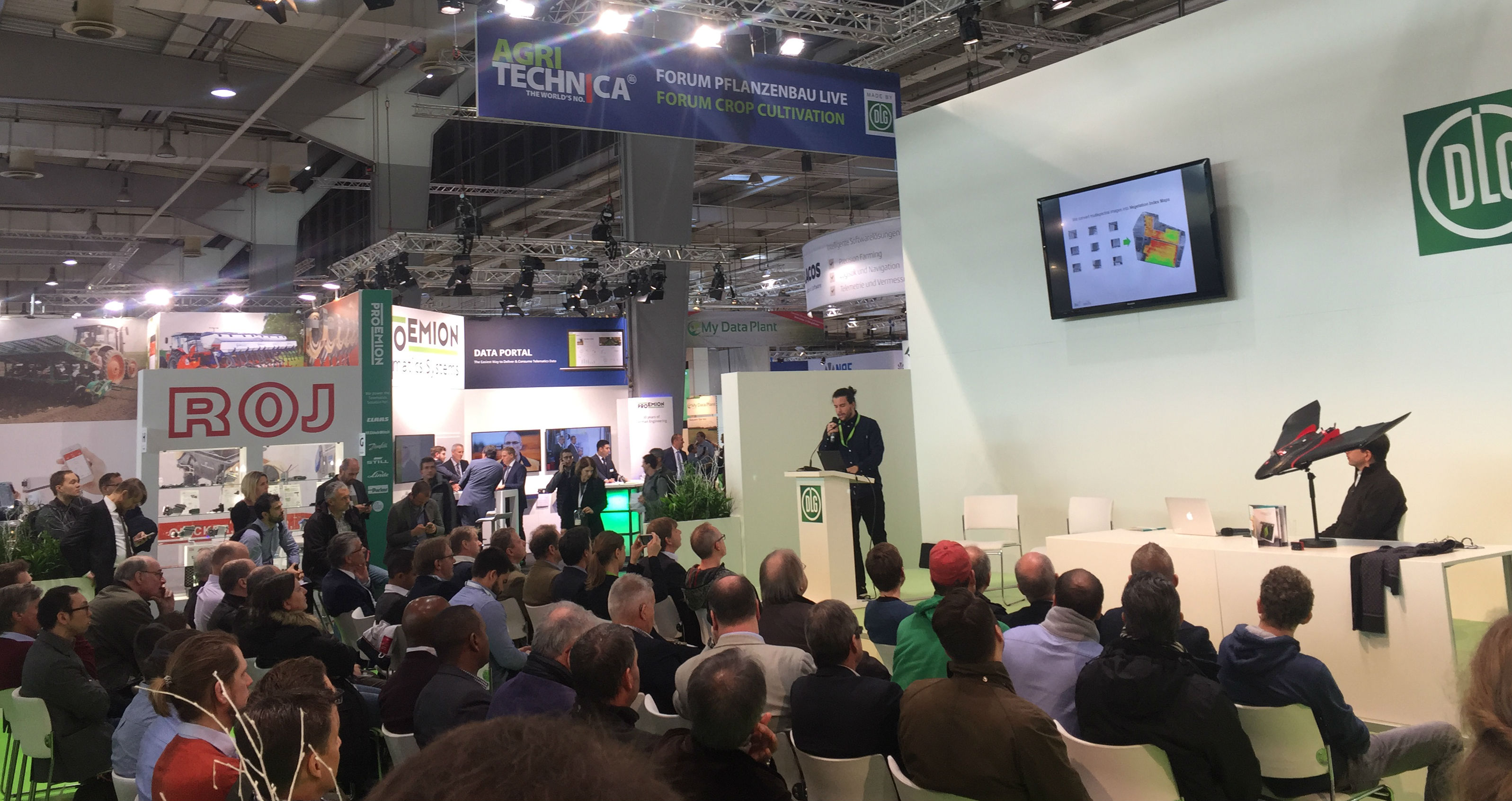
The team was assembled, and work on Pix4Dfields had already begun, but a major inspiration for us was attending Agritechnica in November 2017 in Hannover. This biannual event brings together all the big names in agriculture for a weeklong "agriculture extravaganza".
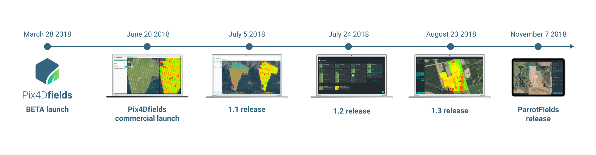
Pix4Dfields beta launch
After Agritechnica, it was like a new wave of energy and motivation kicked in and for the next four and half months the team developed, created and perfected the beta version of Pix4Dfields which was announced at the end of March 2018. The new Pix4D product for agriculture was opened to selected users only in order to receive feedback and perfect the product for the commercial launch.
We showed Pix4Dfields’ uniquely fast processing engine and the easy-to-use interface for the first time in a public webinar with Scholar Farms.
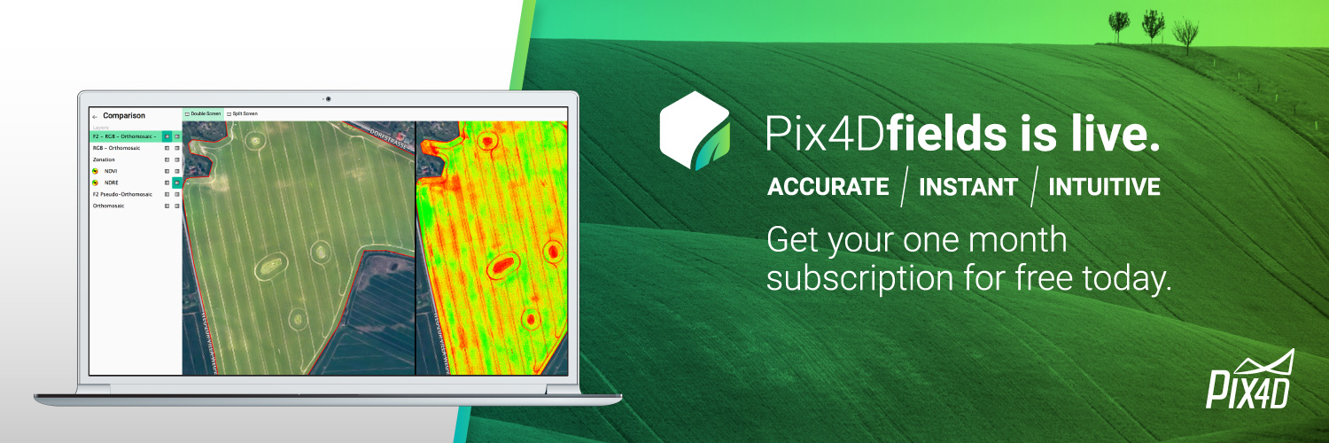
Introducing Pix4Dfields
After months of development followed by beta testing and implementing user feedback from all over the world - in June 2018 Pix4Dfields was launched commercially.
The idea behind Pix4Dfields was to create one product for all drone-based agricultural workflows. Or to quote our CEO Cristoph Stretcha: “Our solution fits the needs of the agriculture industry and we believe Pix4Dfields will become a staple tool, just like a meter is for a construction site worker.”
A summer of features
Throughout the Summer the team released three new versions of Pix4Dfields, packed with new features and updates. In early July 2018 with the Pix4Dfields 1.1 release we added the digital surface model and improved MicaSense RedEdge processing which we then discussed in more detail in our joint webinar with MicaSense.
Later in July with the Pix4Dfields 1.2 release we added histograms of data distribution for digital surface models and indices, followed by the 1.3 release in August where we added the much requested index calculator.
Lessons learned at InfoAg
To showcase the power of the new Pix4Dfields release, we headed to InfoAg in St. Louis, Missouri. Joined by our colleagues from the Pix4D US office and Nathan Stein from Parrot, we were able to demonstrate the potential of Pix4Dfields at a high-caliber event.
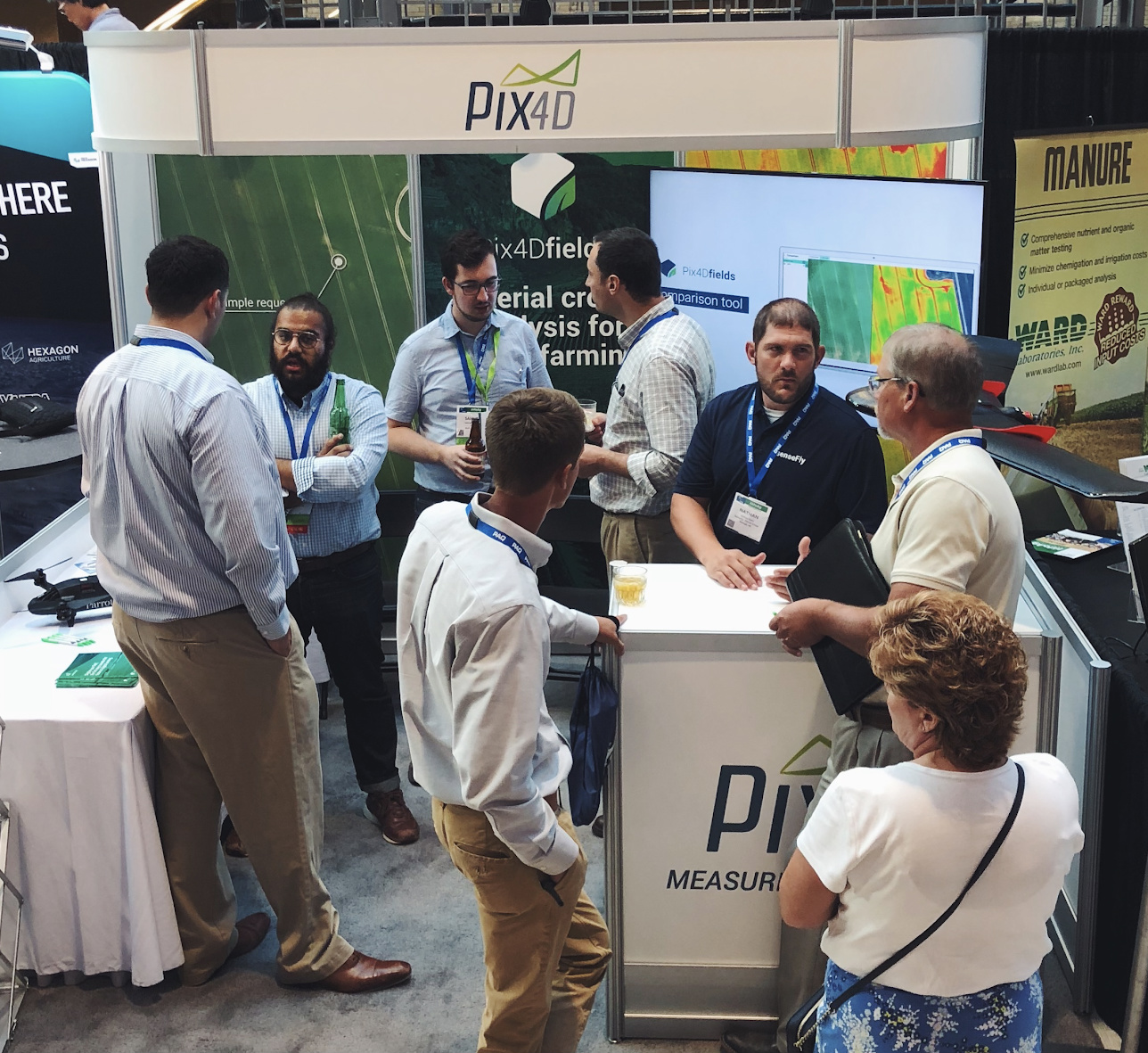
Our booth was crowded as word spread, and people swung by to see Pix4Dfields' processing speed live. Pix4Dfields was able to crunch 160 acres in less than 1.5 minutes locally on a standard laptop.
The five minute crop protection assessment
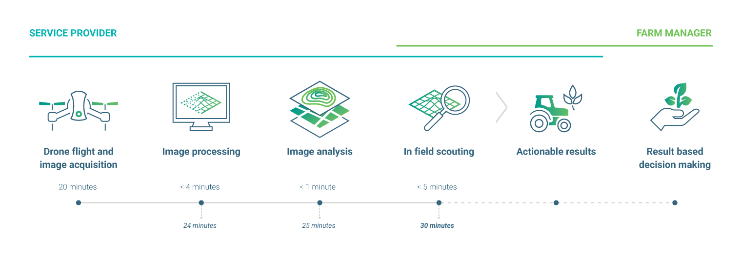
As a part of our July 2018 US trip, we visited one of Pix4Dfields’ early adopters: Pinpoint Aerial Solutions (PAS). They invited us to visit a prune farm in Yuba City and see how the team uses Pix4Dfields. Together with PAS and the farm manager, we were able to use Pix4Dfields onsite to get actionable results ready for decision making in less than 30 minutes. This proved Pix4Dfields can have a direct impact on farm management – and consequently on a farm’s profit.
Parrot Bluegrass Fields
Going into Fall, we were now working on two products: Pix4Dfields and ParrotFields.
Together with Parrot Business Solutions we created a complete agricultural solution: Parrot Bluegrass Fields which incorporates the hardware required (the drone and the sensor) with ParrotFields mobile app and Pix4Dfields software.
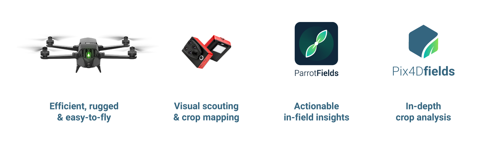
Parrot Bluegrass Fields was officially announced at EIMA in November 2018 in Bologna, Italy and has since been made available for purchase.
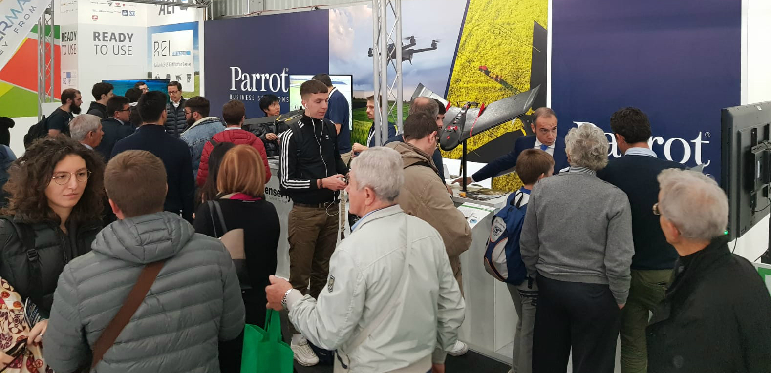
A month of industry events
November ended up being one of the busiest months in 2018. Not only did we successfully launch another product, but also attended three events in three different countries: EIMA in Italy, CropTec in the UK and Agromek in Denmark. At each event, we spoke to users about how Pix4D's agricultural solutions can help their businesses.
Looking forward to 2019
As the new year approaches, it’s time to reflect on the past year and plan for the next. We couldn’t be more proud of our achievements and grateful to everyone who has been a part of the Pix4D Agriculture journey.
We wouldn’t have made it this far without all of your input and feedback. The future looks bright and we can’t wait to share all the new and exciting things we have planned for 2019.