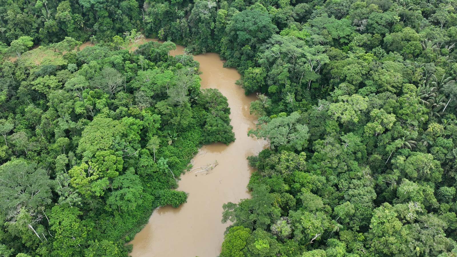
Mapping the Amazon Rainforest with PIX4Dmatic
The Amazon Rainforest is the largest rainforest on Earth, spanning nearly half of the South American continent. It harbors the highest concentration of species on the planet and plays a crucial role in climate stabilization. Storing 150-200 billion tons of carbon and releasing 20 billion tonnes of water into the atmosphere daily, the Amazon significantly influences global carbon and water cycles.
However, the Amazon is increasingly vulnerable to large-scale deforestation. In response, Mossy Earth, a social enterprise focused on restoring degraded ecosystems, acquired 194 hectares of land in the Ecuadorian Amazon to help protect and restore this vital region.
The Yasuní National Park
Researchers in the Amazon found that the highest density of biodiversity across amphibians, birds, mammals, and plants overlaps in the Yasuní area. To protect this special area the Yasun�í National Park was created in 1979 and a no-go zone within the park was declared to protect the national habitat from destructive industries.
Unfortunately, this has often been ignored, and industrial activities have encroached on the area regardless. Local Freddy Gualinga reached out to Mossy Earth when the surrounding land came up for sale; he wanted them to buy and protect it.
Freddy didn’t want the land to be exploited in a way that would damage the rainforest (monoculture plantations, gold mining, etc), the previous land-owners had cut down the forest and replaced it with pastures and cacao plantations. Mossy Earth buying the land was a key step towards preventing a similar outcome; through their ongoing presence and local community engagement they wish to ensure the land is protected and restored in the long term.
The role of drone mapping in land conservation
The first step towards understanding the land was to map it. Satellite imagery wouldn’t provide the spatial or temporal resolution needed and field surveys on foot are time-consuming. Field surveys also inevitably miss hard-to-access areas and don’t produce the high-resolution, quantitative data required.
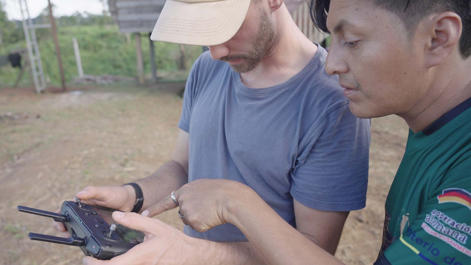
Tiago de Zoeten, the head of science and impact at Mossy Earth, used PIX4Dmatic to get an initial survey of the land to see if it matched the maps they had. This enabled them to:
Have a cost-effective solution to ensure their land management produces the desired results, and if not adjust their practices accordingly
Communicate to their global community of supporters what area and what type of habitat they are protecting (the value of what has been achieved)
Check if pristine areas are safe from threats such as logging, and if degraded areas are recovering as expected by natural regeneration
They have been mapping the area periodically, hoping the resulting data will allow them to quantify results as the change in land cover is the most obvious metric of the project’s success. They need to know if the rainforest on the purchased land is stable and growing, or reducing—otherwise, they would be working in the dark. The hope is that plantations and grasses will naturally regenerate in the coming years.
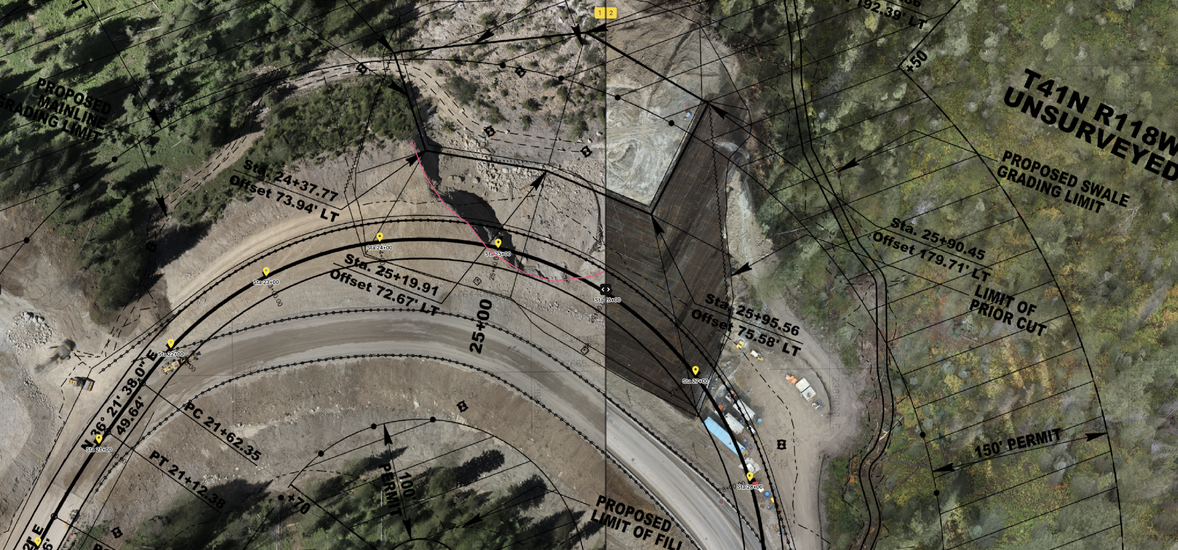
The drone mission
The mission had to be flown from a single take-off point and in a short time period, as conditions in the Amazon change rapidly. They had to take advantage of one of the few periods of stable cloud cover between pouring rain and strong sunlight. They eventually acquired the images—over 1000—in under 3 hours.
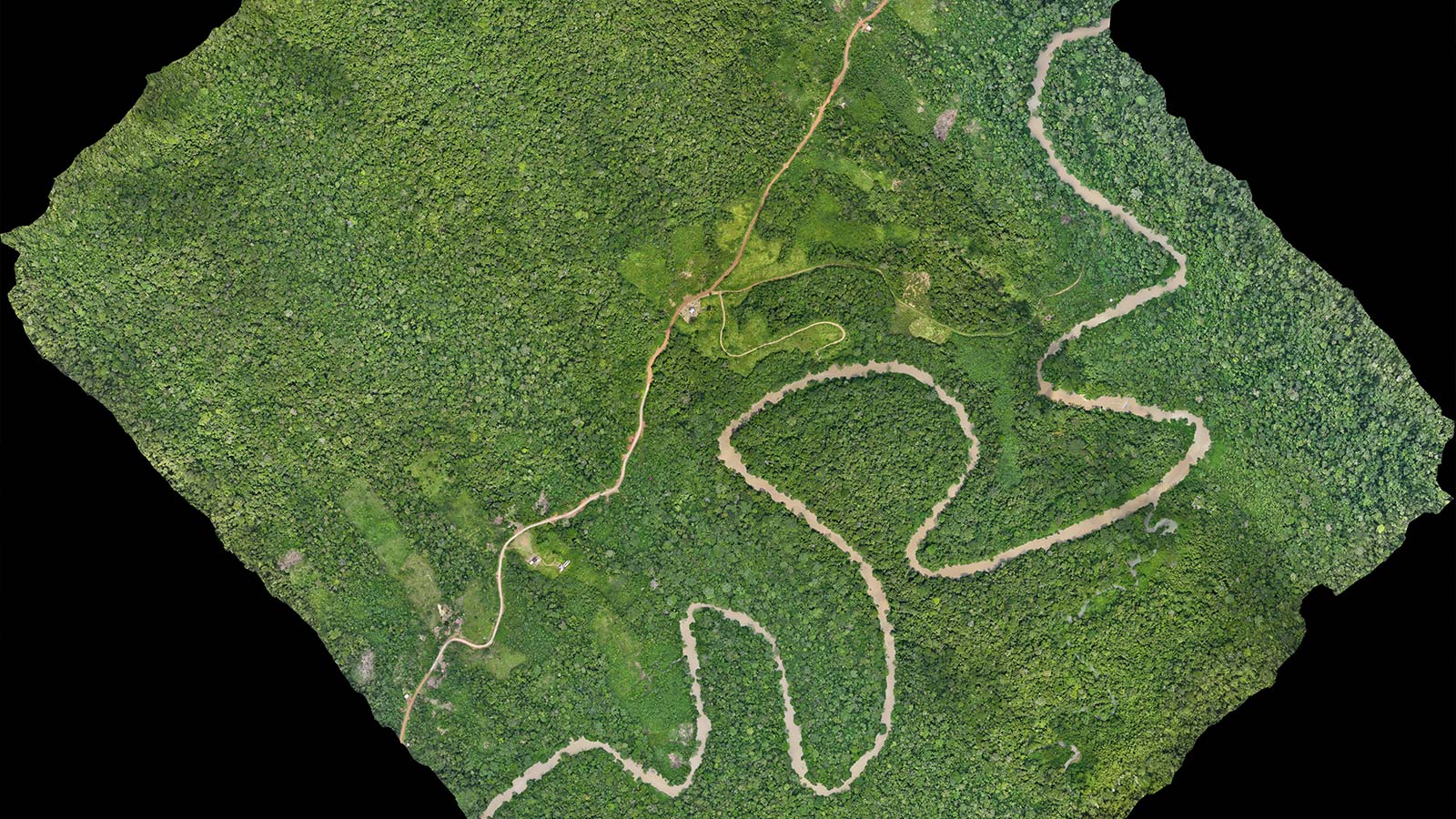
They used a DJI Mavic 3 Multispectral to capture image data and PIX4Dmatic for processing. Once the images were captured with the drone, processing the orthomosaic and digital surface model was very fast (under 2 hours!).
PIX4Dmatic allowed them to process a large number of images swiftly using just a laptop in the field, without being limited by the cloud or upload speed. The result was successful, they managed to process orthomosaics and DSMs on the first attempt using the Nadir processing options template, which is well-suited for large-scale areas.
Mapping insights
It took them a few more days to analyze the orthomosaic and split the area into different land cover classes. The whole process in total took about two and a half weeks. Using PIX4Dmatic made it easy for them to figure out the land cover of each area:
- Mature rainforest: 86.1%
- Cacao plantation: 7.7%
- Grass or degraded cow pasture: 4.1%
- Roads and various houses: 2.1 %
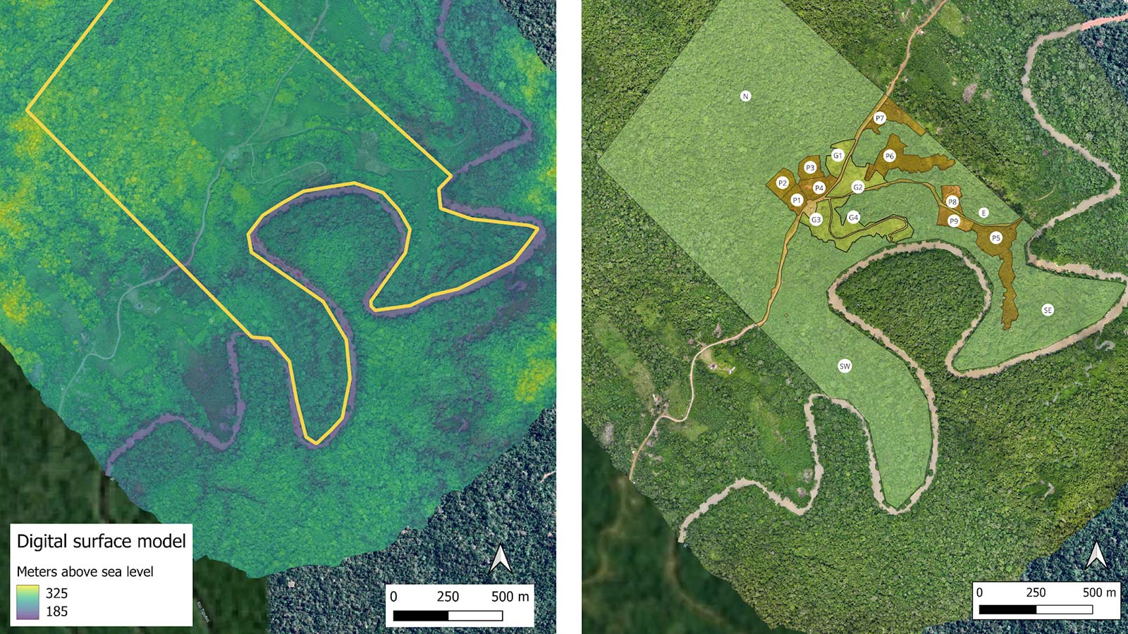
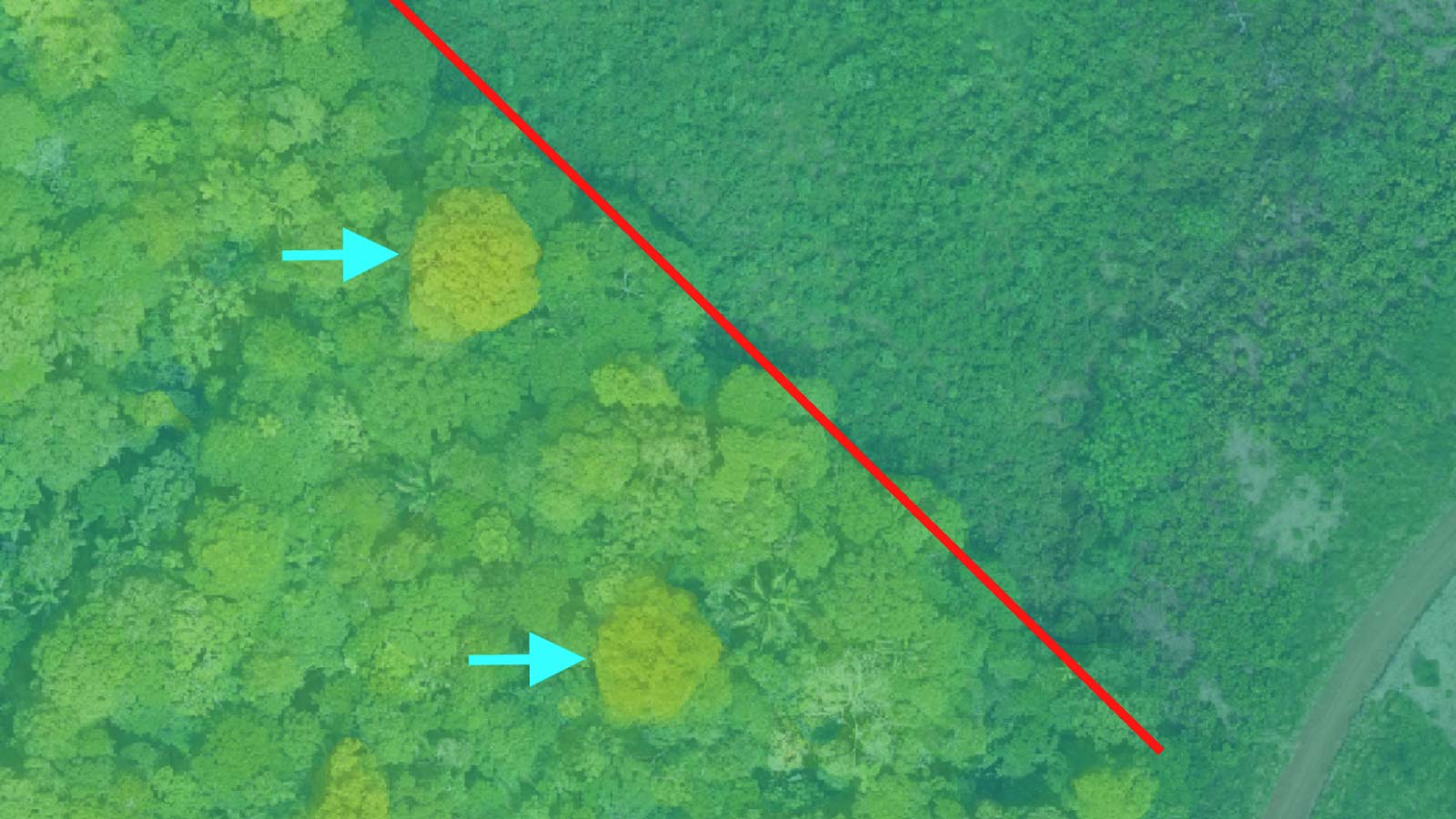
The exported DSM and orthomosaic were uploaded as layers in QGIS analysis software—a seamless process. Overlaying the orthomosaic and the DSM with varying levels of transparency generated a highly informative map for classifying land cover and identifying large emergent trees in the canopy, which are important due to their ecological role and use in timber which risks selective logging. They printed a large-scale version of the map, which proved instrumental in discussions with local community members to gather additional insights on land use history.
PIX4Dmatic provided a high-resolution map that allowed Mossy Earth to understand land cover at the start of the conservation and restoration project, giving them a clear insight into what was happening with the land. Drone mapping will enable them to monitor change over time and ultimately the project’s success. Through continuous monitoring and community engagement, they aspire to create a lasting positive impact on the land.