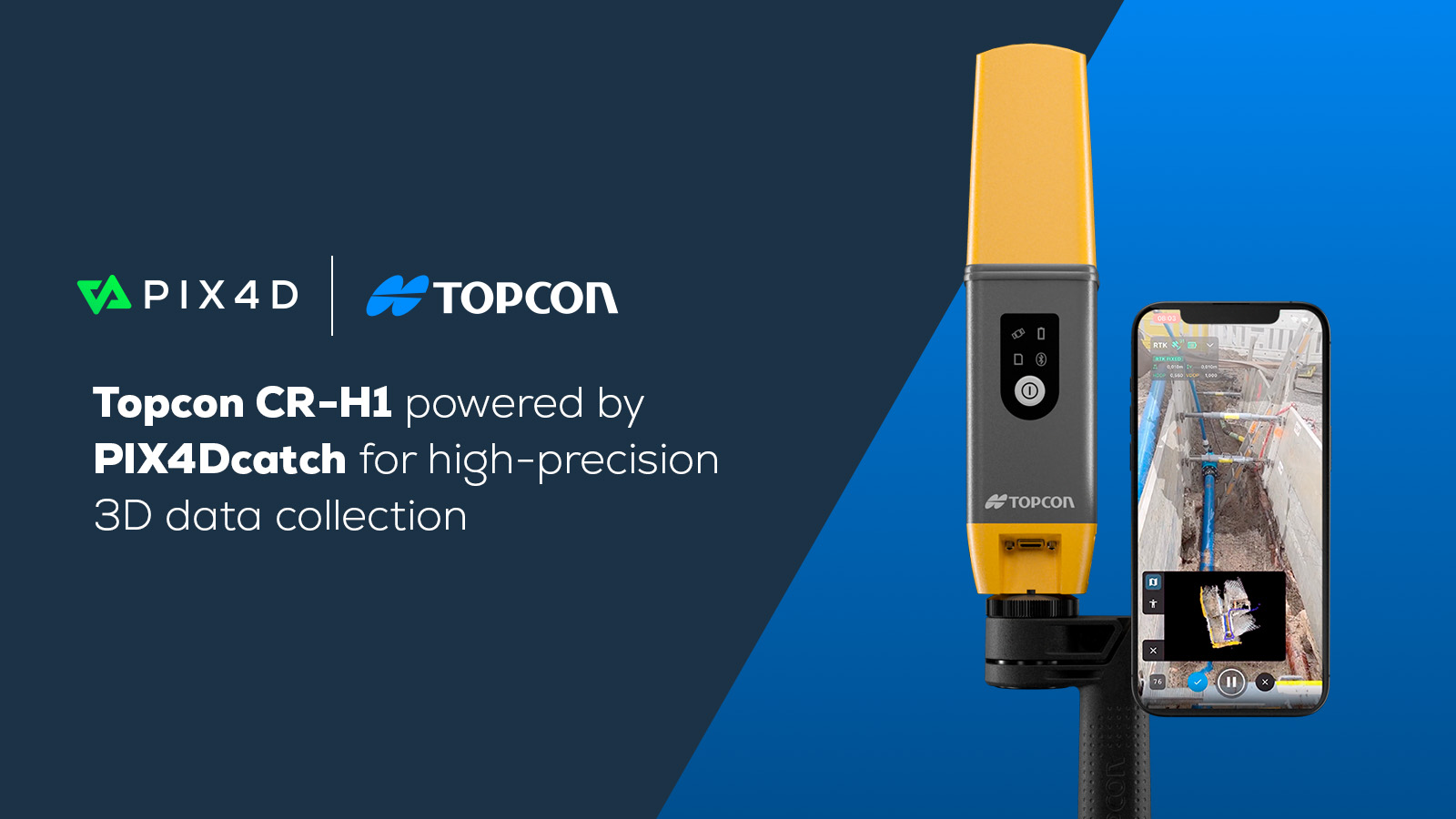
Documenting underground utilities with PIX4Dcatch
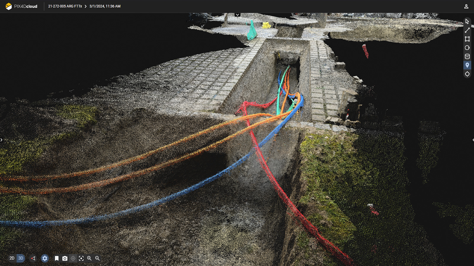
Accurate documentation of underground utilities is crucial in construction because it ensures compliance with regulations and standards and provides a clear record for stakeholders. Additionally, detailed trench documentation aids project management by providing information on underground infrastructure, which can help identify possible issues—avoiding costly rework or delays.
Ingenieurbüro Daeges is an engineering and planning firm specializing in constructing fiber optic broadband networks throughout southern Germany. Every year they measure and document around 100 km in the fiber optic area alone. Accurate documentation with high GIS requirements is a crucial part of their projects. Meeting these requirements entails meticulous surveying of installed pipelines, connection points, and associated physical infrastructure essential for network maintenance.
Documenting trenches with PIX4Dcatch
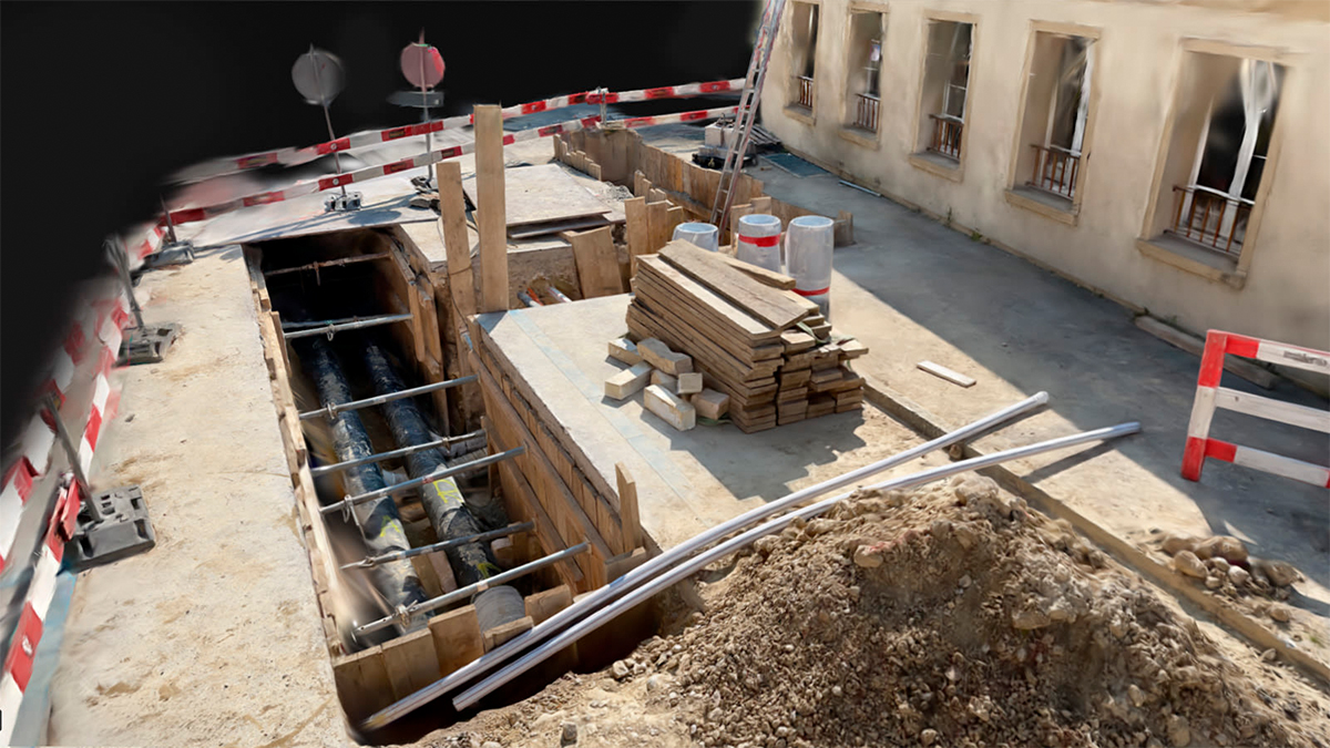
Daeges' workflow includes documenting trenches before closure, an essential step to capturing the details of the installed pipe network and monitoring the construction progress.
Their operations span southern Germany and with demanding project schedules, it’s often impractical for a construction manager or surveyor to be always on-site. Our mobile scanning solution - PIX4Dcatch with RTK accuracy - offers a solution; ensuring thorough documentation even in their absence. The mobile scanning device has allowed Daeges to empower on-site staff to efficiently document infrastructure on the go.
The ease of use of PIX4Dcatch has empowered the on-site personnel to easily measure and upload data for review, regardless of their familiarity with survey equipment. This accessibility has been crucial for ensuring its ready uptake and acceptance on-site. This has facilitated efficient project management and documentation processes.
Challenges
They encountered a challenge with the speed of the data upload due to poor mobile network coverage in areas where site staff are operating and limited access to office facilities. They consulted with the Pix4D development team to find a solution.
Consequently, Pix4D introduced a multi-upload feature to the app, allowing staff on-site to select and upload multiple datasets simultaneously, mitigating the effects of the site-office disconnect. Streamlining the upload process reduced both the time spent on data upload and disruption to site work, which meant data was available sooner in the office for timely review.
AR solutions for construction
To address the challenge of a quick and efficient workflow, CEO and founder, Oliver Daeges, has emphasized the importance of digital solutions like PIX4Dcatch. For construction, he says, “speed is a big issue. Documentation on-site, immediate data evaluation, comparison with planning, and immediate feedback to construction companies is extremely important.” To effectively meet these challenges, Daeges states, innovative, technological solutions must be developed and deployed.
“The ease of capture and upload with PIX4Dcatch, the automated data processing, and digitization with PIX4Dcloud, have changed how we document our projects. The distance between the site and the office has never been so short. We are optimistic that with AI-supported object recognition and digitization, the documentation process as we currently know it will become obsolete.” - Robert Greenhalgh, Survey leader
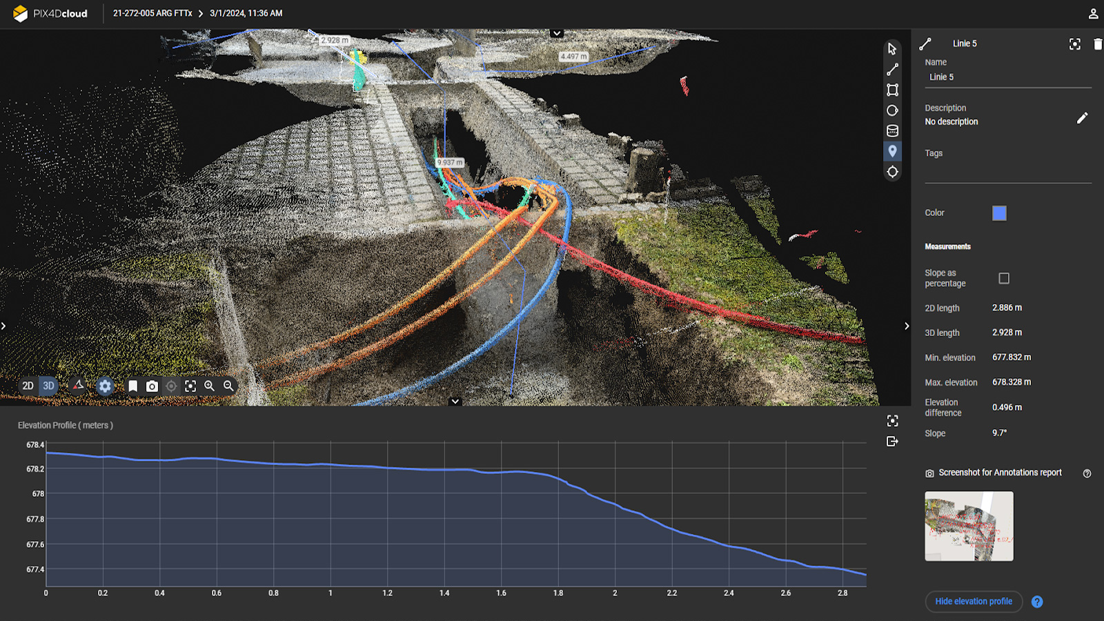
Data processing: from Catch to Cloud
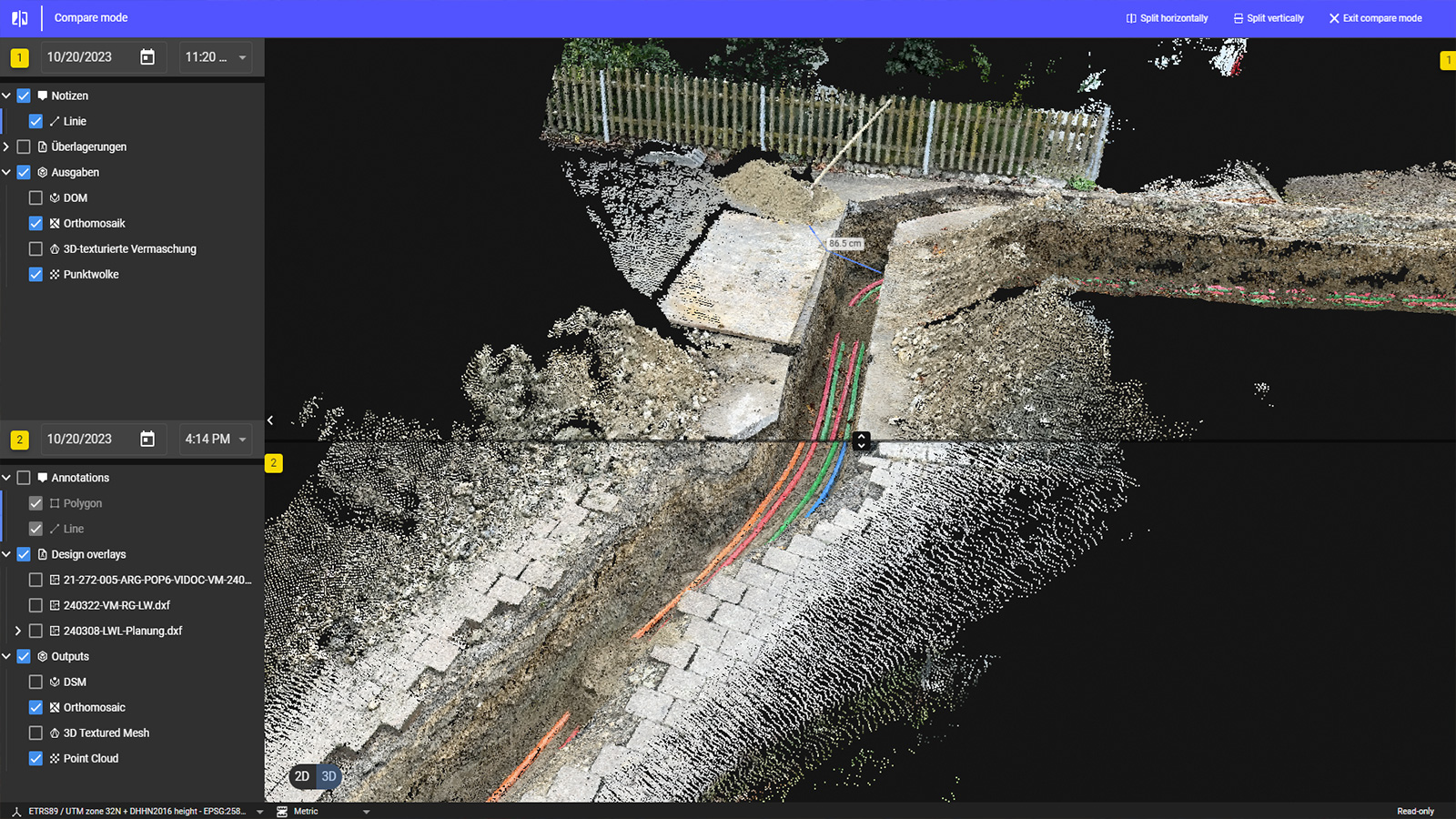
PIX4Dcloud was used to process the data into point cloud and orthophoto deliverables. The timeline feature of PIX4Dcloud allowed Daeges to evaluate a project’s evolution over time. For processing, they found the Upload to PIX4Dcloud feature extremely useful, especially the email notification sent on completion.
This feature has allowed them to optimize their project overview and avoid time lost on repeated procedural steps—important when working across multiple projects for various subcontractors! They found the Pix4D workflow easy to use with speedy processing and a range of available deliverables.
Mobile scanning and construction
Since 2019, Pix4D has been an integral component of Daeges’ drone mapping software and they have been eagerly following the development of PIX4Dcatch. They believe that mobile scanning, as an efficient, accurate, and accessible tool will be a game-changer for the industry.
As a result of using PIX4Dcatch, the quality of Daeges’ fiber-optic broadband project documentation has significantly improved; by providing them with real-time access to (geo-referenced) construction data they could give project stakeholders. Additionally, Daeges believes that mobile scanning tools like PIX4Dcatch could have an even bigger effect on the construction industry—by paving the way to comprehensive 3D project documentation.