Advanced 3D mapping and drones to combat urban warming
As cities continue to grow and develop, urban warming has become a significant concern. An urban heat island (UHI) is a metropolitan area warmer than its rural surroundings. This urban warming is caused by increased human, vehicular, and industrial activities, a dense population, and the nature of city infrastructure. The heat can become trapped and result in poorer air and water quality.
Thermal modeling is crucial in understanding and mitigating the effects of urban warming. It involves creating visual representations of temperature data. By mapping temperature variations across urban landscapes, thermal models help to identify hotspots, plan for green spaces, and inform sustainable urban development.
3D thermal mapping in urban planning
We spoke with Thomas Pingel, an associate professor in the Department of Geography at Binghamton University who is using Pix4D to generate 3D thermal maps. Professor Pingel teaches GIS and Remote Sensing, specializing in LiDAR, drones, and geovisualization (the visual representation of geographical and spatial data to help understand complex patterns, relationships, and trends).
The thermal maps generated with Pix4D will be used to educate the public about urban warming and to assist with urban planning by helping to integrate green spaces into city renewal plans. He provided us with more project details in our interview:
How do 3D models play a role in addressing urban warming?
This project aims to investigate the use of 3D thermal visualization models for public education. We want to educate about the rapid warming of cities and we also want to aid urban planners in making and communicating plans for renewal and including green spaces. This project is important because decisions made now affect the quality of cities for many decades to come.
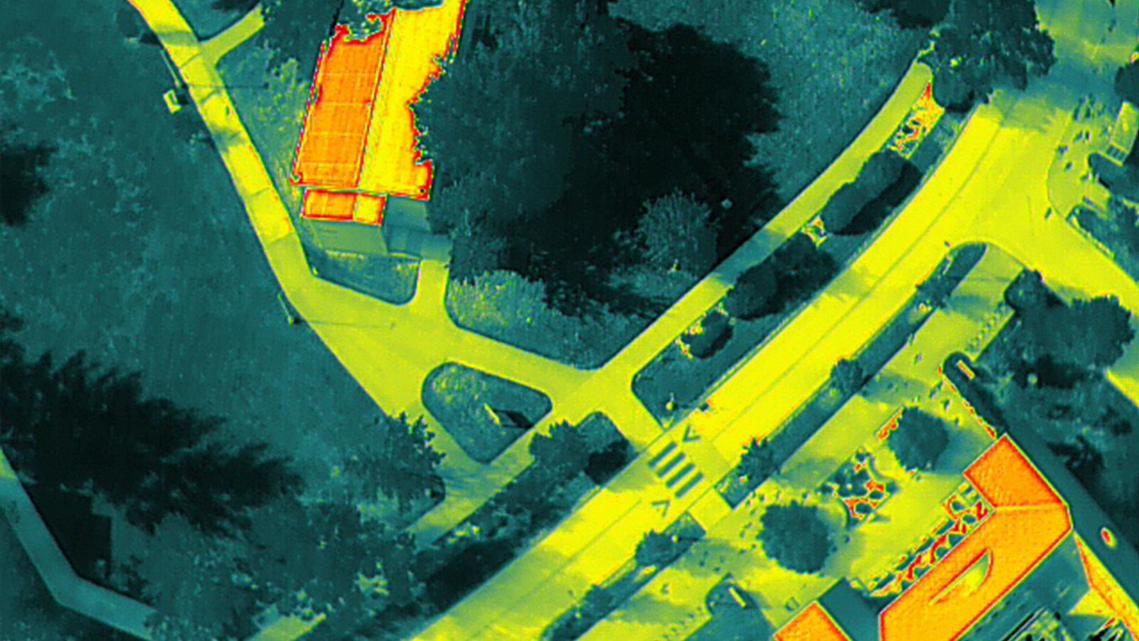
Previous work investigated the role of appropriate color maps and shading to communicate the thermal properties of cities. This work extends that by looking at the importance of 3D maps – what does a manipulatable, 3D model that includes facades, shadows, etc., add to the discussion? We expect these empirical thermal models to improve 3D planning tools.
How does Pix4D contribute to this project?
Pix4D gives me a great deal of control over the run. The large option set of allows me to work through problems and tune the reconstruction—other software I’ve used tends to work or not work, but PIX4Dmatic allowed me to work through less-than-perfect data. I used PIX4Dmatic for the RGB data, which was used to finally position the thermal data in PIX4Dmapper (thermal mapping is currently in the pipeline for PIX4Dmatic!)
The output file structure for Pix4D is easy to work with, so using some novel techniques to “bootstrap” knowledge from the RGB data to the thermal has been particularly useful. Export to 3D tiles, quick run time, and excellent support have all been great. The tools in the pyopf toolkit have been fantastic in supporting ultra-high res NeRF-based “flythroughs”.
What have you accomplished so far?
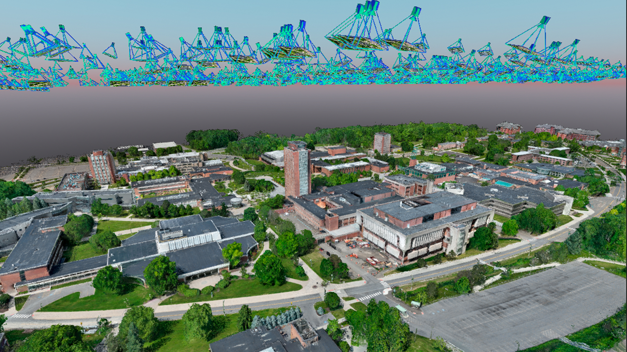
So far we’ve created 3D thermal maps of a large area on campus with diverse land cover (large buildings of many different types/styles, pavement, grass, large forested areas), and successfully fused thermal SfM with lidar for an outstanding product. We’ve used the pyopf toolkit to connect our SfM reconstructions to NeRFs (using nerfstudio). Many technical barriers have been knocked out!
The next steps are to add the facades of buildings using ground-based data capture, especially useful in dense urban areas where drone flying is not feasible or wanted by the local population, and to develop deep learning-based models to apply quality data capture where we can fewer quality data (e.g., airborne lidar, or high altitude, manned aircraft based SfM). We had no problems during processing.
“Pix4D is a reliable and robust software that distinguishes itself from other SfM tools with its extensive user community and user-friendly interface, while still offering advanced features for expert-level capabilities in 3D modeling." - Thomas J. Pingel, Ph.D. Associate Professor, Department of Geography, Binghamton University