
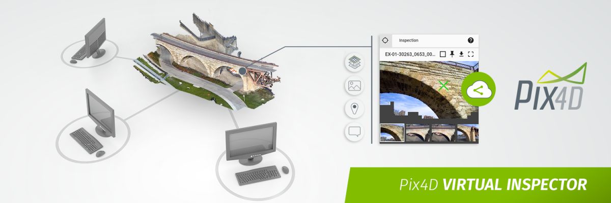
Onsite inspections just went virtual — with Pix4D Cloud
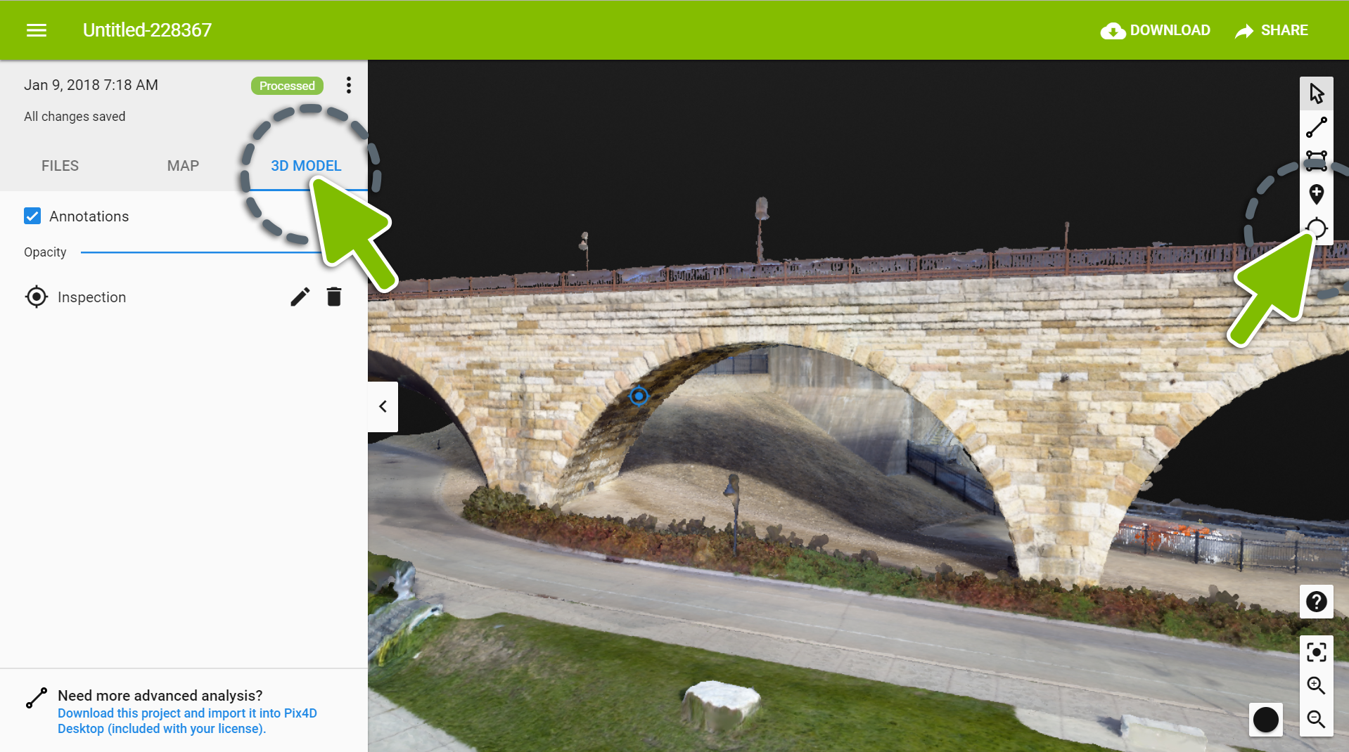
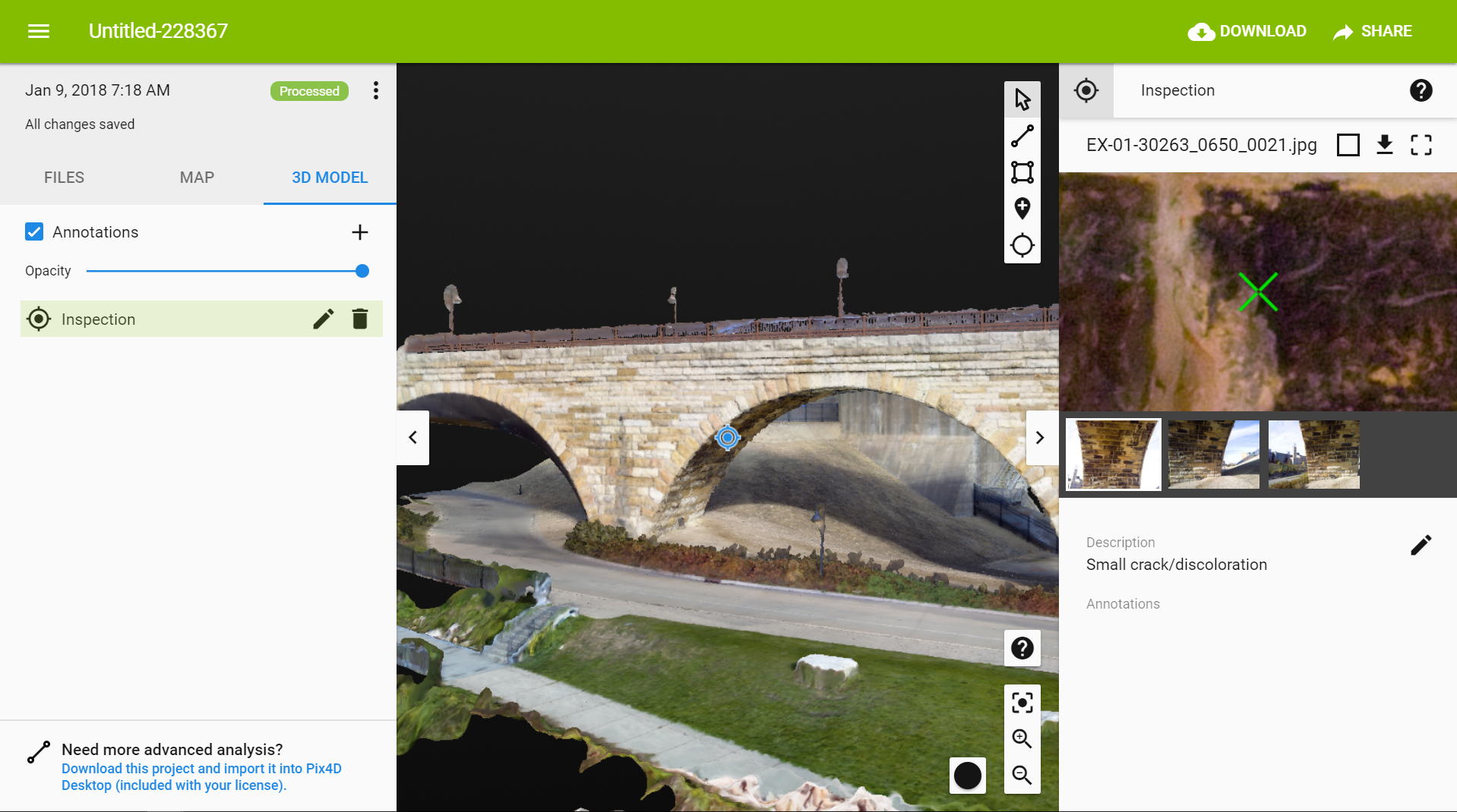
The Pix4D rayCloud is popular because of its intuitive display of the connections between the 2D original images and the reconstructed 3D object space.
Today, we make this iconic feature available on the Pix4D Cloud.

Virtually inspect any point of interest in 3D on Pix4D Cloud
Start with high-resolution images from drones or handheld cameras, upload them to Pix4D Cloud, and automatically process using the Pix4D processing engine. In a web browser, view and interact with the detailed 3D model and related original images.
Intuitive and interactive
Locate and identify the points of interest in the 3D model then inspect all of the images that contribute to the point in the reconstruction. Add comments and pin the images with detailed information.
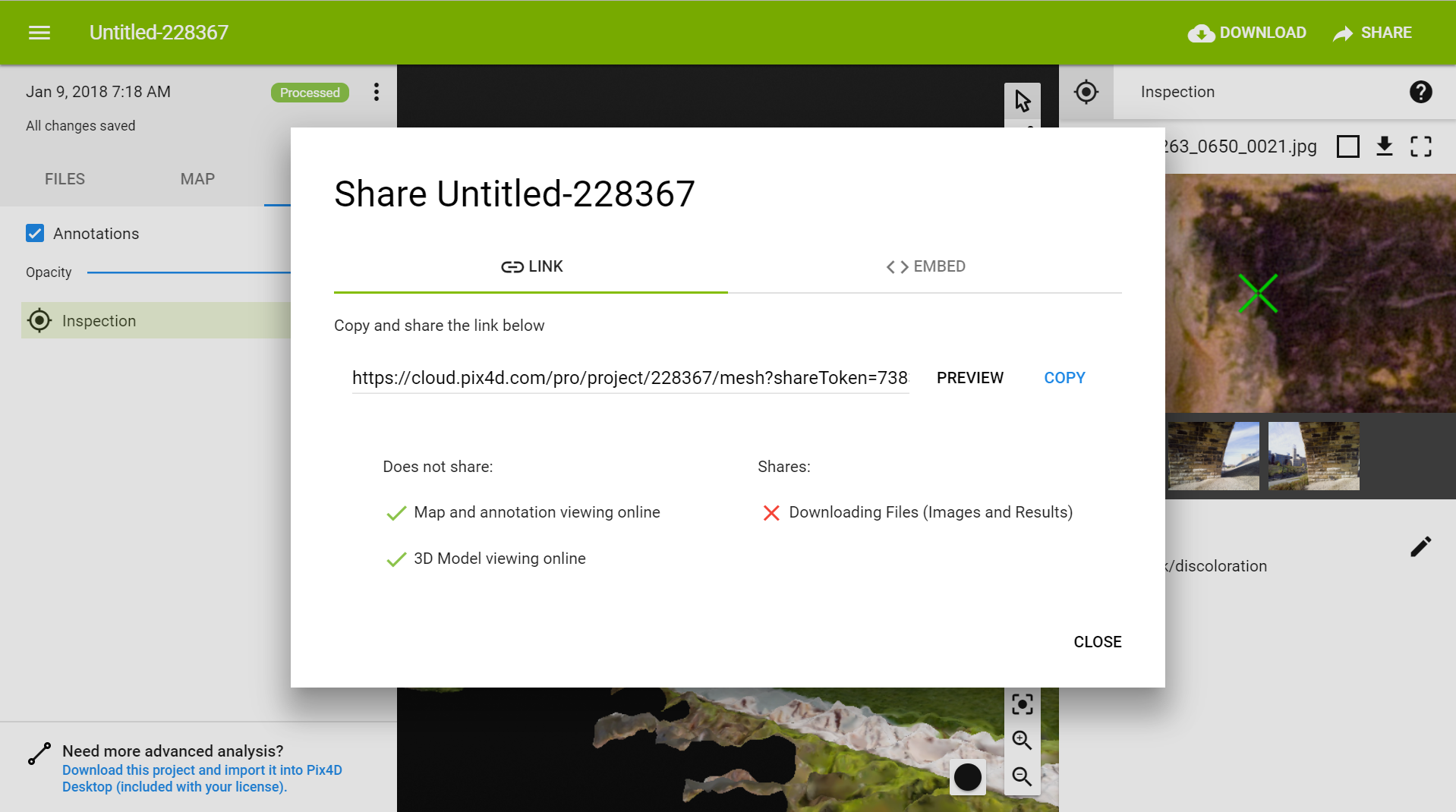
Easily collaborate and share inspections
Identify and tag the images you would like to share and add comments or descriptions. Easily share the virtual inspections with a shareable link. Onsite or remotely, easily monitor all the defects or area of interest with their precise geolocation.
| Dataset courtesy of the Minnesota Department of Transportation and [Collins Engineers, Inc.] using a senseFly Albris drone. | |
| Read the entire story on CityLab. |


