Efficient construction management with PIX4Dcloud Advanced
| First published | April 27, 2017 |
| Updated | June 8, 2020 |
A volcanic archipelago in the Central Pacific of only 11,000 square miles, Hawaii has seen sustained economic growth for the last few years, and a record-breaking pace for the tourism industry. Construction benefits from this growth with an increasing need for infrastructure.
Hawaiian Dredging Construction Company (HDCC) is the oldest and largest general contractor in Hawaii. Involved in all phases – pre-construction, design-build and construction – the company works on building, heavy infrastructure, waterfront/foundation, power/industrial and commercial projects.
HDCC was commissioned by SamKoo Pacific LLC for the construction of a 45-story tower condo building in Honolulu: the SamKoo Kapiolani Residence. Started in early 2017, the project was delivered in 2018.
Project details
| Company | Hawaiian Dredging Construction Company |
| Industry | Construction |
| Location | Honolulu, Hawaii (USA) |
| Project | Condo building |
| Project owner | SamKoo Pacific LLC |
| Project size | 56,250 Square Feet / ~5,225 Square Meters |
| Project date | 2017 - 2018 |
| Hardware | DJI Mavic |
| Software | PIX4Dcapture Former Pix4Dbim - Now PIX4Dcloud Advanced |
| Number of images | 250 images per mission |

An easy solution
Offering an easy solution for site surveying and data collection, at lower cost in comparison to traditional land surveying methods, drones are used more and more by major construction companies. HDCC commonly uses drone technology to get regular as-built documentation of their jobsites and monitor the construction progress.
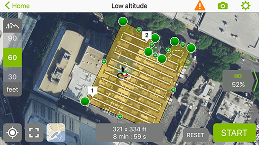
HDCC uses a DJI Mavic drone and PIX4Dcapture to plan, fly and collect images of the condo building site.
The polygon mission in Pix4Dcapture enables HDCC to optimize drone flights within a well-defined area, and above all get higher-quality data. After testing the feature, they immediately endorsed it.
“With the polygon mission in PIX4Dcapture, we are able to make a “notch” in our mission for the tower crane at the edge of the jobsite. We’re getting much higher resolution images now that we are able to cover the entire site at an altitude lower than the top of the tower crane,” explains Christopher Baze, BIM manager at Hawaiian Dredging Construction Company.
The advantages of cloud-based processing
Once collected, data is processed with PIX4Dcloud Advanced. The advantages of cloud-based processing are obvious to the HDCC team: outputs are quickly delivered at the same quality as desktop processing, except it’s done automatically, preventing any interference with other processing tasks. Only a couple of hours are needed between drone flight and result acquisition.“I see processing in the cloud as the same thing as processing locally on desktop, but faster and it doesn’t lock up my computer. Being able to upload the photos and continue working without a performance impact is huge!” says Chris.
Easier site documentation management
In addition to fast, trouble-free and high-quality data processing, Pix4Dcloud Advanced offers another major benefit to HDCC: the easing of site documentation management.
Construction professionals know well that documenting a project is key in many ways, and at all phases of a project: design, planning, construction, inspection, and maintenance.
To get significant up-to-date documentation, HDCC flies the site on a weekly basis, so large numbers of images are routinely collected. This amount of data represents an important source of documentation for the site, but it’s only relevant when it’s well sorted, and all stakeholders can access it and see the big picture quickly and easily.
HDCC found the right solution for this. Chris explains:
“We’ve started to use PIX4Dcloud Advanced as a central data repository for all of our jobsites. It’s always time-consuming and sometimes challenging to sort through jobsite documentation photos to find out what happened when. Traditionally, we’d have to look through hundreds of photos on a jobsite server to figure out what happened when. It is very difficult to locate exactly what you are looking for because hundreds of randomly sorted photos are stored in folders organized by date. With the PIX4Dcloud Advanced, we’re able to store orthoimages and 3D models that are way easier to navigate than folders containing hundreds of photos. The Pix4D models and orthoimages definitely create a synergy of the photos, which makes it way easier to zoom in and find exactly what you’re looking for.”
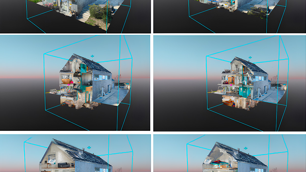
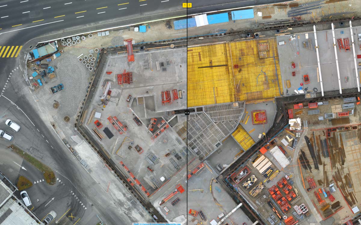
With PIX4Dcloud Advanced, HDCC can permanently store all processed data on one single platform. The compare mode allows HDCC to display all datasets acquired for the project, creating a visual archive of the whole jobsite situation over time. The HDCC team can easily verify the project's progress.
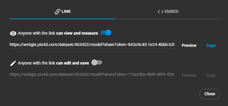
PIX4Dcloud Advanced is mainly used as an in-house tool, but with built-in project sharing options it is also shared with owners, consultants, and subcontractors as needed or requested. It’s a huge time saver, eliminating confusion or work duplication, and fostering communication and collaboration.
This is the beauty of PIX4Dcloud Advanced. There is no need to read pages of documentation, or sit through countless reports or folders anymore — all the information needed is available at any time to anyone involved in the project.