Generating interactive 3D real estate experiences
Showcasing houses digitally
Real estate company Immoconcept sells and rents French properties to a customer base primarily in Eastern Europe.
With offices in Paris, Nice and Moscow, the company wanted to enhance their website experience and give clients a new way to examine properties remotely.
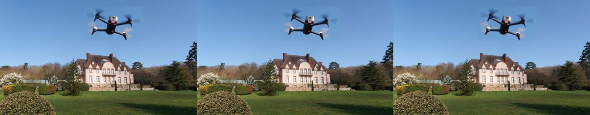
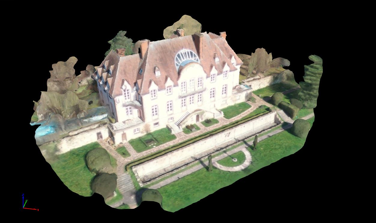
Immoconcept decided to use drone-based 3D mapping to create a more attractive and interactive website, showcasing one of their listed properties, “Chateau Lion,” located 30km from Paris.
Project Information
| Company | Immoconcept |
| Country | France |
| Industry | Real Estate |
| Project Manager | Irina Duport |
| Project Size | 500 Square Meters |
| Drone | Parrot Bebop 2 |
| Number of Images | 109 |
| GSD | 6.32 cm |
| Software | Pix4Dcapture Pix4Dmapper |
Drone mapping the chateau
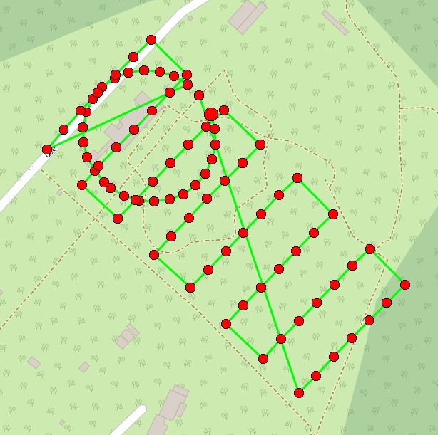
To map the 500m² property, a Parrot Bebop 2 drone flew one grid flight to capture the chateau gardens and horizontal surfaces, and one circular flight around the main building to capture facade details.
Each flight took less than 15 minutes, and was both planned and automatically executed via the free Pix4Dcapture app on a Sony Xperia mobile phone.
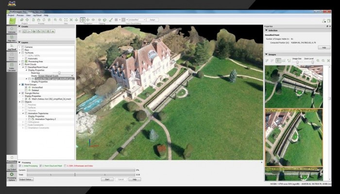
After the flights were completed, 109 images were transferred to the Pix4D cloud and processed with Pix4Dmapper software.
And voilà!
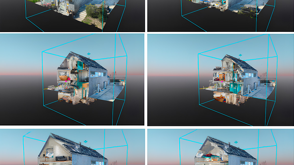
A photorealistic 3D model of the property was ready to share online in less than half an hour after sending the images to process on Pix4Dmapper cloud.
This georeferenced 3D model was then uploaded to Sketchfab, a model visualization platform.
Immoconcept embedded the 3D Sketchfab viewer on its website as part of a multimedia gallery, where clients could explore the property at will.
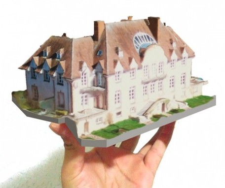
If these images are processed on Pix4Dmapper desktop software, additional outputs are available, including custom fly-through videos, linear and surface measurements, and 3D mesh files that can be used to 3D print.
"Powerful tools for real estate agents"
Mapping property with a Parrot Bebop 2 drone and Pix4Dcapture can be done by anybody. Processing is done in the cloud, so there’s no need to be a mapping expert or tech geek to create a 3D model.
Virtual models are powerful tools to enhance property promotion in ways that photo and video can not. This workflow is particularly suited to real estate agencies, owners who want to sell or rent their property, or even landowners who want to scan their site for architectural planning. An added advantage is the low mission cost and the capability of taking precise measurements without having to visit again the property, like in the case of Prodrigo.
Irina Duport, Immoconcept founder and CEO commented: "Our customers are mainly based in Russia and can now discover the properties on their own from their home much better than by simply looking at a video. They can precisely select only the most relevant homestead to visit, improving the efficiency of their travel, sometimes difficult to organize."
"I was impressed by the way the Parrot Bebop 2 drone together with Pix4D software mapped the property; it was so quick and easy.” says Irina. “Customers clearly appreciate being able to discover our properties this way.”