

Cell tower inspection with drone for new antenna mount
Using drones to inspect industrial structures is becoming a trend, not just due to the method’s low cost, speed and efficiency, but also because of the lower risk incurred when compared to traditional inspection methods.
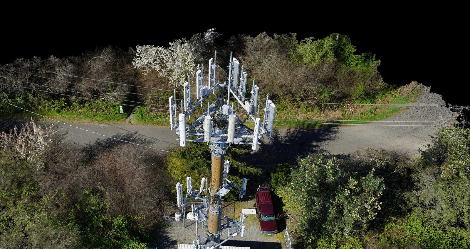
One monopole telecommunication tower on Vashon Island in Washington state is deemed unclimbable by a contracted tower crew, due to structural limitations.
In order for engineers to identify, analyze, and design a new antenna mount for the cell tower, a well known telecommunications company requested that Ryka UAS, a professional drone inspection company from Seattle, survey the tower and create a high-definition 3D point cloud of it.
Climb the unclimbable
In order to closely map this unclimbable tower and capture all assets, Ryka used a professional quadcopter drone from Turbo Ace. The Matrix-E has a Sony A6000 camera and compatible Geo-Snap system from Field Of View LLC (a camera add-on which uses the onboard GPS/IMU to provide a stand-alone geotagging and triggering solution), and acquired 24.3-megapixel images with good geolocation quality.
The team manually flew the quadcopter drone around the tower with a flight plan consisting of several vertical columns approximately 13 meters away from the cell tower.
Project details
| | | ---------- | ---------- | | Company | Ryka UAS | | Country | United States | | Industry | Inspection | | Project Date | April 2016 | | Project Size | 0.12 Acres | | Equiment | Matrix-E + SONY A6000 | | Software | Pix4Dmapper | | Number of Images | Around 400 | | GSD | 0.2 cm |
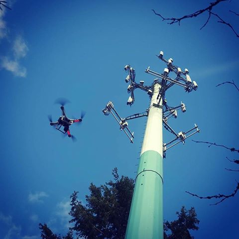
Electromagnetic wave interference can be a challenge for operating near communication sites, but thanks to an experienced drone pilot, the team was able to fly close to the tower, capturing images with over 80% of overlap and getting a high ground sampling distance of 0.2 centimeters.
Roughly 400 images provided detailed information of the telecom antenna and the mount for inventory purposes.
Accurate, georeferenced, 3D densified point cloud
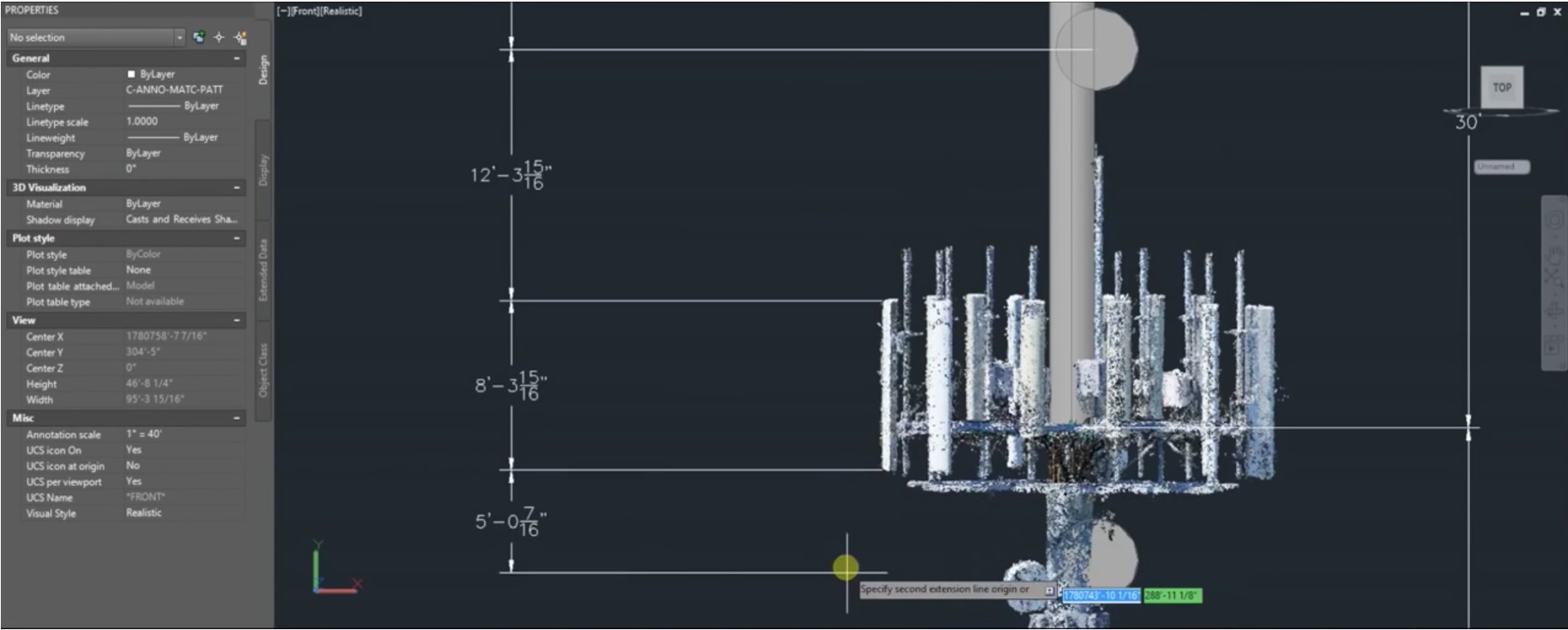
It took less than a day to acquire the images and process them into a precise, dense 3D point cloud which focuses on the upper rad center mounts, wireless-panel style antennas, and associated mounts. The project engineer measured the mount brackets using the high-resolution images in combination with the LAS point cloud.
Pix4Dmapper outputs can then be integrated with CAD software for final analysis.
Within two to three days, Ryka UAS delivered final analysis results in CAD to their client.
Robert Erdt, Ryka UAS says: “It was difficult to obtain a good result purely from automatic processing. The first attempt gave us three towers instead of one. The repetitive surfaces were due to the big difference of view angles and image content. Adding manual tie points helped resolve the issue and gave us the impressive final results.”
Efficient and cost effective inspection
Traditionally, a crane crew would have been needed to inspect this tower structure, but at a much higher cost and with limited vantage points. Creating a 3D model of the cell tower with drones and photogrammetry software proved to be faster, more efficient and greatly reduced the inspection cost.
Erdt continues: "We have been thoroughly impressed with the overall functionality and quality of the results that have been generated as well as the commitment of Pix4D to make improvements in the software and its usability. Beyond creating impressive digital representations of infrastructure, the software has endless applications for many other industries we work with. The powerful analytics functions and outputs, speed up our workflows and increased the efficiency for the engineering team.”


