Keeping the K in carrots: uncovering potassium variations
Carrots are a key high-value crop in Dutch agriculture, with net yields up to 100 t/ha and a high nutrient requirement, especially for potassium. As farms increase in size and technologies evolve, it pays to use new technologies for better and more precise management of larger fields.
This helps in two ways: more efficient operation save money on inputs, as well as it increases the total yield by the end of the year. In other words: more savings, more benefits.
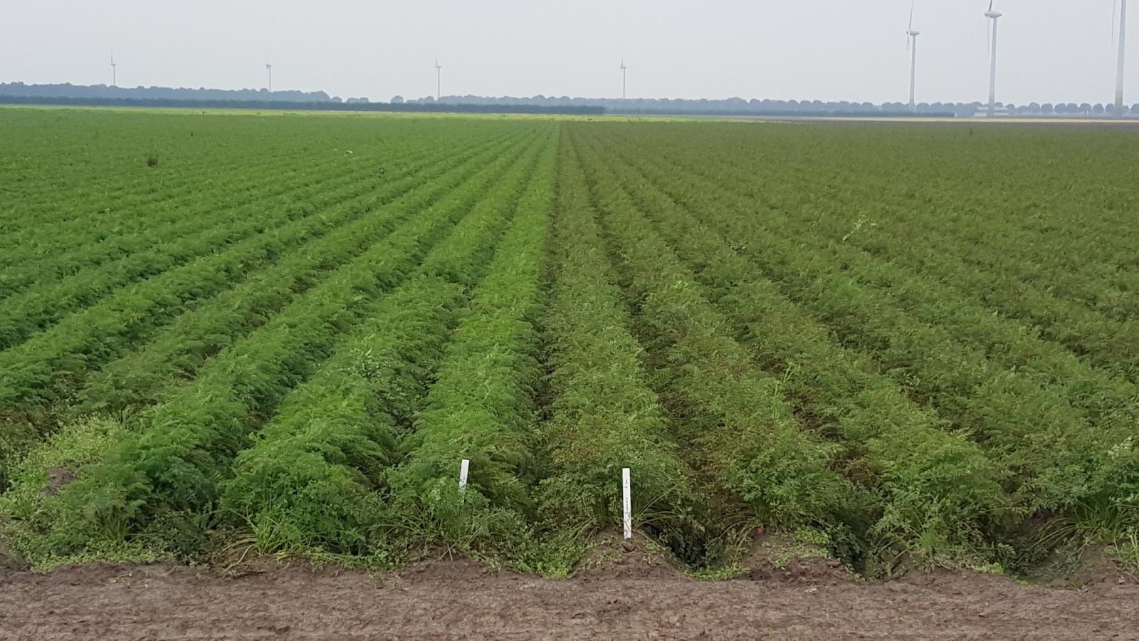
This farmer grows organic carrots and has fields with a lot of variation, a known issue for him. Carrots is an important cash-crop with high demands in nutrients, especially potassium. To assess the carrot plant health, quickly detect deficiencies and problems, and improve cultivation, the farmer together with agronomy firm Agrifirm asked Aurea to acquire imagery and help with analysis and interpretation.
| Organization | Aurea Imaging |
| Country | The Netherlands |
| Industry | Agriculture |
| Project Date | October 2015 |
| Project Members | Bert Rijk, Anja Hoorweg |
| Project Size | 10 Hectares |
| Number of Images | 176 |
| GSD | GSD 12 cm |
The project included image acquisition & processing, selection of soil sampling locations based on the imagery and advising on the implications of the results.
Flying the field
A senseFly eBee fixed wing drone acquired the images using a multispectral camera with sensors in red, green, near-infrared and red-edge bands. A single 15 minute flight in grid pattern had a high frontal overlap of 80% and side overlap of 75%. 176 images at 12 cm GSD were taken at 120m altitude.
The analysis
The field had 3 different cropzones with 3 different varieties. Initially, although the NDRE map (below) clearly showed variability, the map was taken into the field for digital scouting by the Agrifirm agronomists and no clear differences in crop condition were seen.
This can be explained by the fact that plants show differences on their reflection to light for color the human eye can’t see but that multispectral camera can.
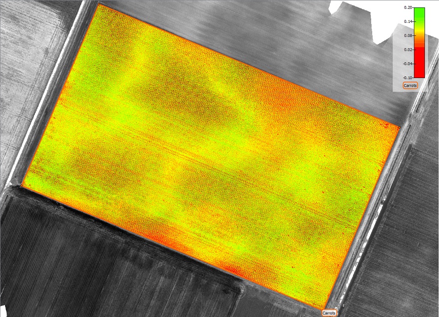
Based on the NDRE imagery, 2 locations were selected for soil sampling, one sample on a ‘good = green’ location and one on a ‘bad=red’ location.
The soil analysis showed large differences. Especially the soil potassium (K) reserve, expressed as the ‘P-value’ was 9 in the ‘bad=red’ location and 55 in the ‘good=green’ location. The target P-value is 30 – 40 for carrots.
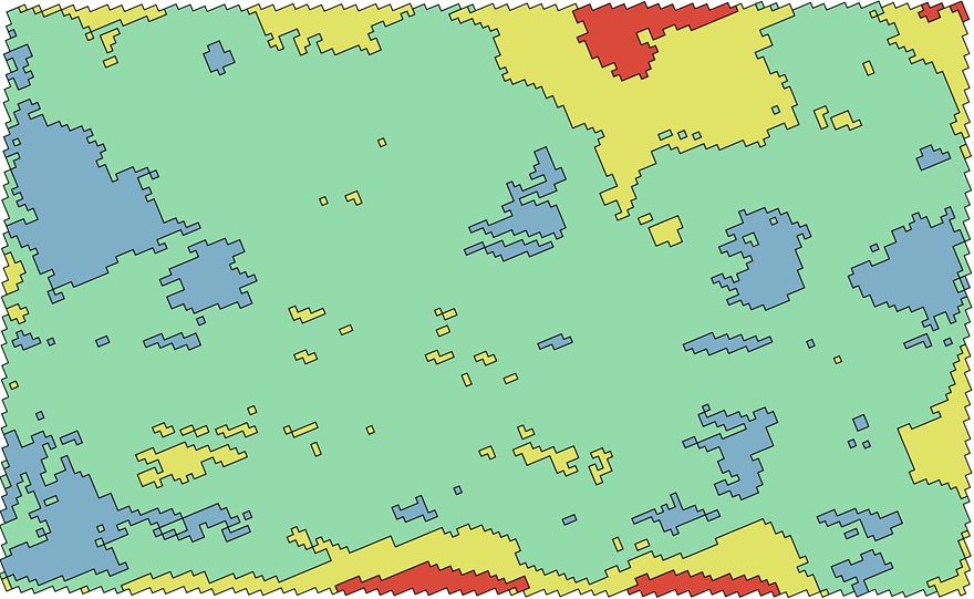
The prescription
Current fertilization recommendations (image below) are based on a mixture of soil taken from across the field and the information derived from the NDRE map.
Extra potassium fertilizer on the good locations might just flush to the groundwater while the worse locations will benefit from a much larger dosage of P.
It is interesting to mention the added value of the imagery, as the agronomists could hardly find the nutrient deficiencies even when the location was known.
Why use drone-mapping to optimze crop production?
The NDRE Map, generated from Pix4D Index Calculator, assisted in selecting soil sampling locations and the discovery of soil potassium variations, which have a potentially large influence on crop growth and quality. This targeted K-fertilization lowered costs by reducing fertilizer input and reduced the negative environmental impact of K percolation into groundwater.
On-site scouting uses visual inspection to assess crop status from the ground. Unfortunately, such ground-based techniques are limited to what the human eye can see. Innovative technologies using drones and multispectral imagery have tremendous potential in complementing field scouting and the art of agronomy.