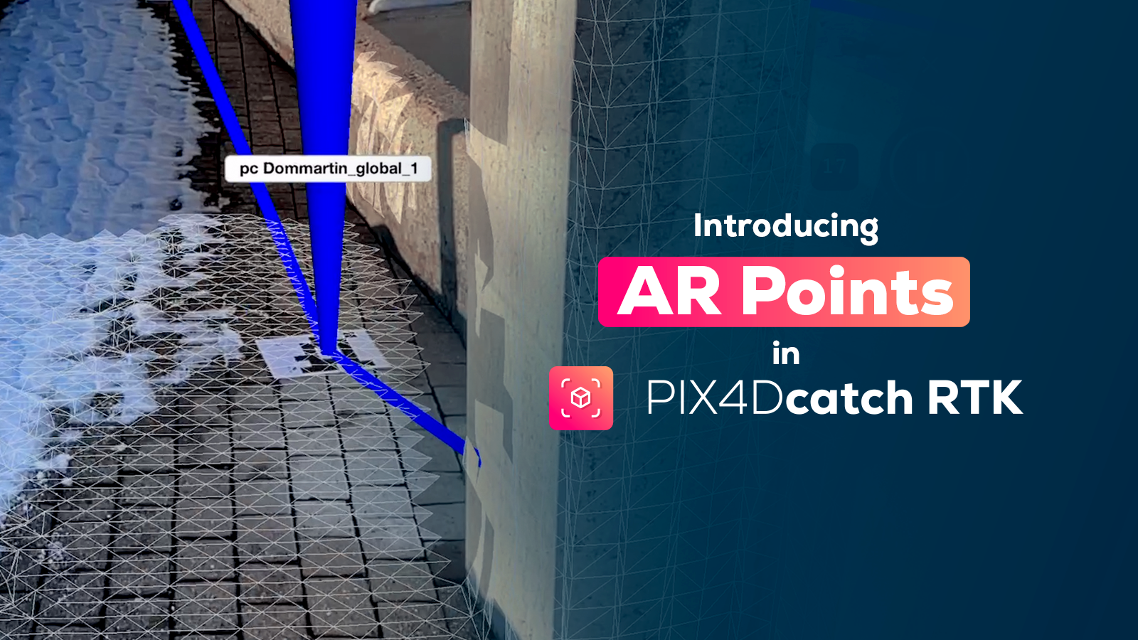
Interview: how to make money with your drone
It’s a question we get a lot here at Pix4D. There’s no one easy answer, but at 2018 SPAR 3D Expo & Conference Pix4D Business Development Manager Julian Norton tried to find the answer in an interview with WGAN-TV.
Watch the video below for Julian’s advice on…
- What camera you need to use with your drone.
- How to fly and capture images successfully, even if you don’t have any experience.
- How to get great 3D models with Pix4D.
WGAN-TV How to Make Money with a PIX4D and Your Drone from We Get Around Network on Vimeo.
WGAN-TV How to Make Money with a PIX4D and Your Drone from We Get Around Network on Vimeo.
Julian also had some advice for how to make money with a drone and Pix4D.
“Imagine offering a 3D modelling service to realtors in your city. Where you go and fly around a property, produce a 3D model which could be displayed on the website of the property company. It’s a great way of advertising, and it needs somebody to do it.”
This is easy to do with Pix4Dmapper – check out this blog post for more.
“City modelling, landscape modelling, anything where 3D deliverables are useful – for surveying maybe, or for the GIS market as well. There’s always something that needs a 3D database.”
Plus, Julian notes that experienced drone flyers could potentially work with the construction business, earthworks, mining or agriculture. Pix4D’s software is easy-to-use, even for those who aren’t familiar with photogrammetry.
Mentioned in the video
The video mentions a range of Pix4D solutions.
- Pix4Dcapture, our mobile app which will automatically fly your drone while uploading images to the cloud.
- Pix4Dbim, which is designed especially for the building industry and includes extra features including comparing as-built to plans.
- Crane Camera, which produces automated site visualisation on a daily basis.
- Pix4Dmapper, our professional photogrammetry software.
Thank you to WGAN-TV for sharing the video!