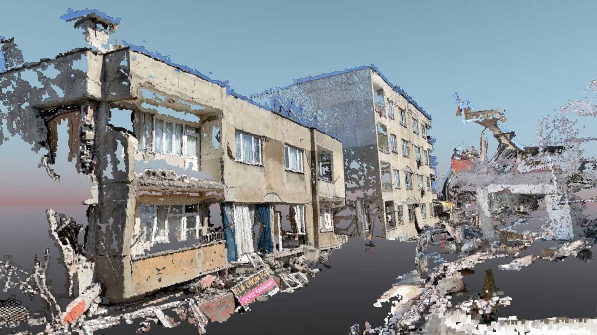
Damage assessment with the PIX4Dcatch RTK workflow
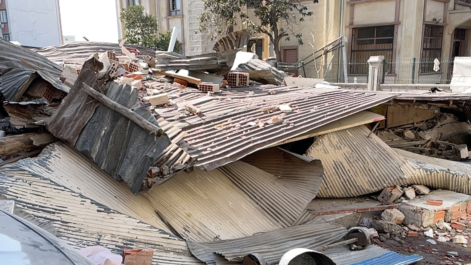
After the devastating Kahramanmaraş-centered earthquake on February 6, 2023, the team from Atay Mühendislik, in Ankara, Turkey, used photogrammetry to swiftly generate critical information for rescue teams. Under the coordination of the Ministry of Environment, Urbanization and Climate Change, they used both aerial and terrestrial mapping in the disaster zone to provide vital information to emergency responders.
Three separate teams from Atay went into the earthquake zones. Two teams used drones and aerial mapping to provide seach and rescue teams with support, and the third team employed terrestrial mapping with the the PIX4Dcatch RTK workflow in order to assess the damage.
High-precision terrestrial scanning with a smartphone
The PIX4Dcatch RTK workflow is a terrestrial scanning solution that can obtain 3D models with centimeter-level absolute accuracy. An RTK antenna is attached to a smartphone (ideally one equipped with LiDAR sensors) and using PIX4Dcatch (a free mobile app) you can obtain RTK-accurate georeferenced images using just the phone, and then process these into 3D models using PIX4Dmatic or PIX4Dcloud. This workflow is ideal for accessing areas a drone may not be able to reach.
Assessing the damage
The teams in the region were sheltered in their cars throughout the process, using electricity provided by mobile generators, as the aftershocks of the earthquakes continued and almost all of the hotels were destroyed. In this respect, the ease of use of the PIX4Dcatch RTK workflow, and the speed of PIX4Dmatic were extremely valuable to them. There was so much destruction on the roads that transportation was difficult, but with the PIX4Dcatch RTK workflow, they still managed to capture 140 images, which were then processed in just 10 minutes using PIX4Dmatic.

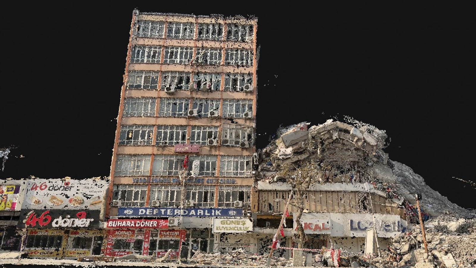
The team managed to acquire data with LiDAR by scanning with RTK correction data obtained from the TUSAGA Active GNSS network, with an absolute precision accuracy of <5 cm and an internal sensitivity of <1 mm. A point cloud was produced from the terrestrial images and LiDAR, taken with the PIX4Dcatch RTK workflow. After the collected data was processed in PIX4Dmatic, it was used to determine the wreckage area of demolished buildings and the condition of the roads.
Project Details
| Location | Ankara, Turkey |
| User | Atay Engineering |
| Software used | PIX4Dmatic PIX4Dcatch RTK |
| Hardware used | RTK device and Ipad Pro |
| Processing hardware | CPU AMD Ryzen 9 5900HS with Radeon Graphics, 3.30 GHz, 32GB RAM, 64-bit operating system, x64-based processor |
| Area covered | circa 2500m2 2 |
| Processing time | <10 minutes |
| Total number of images | <140 |
| GSD | 0.6 cm/px |
Responding with speed and efficiency with terrestrial mapping
The condition of the buildings and the degree of damage in the wake of the earthquake was rapidly assessed. The entire project, from start to finish was completed in about 25 minutes. The team found the interface of the Pix4D software easy to use and simple to understand, they opted for Pix4D because of its speed, efficiency, and high-quality results.
This was an emotionally challenging process for the Atay team, but the use of photogrammetry enabled them to provide critical information for damage assessment. Their goal was to offer valuable assistance in the wake of the disaster. The PIX4Dcatch RTK workflow demonstrated how photogrammetry can be effectively used to respond to stressful and challenging situations such as this terrible earthquake, swiftly providing essential information where required.
“Pix4D's software is very easy to understand, with high-quality results." - Atay Mühendislik